
SLIDE 1
Steerpath Indoor navigation for apps Nimble Devices Founded in - - PowerPoint PPT Presentation
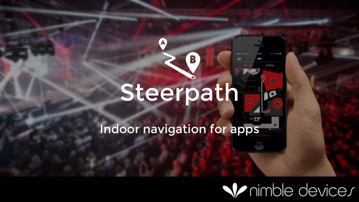
Steerpath Indoor navigation for apps Nimble Devices Founded in 2013 by Mikko, Tuomas and Sam 20+ years in working with Bluetooth technology Thesis on indoor positioning, two M.Sc.s in robotics including sensor fusion.
– Founded in 2013 by Mikko, Tuomas and Sam – 20+ years in working with Bluetooth technology – Thesis on indoor positioning, two M.Sc.s in robotics including sensor fusion. – Hardware, software and international business experience – Technology provider for the B2B market
Where are the baby bottles?
Where was it we were supposed to meet?
Umm… Where’s my transfer flight?
External maintenance workers: Where’s the machine I need to fix? Students at Universities: Where is room Z2431? Customers in electronics stores: Why can’t I just ask the personnel to come to me? M u s e u m s : H
d
e g a m i f y
r e x h i b i t i
? Parents with baby strollers: Where’s the stair-free route? Hotel guest: How do I get to the breakfast room? Cruise ships: How will people find the Aft- pub during happy hour? Hardware store: How could we make customers more self-sufficient? C
s t r u c t i
w
k e r s : I n w h i c h r
d i d I p u t t h e g e n e r a t
l a s t w e e k ?
investors
hackathons
– GPS compatible format – Geofence zones of any shape i.e. not tied to beacons
– For example for triggering when entering a floor or a room
– Beacon distance zones
– Triggers based on distance to beacon – Can provide cm accuracy for special cases
– Route calculations on the fly
– For example for guiding and product search
– Automatic floor change detection – Everything works offline
– Ready to be dragged and dropped into your app – Example apps for you to play with – Fully documented – No site surveying / fingerprinting required
Actual developer quote:
“Integration into my App took maybe 20 minutes”
Guide with navigation
– Product search in a supermarket – Virtual guided tour in a museum – Find my friend - community – Help me button
React with triggers
– Entered meeting room – Close to cafeteria – Left the building
We are the best choice
No calibration – Anyone can install & maintain Unlimited users and devices Fully offline – Robust – Works in any venue – Does not load the network – Perfect for travellers Crossplatform Quick to integrate “Integration took maybe 20 minutes”
Guidio Audio guide: Discover freely and stop to learn more
Press a button and the store personnel will come to you
Find my friend: Share your indoor location
Drag and drop – Beacons and their IDs – Walls, Zones, Routes – Data is compiled to a single positioning file
–
One beacon per 150m² for large venues
–
Adjustable accuracy 2-5m – No wiring – 2 years on battery
–
Beacons cost about ~$20 each
Grand central terminal - NYC
– Drag and drop positioning and navigation engine to your project – Positioning file can be online
– API interfaces are same as native GPS APIs “Integration into my App took maybe 20 minutes”
Challenge:
Solution included:
guidance
By the numbers – 15 000 visitors – 10 000 downloads – 54 000 map-views – 25 000 m2 – 150 beacons – 2 x Grand One finalist
– Free to develop
– SDK, documentation and tools are free to use – All features always available including routing and triggers
– License cost is per venue
– Unlimited number of users and devices – Multiple apps – Pricing tiers for different venue sizes and number of triggers
– Battle tested
– Easy to integrate – Easy to deploy
– iOS and Android – Unique features – Powering new experiences – Free to set up and develop!
“Nimble Devices’ positioning product is one of the easiest to integrate while also being one
– Scott Roberts Director at ShopperTrak
“Nimble Devices helped us achieve the impossible in a super short period of time - the installation of an entire Geo-Fenced beacon network in Grand Central Terminal NYC in under 1 week. Great team and great product!”
– Dan Seidman CEO at Promotional Communications
“Excited about the revolution that Nimble Devices’ technology can trigger for our daily mobile experiences!”
– Jyrki Katainen European Commission Vice-president
“The impressive positioning and navigation technology by Nimble Devices is clearly leading the charge when it comes to breaking down barriers between physical and digital space.”
– Peter Vesterbacka Mighty Eagle at Rovio
“Steerpath worked absolutely perfectly for us. It provided something to our 15 000 attendees, which they really loved to use, while helping them to find the right stages, demo stands and restaurants really easily through the app. Highly recommended!”
– Miki Kuusi Co-Founder and CEO of Slush
Steerpath knows you have arrived Automatic check- in Faster Service Targeted VIP customer experience Instant offers to use during your stay
Indoor positioning and location aware services Find your room with visual guides Navigate you to the roof terrace in time for the evening entertainment
Start with your floorplan
Add some beacons
Get your position
Add zones which trigger actions
Any number of zones for any number of uses
Add points of interest
And obtain routes to them
End result without any calibrations on site