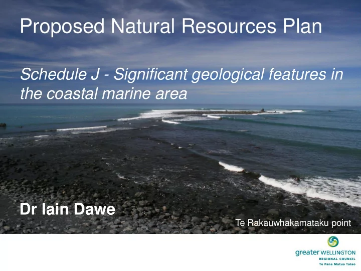

Proposed Natural Resources Plan Schedule J - Significant geological features in the coastal marine area Dr Iain Dawe Te Rakauwhakamataku point
Statutory requirements NZCPS 2010 Policy 15 – Natural features and landscapes: “To protect the natural features and natural landscapes (including seascapes) of the coastal environment from inappropriate subdivision, use and development” Natural features includes: (i) natural science factors, including geological, topographical, ecological and dynamic components RPS Policy 25 – Identifying outstanding natural features and landscapes in district and regional plans: “District and regional plans shall identify outstanding natural features and landscapes…” (a) Natural science values including geological, ecological, topographical and natural process components of the natural feature or landscape (b) Representativeness; Research/Educational value; Rarity (c) B e “exceptional” and have a degree of naturalness
Assessment criteria There are four main criteria by which the sites have been assessed: • The representativeness of the site or feature within the region (rare to common) • The integrity of the site or feature, the degree of modification it has experienced and its potential for protection or restoration (unmodified to heavily modified) • The vulnerability of the site or feature to disturbance and its potential for remediation if it was disturbed (high to low) • The scientific merit of the site or feature and the educational opportunities it presents (local to international) The sites assessed contain or display one or more of the following significant geological features: • Geomorphic landforms (incl. natural processes) • Earth deformation/seismic features • Structural geology (eg, faults) • Sedimentary/Metamorphic/Igneous geology • Minerals • Fossils
Previous work & references • “Geological Features of the Wellington Region”. Wellington Regional Planning Authority (1975) (updated 1985) Turakirae Head • “RPS review: Coastal environmental sites of regional significance”. Boffa Miskell (2007) with input from Prof. Mike Crozier and Nick Preston (VUW) • Kenny & Hayward (1996), “Inventory and maps of important geological sites and landforms in the Manawatu and Wellington regions”. Geological Society of New Zealand. • Homer & Moore (1989), “Reading the Rocks: A guide to the Geological Features of the Wairarapa Coast”. GNS Science. • Geological sites listed in the various district and regional plans • 75 scientific peer reviewed articles/reports/theses
Titahi Bay Criteria Value Classification Representativeness 1 Nationally rare fossil forest Integrity 2 Partly modified • Over 120,000 yrs old Vulnerability 2 Vulnerable • Scientific & 2 National Shoreline was several km west Educational Value significance and Mana Is. connected to mainland • Titahi Bay low lying valley with Total 7 Rank 2 swampy podocarp forest • Forest drowned and covered in sand in last interglacial warm period as sea levels rose (2-4 m higher than present) • Sub-fossil tree stumps of rimu, matai and totara • Intermittently uncovered by erosion when they become vulnerable to damage • Internationally uncommon • Good example of paleo- environment for climate research and education
Discrete sites examples Rock Point and Titahia corrugata Webby Criteria Val Classification ue Representa 1 Rare tiveness Integrity 1 Unmodified Vulnerabilit 2 Vulnerable y Scientific & 2 National Educationa significance l Value Total 7 Rank 2 Pariwhero/Red Rocks Criteria Val Classification ue Represent 2 Uncommon ativeness Integrity 1 Unmodified Vulnerabil 2 Vulnerable ity Scientific 2 National & significance Education al Value Total 7 Rank 2
Lake Onoke and barrier spit • Nationally significant, only two such landform features of this type in New Zealand (Te Waihora/Lake Ellesmere) • Reflects a range of tectonic, sedimentological and geomorphological processes • Geologically young (Holocene aged) formed in past few 1000 yrs from a tidal bay Criteria Value Classification • The ‘spit’ is 3.5 km long and 350 m at its Representati 1 Regionally veness Unique widest formed from sediment transport from Integrity 2 Partially modified the east connecting spit to western side to Vulnerability 2 Vulnerable form a ‘barrier’ beach Scientific & 2 National Educational significance Value • Tectonic uplift from 1855 EQ moved outlet Total 7 Rank 2 from Kiriwai lagoon to Lake Ferry creating illusion it grew from west to east • Foraminifera (small marine amoeba) have been recorded living above the high tide mark (uncommon) and is an important locality for research into biogenic fossil markers
Larger scale landforms examples Whiterock – Te Kaukau coast Cape Palliser/Matakitaki Also have natural character Whakataki shore platforms
Recommend
More recommend