
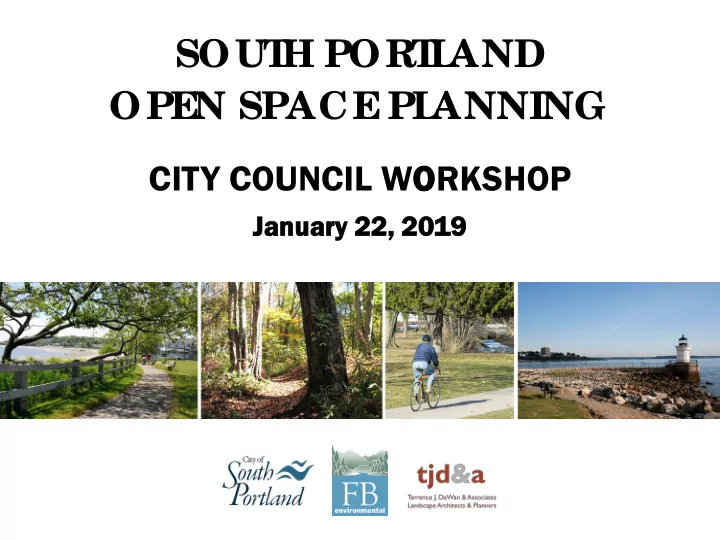
SLIDE 1
OPE N SPACE PL ANNING SOUT H PORT L AND
CITY COUNCIL WORKSHOP
Ja Janu nuary 2 22, 2 , 2019
SOUT H PORT L AND OPE N SPACE PL ANNING CITY COUNCIL WORKSHOP - - PowerPoint PPT Presentation
SOUT H PORT L AND OPE N SPACE PL ANNING CITY COUNCIL WORKSHOP Ja Janu nuary 2 22, 2 , 2019 OPEN SPACE PLANNING AGENDA 1. Introduction 2. Open Space Planning Process 3. The State of Open Space 4. Vision Statement 5. Goals 6.
OPE N SPACE PL ANNING SOUT H PORT L AND
CITY COUNCIL WORKSHOP
Ja Janu nuary 2 22, 2 , 2019
OPEN SPACE PLANNING
CONSU SULTAN ANTS
FB FB E Envir ironm nment ntal al Ter errenc ence e J. D . DeW eWan & an & Associat iates es
Forrest Bell, Principal and Project Manager Jessica Kimball, Landscape Architect Maggie Burns, Hydrologist and GIS specialist
OP OPEN S SPACE C COM OMMITTEE
Barbara Dee (chair) Tom Blake (vice-chair) Kate Lewis Jane Eberle Dan Hogan Patti Smith Susan Chase Kate Gatti Richard Rottkov Sharon Newman Victoria Morales Catherine Callahan Kat Taylor Ashley Krulik Max Wibby Andrew Gagnon Kathi Perkins
CITY STAFF
Kevin Adams, Director of Parks,
Recreation and Waterfront
Tex Haeuser, Director of Planning and Development Fred Dillon, Water Resources
Protection
OPEN SPACE PLANNING
The 2001 South Portland Open Space Strategic Plan was completed but never accepted by the City Council or fully implemented. The South Portland Conservation Commission initiated this open space planning process with the belief that an updated Open Space Plan is needed to guide the City in the evaluation, protection, and expansion of open space.
OPEN SPACE PLANNING
1. Document the State of Open Space (mapping, research, public outreach) 2. Define a Vision Statement for Open Space in South Portland 3. Establish Goals to achieve the Vision 4. Identify Strategies to ensure the Goals and Vision are met 5. Ensure the Open Space Plan strategies are implemented
OPEN SPACE PLANNING
COMMI MMITTEE EE W WORK
Open Space Committee
Sub-Committee Meetings
PUB PUBLIC OUTR OUTREACH
Online Community Survey was open for 7 weeks (May-July 2018), 716 responses Open Space Public Forum on July 31, 2018
ONLINE COMMUNITY SURVEY
MOST VISITED OPEN SPACES
ONLINE COMMUNITY SURVEY
ONLINE COMMUNITY SURVEY
1 2 3
Approximately 50 members of the public attended the Public Forum. Small groups worked together in mapping and brainstorming activities
PUBLIC FORUM
We have digitized the mapping work from the public forum. The end result is a spatial database showing the community work.
FORUM RESULTS DIGITIZATION
NOTES: Go Good pl place t to pu put i in kayak CLA LASSIF IFICATION: W N: Water A r Access ss
The Public Forum spatial database is accessible and searchable. This data has informed the Open Space Plan and may inform future planning work.
ACCESSIBLE DATA
GOOGLE EARTH
We synthesized the big ideas from the public forum into a
pedestrian corridors, water access, and open space conservation.
PUBLIC FORUM: BIG IDEAS
Open Space refers to any parcel or area of land or water, the preservation of which would achieve any of the following: 1. Conserve and potentially enhance natural or scenic resources 2. Protect water quality 3. Promote conservation of soils, wetlands, beaches, or tidal marshes 4. Enhance the value to the public of abutting or neighboring parks, trails, forests, or nature preserves 5. Enhance recreation opportunities
Basketball Court Greenbelt Vacant Lot Golf Course Utility Corridor
THE STATE OF OPEN SPACE
OPEN SPACE DEFINITION
THE STATE OF OPEN SPACE
PARCEL MAPPING
THE STATE OF OPEN SPACE
CITY PARKS + OTHER MUNICIPAL LANDS
City-owned Land (non-park) City-owned Park
THE STATE OF OPEN SPACE
PAPER STREETS
City-owned Land (non-park) City-owned Paper Street
THE STATE OF OPEN SPACE
SPLT + EASEMENTS
City-owned Land (non-park) City-owned Park Conservation Easement South Portland Land Trust
THE STATE OF OPEN SPACE
LAND + WATER CONSERVATION FUNDS
City-owned Park (no legal protections) City-owned Park (LWCF protection)
TOTAL AREA OF SOUTH PORTLAND = 8,996 acres MUNICIPAL LAND = 735 acres (8.2%) CITY PARKS = 368 acres (4.1%) LAND IN CONSERVATION EASEMENTS = 25 acres (<1%) PUBLIC SHORELINE = approx. 3 miles (~17%)
THE STATE OF OPEN SPACE
PUBLIC LAND SUMMARY
The vision for South Portland is a city that is vibrant, healthy, and equitable. It is a desirable community to live and visit, and one that emphasizes the importance of open space. South Portland should:
protection in future development and
neighborhoods and open spaces that is accessible to a broad range of residents.
community character and uphold neighborhood-based development patterns.
for all residents and visitors.
and sea level rise adaptation.
access to natural landscapes as development growth continues in and around the city.
Protect Existing City-Owned Open Space
TIERED PROTECTION SYSTEM
Important City-owned open space should be protected from future sale or development. Currently, there are City-owned open space properties with no legal protection to be maintained as open space.
Bug Light Park Greenbelt Mill Creek Park
STRATEG EGY
Three-Tiered Protection System. All City-owned open space lands should be assigned to one of three tiers
Protect Existing City-Owned Open Space
LAND TO BE PROTECTED BY CONSERVATION EASEMENTS
TIERED PROTECTION SYSTEM
Bug Light Park Legere Park Hinckley Park
TIER 1
conservation easement holder will be a group such as the South Portland Land Trust.
Protect Existing City-Owned Open Space
TIERED PROTECTION SYSTEM
Old City Land Fill Hamlin School
LAND TO UNDERGO A PUBLIC REVIEW PROCESS PRIOR TO SALE
TIER 2
Legion Square Park
and public comment process prior to a City Council vote to sell or develop the property.
Protect Existing City-Owned Open Space
TIERED PROTECTION SYSTEM
rather than public open land.
Planning Staff to the City Council.
LAND SUBJECT TO STAFF REVIEW PRIOR TO SALE
TIER 3
1 Ocean Street 15 Mountain View Road 80 Running Hill Road
Protect Existing City-Owned Open Space
TIERED PROTECTION SYSTEM
phase of the Open Space Plan, not in the Plan itself.
included in the process.
parcel will be placed in a protection tier at that time.
IMPLEMENTATION
Protect Existing City-Owned Open Space
ESTABLISH AN OPEN SPACE ZONING DISTRICT
A new Open Space Zoning district will improve the City’s ability to manage and enhance the existing City-owned open spaces.
Acquire Additional Open Space
PROACTIVE APPROACH TO LAND ACQUISITION
The City does not have a strategy for private land acquisition to expand or strengthen the public open space network. The Open Space Plan will recommend the City take a proactive approach to open space land acquisition.
STRATEG EGY
Acquire Additional Open Space
FLOWC WCHART
PROACTIVE APPROACH TO LAND ACQUISITION
IDENTIFY P PRI RIVATE L LAND CONDUCT E T EVAL ALUATION LANDOWN WNER OU OUTREACH LANDOWNER ER I IS INTERESTED ED LANDOWNER ER N NOT I INTERESTED ED STRATE TEGY T Y TO ACQUIRE L LAND STRATEGY F FOR L LAND MANA NAGEMENT NT PROPOSAL TO C O CIT ITY C COU OUNCIL CONTIN INUE E EVALUATIO ION CITY C Y COUNCIL DOES N S NOT SUPPO PPORT ACQUIS ISIT ITIO ION MOVE VE ON ON TO ANOTHER P PROPE PERTY CITY C Y COUNCIL SUPPO PPORTS ACQUIS ISIT ITIO ION PROCE CEED W WITH ACQUIS ISIT ITIO ION CONTIN INUE E EVALUATIO ION
Acquire Additional Open Space
EVALUATI TION ON CHART RT
PROACTIVE APPROACH TO LAND ACQUISITION
Provide Public c Access a ss and Connecti ctivity ty to Open S Space ce Prese serve a and Enhance ce Natu tural Reso source ces Enhan ance Comm
arac acter an and Li Livab ability of
Protect ct the City f ty from P Potenti tial Impact cts s of Climate Change
Acquire Additional Open Space
ACQUI UISITION M METHODS
PROACTIVE APPROACH TO LAND ACQUISITION
accessible open space within property boundaries
Preserve and enhance natural resources and wildlife habitat
MAPPING
Maintain up-to-date natural resource data for evaluation of
Natural Resource data to be provided as
Preserve and enhance natural resources and wildlife habitat
HABITAT MAPPING
Preserve and enhance natural resources and wildlife habitat
WETLAND + WATER RESOURCE MAPPING
Preserve and enhance natural resources and wildlife habitat
SHORELAND ZONING
South Portland has ~19 miles of harbor shoreline
1. Identify areas located within easy walking distance to open space and areas that need improved access to open space. 2. Describe potential connectivity improvement strategies to strengthen the open space network. 3. Summarize open space access issues and opportunities for each neighborhood.
MAPPING + ANALYSIS
Improve Connectivity and Access to Open Spaces
COMMUNITY SURVEY ANALYSIS
Improve Connectivity and Access to Open Spaces
OPEN SPACE ACCESS ANALYSIS
Improve Connectivity and Access to Open Spaces
POTENTIAL CONNECTIVITY STRATEGIES
Improve Connectivity and Access to Open Spaces
Finance the protection and acquisition of open space
REVISE LAND BANK ORDINANCE
FUN UNDING NG
City’s Capital Improvement Plan until balance exceeds 1 million.
property (60% of unimproved land sale / 30% of improved land sale).
appropriated by City Council; grants received.
Chapter 18 Article VII Established in 1987 Approximate balance: $800,000
US USES
conservation restrictions, development rights or easements, in real property.
interests in land held by it in a manner which allows public use and enjoyment (amount for maintenance not to exceed 10% of Land Bank balance). CURRENT GUIDANCE: Any proposed acquisition or sale of any real property interest shall be referred to the Planning Board for review and recommendation.
POTENTIAL
REVISIONS
Establish Three-tiered Protection System Establish Open Space Zoning District Revise Land Bank Ordinance Preserve and Enhance Natural Resources Improve Connectivity and Access To Open Space Form a Proactive Approach to Land Acquisition COMMITTEE / CITY COUNCIL APPROVAL PLANNING BOARD / CITY COUNCIL CITY COUNCIL COMMITTEE / CITY COUNCIL APPROVAL VARIOUS ENTITIES VARIOUS ENTITIES IMMEDIATE IMMEDIATE IMMEDIATE ON GOING ON GOING ON GOING
STRATEGY WHO WHEN