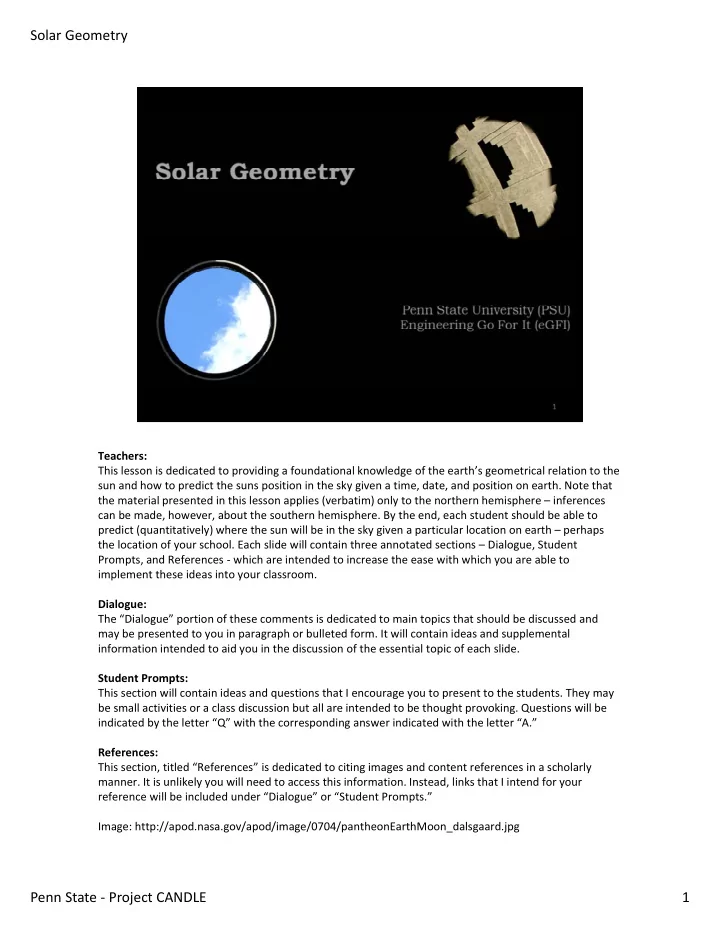
SLIDE 1 Teachers: This lesson is dedicated to providing a foundational knowledge of the earth’s geometrical relation to the sun and how to predict the suns position in the sky given a time, date, and position on earth. Note that the material presented in this lesson applies (verbatim) only to the northern hemisphere – inferences can be made, however, about the southern hemisphere. By the end, each student should be able to predict (quantitatively) where the sun will be in the sky given a particular location on earth – perhaps the location of your school. Each slide will contain three annotated sections – Dialogue, Student Prompts, and References ‐ which are intended to increase the ease with which you are able to implement these ideas into your classroom. Dialogue: The “Dialogue” portion of these comments is dedicated to main topics that should be discussed and may be presented to you in paragraph or bulleted form. It will contain ideas and supplemental information intended to aid you in the discussion of the essential topic of each slide. Student Prompts: This section will contain ideas and questions that I encourage you to present to the students. They may be small activities or a class discussion but all are intended to be thought provoking. Questions will be indicated by the letter “Q” with the corresponding answer indicated with the letter “A.” References: This section, titled “References” is dedicated to citing images and content references in a scholarly
- manner. It is unlikely you will need to access this information. Instead, links that I intend for your
reference will be included under “Dialogue” or “Student Prompts.” Image: http://apod.nasa.gov/apod/image/0704/pantheonEarthMoon_dalsgaard.jpg
1 Penn State ‐ Project CANDLE Solar Geometry
SLIDE 2
This module was created by Ph.D. candidate Tony Esposito (e: txe136@psu.edu) from the Department of Architectural Engineering at Penn State University – University Park. This module was only possible due to the generous contribution of Project CANDLE and NSF Sponsored GK‐12 CarbonEARTH. Visit their perspective websites at the links below: ProjectCANDLE: http://www.engr.psu.edu/candle/ (Contact: Kevin Houser – khouser@engr.psu.edu) CarbonEARTH: http://www.carbonearth.org (Contact: Renee Diehl – rdiehl@psu.edu)
2 Penn State ‐ Project CANDLE Solar Geometry
SLIDE 3
3 Penn State ‐ Project CANDLE Solar Geometry
SLIDE 4
Dialogue: These symbols will be used throughout the lesson to indicate various action items. Introduce these symbols and their meanings to the students. Student Prompts: Be sure the students understand what each of these symbols indicates. Reference: Question Mark (image): http://www.clker.com/clipart‐7596.html Cautionary Mark (image): http://www.public‐domain‐photos.com/free‐ cliparts/computer/actions/warning‐1250.htm
4 Penn State ‐ Project CANDLE Solar Geometry
SLIDE 5 The first section of this lesson is dedicated to understanding the fundamentals of the Earth’s relationship to the sun and integrating the appropriate terminology into our
- vocabulary. At the end of SECTION 1 students should understand the following:
- The Earth’s orbit around the sun
- The Earth’s rotation around its own axis
- The tilt of the Earth’s axis relative to the sun
- The cause of the season on earth (i.e. earths axial tilt)
Additionally, students will be able to plot – as viewed from above – the location of the earth relative to the sun indicating the earths position for the four seasons and the directions of rotation of the earth around the sun and the earth around its own axis. References: Image credit: http://oldroadapples.wordpress.com/2014/02/21/1‐in‐4‐americans‐think‐ sun‐rotates‐around‐earth/
5 Penn State ‐ Project CANDLE Solar Geometry
SLIDE 6 Dialogue: Use this time to probe the students’ current knowledge about the various topics to be presented in this section:
- The Earth’s orbit around the sun
- The Earth’s rotation around its own axis
- The tilt of the Earth’s axis relative to the sun
- The cause of the season on earth (i.e. earths axial tilt)
Student Prompts: Encourage the students to begin to think about the geometry between the earth and the sun as the earth orbits around the sun and rotates about its own (tilted) axis. References: No references for this slide.
6 Penn State ‐ Project CANDLE Solar Geometry
SLIDE 7 Dialogue: You may front‐load these videos and then proceed with the remainder of the powerpoint,
- r you may show them periodically throughout the presentation as you feel most
- appropriate. There are many more resources online that you may utilize. A quick google
search should reveal many. Student Prompts: Encourage the students to pay close attention to these videos and form their own questions about the topics presented. Additionally, it may be helpful to have the students review the worksheet before watching the video to anticipate the information to pay particular attention to. References: No references for this slide.
7 Penn State ‐ Project CANDLE Solar Geometry
SLIDE 8
Dialogue: To your discretion. The complexity of the conversation around this question will depend on the students’ previous knowledge of the subject matter. Student Prompts: Q: When viewing the solar system from above (“Plan View”), in which direction does the EARTH rotate around the SUN? References: Image (modified from its original version): http://www.eyeonthesky.org/lessonplans/08sun_moonplayground.html
8 Penn State ‐ Project CANDLE Solar Geometry
SLIDE 9
Dialogue: The earth orbits the sun in a counterclockwise (anti‐clockwise) manner. Student Prompts: A: Earth orbits counterclockwise around the sun (when viewed from above). Have the students record the above answer on their worksheet. References: Image (modified from its original version): http://www.eyeonthesky.org/lessonplans/08sun_moonplayground.html
9 Penn State ‐ Project CANDLE Solar Geometry
SLIDE 10
Dialogue: To your discretion. The complexity of the conversation around this question will depend on the students’ previous knowledge of the subject matter. Student Prompts: Q: When viewed from above (“Plan View”), in which direction does the EARTH rotate around its own axis? References: Image (modified from its original version): http://www.eyeonthesky.org/lessonplans/08sun_moonplayground.html
10 Penn State ‐ Project CANDLE Solar Geometry
SLIDE 11
Dialogue: The earth rotates around its own axis in a counterclockwise (anti‐clockwise) manner. Student Prompts: A: Earth rotates counterclockwise around its own axis (when viewed from above). Have the students record the above answer on their worksheet. References: Image (modified from its original version): http://www.eyeonthesky.org/lessonplans/08sun_moonplayground.html
11 Penn State ‐ Project CANDLE Solar Geometry
SLIDE 12
Dialogue: To your discretion. The complexity of the conversation around this question will depend on the students’ previous knowledge of the subject matter. Student Prompts: Q: What is the Earth’s axial tilt relative to its orbital plane? References: No references for this slide.
12 Penn State ‐ Project CANDLE Solar Geometry
SLIDE 13
Dialogue: Any further discussion useful for your classroom. Student Prompts: A: Earth is tilted off‐axis 23.5° relative to its own orbital plane Have the students record the above answer on their worksheets. References: Image credit: http://www.skepticalscience.com/Drought_in_the_Amazon_A_death_spiral_part_1_seaso ns.html
13 Penn State ‐ Project CANDLE Solar Geometry
SLIDE 14 Dialogue: Encourage the students to consider how the axial tilt affects our earthly experience! Student Prompts: Encourage the students to consider what effect this axial tilt has on our experience on earth. Q: (In the northern hemisphere) What time of year will the sun feel the hottest? How does this relate to the earths tilt? Q: (In the northern hemisphere) What time of year will the sun feel the coolest? How does this relate to the earths tilt? Q: What conclusions can you make about the relationship between the seasons and the earths axial tilt? Q: How would the axial tilt effect the location (we perceive) the sun to be in the sky? (More
References: Image credit: http://www.skepticalscience.com/Drought_in_the_Amazon_A_death_spiral_part_1_seaso ns.html
14 Penn State ‐ Project CANDLE Solar Geometry
SLIDE 15
Dialogue: ‐‐ Student Prompts: A: The sun is the hottest in the summer. This is when the earth is tilted towards the sun. A: The sun is the coldest in the winter. This is when the earth is tilted away from the sun. A: Summer is when the sun it tiled toward the sun – Winter is when the sun is tilted away from the sun. What about the equinoxes? A: (Northern Hemisphere) Sun is highest in the sky during summer and lowest in the sky during winter. References: Image credit: http://www.skepticalscience.com/Drought_in_the_Amazon_A_death_spiral_part_1_seaso ns.html
15 Penn State ‐ Project CANDLE Solar Geometry
SLIDE 16
Dialogue: Encourage the students to think about their location on earth and how the axial tilt will position them closer or further away from the sun (based on the time of the year). Student Prompts: Q: In the diagram, which season are represented? References: Image credit: http://www.skepticalscience.com/Drought_in_the_Amazon_A_death_spiral_part_1_seaso ns.html
16 Penn State ‐ Project CANDLE Solar Geometry
SLIDE 17
Dialogue: At this time it might be useful to encourage the students to think about how this axial tilt relates to the perceived height of the sun in the sky. That is – in the northern hemisphere – the sun appears highest in the sky during summer (summer solstice) and lowest in the sky during winter (winter solstice). Student Prompts: A: (Left) Winter in the northern hemisphere – (Right) Summer in the northern hemisphere Be sure that the students fully understand this concept. It will be extremely important for the remainder of this lesson and will be the main focus of the activity at the end of this section. References: Image credit: http://www.skepticalscience.com/Drought_in_the_Amazon_A_death_spiral_part_1_seaso ns.html
17 Penn State ‐ Project CANDLE Solar Geometry
SLIDE 18
Dialogue: At this time it might be useful to encourage the students to think about how this axial tilt relates to the perceived height of the sun in the sky. That is – in the northern hemisphere – the sun appears highest in the sky during summer (summer solstice) and lowest in the sky during winter (winter solstice). Student Prompts: Q: Why must we make the distinction of “northern hemisphere?” References: Image credit: http://www.skepticalscience.com/Drought_in_the_Amazon_A_death_spiral_part_1_seaso ns.html
18 Penn State ‐ Project CANDLE Solar Geometry
SLIDE 19
Dialogue: At this time it might be useful to encourage the students to think about how this axial tilt relates to the perceived height of the sun in the sky. That is – in the northern hemisphere – the sun appears highest in the sky during summer (summer solstice) and lowest in the sky during winter (winter solstice). Student Prompts: A: Because the seasons are reversed in the southern hemisphere! That is, when the northern hemisphere has summer (sun highest in the sky), the southern hemisphere has winter (sun lowest in the sky). References: Image credit: http://www.skepticalscience.com/Drought_in_the_Amazon_A_death_spiral_part_1_seaso ns.html
19 Penn State ‐ Project CANDLE Solar Geometry
SLIDE 20
Dialogue: Presented here are the key terms that students should familiarize themselves with. It is to your discretion how you’d like to present these definitions to the students. I’ve included it at the end anticipating that it might be best to assign a technical definition to these words after they’ve been presented in the videos, discussed with the class, and worked into normal vocabulary. Student Prompts: Technical Definitions References: No references for this slide.
20 Penn State ‐ Project CANDLE Solar Geometry
SLIDE 21
Dialogue: Presented here are the key terms that students should familiarize themselves with. It is to your discretion how you’d like to present these definitions to the students. I’ve included it at the end anticipating that it might be best to assign a technical definition to these words after they’ve been presented in the videos, discussed with the class, and worked into normal vocabulary. Student Prompts: Technical Definitions References: Modified Wikipedia entries were used in definition of terms.
21 Penn State ‐ Project CANDLE Solar Geometry
SLIDE 22
Dialogue: Presented here are the key terms that students should familiarize themselves with. It is to your discretion how you’d like to present these definitions to the students. I’ve included it at the end anticipating that it might be best to assign a technical definition to these words after they’ve been presented in the videos, discussed with the class, and worked into normal vocabulary. Student Prompts: Technical Definitions References: Modified Wikipedia entries were used in definition of terms.
22 Penn State ‐ Project CANDLE Solar Geometry
SLIDE 23
Dialogue: In this activity students will demonstrate their understanding of the Earth‐Sun geometry by drawing a plan view of Earth’s orbit around the sun indicating the four (major) dates (positions) listed above. Refer to the link below for additional help with this activity: http://www.moonstick.com/motions.htm Student Prompts: Students should fully document and label the above positions with titles, dates, appropriate Julian day, and the direction of Earth’s tilt. Inclusion of the birthday activity is encourage each student to personalize their assignment. NOTE: Calculation of Julian day will be critical for later sections! References: No references for this slide.
23 Penn State ‐ Project CANDLE Solar Geometry
SLIDE 24
Dialogue: The image provided above is there for reference only. It is to your discretion if you’d like it present during the quiz. The “quiz” sheet has been intentionally left blank. Quizzing is being left to your discretion so that you may emphasize material/topics that you find most important. It may be material taken from the videos, presentation, worksheets, activities, any combination of them, or something else. The main purpose of the “quiz” sheet is to serve as a quiz template that maintains the format of the other education material used in this lesson. Student Prompts: ‐‐‐‐‐ References: Image credit: http://oldroadapples.wordpress.com/2014/02/21/1‐in‐4‐americans‐think‐ sun‐rotates‐around‐earth/
24 Penn State ‐ Project CANDLE Solar Geometry
SLIDE 25 The second section of this lesson is dedicated to understanding how we quantify time and position on earth and integrating the appropriate terminology into our vocabulary. At the end of SECTION 2 students should understand the following:
- How longitude is defined
- How latitude is defined
- How longitude and latitude are used to define a position on Earth
- How these lines correspond to time and time zones.
References: Latitude image: http://www.britannica.com/EBchecked/media/109270?topicId=331993 Longitude image: http://www.britannica.com/EBchecked/media/109271?topicId=331993
25 Penn State ‐ Project CANDLE Solar Geometry
SLIDE 26 Dialogue: You may front‐load these videos and then proceed with the remainder of the powerpoint,
- r you may show them periodically throughout the presentation as you feel most
- appropriate. There are many more resources online that you may utilize. A quick google
search should reveal many. Student Prompts: Encourage the students to pay close attention to these videos and form their own questions about the topics presented. Additionally, it may be helpful to have the students review the worksheet before watching the video to anticipate the information to pay particular attention to. References: No references for this slide.
26 Penn State ‐ Project CANDLE Solar Geometry
SLIDE 27
Dialogue: Depending on your grade level, latitude may be a familiar topic. In any case, you may use this time to identify the knowledge of your students and pinpoint any gaps in their knowledge. Student Prompts: Q: What is latitude? References: No references for this slide.
27 Penn State ‐ Project CANDLE Solar Geometry
SLIDE 28 Dialogue: Use the picture above to reiterate the fact that lines of constant latitude are concentric circles parallel with the equator. Student Prompts: A: Latitude is a geographical coordinate that specifies the north‐south position of a point
References: Image credit: http://www.britannica.com/EBchecked/media/109270?topicId=331993
28 Penn State ‐ Project CANDLE Solar Geometry
SLIDE 29
Dialogue: If students do not fully understand the concept of a “convention” it might be best to take the time to explore the topic. That is, the north pole is +90° (90°N) latitude by convention. By convention, the south pole is ‐90° (90°S) latitude. Introduce the idea that the positive and negative symbols can be removed and replaced with N (for “North”) and S (for “South”). That is, “N” corresponds to a positive latitude, whereas “S” corresponds to a negative latitude. Student Prompts: Lines of constant latitude are measure in degrees and range from ‐90° (South Pole) and +90° (North Pole) If students don’t understand the concept of a “convention” it References: Image credit: http://www.britannica.com/EBchecked/media/109270?topicId=331993
29 Penn State ‐ Project CANDLE Solar Geometry
SLIDE 30
Dialogue: Sharp students will notice that the answer to the question is in the picture! Student Prompts: A: Where is the logical place for the lines of 0° latitude? References: Image credit: http://www.britannica.com/EBchecked/media/109270?topicId=331993
30 Penn State ‐ Project CANDLE Solar Geometry
SLIDE 31 Dialogue: Emphasize that the equator is 0° latitude. It is the most logical answer given that it is not
- nly a familiar location on earth, but it also perfectly divides the Earth into what we call the
“Northern Hemisphere” and “Southern Hemisphere.” Student Prompts: A: The equator! References: Image credit: http://www.britannica.com/EBchecked/media/109270?topicId=331993
31 Penn State ‐ Project CANDLE Solar Geometry
SLIDE 32
Dialogue: Facts about latitude taken from the link below: http://www.britannica.com/EBchecked/media/109270?topicId=331993 Student Prompts: Review these facts with the class and be sure that the students understand these facts References: Image credit: http://www.britannica.com/EBchecked/media/109270?topicId=331993
32 Penn State ‐ Project CANDLE Solar Geometry
SLIDE 33
Dialogue: Depending on your grade level, longitude may be a familiar topic. In any case, you may use this time to identify the knowledge of your students and pinpoint any gaps in their knowledge. Student Prompts: Q: What is longitude? References: No references for this slide.
33 Penn State ‐ Project CANDLE Solar Geometry
SLIDE 34
Dialogue: Use the image above to reiterate that lines of constant longitude pass through the north and south poles and contain—through their center—the Earth’s axis. Student Prompts: A: Longitude is a geographical coordinate that specifies the east‐west position of a point on the Earth’s surface. References: Image credit: http://www.britannica.com/EBchecked/media/109270?topicId=331993
34 Penn State ‐ Project CANDLE Solar Geometry
SLIDE 35
Dialogue: The idea of a “convention” will be specifically important for the next few slides as the definition of longitude is not as logical as the definition of latitude. Student Prompts: Lines of constant longitude run north‐south and are measured in degrees. Longitude ranges from ‐180° to +180° [‐180° ≤ L ≤ +180°] References: Image credit: http://www.britannica.com/EBchecked/media/109270?topicId=331993
35 Penn State ‐ Project CANDLE Solar Geometry
SLIDE 36
Dialogue: Sharp students will notice that the answer is in the picture above, however it is not necessarily logical. Student Prompts: Q: Where is the logical position for 0° longitude? References: Image credit: http://www.britannica.com/EBchecked/media/109270?topicId=331993
36 Penn State ‐ Project CANDLE Solar Geometry
SLIDE 37 Dialogue: The definition of 0° longitude is not as logical as the definition of 0° latitude. It passes through the Royal Observatory in Greenwhich, England and is such because of historical
- reasons. As a great addition to this course material, I highly recommend adding a history
lesson which discusses the historical challenge that navigators faced in determining their longitude at sea. I recommend the book titled “Longitude: The True Story of a Lone Genius Who Solved the Greatest Scientific Problem of His Time” written by Dava Sobel. It walks through the entire history and discusses the relevance of the Royal Observatory in Greenwhich, England. Student Prompts: A: As is turns out, there is no logical location of 0° longitude. 0° longitude (also called the “Prime meridian”) passes through the Royal Observatory in Greenwich, England. This is for historical reasons. References: Image credit: http://www.britannica.com/EBchecked/media/109270?topicId=331993
37 Penn State ‐ Project CANDLE Solar Geometry
SLIDE 38
Dialogue: By convention lines of positive longitude are east of the prime meridian and lines of negative longitude are west of the prime meridian Student Prompts: Lines of positive longitude are east of the prime meridian Lines of negative longitude are west of the prime meridian References: Image credit: http://www.britannica.com/EBchecked/media/109270?topicId=331993
38 Penn State ‐ Project CANDLE Solar Geometry
SLIDE 39
Dialogue: Facts about latitude taken from the link below: http://www.britannica.com/EBchecked/media/109271?topicId=331993 Student Prompts: Review these facts with the class and be sure that the students understand these facts References: Image credit: http://www.britannica.com/EBchecked/media/109271?topicId=331993
39 Penn State ‐ Project CANDLE Solar Geometry
SLIDE 40
Dialogue: The prime meridian has other significance than just being the convention for 0° latitude. Encourage the students to think of what this significance might be. The topic to be presented next, however, are likely to be unfamiliar to most of the students. Hint: the prime meridian is used in the definition of Coordinated Universal Time (UTC) and the International Date Line which is the location on Earth that determines when a new calendar day is entered. Student Prompts: Q: Besides being 0° latitude, what other significance do you think the prime meridian has? References: No references for this slide.
40 Penn State ‐ Project CANDLE Solar Geometry
SLIDE 41
Dialogue: The prime meridian is used to define UTC which is the time standard that is used to regulate clocks and time across the Earth. There are 12 time zones east of the prime meridian (1 per 15° of rotation) and 12 time zones west of the prime meridian (1 per 15° of rotation). (There are actually more than this but they are due to legalities. Understanding that there exists 12 time zones on each side of the prime meridian is sufficient for this lesson). Student Prompts: A: The prime meridian is used as the primary time standard by which the whole world regulates their clocks and time! This is called Coordinated Universal Time (UTC) and the time zone at the prime meridian is denoted UTC‐00:00 References: ‐‐‐‐‐
41 Penn State ‐ Project CANDLE Solar Geometry
SLIDE 42
Dialogue: Use the diagram above to demonstrate the concept of time zones and how it relates to where you live. Make specific now to the location of your school on the map and have the students note this time zone on their worksheets. Also, point out the “International Date Line” marked above. This hasn’t been discussed yet but will proceed this slide. Student Prompts: Q: What is the time zone of your house? Your school? References: Image credit: http://upload.wikimedia.org/wikipedia/commons/8/88/World_Time_Zones_Map.png
42 Penn State ‐ Project CANDLE Solar Geometry
SLIDE 43
Dialogue: It might be useful to have students do independent or group research into this topic. It may be difficult for students to understand the idea that different places on Earth can have different times and different calendar dates. Student Prompts: Q: What significance does the “International Date Line Have?” What important feature do you notice about it (in relation to the prime meridian)? References: Image credit: http://upload.wikimedia.org/wikipedia/commons/8/88/World_Time_Zones_Map.png
43 Penn State ‐ Project CANDLE Solar Geometry
SLIDE 44
Dialogue: Use the graphic above (an animated .GIF that can be seen in “slide show” mode) to help demonstrate the idea that a new day begins at the International Date Line and that it is exactly opposite the Prime Meridian on the globe. Student Prompts: A: The International Date Line is 180° around the earth from the prime meridian. The International Date Line is the point on Earth where a new calendar day begins! References: Image credit: http://upload.wikimedia.org/wikipedia/commons/8/88/World_Time_Zones_Map.png
44 Penn State ‐ Project CANDLE Solar Geometry
SLIDE 45
Dialogue: Presented here are the key terms that students should familiarize themselves with. It is to your discretion how you’d like to present these definitions to the students. I’ve included it at the end anticipating that it might be best to assign a technical definition to these words after they’ve been presented in the videos, discussed with the class, and worked into normal vocabulary. Student Prompts: Technical Definitions References: No references for this slide.
45 Penn State ‐ Project CANDLE Solar Geometry
SLIDE 46
Dialogue: Presented here are the key terms that students should familiarize themselves with. It is to your discretion how you’d like to present these definitions to the students. I’ve included it at the end anticipating that it might be best to assign a technical definition to these words after they’ve been presented in the videos, discussed with the class, and worked into normal vocabulary. Student Prompts: Technical Definitions References: Modified Wikipedia entries were used in definition of terms.
46 Penn State ‐ Project CANDLE Solar Geometry
SLIDE 47
Dialogue: Presented here are the key terms that students should familiarize themselves with. It is to your discretion how you’d like to present these definitions to the students. I’ve included it at the end anticipating that it might be best to assign a technical definition to these words after they’ve been presented in the videos, discussed with the class, and worked into normal vocabulary. Student Prompts: Technical Definitions References: Modified Wikipedia entries were used in definition of terms.
47 Penn State ‐ Project CANDLE Solar Geometry
SLIDE 48
Dialogue: In this activity students will demonstrate their understanding of longitude and latitude by finding geographical coordinates for specified places, and drawing their location on a diagram indicating the appropriate coordinates. Note that longitude and latitude can be expressed as fractional degrees or in terms of “minutes” and “seconds.” For simplicity, I recommend sticking with fractional degrees as this is the easiest format to understand and understanding the conversion from “minutes” and “seconds” to fractional degrees is of little important for this lesson. For added problems, utilize the following video: https://www.youtube.com/watch?v=wcfqKiEmIeQ Student Prompts: References: Image on worksheet: http://classedenini.eklablog.com/latitude‐et‐longitude‐a85673812 Image on worksheet:
48 Penn State ‐ Project CANDLE Solar Geometry
SLIDE 49
Dialogue: The images provided above is there for reference only. It is to your discretion if you’d like it present during the quiz. The “quiz” sheet has been intentionally left blank. Quizzing is being left to your discretion so that you may emphasize material/topics that you find most important. It may be material taken from the videos, presentation, worksheets, activities, any combination of them, or something else. The main purpose of the “quiz” sheet is to serve as a quiz template that maintains the format of the other education material used in this lesson. Student Prompts: References: Latitude image: http://www.britannica.com/EBchecked/media/109270?topicId=331993 Longitude image: http://www.britannica.com/EBchecked/media/109271?topicId=331993
49 Penn State ‐ Project CANDLE Solar Geometry
SLIDE 50 The third section of this lesson is dedicated to understanding (and using) mathematical equations to predict the location of the sun in the sky. At the end of SECTION 3 students should understand the following:
- How to quantify solar position
- How to calculate solar position
- The difference between solar time and local time (time on your clock)
- How daylight savings time affects standard time
Student Prompts: ‐‐‐‐‐ References: Sun Image: http://www.clipartbest.com/sun‐clipart‐images Sky Image: http://bestclipartblog.com/32‐sky‐clip‐art.html/ Solar Window Image: http://www.solarfeeds.com/solar‐system‐design‐on‐the‐fall‐equinox/
50 Penn State ‐ Project CANDLE Solar Geometry
SLIDE 51
Dialogue: It’s important as you begin this section that you disassociate the time on your watch and the location of the sun in the sky. Obviously mathematical equations link the time on our watch and the position of the sun in the sky, but it isn’t always obvious. Student Prompts: ‐‐‐‐‐ References: Image credit: http://en.wikipedia.org/wiki/Horizontal_coordinate_system#mediaviewer/File:Azimuth‐ Altitude_schematic.svg
51 Penn State ‐ Project CANDLE Solar Geometry
SLIDE 52
Dialogue: Be sure that students understand angles and how to measure them. A small precursor activity to this could be to allow students to measure angles using a protractor. Discuss the use of measuring an angle from a fixed reference location. The reference location for Solar Azimuth Angle (as) is always measured from a line extending from the observer in the South direction. The Solar Altitude Angle (at) is always measure vertically from the horizon line. Student Prompts: ‐ Describe Solar Azimuth Angle (out loud) and describe how is it measured. ‐ Describe Solar Altitude Angle (out loud) and describe how it is measured. References: Image credit (modified): http://en.wikipedia.org/wiki/Horizontal_coordinate_system#mediaviewer/File:Azimuth‐ Altitude_schematic.svg
52 Penn State ‐ Project CANDLE Solar Geometry
SLIDE 53
Dialogue: ‐‐‐‐‐ Student Prompts: ‐‐‐‐‐ References: Image credit: http://en.wikipedia.org/wiki/Horizontal_coordinate_system#mediaviewer/File:Azimuth‐ Altitude_schematic.svg
53 Penn State ‐ Project CANDLE Solar Geometry
SLIDE 54 Dialogue: Discuss daylight savings time and why it is used. Historically it was used to extend daylight hours into the evening to save energy when incandescent lighting was the primary source
Student Prompts: Q: What is Daylight Savings Time (DST)? Q: Why is it used? Q: Do all parts of the world use it? References: Image credit: http://en.wikipedia.org/wiki/Horizontal_coordinate_system#mediaviewer/File:Azimuth‐ Altitude_schematic.svg
54 Penn State ‐ Project CANDLE Solar Geometry
SLIDE 55 Dialogue: This calculation will require the use of a calculator and an understanding of how to use the Sine function. It is to the teachers discretion to decide how complex to delve into the topic
- f the Equation of Time (ET). It requires a thorough understanding of the geometric
relationship between the Earth and the Sun. You may dive deeply into this topic or present it as a step in the calculation procedure. Student Prompts: Q: What does the 365.25 in the denominator represent? A: The number of days that it takes the Earth to make 1 full rotation around the sun, which is not 365 as commonly thought. It is why we have a leap day every 4 years (0.25 * 4 = 1 extra day) References: http://www.umass.edu/sunwheel/images/Image8.jpg
55 Penn State ‐ Project CANDLE Solar Geometry
SLIDE 56 Dialogue: This calculation will require the use of a calculator and an understanding of how to use the Sine function. It is to the teachers discretion to decide how complex to delve into the topic
- f the Equation of Time (ET). It requires a thorough understanding of the geometric
relationship between the Earth and the Sun. You may dive deeply into this topic or present it as a step in the calculation procedure. Student Prompts: ‐‐‐‐‐ References: http://www.umass.edu/sunwheel/images/Image8.jpg
56 Penn State ‐ Project CANDLE Solar Geometry
SLIDE 57
Dialogue: Emphasize that the longitude correction is calculated based on your location relative to the standard meridian for your time zone. Student Prompts: ‐‐‐‐‐ References: Image credit: http://en.wikipedia.org/wiki/Horizontal_coordinate_system#mediaviewer/File:Azimuth‐ Altitude_schematic.svg
57 Penn State ‐ Project CANDLE Solar Geometry
SLIDE 58
Dialogue: A calculation of solar time compares Student Prompts: ‐‐‐‐‐ References: Image credit: http://en.wikipedia.org/wiki/Horizontal_coordinate_system#mediaviewer/File:Azimuth‐ Altitude_schematic.svg
58 Penn State ‐ Project CANDLE Solar Geometry
SLIDE 59
Dialogue: Emphasize that the longitude correction is calculated based on your location relative to the standard meridian for your time zone. Student Prompts: ‐‐‐‐‐ References: Image credit: http://en.wikipedia.org/wiki/Horizontal_coordinate_system#mediaviewer/File:Azimuth‐ Altitude_schematic.svg
59 Penn State ‐ Project CANDLE Solar Geometry
SLIDE 60 Dialogue: This calculation will require the use of a calculator and an understanding of how to use the Sine function. It is to the teachers discretion to decide how complex to delve into the topic
- f solar declination. It requires a thorough understanding of the geometric relationship
between the Earth and the Sun. You may dive deeply into this topic or present it as a step in the calculation procedure. Student Prompts: ‐‐‐‐‐ References: Image credit: http://en.wikipedia.org/wiki/Horizontal_coordinate_system#mediaviewer/File:Azimuth‐ Altitude_schematic.svg
60 Penn State ‐ Project CANDLE Solar Geometry
SLIDE 61 Dialogue: This calculation will require the use of a calculator and an understanding of how to use the Sine function. It is to the teachers discretion to decide how complex to delve into the topic
- f solar declination. It requires a thorough understanding of the geometric relationship
between the Earth and the Sun. You may dive deeply into this topic or present it as a step in the calculation procedure. Student Prompts: ‐‐‐‐‐ References: Image credit: http://en.wikipedia.org/wiki/Horizontal_coordinate_system#mediaviewer/File:Azimuth‐ Altitude_schematic.svg
61 Penn State ‐ Project CANDLE Solar Geometry
SLIDE 62
Dialogue: Presented here are the key terms that students should familiarize themselves with. It is to your discretion how you’d like to present these definitions to the students. I’ve included it at the end anticipating that it might be best to assign a technical definition to these words after they’ve been presented in the videos, discussed with the class, and worked into normal vocabulary. Student Prompts: Technical Definitions References: No references for this slide.
62 Penn State ‐ Project CANDLE Solar Geometry
SLIDE 63
Dialogue: Presented here are the key terms that students should familiarize themselves with. It is to your discretion how you’d like to present these definitions to the students. I’ve included it at the end anticipating that it might be best to assign a technical definition to these words after they’ve been presented in the videos, discussed with the class, and worked into normal vocabulary. Student Prompts: Technical Definitions References: Modified Wikipedia entries were used in definition of terms.
63 Penn State ‐ Project CANDLE Solar Geometry
SLIDE 64
Dialogue: Presented here are the key terms that students should familiarize themselves with. It is to your discretion how you’d like to present these definitions to the students. I’ve included it at the end anticipating that it might be best to assign a technical definition to these words after they’ve been presented in the videos, discussed with the class, and worked into normal vocabulary. Student Prompts: Technical Definitions References: Modified Wikipedia entries were used in definition of terms.
64 Penn State ‐ Project CANDLE Solar Geometry
SLIDE 65
Dialogue: In this activity students will demonstrate their understanding of longitude and latitude by finding geographical coordinates for specified places, and drawing their location on a diagram indicating the appropriate coordinates. Note that longitude and latitude can be expressed as fractional degrees or in terms of “minutes” and “seconds.” For simplicity, I recommend sticking with fractional degrees as this is the easiest format to understand and understanding the conversion from “minutes” and “seconds” to fractional degrees is of little important for this lesson. For added problems, utilize the following video: https://www.youtube.com/watch?v=wcfqKiEmIeQ Student Prompts: References: Image on worksheet: http://classedenini.eklablog.com/latitude‐et‐longitude‐a85673812
65 Penn State ‐ Project CANDLE Solar Geometry
SLIDE 66
Dialogue: In this activity students will demonstrate their understanding of longitude and latitude by finding geographical coordinates for specified places, and drawing their location on a diagram indicating the appropriate coordinates. Note that longitude and latitude can be expressed as fractional degrees or in terms of “minutes” and “seconds.” For simplicity, I recommend sticking with fractional degrees as this is the easiest format to understand and understanding the conversion from “minutes” and “seconds” to fractional degrees is of little important for this lesson. For added problems, utilize the following video: https://www.youtube.com/watch?v=wcfqKiEmIeQ Student Prompts: References: Image: http://astroedu.iau.org/media/activities/attach/09a3cb64‐c6c3‐49ac‐9952‐ 07b3f7c11958/astroedu1503‐shadow.jpg
66 Penn State ‐ Project CANDLE Solar Geometry
SLIDE 67
Dialogue: The images provided above is there for reference only. It is to your discretion if you’d like it present during the quiz. The “quiz” sheet has been intentionally left blank. Quizzing is being left to your discretion so that you may emphasize material/topics that you find most important. It may be material taken from the videos, presentation, worksheets, activities, any combination of them, or something else. The main purpose of the “quiz” sheet is to serve as a quiz template that maintains the format of the other education material used in this lesson. Student Prompts: References: Image credit (modified): http://en.wikipedia.org/wiki/Horizontal_coordinate_system#mediaviewer/File:Azimuth‐ Altitude_schematic.svg
67 Penn State ‐ Project CANDLE Solar Geometry
SLIDE 68
Dialogue: An extra resource Student Prompts: ‐‐‐‐‐ References: http://www.stellarium.org/
68 Penn State ‐ Project CANDLE Solar Geometry