
SLIDE 1
Selected Land Use Register
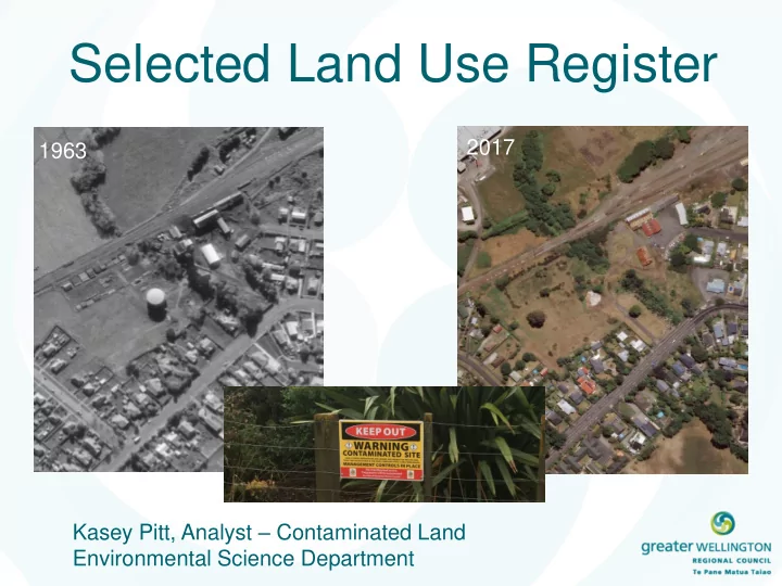
Kasey Pitt, Analyst – Contaminated Land Environmental Science Department 2017 1963
Selected Land Use Register 2017 1963 Kasey Pitt, Analyst - - PowerPoint PPT Presentation
Selected Land Use Register 2017 1963 Kasey Pitt, Analyst Contaminated Land Environmental Science Department Outline What is the Selected Land Use Register (SLUR) Relationship with Territorial Authorities Contaminated Land
Kasey Pitt, Analyst – Contaminated Land Environmental Science Department 2017 1963
Sec 30(1)(ca) Sec 31(b)(iia)
Internal SLUR database – Entry for 34 Chapel Street, Masterton
http://mapping.gw.govt.nz/GW/GWpublicMap_Mobile/?webmap=72ece62d902e4c3fb6 506136104abbf9
https://ta-extranet.gw.govt.nz/index.cfm?CFID=48969&CFTOKEN=86871148
http://mapping.gw.govt.nz/gw/taextranet-gis/
1941 1941
Sites are released and appear on the external services Property owners are sent a notification letter Approved sites are entered onto the SLUR Reviewed by Suitably Qualified and Experienced Practitioner Information gathered and prepared Site Identified
Identify error Create file note Review Complete update
Current SLUR Categories New Categories Category I – Verified History of Hazardous Activity or Industry Verified HAIL Site
Category II - Unverified History of Hazardous Activity or Industry Unverified HAIL Category III – Contamination Confirmed Contaminated for <land use>
Category IV – Contamination Acceptable, Managed/Remediated Suitable for <land use>
Managed for <land use> Category IV AND Category V – No Identified Contamination At or Below Background
Category VI – Entered on Register in Error Verified Non-HAIL