
SLIDE 1
Save the Railway Path! - - PowerPoint PPT Presentation
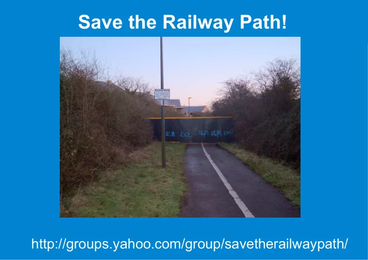
Save the Railway Path! http://groups.yahoo.com/group/savetherailwaypath/ The Problem: Traffic Bristol is congested Commuter traffic in and out City Centre+North Fringe School run traffic in term time More to Come! 30-40,000 of houses
Bristol is congested Commuter traffic in and out City Centre+North Fringe School run traffic in term time
17/1/2007 Public Transport Corridor Options
17/1/2007 Public Transport Corridor Options
"In terms of risk to delivery, the relatively simpler
"The J2 alignment to Emerson's Green also has
"Use of the Bristol to Bath railway path...could
17/1/2007 Public Transport Corridor Options
1/12/2007 option appraisal results
Prices to match buses 6 buses/hour
One-way commuter
Will only offset damage
Not current Air Quality
It's too narrow for bus+path+greenery entry points will be "rationalised" to a few "safe"
Anything that lives there is doomed We would get 3m of track; no way to get off it. Split the community like the M32?
Easton-Staple Hill Disused Railway SNCI
The Lido SNCI -route runs alongside Rodway Common SNCI -route cuts through site Royate Hill local nature reserve Protected species: badgers, glow worms, bats?
A project initiated by the Bristol Cycling Campaign. As this is a broader issue than just cycle access, we've set up a separate mailing list and want anyone who cares about this path to get involved. It was created by Sustrans for a route for everyone, and that is how it should remain. We have a mailing list for anyone interested -come join us. Look for "save the railway path" under yahoo groups.
This shouldn't be news to anyone. Bristol is very prosperous for a UK city, and has a worst-in-class public transport system. There are some fundamental historical reasons for this (no single central focal point, privatised buses since the early twentieth century, hilly and narrow roads. FirstBus just amplifies the problem with dirty and unreliable buses. The UWE buses U1, U2, U3 show things can be different Since the mid eighties, development around the northern ring road in Filton, Stoke Gifford and the A38 up to the M5 have created a new congestion zone, the North Fringe. This has commuter traffic from out of Bristol coming in , and Bristol residents heading out, plus students Back in about 1994 you could drive in and
arrivals have changed that. Now you need to be on the road before 4:30 (this pic was taken at 4:45) or after 6:15pm.
Regional Spatial Strategy. including 10,500 to the south west, 8500 North and East, 6000 to the south east. Thousands in Hengrove.
Greater Bristol Transport Study (2005) http://www.gos.gov.uk/gosw/transport/regtransstrat/gbsts/ Transport plan: http://www.westofengland.org/site/JointLocalTransportPlan_2867.asp These proposed various things, including some Bus Rapid Transit routes which followed the routes shown here.
The route options investigated included the original A432 proposal, but someone found a 'disused' railway nearby….
The key thing here is that since march, the railway path has been targeted for a BRT. By the time consultation begins, 12+ months time will have been invested in turning it into a bus lane. When consultation comes the questions will be "what color do you want the buses" rather than "do you want the buses?"
7
the "contentious" reference is p54 of 2007-01-17-public-transport-corridor-
8
From: 2007-05-corridor-options-short-list-report-part-2-of-3.pdf
From: 2007-05-corridor-options-short-list-report-part-2-of-3.pdf Look familiar? The green bit at the end is houses that don't exist. Note that the stations are designed to be 15 minutes walk away, on a par with the distribution of stations along the shirehampton line and the London undeground inner suburbs. There is perceived to be no need for feeder buses (as per LU or the Bogota BRT system). Presumably if you are not going to the centre of town, you have a 15 minute walk at the far end. So the BRT routes do give you up to 30 minutes of walk.
Note how being complementary to the showcase bus routes is a feature. So, the council funds a lot of work to help the popular bus routes (which don’t work that well), then they pick on this route precisely because it is complementary, because there is no bus running down this route.
12
The route will be priced to be the same as whatever classic buses are charging, but only 6/hour are planned in peak hours; 2/hour at weekends. Assume 50 people per bus, 300/hour inbound. Maybe at 100/bus you'd get 600/hour, but as there is no outbound traffic to Emerson's green, buses would still be effectively at 50% capacity. The NO2 and CO2 pollution would be double that of buses that were full both directions. Also, 300 passengers an hour? 50 million pounds? Pricing: 'comparable with other bus fares' Some of the FOI docs talk about reduced pollution of hybrid/biodiesel vehicles. Adding such vehicles over existing routes would help. Diesels are very polluting in stop/go traffic so if they can go for longer without stopping things are better. That can be achieved on the M32 hard shoulder; the railway path would need stop signs for the crossing and for the one way system. Also they want to run existing buses down here which will be classic legacy diesel. Pollution Map from the 2003 Air Quality Management Study.
13
One interesting question is where does the money come from? 10M from the council, the rest from central govt under a Transport Innovation Fund (TIF)
current work http://www.dft.gov.uk/pgr/regional/tif/tifpumpprimingcosts They got £800K for this http://news.bbc.co.uk/1/hi/england/bristol/7191188.stm
http://www.dft.gov.uk/pgr/regional/tif/transportinnovationfund See the PDF : http://www.dft.gov.uk/pdf/pgr/regional/tif/execsummtifguideprogrammeentry The current proposal is targeting a Sept 2008 bid on the railway path; they've focused on this exclusively since july 2007. If they switch to a new route they may get in by dec 2008, otherwise they slip a year. This is why stopping the plan early is good -by keeping the plan a secret until November, they stopped us pointing
The people planning the bus lane have been trying (albeit reluctantly) to leave a cyclepath in, but they've missed the Railway Path is more than just a fast way to cycle around. It is a path used by everyone near it to get around, for kids to play
When you hear someone say 'they can coexist', they mean a narrow track can survive alongside two bus roads, but it would no longer be the railway path as we know it.
Although it was a two way train track, there's not enough room for two way vehicles and other users. Some bits will be one way for the bus (tunnels) but they are also thinking of side routes for the path at lodge causewayside and other places. Also, since the railways, its gone green.
The environmental report is pretty dismissive of the issues here, but the fact remain that (a) the core of the path is itself a nature reserve and (b) if there are protected species on it, they don’t get to cut things down. Note that the docs also imply that Royate Hill is in trouble, which is odd as it isnt currently part of the
engineering. We know there are badgers 100 metres away from the community centre, we know there are glow worms at the far end. We'd like to know what else lives along there, preferably with photographs. This makes deniability hard.
This is another proposal the WEP was looking at. For some reason they decided to leave it alone, apparently because it would be more disruptive to the city centre, and so upset people (search the minutes for this)
Estimated Cost including Park & Ride on a par with converting the railway path. Buses would take P&R commuters into the city, but also north fringe commuters
double.
Its clear from the evening post that a lot of people are still upset about the loss of the mangotsfield railway, and think running buses along here will roll back time. It wont. If the railway path had stayed a railway it would have exactly the same funding and frequence problems as the Shirehampton line, and what few passengers there were would be staging fare strikes. At 2.5M+ users/year, the number of users of the path as it currently stands far outnumbers those a railway line or bus lane could achieve. The BRT investigation actually looked at turning the Shirehampton lane in to a BRT route, but network rail told them to stop it. It’s a frei
new bridge over the river, which is another proposal of the Joint Local Transport Plan, and not just help people commuting in to Bristol Centre (as a P+R would do), it would terminate at Temple Meads and so help with connections to the North Fringe and London.
Here's a French path that runs down from Annecy all the way to the town centre, here's a road bike and a rollerblader enjoying it.
rollerbladers from using it. Rights of way at most junctions, and those that do have stops, they have barriers you can skirt round.