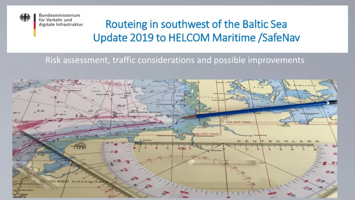
Rou outeing in n sou outh thwest of of the the Bal Baltic Sea - - PowerPoint PPT Presentation

rou outeing in n sou outh thwest of of the the bal baltic
SMART_READER_LITE
LIVE PREVIEW

Rou outeing in n sou outh thwest of of the the Bal Baltic Sea - - PowerPoint PPT Presentation

Rou outeing in n sou outh thwest of of the the Bal Baltic Sea Sea Upda pdate 2019 to to HEL HELCOM Marit Maritim ime /Sa SafeNav Risk assessment, traffic considerations and possible improvements www.bmvi.de SW Baltic sea 1.


slide-1
SLIDE 1

Rou

  • uteing in

n sou

  • uth

thwest of

  • f the

the Bal Baltic Sea Sea Upda pdate 2019 to to HEL HELCOM Marit Maritim ime /Sa SafeNav

Risk assessment, traffic considerations and possible improvements

  • www.bmvi.de
slide-2
SLIDE 2

SW Baltic sea

  • 1. Area overview
  • 2. Traffic Analysis and risk assessment (preliminary results)
  • 3. Possible improvements
slide-3
SLIDE 3

Example of maximum ship sizes Tanker shipping:

  • L = 250 m B = 44 m T = 15.0 m
  • LNG Shipping (Q-Max)
  • L = 345 m B = 54 m T = 12m
  • Container shipping (e.g. Maren Maersk)
  • L = 400m B = 60m T = 14.5m

Port limits:

  • Rostock 16.5m planned
  • Kiel Canal 10.5m planned
  • Luleå 11 m (tanker)
  • Kemi 12.5m (?????)
  • Klaipėda 12.5 m (tanker, LNG, container)
  • Primorsk 15 m (tanker)
  • Ust Luga 17.5m (tanker, container)
  • Gdańsk 15 m (container, bulk)
  • Rostock extension to 16.5m
  • Aabenraa 18m (Bulker)

NOK 9,5 m T-Route 15,5 m Öresund 8,0m

Source: Kari Liuth: Maritime cluster in the Baltic Sea region and beyond , 02.06.2019

slide-4
SLIDE 4

Weather conditions

  • Most probable wind directions are

S, SW and W.

  • The frequency on the wind force is

as follow:

  • 0-3 Bft 41,7 %
  • 4-5 Bft 42,3 %
  • 6-7 Bft 14,4 %
  • 8-12 Bft 1,16 %
  • The Average high of the waves is

0,9 m; between 0-1m by 74,9 %.

  • By windless or calm sea current of

0,5 kn. In extreme situations (strong E‘ly or W‘ly winds) current

  • f 4 kn is possible. [1]

Source: [1] BSH, Naturverhältnisse Ost Se, 2008, pp. 10-12; [2] Admiralty Sailing Directions NP 18, 2018; [3]BSH, Berechnete Strömungen des operationellen Modellsystems des BSH, 05.082019

[2] [2] [3]

– –

slide-5
SLIDE 5

Bathymetry

  • Water depth is

limited

  • Vessel with draft
  • ver 12 m are

restricted in there movement in the area of Öjet und Kadetrinne

Source: EMODnet,2019

slide-6
SLIDE 6

Nature Protection Areas

Since 2005 recognised as a Particularly Sensitive Sea Areas (PSSA) NATURA 2000 areas:

  • Fehmarnbelt
  • Kadetrinne
  • Plantagenetgrund
  • Darss

Source: Natura 2000 End 2018 - Shapefile, 2019

slide-7
SLIDE 7

Offshore wind expansion

Wind park Status Arcadis Ost 1 Consent Authorised Kriegers Flak II Consent Authorised Arcona&Wikinger Fully Commisioned, Concept Authorised Baltic Eagle Consent Authorised Baltic 2 Fully Commisioned Gennaker Consent Authorised Kriegers Flak Pre-Construction Kriegers Flak Pre-Construction Rødsand 2 Fully Commissioned Nysted Fully Commissioned

Source: FEP 2019 (BSH), LEP M-V 2016, 4COffshore

slide-8
SLIDE 8

Pleasure crafts

  • When pleasure vessels

cross “open water”, they prefer to go in straight lines between the harbours.​

  • Pleasure vessels

generally try to avoid sailing in TSS and deep water ways

  • Not more then 25 %

have AIS transmitter.

Source: FEP 2019 (BSH); LEP M-V 2016; 4COffshore;

slide-9
SLIDE 9

Fishing vessels

  • the fishing efforts

variable between the months and the years.

  • Main fishing areas

are N‘ly of Ruegen, N’ly of Wismar and the Bay of Kiel.

Source: Thünen-Institut für Ostseefischerei (OF), 2019

slide-10
SLIDE 10

Commercial shipping

  • Around 33 thousand

vessel paused trough Fehrmann Belt and 47 thousand Kadetrinne in 2017

  • Vessel are following

recommended routes

  • New offshore

structures may increase the risk of collision and groundings

Source: GDWSFEP 2019 (BSH); LEP M-V 2016; 4COffshore;

Route “T” (

slide-11
SLIDE 11

Accidents at sea 2007-2017 (HELCOM data set)

Source: HELCOM, Shipping accidents, 2018; 6FEP 2019 (BSH); LEP M-V 2016; 4COffshore;

slide-12
SLIDE 12

SW Baltic sea

  • 1. Area overview
  • 2. Traffic Analysis and risk assessment (preliminary results)
  • 3. Possible improvements
slide-13
SLIDE 13

Fehmarn- traffic distribution

T-route (Langeland) T-route (Fehrmann) Kiel-T- Route Kiel- Fehrmann Kiel H-Route (Langeland) H-Route (Fehrmann) Fehrmann Belt

22000 10000 36000 20000 10000

Kiel-T- Route Kiel- Fehrmann Kiel H-Route (Langeland) H-Route (Fehrmann) Fehrmann Belt

30000
slide-14
SLIDE 14

Fehmarn- Risk Assessment preliminary results!

Traffic joinincg here gives relatively high risk

  • f collisions

High since most ships pass through here Complex traffic in this area with several crossing traffic streams

slide-15
SLIDE 15

Kadetrenden- traffic distribution

West North Center ITZ West ITZ East Fehrmann Belt East Gate Kadetrenden

26000 20000 10000 46000 40000 30000 20000 10000

Kadetrenden Kadetrenden

slide-16
SLIDE 16

Kadetrenden- preliminary results!

Complex traffic in this area with several crossing traffic streams Traffic joinincg here gives relatively high risk

  • f collisions

High since most ships pass through here Ships on routes inside ITZ are generally sailing along the same lines in both directions, whereas ships in and entering/exiting TSS Kadetrinne tend to divide into lanes. This leads to relatively fewer head-on collisions.

Source: Ramboll, 2019

slide-17
SLIDE 17

SW Baltic sea

  • 1. Area overview
  • 2. Traffic Analysis and risk assessment (preliminary results)
  • 3. Possible improvements
slide-18
SLIDE 18

TSS Öjet (Fehrmarn)

slide-19
SLIDE 19

TSS Öjet (Fehmarn)

  • slight adjustments new

TSS W'ly of Fehmarnbelt

  • Separation zone on flat

area “Öjet”

  • Possible extension of

the deep water path to the Great Belt

slide-20
SLIDE 20

TSS Öjet (Fehmarn)

slide-21
SLIDE 21

Kadetrinne, „South of Gedser“

<1.5 1.5 - 3 3 - 4.5 4.5 - 6 6-7.5 9 - 10.5 10.5<

3200

2000 1000 Fast ferry Fishing

General Cargo Tanker Other Passenger Pleasure Support

6000 5000 4000 3000 2000 1000 Ship Types- East Gate Ship Draught- East Gate

slide-22
SLIDE 22

Kadetrinne „South of Gedser”

  • connecting TSS „South of

Gedser“ and „North of Rügen

  • Distance Gennaker –

Trafic Lane 1,8 sm

  • Threading, unthreading N-

going traffic

  • Coastal traffic zone east

border to Arkona

  • Adjustment of buoyage

(lateral system)

slide-23
SLIDE 23

Kadetrinne

slide-24
SLIDE 24

Discussion