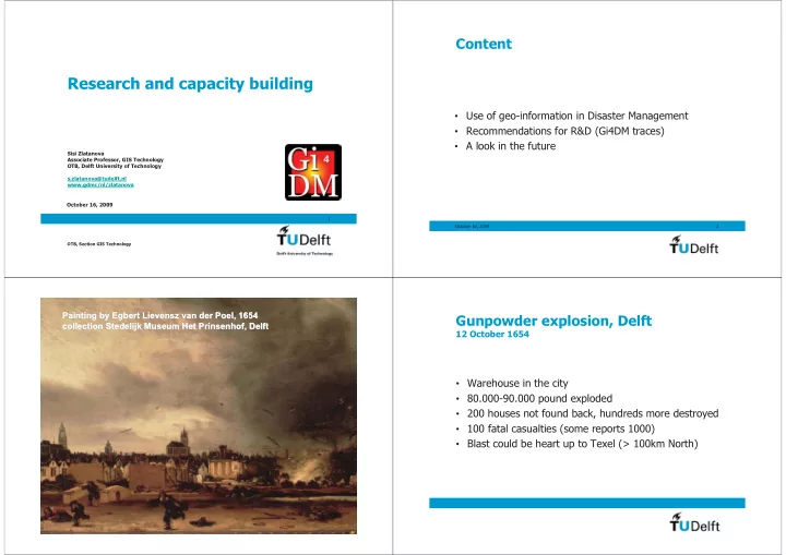
research and capacity building
play

Research and capacity building Use of geo-information in Disaster - PowerPoint PPT Presentation

Content Research and capacity building Use of geo-information in Disaster Management Recommendations for R&D (Gi4DM traces) A look in the future Sisi Zlatanova Associate Professor, GIS Technology OTB, Delft University of


  1. Content Research and capacity building • Use of geo-information in Disaster Management • Recommendations for R&D (Gi4DM traces) • A look in the future Sisi Zlatanova Associate Professor, GIS Technology OTB, Delft University of Technology s.zlatanova@tudelft.nl www.gdmc/nl/zlatanova October 16, 2009 1 October 16, 2009 2 OTB, Section GIS Technology Painting by Egbert Lievensz Lievensz van van der der Poel Poel, 1654 , 1654 Painting by Egbert Gunpowder explosion, Delft collection Stedelijk collection Stedelijk Museum Het Museum Het Prinsenhof Prinsenhof, Delft , Delft 12 October 1654 • Warehouse in the city • 80.000-90.000 pound exploded • 200 houses not found back, hundreds more destroyed • 100 fatal casualties (some reports 1000) • Blast could be heart up to Texel (> 100km North)

  2. Flood Disaster Flood Disaster 1 st February 1953 1 st February 1953 • hurricane-force northwester wind & high spring tides • 1800 people drowned • 72.000 evacuated • thousands of farm animals lost • 150,000 hectares of land inundated People learn … • Users The big picture • Information Time frame • • Some examples from the recent NL past: Prevention and mitigation Preparedness • sea flooding Zeeland 1956 � Delta-works R E • river flooding Betuwe 1995 � New program for (Geo-)ICT E C Natural Disasters: river management and improved dikes G O U N • firework disaster Enschede 2000 � More strict -Standards L O regulations and checking of regulations - Data Industrial Disasters: A M - Architecture T I - Services Post- Disaster I C - Command and O S Humanitarian Disasters: Control (CC) N S Response October 16, 2009 7 16 October 2009 8 Recovery

  3. Geo-information is a small but very Before we had the maps critical part • Provides situational awareness ‘what/who is where’ • Allows for context-aware ‘what info to whom’ • Better visualisation (2D/3D) • Mixed indoor (CAD) and outdoor (GIS) information • Enables analysis (routes, flooding prediction,…) • Provides clear communication interface ‘the map’ • Up to date information; monitoring by satellite sensors • Positioning and navigation (GPS, Galileo) • Location based services (LBS) October 16, 2009 9 October 16, 2009 10 3D visualisation 3D analysis October 16, 2009 11 October 16, 2009 12

  4. What was said in 2005 ‘they what to sell us GIS’ ‘GIS is a tool, it does not solve everything by itself’ ‘there is difference between ‘small’ disasters and ‘big’ disasters’ ‘we have to educate disaster managers’ ‘geo-ICT has to learn from disasters’ ‘technologically everything is possible’ ‘the problem is organization and communication between partners’ ‘we succeeded because we are working together’ ‘our geo-information dates 1973’ ‘response phase cannot be isolated from prevention’ ‘data integration should be based on ontology and semantics’ ‘data are available after 3 days’ vs. ‘data were available after 3 hours’ ‘we have to stay close to the users’ ‘not all the people can work with total station but everybody can measure with steal type’ ‘can it be extended in 3D?’ … 10/16/2009 13 16 October 2009 14 Gi4DM: Series Symposia across the continents What was said in 2006 2009 ... Capacity building ISPRS, ICA, OGC, EC ‘right information vs. any information’ ‘we have to educate disaster managers’ ‘geo-scientists have to understand the users – user centered design’ ‘users feedback is critical … on accuracy, quality, etc.’ ‘web-based information is important’ • Integration and analysis of heterogeneous data ‘there problems with policy and organizational aspects’ • Spatial Data Infrastructures ‘technologically everything is possible’ ‘near-real time satellite-based fire information system is needed’ • 3D/4D Data representation and Context-aware ‘the internet connection to Africa is very slow, most data transport is between NA and Europe’ Round Table at the Joint ICA CEWCM and 4 th Gi4DM, Prague, January 2009: Orhan Altan, Soleil ‘LIDAR-based DEM for costal vulnerability mapping’ Beaulieu, Wolfgang Kainz, Gottfried Konecny, Milan Konecny Paulo Menezes, Virginia Puzzolo, ‘cyclones are still not accurately predicted’ Mark Reichard, Kristi Virrantaus and Sisi Zlatanova ‘knowledge-based, context-aware’ … October 16, 2009 15 October 16, 2009 16

  5. Information facts Technology facts Increased importance of cooperating, sharing of information between Increased research in semantic/ontology aspects of geo-information • • institutions responsible for emergency response at national and science for supporting machine geo-processing; international level; • Remarkable advances in software and hardware for processing, • Enormous amount of data that emergency responders have to perceive management, visualisation, visual analysis and simulation of natural as well as the fact that they are not geo-specialists and work within phenomena on land, in the ocean and in the atmospheric; extreme circumstances. Emergence of Virtual Environments such as Google Earth, Visual Earth, • Availability of data repositories, as geographically organised web-based Second Life and serious games, providing high level of interaction and • Digital Earth representations and dynamic image databases linked to immersion with virtual or real environments global knowledge archives. • Increased international activities for standardisation of service, system • Increased awareness of, and demands for geospatial information by architectures and geospatial information (e.g. OGC) and the various governments, industries, academia and society. successful demonstrations of data integration fro emergency response. October 16, 2009 17 October 16, 2009 18 Progress in use of geo-information Recommendations 1/4 Enormous potential of geospatial databases in emergencies; • • To understand the advanced concepts of many sciences dealing e.g. presentation of information (cartography, man-machine interaction, computer graphics), human behaviour (psychology), Maturing the level of harmonisation and sharing of data in order • etc. in order to successfully apply these concepts in data to take full advantage of information for decision-makers; representation in emergency situations Understanding the need for real-time data integration, constant To study the manner of work and communication in case of crisis • • in order to develop context-aware visualization and analysis. access to data (7/365), ensuring secure interfaces. • To develop systems, which can be used in daily work and not only Developments on national and international levels related to • in case of crisis. harmonisation of geospatial data and building spatial data infrastructures such as GMES and INSPIRE in Europe, and Digital To develop and support all graphic device displays and interfaces. • Earth initiatives; October 16, 2009 19 October 16, 2009 20

  6. Recommendations 2/4 Recommendations 3/4 Accelerate the developments of SDI in Europe and worldwide • To speed-up research on adaptive representation of data in crisis • situation considering the context of the user and the current environment. Involve countries of Central and East Europe, Asia, Africa and • Central and South America in the standardisation activities • To intensify developments in standardized symbology for emergency responders Develop models for efficient management of dynamic information • (being critical for emergency response) and corresponding To extend research in 3D representations as being more intuitive • indexing and retrieval methos with emphasis of the quality of the and towards the integration of dynamic phenomena (such as flood noise, models (and not only data quality) ; wind, air pollution and oils spill); • To continue research on visual analytics and corresponding models for To enhance coordination of international efforts within INSPIRE, • dynamic 3D/4D visualization, interaction and simulation to support GMES and Digital Earth and standardisation organisations as ISO monitoring of natural phenomena. and OGC towards the standardisation of geospatial information; October 16, 2009 21 October 16, 2009 22 Before Recommendations 4/4 • To strengthen the research on integration and harmonisation of different geo-data by considering a larger scope of domains such as construction (AEC/BIM), meteorological/atmospheric, geological, biological, ocean/marine, etc. To increase research on common integrated 3D data models (e.g. such as • CityGML for management and exchange of heterogeneous static and dynamic data. • To further develop client-server, location-based, Net-centric, distributed and federated architectures for geospatial services and analysis to support the work in Command and Control Centres; To intensify research on user-centred applications for both field and desktop • applications The politicians have to be aware of the need for these developments ('research is • done for social benefit') Sector (application)-oriented Paper maps, Radio, Telephone October 16, 2009 23 October 16, 2009 24 Reports RM/ER hardly cooperation Strictly national, regional

Download Presentation
Download Policy: The content available on the website is offered to you 'AS IS' for your personal information and use only. It cannot be commercialized, licensed, or distributed on other websites without prior consent from the author. To download a presentation, simply click this link. If you encounter any difficulties during the download process, it's possible that the publisher has removed the file from their server.

Recommend


More recommend