
SLIDE 1
Regional Climate Modeling Erika Coppola Abdus Salam ICTP, Trieste, - - PowerPoint PPT Presentation
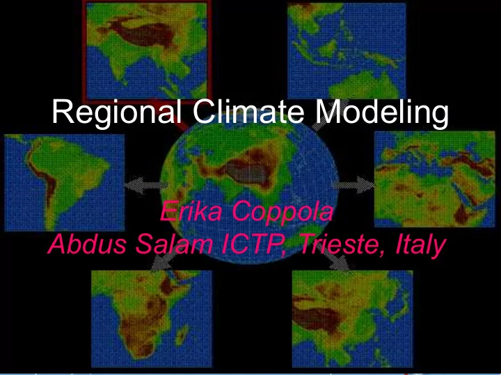
Regional Climate Modeling Erika Coppola Abdus Salam ICTP, Trieste, Italy Regional climate information is critical to assess impacts Information is needed at the regional scale Regional climate modeling: Why? Regional climates are determined
– Planetary/large scale forcings and circulations determine the statistics of weather events that characterize the climate of a region – Regional and local scale forcings and circulations modulate the regional climate change signal, possibly feeding back to the large scale circulations
Like the sun, the Earth emits
than the sun, though, so it emits in the infrared. Some of that infrared energy may be absorbed by molecules in the atmosphere, affecting the global energy balance. ! Extra CO2 or other GHGs lead to a positive forcing of the climate system, an excess greenhouse effect.
Mauna Loa Hawaii
Aerosols absorb and reflect solar radiation
Aerosols change the properties of clouds
is still too coarse to capture regional and local climate processes
Model (RCM) is nested within a GCM in order to locally increase the model resolution. – Initial conditions (IC) and lateral boundary conditions (LBC) for the RCM are obtained from the GCM (One-way Nesting) or analyses of observations.
response of the general circulation to the large scale forcings, the RCM simulates the effect of sub-GCM-grid scale forcings and provides fine scale regional information – Technique borrowed from NWP
Conservation
Conservation
Conservation
Conservation
Equation of state
Inner Domain Fine Scale Buffer Zone (LBC Relaxation)
– Comprehensive climate modeling system
– Process studies and validation – Paleoclimate – Climate change – Seasonal prediction
for numerical weather prediction involving simulations of 1-5 days in length.
approach to climate problems by generating statistics of large numbers of short LAM simulations driven by GCM fields – The model used was a suitably modified version of the NCAR/Penn State mesoscale model MM4
first LAM simulations in climate mode (1-month long) driven by ECMWF analyses of observations and by GCM fields, respectively.
RegCM, which was based on MM4 with suitably modified radiative transfer and land surface process schemes
From Giorgi and Bates (1989)
– Dynamics from the NCAR/PSU MM4 (Anthes et al. 1987) – Physics from the NCAR CCM1 (Williamson et al. 1987) and MM4
– Dynamics from the hydrostatic NCAR/PSU MM5 (Grell et al. 1994) – Physics from the NCAR CCM2 (Hack et al. 1993) and MM5
– Dynamics from the hydrostatic MM5 – Physics from the NCAR CCM3 (Kiehl et al. 1996) and MM5 – Coupled lake model – Coupled tracer transport scheme
– Dynamics from the hydrostatic MM5 – Physics upgrades for convective and non-convective precipitation, air sea fluxes – Coupled with a simple chemistry/aerosol scheme – Sub-grid land surface scheme
Aerosols & Chemistry Snow & Sea Ice Biosphere & Soils Hydrology & Lake Meso-scale Dynamics Radiation Clouds & Precipitation Boundary Layer
Precipitation Radiation Surface Fluxes Albedo
LAND/OCEAN SURFACE Ecosystem Agriculture River Runoff AOGCM
Analysis Ocean Fluxes
used in NWP were modified for long-term integrations (Dickinson et al. 1989; Giorgi 1990; Giorgi et al 1994)
Giorgi and Mearns (1999), Giorgi et al. (IPCC 2001), Leung et al. (2003), Wang et al. (2004)
– Christensen et al. (1995, 1997, 1998), Jones et al. (1995, 1997), Machenauer et al. (1996, 1998) – The Rossby Center – The Baltex project – The Swiss extremes(ETH, U. Fribourg) – C21C->MERCURE->PRUDENCE->ENSEMBLES
– Perfect Boundary Condition experiments – Over 20 RCMs available Worldwide – Wide range of regional domains and resolutions (10-100 km)
– Land-atmosphere interactions, topographic effects, cyclogenesis – Tropical storms, hurricanes – Regional hydrologic and energy budgets
– Regional signals, variability and extremes
– Chemistry/aerosol – atmosphere (Climatic effects of aerosols) – Ocean/sea ice-atmosphere – Biosphere-atmosphere
– Only applied to a lateral buffer zone – Allows more freedom for the model to develop its own circulations in the interior of the domain
– Relaxation to the large scale forcing for the low wave number component of the solution throughout the entire domain – Standard boundary forcing for the high wave number component
– Ensures full consistency between forcing and model produced large scale circulations
should not exceed 6-8
circulation features in the forcing (GCM) fields
– Failure of this condition might lead to severe inconsistencies at the lateral boundaries
generally similar in the nested RCM and driving GCM
– The nested RCM cannot correct for errors transmitted from the large scale GCM fields through the lateral boundaries
driving large scale boundary conditions be of good quality
– Examples: Correct location of jet streams and storm tracks; realistic simulation of monsoons and ICTZ
driving GCM be the same?
– Same physics would lead to a better interpretation of model results – Same physics would maximize consistency between LBC and RCM – GCM physics (e.g. convection) may not be suitable for fine
resolutions – A given scheme may behave very differently at different resolutions
with RCMs having wither the same or different physics schemes from the driving GCM (PRUDENCE)
– The model domain should be large enough to include relevant circulations and forcings and to allow the model to fully develop its own internal dynamics
– The model resolution should be sufficient to capture relevant forcings and to provide useful information for given applications
model domain size and resolution
– The model results generally depend on the model configuration (although this dependence should be made minimal) – There are no precise rules for the choice of model configuration
variability due to the model non-linearities
– Fine scale forcings (e.g. topography) – Mesoscale circulations
– Aerosol effects, land-atmosphere interactions, regional feedbacks, circulations and processes etc.
300km Global Model 25km Regional Model 50km Regional Model Observed
Spatial Correlation Coefficient between precipitation simulation and Frei & Schär data
Observations
GCM RCM – 55 km RCM - 18 km
Observations RegCM CCM1
Regional Model Simulation Global Model Simulation
RCMs simulate extreme rainfall much better than GCMs
Global climate model Regional climate model
RCMs can simulate circulation features not resolved by GCMs
Pressure (hPa) and wind fields (m/s) every 6h from control run