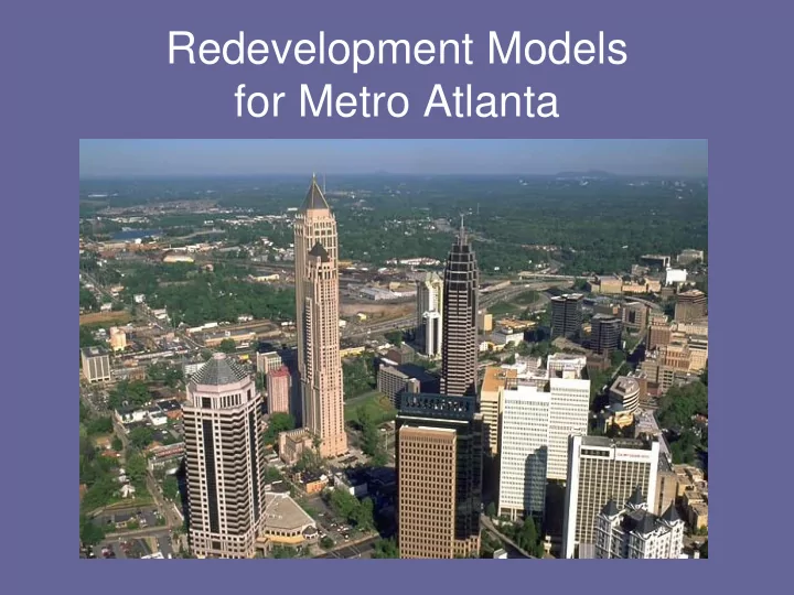
SLIDE 1
Redevelopment Models for Metro Atlanta
SLIDE 2 150,000 new residents expected by 2030 Source: Census Bureau 2005
SLIDE 3
Relevant Law
Georgia Redevelopment Act Georgia Redevelopment Powers Act Downtown Development Authorities Law Enterprise Zone Employment Law
SLIDE 4 Urban Redevelopment Act
O.C.G.A. 36-61-1
- Adopted in 1955
- Governs the use of eminent domain and
bond financing to support public/private partnerships
- Allows cities and counties to redevelop
specific areas
SLIDE 5 Urban Redevelopment Act
Prerequisites to Redevelopment under the Act
- Area must be designated as a “slum area”
- Redevelopment must be “necessary in the
interest of the public health, safety, morals or welfare” of the citizens as declared by the city or county government
- Adoption of a Redevelopment Plan by the local
government
SLIDE 6 Urban Redevelopment Act
“Slum Area” is defined in the statute as: “…a substantial number of deteriorated or deteriorating structures; predominance of defective or inadequate street layout…unsanitary or unsafe conditions…tax or special assessment delinquency exceeding the fair value
- f the land…development impaired by noise or other
environmental hazards; or any combination of such factors…[that] retards the provisions of housing accommodations or constitutes an economic or social liability and is a menace to the public health, safety, morals or welfare in its present condition and use.”
SLIDE 7 Urban Redevelopment Act
Judicial Review
- Local governments can define “slum” and “blight” themselves
- No evidence or proof needed
- Only require that a resolution was adopted
SLIDE 8 Urban Redevelopment Act
- Low real estate value
- Low numbers of building permits
- Low growth in tax assessed value
- High crime stats
- High unemployment
- High commercial and rental vacancy rates
- High percentage of population below the poverty line
- Visual blight: litter, poor quality commercial buildings,
broken/absent sidewalks and curbs, excessive utility poles and
- verhead wires and poor drainage
- Confusing or inefficient street layout
- Unclear property ownership
- Delinquent property taxes
Common indications of blight:
SLIDE 9 Urban Redevelopment Act
Urban Redevelopment Plan Requirements
O.C.G.A. 36-61-1(21)8:
(A)Conform to the general plan for the municipality or county as a whole; and (B)Be sufficiently complete to indicate such land acquisition, demolition and removal of structures, redevelopment, improvements, and rehabilitation as may be proposed to be carried out in the urban redevelopment area; zoning and planning changes, if any; land uses; maximum densities; building requirements; uses, improved traffic, public transportation, public utilities, recreational and community facilities and other public improvements.
SLIDE 10 Urban Redevelopment Act
Choice of Legal Entities to Oversee Development O.C.G.A. 36-61-17
- Local governing body
- New urban redevelopment agency
- Housing authority
- Downtown Development Authority
Each option has its own pros and cons; municipalities choose what is best for their individual circumstances
SLIDE 11 Urban Redevelopment Act
Benefits of the Act
Expands normal powers of local government:
- Can attach design and use requirements/limitations
as covenants running with the land
- Broader powers of eminent domain
- Can issue tax exempt bonds for redevelopment that
do not count in the government‟s debt cap
- Communities can carve out exceptions in their
development ordinances
- Communities can create intergovernmental contracts
allowing for delegation of redevelopment powers to a redevelopment agency
SLIDE 12 Urban Redevelopment Act
Eminent Domain
O.C.G.A. 36-61-8
- Gives property owners the right to keep their property if they have
the willingness and means to develop it consistent with the URP
Covenants Running with the Land
- Land purchasers in an area where a Redevelopment Plan is
enacted have constructive notice of the Plan
- Deed restrictions should be filed if property owners seek to
redevelop their land rather than have it taken by eminent domain
SLIDE 13 Urban Redevelopment Powers Law
O.C.G.A. 36-44-1
- Passed in 1985
- Authorizes TADs
- Lays out procedure and requirements for
setting up TADs
- Lays out procedures for determining
applicable property taxes
SLIDE 14 Differences between URPA and URA
- Creating Urban Redevelopment Areas
under URA doesn‟t require approval from property owners
- Approval from property owners in affected
area necessary for creating a TAD under URPA
- URPA is more procedurally complex than
URA
SLIDE 15 Downtown Development Authorities Law
O.C.G.A. 36-42-1
- Created in 1981
- Authorizes downtown development authority in every GA
city
- Each city must activate the DDA by:
- Designating the boundaries of the downtown area
- Appointing initial directors of the Authority
- Creating a resolution stating there is a need for and
Authority
- Passing the resolution
- Filing copies of the resolution with the Secretary of
State and Dept. of Community Affairs
SLIDE 16
Downtown Development Authority
Contract Powers Authorities have the power to: “…make and exercise contracts, agreements and other instruments necessary or convenient to exercise the powers of the authority…including, but not limited to, contracts for construction of projects, contracts with respect to the use of projects and agreements to join or cooperate with an urban residential finance authority…to contract for any period not exceeding 50 years with the state of Georgia…to use any real property, personal property or fixtures therein…in any manner it deems to the best advantage of the authority and the public purpose”
SLIDE 17 Enterprise Zone Employment Act
- Created in 1997
- Goal is to aid revitalization in areas that are
underdeveloped and suffering from economic decline and disinvestment
- Encourages private businesses to reinvest and
rehabilitate the areas through:
- Property tax exemptions O.C.G.A. 36-88-8(a)(1)
- Abatement or reduction in occupation taxes,
regulatory and building inspection fees O.C.G.A. 36-88-9(a)
- Reduction or waiver of local ordinances O.C.G.A. 36-88-7
SLIDE 18 Enterprise Zone Employment Act
Requirements for area to qualify as an Enterprise Zone
(must meet 4 of the 5)
1. Pervasive Poverty: at least 20% poverty according to 1990 Census 2. Unemployment Rate: at least 10% higher than Georgia 3. Underdevelopment: issuance of building permits and licenses lower than average within the local area 4. General distress: such as population decline, health and safety problems 5. General Blight: whether any portion of this area is included in an Urban Redevelopment Area
SLIDE 19 Livable Centers Initiative
- Westside: Upper Westside, Bankhead,
Historic West End
- Eastside: Grady Homes, Capitol Homes
- Northwest: West Highlands at Perry Blvd.
- Beltline:
SLIDE 20 LCI
- Livable Communities Initiative
- Advances in technology have promoted
urban sprawl, adverse environmental effects, and isolation from communities
- Urban sprawl which forces increasingly
longer trips and traffic congestion are decreasing quality of life and reducing the effectiveness of the automobile as a transportation mode
SLIDE 21 LCI
– Strengthen the link between transit and community planning, including land use policies and transit – Stimulate increased participation by the community in the planning and design process – Increase access to employment, education, and community destinations – Leverage resources available through FSL
SLIDE 22 LCI
– Full community participation in the decision-making process – Well-planned and designed neighborhoods where housing, schools, and parks are within easy walking distance of user- friendly transit and link residents to job opportunities and social services – Transit, pedestrian, and bicycle access that is compatible with land use, zoning, and urban design to reduce dependence on the automobile – Mixed use neighborhoods – Transit services and facilities that provide safe, secure, and accessible services – Environmentally Sound practices that reduce auto trips, conserve space, encourage green areas, and avoid gridlock and improve air quality
SLIDE 23 Tax Allocation Districts
- Objective – TADs are designed to provide incentives for
redevelopment of economically disadvantaged areas that would not otherwise occur.
- Financing Technique – TADs are a public financing tool
used to help pay for the costs of redevelopment within a targeted area by allocating the incremental increase in property tax revenues resulting from redevelopment in the area back into the same area.
- No Tax Breaks – A TAD is neither a tax break for
developers, nor a tax increase for residents.
SLIDE 24 TADs Uses
Clean Up sites with Environmental Issues Neighborhood Preservation Historic Preservation Redevelop underutilized/vacant areas
SLIDE 25
How TADs Work
SLIDE 26
How TADs Work
SLIDE 27
How TADs Work
SLIDE 28 Benefits of a TAD
- TADs provide a mechanism for a local government to
make “challenging” sites attractive to developers.
- TADs act as a catalyst to create jobs, expand tax base
and spur development around the TAD area.
- There is an increase in sales tax revenues to the County
and School Board as a result of new commercial development.
- Local governments do not lose current revenue because
TADs use only the “increment” resulting from improvements in the area.
- TADs use revenue bonds, not general obligation bonds,
so the taxpayers are not at risk.
SLIDE 29 TAD Policy and Guidelines
- Create Decision-Making Process & Outline
Requirements for Approval & Implementation.
- Consider judicious use of TAD financing to increase
property values and tax revenues, reduce poverty, create economic stability, upgrade older neighborhoods and commercial corridors.
- Each application must demonstrate that “but for” the use
- f TAD financing, the project would not be feasible.
SLIDE 30 Eligible Uses for TAD Funds
- Infrastructure improvements, water, sewer,
streets, parking facilities, etc.;
- Construction of new buildings or rehab of
existing ones;
- Professional services costs such as
architectural, financial, legal, marketing and engineering;
- Debt service;
- Real property assembly costs.
SLIDE 31
Downtown Atlanta‟s Redevelopment Plans
Westside and Eastside TADs
SLIDE 32 Benchmarks for Redevelopment
The desired outcomes of a successful Downtown redevelopment effort will be based on the following benchmarks:
- 1. Enhanced physical appearance through streetscape improvements;
- 2. Increased capacity for new and expanded development through
infrastructure improvements
- 3. Increased tax base as a result of private investment;
- 4. Increased sales taxes;
- 5. Increased employment opportunities;
- 6. Increased residents living Downtown;
- 7. Improved housing within the Empowerment Zone Communities;
- 8. Added destination retail opportunities for residents, workers, and visitors;
and
- 9. Added neighborhood support services such as grocery stores, dry
cleaners, pharmacies, banking services etc. for residences.
SLIDE 33
Westside Population Density (NPU M and N)
SLIDE 34 Westside: Locations
- This TAD encompasses a large chunk of
downtown Atlanta west of Peachtree Street
- Areas: NPU M and L (council districts 2
and 3)
- North Avenue and Southern Railway on
the north, Ashby Street on the west, Fair Street on the south, Spring, Williams, Peachtree, and Forsyth Streets on east
SLIDE 35 Westside Redevelopment Plan History
- Established in 1992 then expanded in
1998 to incorporate a TAD
- Used the Olympics to facilitate the areas
around downtown, more specifically Vine City, English Avenue, MLK Drive, and Fairlie-Poplar district.
SLIDE 36
Westside TAD Boundaries
SLIDE 37 Westside TAD
- Created in 1998
- First bond issue in 2001 for $15 million,
second projected for 2005 $50-60 million
- Funding for Centennial Place Elementary
School
- 20% of net proceeds to neigbhorhoods
SLIDE 38
Westside TAD History
This TAD support efforts currently underway
– to remove blighted conditions and expand redevelopment efforts to adjacent residential area of Vine City and English Avenue and commercial/warehouse districts in the area. – to bring connectivity to the area by improving transportation corridors between the CBD, university areas (Clark Atlanta and GA Tech) with the neighborhoods. – allows for infill development projects, by improving sewer and infrastructure, to eliminate the development gaps that divide and encourage new businesses and housing opportunities .
SLIDE 39 Westside Affordable Housing
Total residential units funded by TAD: 568 – Affordable units: 248 – Percent Affordable: 44%
- Centennial House: 101 condominiums
– 26 affordable condos @ 80% AMI
- Northside Village Apartments: 261
apartments
– 222 affordable apartments @ 60% AMI
SLIDE 40
Neighborhood Fund
Westside TAD: Neighborhood Fund
– 20% of net bond proceeds to be set aside for the neighborhood fund
2001:Neighborhood Development Fund $1,375,019
– Allocated to Northside Village Apartments – Partnered with Bethel Northside Village LLC and Bethursday Development Corp
$28 million in total project costs TAD Funds 4.6% of Project Costs ($2 million)
SLIDE 41 Current and Prospective New Developments in the Westside
Winecoff Hotel 59,710 sf hotel $20.5 million investment Centennial East 200 condos plus 25,500 sf in retail $40.5 million investment Historic Westside Village 106 condos & 100 Townhomes $35 million investment The New World of Coca Cola 83,000 sf family entertainment attraction $96.4 million investment 55 Allen Plaza 323,000 sf office space $78 million investment
SLIDE 42 Future Zoning and Land Uses
SLIDE 43 New Development
– Adjacent to the Georgia World Congress Center, Georgia Dome, and CNN Center – $78 million park with 21 acre green space – Largest center city park developed in the U.S. in 20 years – Seen as a catalist for redevelopment including:
- Georgia Aquarium
- New World of Coca-Cola
- Various Retail, Housing (including luxury housing) and
Hotels
SLIDE 44 New Development, cont‟d
– Successfully redeveloped mixed-income and mixed-use community – New developments include a newly built school, a new YMCA center, a police mini- precinct and a renovated community center – Catalyst for Development
- New grocery store and other retail
- More new residential
SLIDE 45
– multi-block neighborhood with mixed-use developments – adjacent to Centennial Olympic Park in one of the most visible sites in Downtown Atlanta – Catalyst for development
- New Apartments and condominiums,
- Increased commercial office space,
- New retail, restaurants,
- Children‟s museum, and
- Overall streetscape improvement of Ivan Allen Boulevard
SLIDE 46
– Proposed development in a railroad “gutch” but in burgeoning area of growth – New Housing at Castleberry Hill and improved Marietta Street corridor with infill development to support the strong base for tourism – Catalyst for development:
- Proposed new commuter rail-line from Lovejoy to
Downtown
- Multimodal Passenger Terminal
- New Residential Development
SLIDE 47
Eastside Atlanta
SLIDE 48
SLIDE 49 Eastside – General Demographics
- Location – Street Boundaries
– North: North St, Piedmont Ave and Freedom Pkwy – East: Southern CSX Railroad and Berean Ave – South : I-20 – West: Cooper St, Forsyth St, Peachtree Center Ave, Courtland St & Spring St.
- Neighborhood Planning Units M, N, V & W
SLIDE 50
SLIDE 51 Eastside – General Demographics
- Population – 20,828 (2000)
– (45% growth from 1990)
- Unemployment – 7.4% (2003)
– 9.8% in 1990 – Atlanta MSA – 4.8%
– Atlanta MSA - $50,309 – 75% low to low-to-middle income households – 500 out of 8,763 made more than $100,000
SLIDE 52
SLIDE 53 Eastside – General Demographics
– 12.6% married families (51.4% in Atlanta MSA) – 4.5% married with children (25.7% in Atlanta MSA) – 19.3 are female headed families (13.6% in Atlanta MSA)
SLIDE 54
SLIDE 55 Eastside – General Demographics
– 67% have high school education – 85% in the Atlanta MSA
– 41.9% overall (10% in the Atlanta MSA) – 29.4% of children (3.5% in the MSA) – 5.7% of the elderly (1.1% of the MSA)
SLIDE 56
SLIDE 57 Eastside - General Demographics
– Vacant Units – 11.5% (5.3% of the MSA) – Owner-Occupied – 22.5% (66.4% of the MSA) – Rented – 77.5% (33.6% of the MSA)
– Almost 70% was built before 1970 – Only 14% was built in the 1990s
SLIDE 58
Eastside Neighborhoods
SLIDE 59 Eastside „Hoods
- Areas where development is lagging
behind the rest of the city.
– Butler Street / Auburn Avenue Redevelopment Plan
- Historical significance of the area.
– Old Fourth Ward Redevelopment Plan – Memorial Drive – Martin Luther King, Jr. Drive Area Revitalization Study
- Most densely traveled corridor in the city.
SLIDE 60
Eastside Tad
SLIDE 61 Eastside TAD
– Figure based on the areas aggregate tax base
– Improve infrastructure, streetscapes and linkages of Downtown‟s business, residential, government, retail and hospitality nodes – In connection with the Westside TAD, it will help Downtown compete with suburban markets for new office space and businesses.
SLIDE 62 Eastside TAD
- In 2005, the City issued $47 million in TAD Bonds for this
redevelopment area which incorporate most of downtown Atlanta east of Peachtree Street and the surrounding depressed neighborhoods.
- This TAD includes diverse developers and projects such
as the Capitol Gateway Development, Sweet Auburn Village and TWELVE Centennial Park, who will develop
- ver two thousand apartments and condominiums, office
buildings, retail space, hotels, and cultural venues.
- TAD Bonds were used to pay for environmental
remediation, wastewater and storm-water management, streetscapes and sidewalks, utility upgrades, parking structures and other infrastructure costs.
SLIDE 63 Eastside TAD
- Why the Eastside Qualifies for a TAD
SLIDE 64 Eastside TAD Bond Conditions
- 20% of net TAD bond proceeds must be used to fund
projects and/or improvements in the neighborhoods –
- ther than direct project subsidy
- 20% of new housing units funded by TAD bonds must be
affordable (max 50% can be AHA units)
- Amount of net bond proceeds equal to 5½% goes to
APS
- 1st bonds must be issued within 5 years of TAD creation
– Issued in 2005 for $47MM
SLIDE 65 Eastside TAD
- What will the TAD do for the area?
SLIDE 66 Eastside Tad
- Already Proposed Projects – 18 projects
– 6,200 housing units – 460,000 square feet of new retail space – 2.45 million square feet of new office space
SLIDE 67 Other Proposed Projects
Twelve Centennial Towers
1,034 condos 102 hotel rooms 5,000 sq. feet restaurant/bar 20,000 retail
Sweet Auburn Village – mixed-use
200 multi-family units
- focus on market-rate and student housing
30,000 square feet of retail 500-600 space parking garage
Memorial Drive Redevelopment
3-mixed use sites 200 residential units 40,000 ft2 of commercial space
SLIDE 68 Other Proposed Projects, cont‟d
– 750,000 ft2 of office, residential, retail and restaurant space – Estimated 2,700 jobs in office & retail
- Taylor Simpson Office Tower
– 500,000 ft2 office tower over Peachtree Center parking deck – 1,800 new jobs
- Historic Oakland Redevelopment
– $15 million renovation and restoration of the cemetery.
– Nation‟s largest privately-funded student housing project – 2,000 bed facility near completion on Piedmont Ave.
- Downtown Health and Bioscience District
– Edgewood Ave near Grady
SLIDE 69
Livable Communities
SLIDE 70 Livable Communities
- Grady Homes Redevelopment
– Affordable Housing
- Replacing 495 distressed apartments
– Focus on Mixed-Use and Education
- “Learning Village” – education improvement
resources for people of all ages
- Linked via the MARTA King Memorial Station to
the Capitol Homes Project.
SLIDE 71
Livable Communities
SLIDE 72 Livable Communities
- Capitol Homes Redevelopment
– Affordable Housing – 854 apartments
- 278 public housing apartments
- 227 low income housing tax credit apartments
- 349 market-rate apartments
– Focus on Mixed-Use and Education
- 45,000 ft2 of retail space
- 15,000 ft2 early child development center
SLIDE 73
Eastside Future Zoning
SLIDE 74
Eastside Future Population Densities
SLIDE 75
Northwest
SLIDE 76 Location
Rough Geographic Boundaries
- Howell Mill East
- West of 285
- Bolton Road South
- Bankhead Highway North
SLIDE 77
Location
SLIDE 78 History
Developed areas with heavy industrial use
- Railroad lines running from NW to SE
- Norfolk Southern Shipping Yard
- CSX Terminals
- Warehouses near the rail lines
SLIDE 79 History
Decline in the area in the 1970s
- Businesses on Bankhead Hwy moved to
the suburbs
- Low rent businesses moved in
- Population decline with many people
moving to suburbs
SLIDE 80
Time for Revitalization
Population is increasingly interested in moving back to urban areas
SLIDE 81 Demographics
- Decline in population while Metro Atlanta‟s
population surges
- Perry Homes
- Unemployment
- 13.7% in Northwest Area (4.7% in Metro
Atlanta, 2002)
- Former Perry Homes tract at 29.2%
SLIDE 82 Demographics
- Income
- Median income for highest tract in NW is
$26,083 (less than half that of median for Metro Atlanta)
- Poverty
- 38% live below the poverty line (compared
with 9.9% for Georgia)
SLIDE 83 Northwest Redevelopment Areas
Two Main Areas (Livable Centers)
- Perry Bolton TAD
- Donald L. Holloway Parkway (formerly
Bankhead Highway) Additional areas in the Northwest tagged for less specific redevelopment
SLIDE 84
Redevelopment Areas
SLIDE 85
Room for Redevelopment
SLIDE 86
Room for Redevelopment
SLIDE 87
Room for Redevelopment
SLIDE 88
Perry Bolton TAD
SLIDE 89
Perry Bolton TAD
SLIDE 90 Perry Bolton TAD
- Created Dec. 31, 2002
- 56% of the units will be affordable housing
- Partnership with AHA to create more than
1900 units
- West Highlands at Perry Boulevard
- Largest development node
SLIDE 91 Perry Bolton TAD
Goals of TAD
- Increase residential density in major corridors
- Support preservation of single-family
neighborhoods
- Promote infill, affordable and mixed-density
housing
- Adapt vacant industrial properties for residential
and other uses
- Create pedestrian-friendly, mixed use
communities
SLIDE 92 West Highlands at Perry Boulevard
- 500 acres
- Located at site of former Perry Homes
public housing project
- Mixed-income, mixed-use
- Public-private partnership with Atlanta
Housing Authority and two residential developers
SLIDE 93
West Highlands at Perry Boulevard
Artist renderings of finished site
SLIDE 94 West Highlands at Perry Boulevard
Center
SLIDE 95 West Highlands at Perry Boulevard
18 acres green infill, 34 acres of nature trails, 9 acres of rec fields
Landfill becomes 18 hole PGA-caliber golf course
SLIDE 96
Donald L. Hollowell Pkwy
SLIDE 97 Donald L. Holloway
conditions
- Improve bus stops
- Incorporate higher
density and mixed use
crime in area
SLIDE 98
Land Use in NW Atlanta
SLIDE 99 Northwest Atlanta 15 Year Land Use Map
SLIDE 100
Northwest Atlanta Zoning
SLIDE 101
The Beltline
SLIDE 102 Beltline History
- Atlanta was originally named Terminus, as the
southeastern end of the Western and Atlantic Railroad.
- The Beltline originally referred to a loop of track
that surrounded Atlanta before the Civil War, which later was expanded to accommodate growth in industry and commerce.
- The decline of commerce by rail transport
caused a similar decline in the areas served by the Beltline, and many areas suffered economically and demographically as they were gradually abandoned.
SLIDE 103 Beltline Why
- In 1999, Ryan Gravel, a Georgia Tech graduate student,
proposed relinking the neighborhoods on the periphery
- f Atlanta through a series of parks, developments, and
a new transit system along the old Beltline.
- Early support came from the Atlanta City Council,
President Cathy Woolard.
- The Trust for Public Land commissioned the Emerald
Necklace Study in 2004
- Studies to evaluated the feasibility of funding through
TADS and new transit systems for the Beltline project were also commissioned by the Mayor and MARTA
- In April 2005, Mayor Shirley Franklin formed the Beltline
Partnership, to implement the Beltline proposals into reality
SLIDE 104
Beltline TAD
SLIDE 105 Beltline TAD
- The BeltLine will leave available capacity for other TADs
under the 10% cap.
2005 City Assessed Taxable Value with Growth @ 8.0% $ 19,505,333,140 ii 10% TAD Limit @ 2005 = $ 1,950,533,314 Total Existing TADs @ 2005 with Growth @ 10.0% $ 1,094,887,871 5.6% Remaining Capacity @ Dec. 31, 2005 = $ 855,645,443 4.4% Anticipated Taxable Value of BeltLine TAD $ 530,374,290 2.7%
Remaining TAD Capacity After the BeltLine 1.7%
Note: Information from the March 2005 TAD Feasibility Study. Updated estimates are currently being refined.
SLIDE 106 Westside Park
- Currently the Bellwood Quarry in Northwest
Atlanta
- The City of Atlanta is planning to purchase the
leasehold from Vulcan Materials company, which runs through 2034, pending approval from the Atlanta City Council and the Fulton County Commission
- Beltline TAD funds will be used to convert the
quarry into a 351 acre park surrounding a 50 acre drinking water reservoir
SLIDE 107
Westside Park
SLIDE 108
Westside Park
SLIDE 109 Bill Kennedy Way & Memorial
- Centered on Memorial Drive, east to
Gibson Street, west to Pearl Street, north to Fulton terrace, South to I-20
- Currently industrial character, with
warehouses and light industry
- Under aggressive redevelopment, with
condos, lofts, and renovations
SLIDE 110 Bill Kennedy Way & Memorial
- Proposed land use, green space, and
circulation:
– 5-8 story mixed-use/residential along Memorial drive – 2-4 story residential near Reynoldstown and Cabbagetown – 1-2 story light industrial near I-20 – 5-8 story residential along Bill Kennedy Way – Transit stop and plaza, and new roadways
SLIDE 111
Bill Kennedy Way & Memorial
SLIDE 112
Bill Kennedy Way & Memorial
SLIDE 113 Northeast Beltline
- 70-Acre section of unused rail corridor
between I-20 and I-85 previously owned by Norfolk Southern railroad
- Runs through Piedmont Heights,
Morningside, Virginia Highlands and Inman Park
- Runs adjacent to Piedmont Park
SLIDE 114 Northeast Beltline
- Proposed 9 housing developments
comprising 3079 units
- 38.4 acres of open and green space
- Part of the Beltline TAD
- Owned by NorthEast Atlanta Beltline
Group, chaired by Wayne Mason
SLIDE 115 The Dispute
- Concerns over plans for 38 and 39 story
residential development at 10th and Monroe
- The City of Atlanta and local neighborhood
groups oppose the NorthEast Atlanta Beltline Group‟s plan
- In defiance, the NorthEast Atlanta Beltline
Group is threatening to walk out on the development all together
SLIDE 116
SLIDE 117 Pro-Development
- Increased density leading to better use of
the transit system in place
- Increased density in-town rather than
green field development out on the fringe
- Opens up the possibility of having
Piedmont Park like Central Park with high- density residential surrounding the park
- Giving the city 43 acres of open space
SLIDE 118 Anti-Development
- Goes against the Beltline‟s mixed-use
building approach
- Towers are very different in scale from the
neighborhoods they are being placed
- Would encourage more developers to put
large buildings around the park.
- Concerns about traffic and congestion in
low-density residential neighborhoods
SLIDE 119 Legal Issues
- Has not been brought to court
- The issue, if brought to court, would be
that of a taking
- Goes against some parts of the GA
Redevelopment Act
- Rather than fight the issue in court the
NorthEast Group has left part of the development process
SLIDE 120 Summary
- Georgia Redevelopment Act
- Provides guidelines for the redevelopment of
blighted areas
- Gives local communities a voice in their own
redevelopment
- Forces developments to adhere to some pre-
established comprehensive plan
SLIDE 121 Summary
- Livable Centers Initiative
- Required community participation
- Promotes well-designed, sustainable
community approved developments
- Tax Allocation Districts
- Used by cities to take advantage of future
land values to make changes to the urban landscape today
SLIDE 122
Comments & Questions