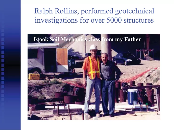
SLIDE 1
Ralph Rollins, performed geotechnical investigations for over 5000 structures
I took Soil Mechanics class from my Father
SLIDE 2
Rachel Rollins is a Civil Engineering student
Rachel took Soil Mechanics class from her Father
SLIDE 3
Granddaughter, Ella, shows early interest in soil behavior…
SLIDE 4
Post-Earthquake Geotechnical Reconnaissance Studies Kyle Rollins Civil & Environmental Engineering Brigham Young University
SLIDE 5
EERI Learning From Earthquakes
SLIDE 6
GEER Team Members in Chile
SLIDE 7
SLIDE 8
Travel in Japan after Fukushima failure
Carried Geiger
counter
Radiation less than
would be received if we stayed in US
SLIDE 9
Earthquake Interrupts Earthquake Briefing
SLIDE 10 Process of Investigation
Coordinate/Collaborate with local
engineers/researchers
1st
st st wave: Initial overview of areas of interest
by advance team
2nd
nd nd wave: Follow-up with second wave to
provide more detailed examination of key sites
3rd
rd rd wave: Measurement of soil properties in
key areas [Vs, SPT (N1)
1 60 60 6 , CPT qc, c Ic, etc.]
SLIDE 11
Understand the Seismo-Tectonic Setting
Magnitude Fault type (Strike-slip, Normal, thrust,
Subduction)
Distribution of acceleration stations and
measured peak accelerations
SLIDE 12 Tectonic Setting
Nazca Plate
South America Plate
13 Earthquakes
M9.5 in 1960
SLIDE 13 M = 8.8 Chile Earthquake
Large Magnitude Subduction Zone Event Long Duration of Shaking (often > 60 s) Well-Designed Earth Systems Shaken Many Opportunities to Gain Knowledge
Hospital in Curico R. Boroschek, Universidad de Chile
SLIDE 14 Ground motions
K-NET: surface (693) Kik-NET: v array (496) BRI: buildings (50) 16 recordings PGA > 1.0 g Rrup = 49 to 500 km
SLIDE 15 Accelerations at K-Net Tsukidate (MYG004 station)
(from National Research Institute for Earth Science and Disaster Prevention, NIED, 2011)
~ 50 seconds
SLIDE 16 M7.6 Samara Costa Rica Earthquake 2012
Nicoya Peninsula Zone of Amplification
- Fig. 1.1 – Location of epicenter and peak ground accelerations measured by the seismic network
- perated by the Engineering Seismology Laboratory (LIS) at the University of Costa Rica. The
recordings are color coded according to the acceleration level and Mercalli scale categories shown at the base of the map (LIS, 2012a).
Ni Nico coya ya a ya a Peni insul la Zo Zo Zo Zo
ne ne ne ne ne e ne ne ne ne ne n
f f Am Am Am Am Am m Am Am Am m Am Am m Am Am m Am Am m Am m Am m Am mpl pl pl pl pl pl pl pl pl pl pl pl pl p if if f if if f if i ic ic ic c ic ic ic ic i at at t at at at at at at at at at at at atio io io io io ion
Peninsula
SLIDE 17
Understand the Geologic Setting
Areas of deep soft soil Areas of saturated loose sand/fill material Areas of rock or stiff soils Basin structure
SLIDE 18
- Fig. 2.1 - Geology map of Costa Rica (modified from Dutch 2012) with locations of epicenters from
M7.5 1991 Limon Earthquake and M7.6 2012 Samara Earthquake
M7.5 1991 Limon Epicenter M7.5 2012 Samara Epicenter Limon
Intensity Map Geology Map Understand Surface Geology Relative to Shaking
SLIDE 19
What are we looking for?
SLIDE 20
What are we looking for?
Liquefaction Triggering
Gravels Silts/Sandy Silts/Clayey sands Magnitude effects on liquefaction
Liquefaction Effects
Settlement Uplift of utilities Lateral Spreading Residual Strength of liquefied soil Pile downdrag
SLIDE 21
What are we looking for?
Ground Response and Amplification
Topographic Amplification Influence of local soil conditions Basin effects Resonance with structural period
Comparison of good and bad performance
at adjacent sites
Influence of ground improvement on
performance
SLIDE 22
What are we looking for?
Landslides
Slope, acceleration level, duration, etc.
Influence of foundation type on
performance (shallow vs deep foundations)
Performance of utilities/pipelines Performance of levees and dams Behavior of earth retaining systems Performance relative to Tsunami
SLIDE 23
Mechanics of Liquefaction
SLIDE 24
Definition of Liquefaction
A decrease in strength and stiffness caused by a build-up of water pressure due to earthquake shaking.
= ( - u) tan
where = vertical stress from soil u = the water pressure tan = the friction coefficient
SLIDE 25
Where will we find liquefaction?
Port facilities Beaches Rivers/bridges Low lying areas with loose fill
SLIDE 26 Look for sand boils and ejecta indicating liquefaction
Photo credit: D.
- D. Zekkos
- s, 2014 Cephalonia
SLIDE 27
Gravel Ejecta after 2008 M7.6 Wenchuan, China Earthquake
Photo Credit: Cao et al, 2013
SLIDE 28
Chinese Dynamic Cone Penetrometer
SLIDE 29
Gravel Liquefaction Curves
SLIDE 30 Liquefiable soil
SLIDE 31
Liquefaction in Adapazari, Turkey
Photo credit: USGS Sanchio et al (2004)
SLIDE 32 GEER 2011 (photo: Boulanger)
Effects on buildings (e.g., Kamisu City)
SLIDE 33 GEER R 2011 1 (photo: K.M. Rollins)
SLIDE 34 GEER 2011 (photo: Rollins)
SLIDE 35 Settlement analyses for the Urayasu area Katsumata &Tokimatsu (2012) 2) – AIJ procedures
- Katsumata &Tokimatsu (2012)
K 2) AIJ procedures A Missing information? Other procedures? Bias & dispersion?
SLIDE 36 Liquefaction around Pile Supported Ferris Wheel
GEER Photo: K.M. Rollins
SLIDE 37 Building Settlement & Rotation
Constructed on 26 m long concrete Piles (3° Rotation)
GEER 2011 (photo: K.M. Rollins)
SLIDE 38 Liquefaction settlement of building on shallow footings
- Fig. 2.5 – Foundations Punching through liquefied ground (a) exterior column, north side; (b) interior column, left behind a 60cm crater.
SLIDE 39
Shear wave velocity, Vs, from Surface Wave Measurements at Liquefaction Site-Costa Rica 2012
Vs profile: R. Luna
SLIDE 40 Drag Load & Settlement from Liquefaction
Bearing Stratum Liquefiable Soil Non-Liquefiable Soil
End nd- d-Bearing Side Shear Applied Load Reduced Side Shear Side Shear Reduced Side Shear
Liquefied Soil
Negative Negative Side Shear
SLIDE 41 Lateral spreading Pier settlement
Juan Pablo II Bridge, Concépcion
Bent damage due to lateral spreading on NE approach Liquefaction-induced pier settlements along bridge span
N
Photo taken from NE
SLIDE 42 Piers # 113-116 Piers # 113-116
J uan Pablo II Bridge
Liquefaction-induced pier settlements along bridge span
0.5m-0.7m
M odes of deformation
Liquefaction-induced pier settlement
SLIDE 43
Before earthquake After earthquake
SLIDE 44
Port of Coronel, South of Concepcion
SLIDE 45
Lateral Spreading at Puerto Coronel
SLIDE 46 “Bring a tape and a field book, not just a camera!”
Emeritus Prof. BYU
SLIDE 47 Lateral Spreading at Puerto Coronel
Coronel, Chile Port Lateral Spread 0.00 0.20 0.40 0.60 0.80 1.00 1.20 1.40 5 10 15 20 25 30 Distance from Wall Face (m) Cumulative Horizontal Displacement (m) Line 1 Line 2
SLIDE 48
Lateral Spreading Damage - Ports
Ground Movement
2010 M8.8 Maule Chile Earthquake
SLIDE 49
Sketch from field notes
SLIDE 50
Base Isolated Pier (< 0.5 m offset)
Base isolators Stabilizing Pile
SLIDE 51
Collapse Holes from Lateral Spreading
SLIDE 52
Collapse Holes from Lateral Spreading
SLIDE 53
Lateral Spreading at Puerto Coronel
SLIDE 54 Lateral Spreading at Puerto Coronel
Near Port Coronel, Chile Lateral Spread 0.5 1 1.5 2 2.5 3 20 40 60 80 100 Distance from Wall Face (m) Cumulative Horizontal Displacement (m)
SLIDE 55 Fisherman’s Pier at Coronel
Lateral spread measurement line Damaged piles due to lateral spreading
SLIDE 56
Lateral Spreading near Puerto Coronel
Ground Movement
SLIDE 57 D=2.8 m D=1.5 m D=0.45 m D= 0 m (N1)
1 60 60 6 < 10
10<(N1)
1 60 60 6 < 15
16<(N1)
1 60
20<(N1)
1 60
SLIDE 58
Contrasting Performance of Adjacent Piers
SLIDE 59
Contrasting Performance of Adjacent Structures
SLIDE 60
Contrasting Performance of Adjacent Structures
SLIDE 61
Geo-referenced Photographs
SLIDE 62
SLIDE 63
SLIDE 64
Port of Iquique, Chile April 2014
SLIDE 65
Cone Penetrometer Testing
(Donated by ConeTec)
SLIDE 66
Cone Penetration Test Soundings
SLIDE 67
Port of Iquique, Chile April 2014
SLIDE 68
UAVs for Reconnaissance
SLIDE 69
Identifying unique points from multiple directions
SLIDE 70
Structure from Motion Point Clouds
Kevin Franke, BYU
SLIDE 71
Structure from Motion Point Clouds
SLIDE 72 Measured vs. UAV Displacements
0.0 0.5 1.0 1.5 2.0 2.5 10 20 30 40 50 60 Cumulative Displacement (m) Distance from West Base (m) Section Through CPT 3, 4 and 5 UAV-CPT 3,4 and 5 North End of Pier UAV North End of Pier
SLIDE 73
Passive Force from Lateral Spreading
Passive force often drives displacement
Selection of smaller passive force (lower Kp)
may be unconservative
Liquefaction
SLIDE 74 Lateral Spread of Abutment in bridge
35 5 cm 35 5 m cm
rebar Shearing of Shearing of back wall back wall
SLIDE 75 Lateral Spreading Around Abutment
Retaining wall Abutment wall
SLIDE 76
Lateral Spread Damage-Bridge
1991 Limon, Costa Rica Earthquake
SLIDE 77
Obtain plans for bridge foundations
SLIDE 78 24.96 6 m 75.02 m 75.24 m 176.14 m
Rio Estrella Bridge, Costa Rica, 1991
SLIDE 79
Liquefaction in the Atacama Desert?
SLIDE 80
Liquefaction in the Desert?
SLIDE 81
Liquefaction at Tana Bridge
SLIDE 82
Liquefaction in the Atacama Desert
SLIDE 83 Lateral Spreading at Puerto Valparaiso
Lateral displacement and settlement behind dock wall Apparent lateral spreading at Berth 5
SLIDE 84
Lateral Quaywall Movement at Puerto Valparaiso
SLIDE 85 Lateral Spread at Puerto Valparaiso
Valpariso, Chile Port Lateral Spread
10 20 30 40 50 60 5 10 15 20 25 30 35 40 Distance from Wall Face (m) Cumulative Horizontal Displacement (cm)
Horizontal Movement
SLIDE 86
Lateral Spreading at Port of Valparaiso
SLIDE 87 Shear failure Lateral spread
Liquefaction Lateral spread Lateral spread Deck settlement Deck settlement
J uan Pablo II Bridge
evidence of liquefaction
Lateral spreading and bridge bent damage on NE approach
Deck settlement
SLIDE 88
La Mochita Bridge, Concépcion
SLIDE 89 Site Effects: Vespucio Norte & Ciudad Empresiarial
Gravel, Sandy Gravel, S gravel Silty Clay, Silty Sand Collapse Collapse p No collapse
H/ V peaks: 0.5-2sec (Bonnefoy et al, 2008) Damage to 5 to 20-story buildings Qfno
Localized Damage – Site Effects? A B
C Silty C
A
B
SLIDE 90 Liquefaction at Strong Motion Sites
GEER 2011 (photo: K.M. Rollins)
SLIDE 91 GEER 2011 (photos: Boulanger)
Strong ground motion stations with liquefaction nearby
SLIDE 92 Station CHB024 Station CHB009
0.1 0.2
Acceleration (g)
40 80 120 160 200
Time (s)
0.1 0.2
CHB009 - NS CHB009 - EW
0.1 0.2 40 80 120 160 200
Time (s)
0.1 0.2
CHB024 - NS CHB024 - EW GEER 2011 (photos: Boulanger)
SLIDE 93
Landslides in Steep Slopes/Stiff dry clay
West of Arauco
SLIDE 94
Landslides in Steep Slopes/Stiff dry clay
SLIDE 95
SLIDE 96 Bearing Failure and Lateral Spread at Tupul Bridge
Bearing failure along highway Lateral spreading impacts bridge abutment Tupul Bridge
SLIDE 97 Failure of Highway Embankment
Liquefiable Zone Embankment Fill Soft Clay Liquefiable Zone Embankment Fill Soft Clay
SLIDE 98
SLIDE 99
SLIDE 100 Skewed Bridge Abutment Overview
40% of 600,000 bridges in US are skewed Current AASHTO design code does not
- consider any effect of skew on passive force
Observations of poor performance of skewed
Shamsabadi et al. 2006
SLIDE 101
Greater Damage to Skew Abutments
SLIDE 102
Permanent Abutment Offset at Skewed Bridge
4 inch 4 inch Longitudinal Longitudinal Displacement 3 inch 3 inch Transverse Transverse Displacement
SLIDE 103
Earthquake Damage to Skewed Bridges (Paine, Chile)
Top Bridge Bottom Bridge Top Bridge
Bridge decks have rotated and bridge was demolished
Bottom Bridge
Bridge deck was offset and was eventually demolished
Top Bridge
Bridge remained in service after the earthquake
SLIDE 104
Damage rate for skewed bridges was twice that of non-skewed bridges (Toro et al 2013)
SLIDE 105 Field Test Setup - Plan View
12.75 inch Dia. Steel Pipe Piles 11 ft wide x 5.5 ft high Pile Cap 24 ft 22 ft Transverse Wingwalls 2 x 4 ft Reinforced Concrete blocks 4 ft Dia. Drilled Shaft Sheet Pile Wall Section AZ-18 2 – 600 kip Actuators
SLIDE 106 Field Test Setup Elevation View
11 ft m wide x 5.5 ft high x 15 ft long Pile Cap 6 ft 6.4m 4 ft Dia. Drilled Shaft Sheet Pile Wall Section AZ-18 2 – 600 kip Actuators 12.75 inch Dia. Steel Pipe Piles
SLIDE 107
No Skew - 0° Test Setup
SLIDE 108
15° Skew Test Setup
SLIDE 109
30° Skew Test Setup
SLIDE 110 Passive Force Reduction Factor vs. Skew
Rskew = 8x10-052 - 0.018 + 1 R² = 0.98 0.1 0.2 0.3 0.4 0.5 0.6 0.7 0.8 0.9 1 15 30 45 60 75 90 Reduction Factor, Rskew Skew Angle, [degrees] Lab Tests Numerical Analysis Field Tests (This Study) Proposed Reduction Line
SLIDE 111
Settlement and Sliding of Approach Fills
SLIDE 112
Settlement and Sliding of Approach Fills
SLIDE 113
SLIDE 114
SLIDE 115 Damage to braced retaining system
GEER 2011 (photo: K.M. Rollins)
SLIDE 116
No Damage Associated with MSE Walls
SLIDE 117
SLIDE 118
SLIDE 119
SLIDE 120
Highly Corrosive Soil
SLIDE 121
Sand Compaction Piles (Fudo T etra)
SLIDE 122 Typical Installation Arrangement
Elevation View Plan View
Building Area Treatment Area Z/ 2 Non-liquefiable Soil Non-liquefiable Soil Liquefiable Soil
Treatment zone, Z
Z/ 2 Sand column Area Replacement ratio (Ar) of 10% for low fines to 20% for higher fines
Sand Pile
Gravel column
SLIDE 123 Contrast between T
Urayasu City Liquefaction
Courtesy Japan Probe Courtesy Japan Probe Area around structures in T
treated with compaction Piles-little settlement Parking lot at T
and experienced 50 cm of settlement
Parking Lot at T
Space Mount at T
SLIDE 124 GEER 2011 (photo: K.M. Rollins)
SLIDE 125
Seismic Performance of Dams & Levees
Coihueco Zoned Earth Dam Upstream Slope Failure Rapel Concrete Dam (most dams performed well) Levee Breach
SLIDE 126 Seismic Performance of Tailings Dams
Las Palmas Tailings Dam Failure
Approximate area of failure and flow direction
SLIDE 127 Naruse River left levee at km 11.3
GEER 2011 (photo: L. F. Harder)
SLIDE 128 River System Type and Number of Levee Damage Sites Reported Failure Settlement Slope Slumping Levee Cracking Revetment/ Wall Damage Gate Damage Other Total Mabuchi 1 1 1 5 1 5 13 Kitakami 13 62 47 278 121 67 58 646 Naruse 9 27 25 183 56 26 37 363 Natori 1 2 1 26 2 2 1 35 Abukuma 2 26 16 73 2 10 3 132 TOTAL 25 118 90 561 186 106 104 1190
Levee Damage in the Tohoku Region (MLIT 2011)
SLIDE 129 GEER Photo: K.M. Rollins
Tsunami Damage
SLIDE 130
SLIDE 131
SLIDE 132
SLIDE 133
Car on top of 4 story building
SLIDE 134
Pile Supported Building vs Tsunami
SLIDE 135
Rematch
SLIDE 136 Tips for Sucessful Geotechical Recon
Be safe out there Develop friendships during your career Collaborate with local engineers, geologists,
seismologists
Make use of Google Earth for scouting/reporting Document performance, don’t just photograph Use UAVs for topographic mapping Quantify site conditions if possible (Vs, CPT, SPT, DMT) Look for contrasting sites (good/bad performance) Obtain plans where if possible Morning plan of attack, Evening reports