SLIDE 1
PURPOSE OF THIS MEETING is to Inform the Public About Proposed - - PowerPoint PPT Presentation
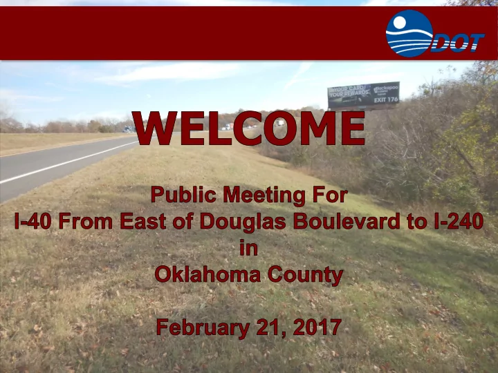
PURPOSE OF THIS MEETING is to Inform the Public About Proposed Improvements to I-40 From East of Douglas Boulevard to I-240 in Oklahoma County and Obtain Input PURPOSE OF THE PROJECT is to Accommodate Existing and Future Traffic on I-40
SLIDE 2
SLIDE 3
PURPOSE OF THE PROJECT
…is to Accommodate Existing and Future Traffic
- n I-40 and Provide Adequate Vertical Clearance
Under Bridges
N N
SLIDE 4
PROJECT BACKGROUND
- ODOT is Currently Studying Improvements on I-40 From I-35 to I-240,
Including
- Additional Driving Lanes
- Frontage Roads (I-35 to Douglas Blvd.)
- Bridge Improvements
- Projects Currently Scheduled Include
- I-40 and Scott Street
- I-40 and Sunnylane Road
- I-40 and Crutcho Creek & 15th St.
- I-40 and Sooner Road
AERIAL OF I-40 CORRIDOR
N
I-40 & Douglas Blvd. I-40 & Choctaw Rd.
- I-40 and Douglas Boulevard
- I-40 Between Douglas and I-240
- I-40 and Choctaw Road
I-40
Widening
SLIDE 5
SLIDE 6
CURRENT PROJECT AREA INFORMATION
- General Data on I-40
- Project Length - 4.8 Miles
- Original Construction 1963
- 4 Overlays to Date (1975, 1988, 2002, 2015)
- 4-Lane Divided Freeway With
- 10-Foot Outside Shoulders
- 4-Foot Inside Shoulders
- Grass Median With Cable Barrier
- Speeds – Posted 70 mph
- Current Traffic (2015):
- 44,260 Vehicles/Day (East of Douglas)
- 37,960 Vehicles/Day (East of Anderson)
- Projected Traffic (2045):
- 63,240 Vehicles/Day (East of Douglas)
- 53,080 Vehicles/Day (East of Anderson)
- 15% Trucks
SLIDE 7
EXISTING BRIDGES
- Bridges over I-40
- Post Road – 16’ 4” Vertical Clearance
- Westminster Road – 16’ 4” Vertical
Clearance
- SE 59th Street – 17’ 3” Vertical Clearance
N N
Westminster Rd. – Concrete Slab Span Bridge SE 59th St. – Steel Beam Span Bridge
SLIDE 8
EXISTING BRIDGES
- I-40 Bridges
- Anderson Road (2 bridges) – 14’ 10” Vertical
Clearance
- Hog Creek – Reinforced Concrete Box
- I-240 WB Ramp (2 bridges) – 17’ 8” Vertical
Clearance
Hog Creek – 3 Cell Reinforced Concrete Box
N
Anderson Rd. – Steel Beam Span Bridge
SLIDE 9
CURRENT PROJECT AREA INFORMATION
- Collision Data (2006-2016)
- Total: 677 Documented Accidents
- 448 Property Damage Only
- 220 Involved Injury (332 People)
- 9 Fatal (10 People)
- On Average More Than 1 Accident/Week
- Most Common Types
- 1. Fixed Objects (Cable Barrier)
- 2. Rear Ends
- 3. Side Swipes Same Direction
Overall Accident Rate is 1.4 Times the State Average for Similar Highways. Fatal Accident Rate is Nearly 2 Times the State Average
SLIDE 10
EXISTING CONDITIONS WARRANT IMPROVEMENT
- Pavement Condition
- Bridge Conditions
- Provide Adequate Vertical Clearance of 16’ 9”
- Provide Adequate Bridge Width for New Lanes
- SE 59th Street Bridge Recently Replaced – No
Additional Work
- Traffic Conditions
- Existing Traffic –
Level of Service (LOS) D
- Future Traffic –
Level of Service (LOS) F
SLIDE 11
SLIDE 12
PROJECT CONSTRAINTS
- Identified Key Project
Features/Constraints and Collected Data
- Utilities
- Developments
- Homes
- Businesses
- Environmental
- Cultural Resources
- Threatened & Endangered Species
- Waters and Wetlands
- Sites Containing Potentially Hazardous
Materials
- Noise
SLIDE 13
PROJECT CONSTRAINTS
- The Project Will Have NO IMPACTS To:
- Private Property (No Acquisition Required)
- Wetlands
- Cultural Resources
- Historic Sites
- Parks
- Farmlands
SLIDE 14
PROJECT CONSTRAINTS
- Project Constraints
- Utilities
- Under Ground
− Electric, Fiber Optic (ODOT Lines)
- Utility Relocations, if Required, Will Occur
Prior to Construction
SLIDE 15
PROJECT CONSTRAINTS
- Streams
- Four (4) Identified Streams are Located Within
the Study Area.
- Minimal Impacts May Occur if Culverts are
- Extended. Appropriate Permits Will be Obtained
From the US Army Corps of Engineers
N N
SLIDE 16
PROJECT CONSTRAINTS
- Threatened & Endangered Species
- No Suitable Habitat for Threatened and Endangered Species
- Bridges may Provide Nesting Habitat for Migratory Birds (Cliff and Barn
Swallows)
SLIDE 17
PROJECT CONSTRAINTS
- Storage Tank Sites or Potentially Hazardous Materials
- Seven (7) Low-Risk Sites Were Located Near the Project, but Will not be
Affected by the Project Tinker Air Force Base
SLIDE 18
SLIDE 19
PROPOSED ROADWAY
- I-40 Improvements
- Full Pavement Reconstruction
- Roadway Typical Sections
- Six 12-Foot-Wide Lanes
- 10-Foot-Wide Outside & Inside Shoulder (or as Wide as Possible)
- Concrete Median Barrier
- Design Speed – 70 mph
- Extend Acceleration & Deceleration Lanes
for Anderson Rd. Interchange
- I-40 Will Remain Open
During Construction
SLIDE 20
PROPOSED ROADWAY
- I-40 Improvements
- Full Pavement Reconstruction
- Roadway Typical Sections
- Six 12-Foot-Wide Lanes
- 10-Foot-Wide Outside & Inside Shoulder (or as Wide as Possible)
- Concrete Median Barrier
- Design Speed – 70 mph
- Extend Acceleration & Deceleration Lanes
for Anderson Rd. Interchange
- I-40 Will Remain Open
During Construction
SLIDE 21
PROPOSED SPAN BRIDGES
- Proposed Post Road Bridge
- I-40 Will be Lowered Approximately 6”
for Vertical Clearance
- No Change to Post Road
- Post Road Will Remain Open During
Construction
N
SLIDE 22
PROPOSED SPAN BRIDGES
- Proposed Westminster Road Bridge
- Westminster Road Bridge Will be Raised
Approximately 1’ to Provide Vertical Clearance
- Westminster Roadway Will Tie Back to
Existing
- Temporary Road Closure During
Construction – Estimated at 60 Days
N
SLIDE 23
PROPOSED SPAN BRIDGES
- Proposed Anderson Road Bridges
- One Bridge
- 117 Feet Wide – 6 Lanes
- 3 Spans – 215 Feet Long
- Prestressed Concrete Beams
- Vertical Clearance – 16’-9”
- Horizontal Clearance for Future
Improvements on Anderson Road
- Phased Construction - I-40 and
Anderson Road will Remain Open
Example of a Prestressed Concrete Beam Bridge
N
SLIDE 24
PROPOSED SPAN BRIDGES
- Proposed I-240 WB Ramp Bridges
- One Bridge
- 117 Feet Wide – 6 Lanes
- 3 Spans – 202 Feet Long
- Rolled Steel Beams
- I-40 and I-240 Ramp Will Remain
Open
Example of a Rolled Steel Beam Bridge
N
SLIDE 25
SLIDE 26
NOISE STUDY
- A Noise Study was Completed According to
Federal Highway Administration (FHWA) Regulations and ODOT Noise Policy
- Existing (2015) and Future (2045) Noise Levels
were determined by the FHWA Traffic Noise Model, factoring in roadways, traffic data, terrain and receptor site locations.
- Validation to verify accuracy of Noise Model was
completed by taking sample readings with a precision sound level meter
- Eighty-Nine (89) Noise-Sensitive Receptors
(Homes) at various distances adjacent to I-40 were evaluated.
SLIDE 27
NOISE IMPACTS
- Existing Noise Condition
- Based on Existing I-40 Roadway Features and
Traffic Volumes
- Future Noise Condition
- Based on Additional Lanes on I-40 and Increased
Traffic Volumes - Will Generate More Noise
- Traffic Will Not be any Closer to Homes than
Today
- Noise Impacts
- An Impact Occurs When Exterior Future Noise
Levels are 66 dB(A) or Above, or When Future Levels are 15-dB or More Above Existing Levels
- For Existing Condition – 38 Homes Impacted
- For Future Condition – 56 Homes Impacted
- Future Levels Range 59.9 to 77.2 dB(A)
- Future Levels over Existing Levels Range +0.9 to
+5.4 dB
SLIDE 28
NOISE WALL CONSIDERATION
- Noise Walls Were Considered for all Impacted
Homes – Walls Must Meet ODOT’s Feasible and Reasonable Criteria
- A Benefitted Receptor Must Achieve at least 5 dB
Reduction to be considered Feasible.
- Reasonableness Means that a Wall Must Achieve
at Least a 7 dB Reduction for at Least 75% of Benefitted Receptors, and
- Noise Wall cost Must not Exceed $30,000 per
Benefitted Receptor.
- Modeling Determined that Noise Walls would be Ineffective due to:
- Not Achieving a Reasonable Acoustic Reduction at a 22-feet Maximum Wall
Height
- High Cost Per Benefitted Receptor - in All Cases Exceeding $100,000
- Therefore, Noise Walls are Not Recommended for this Project.
SLIDE 29
PROJECT SUMMARY
- Proposed Improvements
- New Lanes in the Median
- New Pavement
- Lower I-40 Under Post Road
- Raise Westminster Bridge
- New Bridges for I-40 Over Anderson Rd. and I-240
- Proposed Improvements – All Within Existing Right-of-Way
N N
SLIDE 30
SLIDE 31
SCHEDULE
I-40 & Douglas Blvd. Right-of-Way: 2017 Construction: 2020 Cost: Est. $46 M I-40, Douglas to I-240 No R/W or Utilities Construction: 2020 Cost: Est. $70.1 M I-40 & Choctaw Road Construction: 2017 Cost: Est. $43.5M
SLIDE 32