
SLIDE 1
PUBLIC INFORMATION CENTRE No.1 November 21 st , 2007 Mount Pleasant - - PowerPoint PPT Presentation
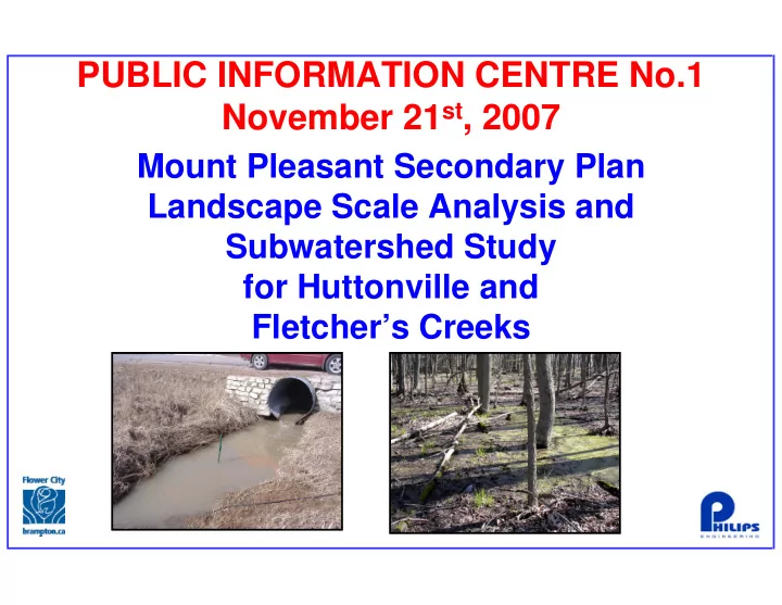
PUBLIC INFORMATION CENTRE No.1 November 21 st , 2007 Mount Pleasant Secondary Plan Landscape Scale Analysis and Subwatershed Study for Huttonville and Fletchers Creeks Background Information The City of Brampton completed the North
North West Brampton
selection?
Phase 1
Subwatershed Characterization
Phase 2
Impact Assessment
Phase 3
Management Strategies and Implementation
Phase 4
Long-term monitoring
environmental resources?
transportation studies, etc.?
recommendations?
more information is available?
transportation studies, etc.) ?
public needs?
LSA
Credit River Water Management Strategy
identifies:
contamination
measures
targets
initial thought on community planning, transportation and public works, etc.)
framework and sustainable management practices
findings to city initiatives
relation to LSA) and sustainable management practices
findings to city initiatives
LSA) and sustainable management practices
findings to city initiatives
addresses measurable subwatershed goals
Management program (AEM) to evaluate assumptions, recommendations
for updating the Subwatershed Study and Landscape Scale Analysis
North West Brampton
North West Brampton
North West Brampton
Phase 1 Identify and Describe the Problem(s) Phase 2 Alternative Planning Solutions Phase 3 Alternative Design Concepts For the Preferred Solution Phase 4 Environmental Study Report Phase 5 Implementation
Environmental Study Report (ESR).
record for review for 30 days.
government agencies of completion of the ESR and of the Part II Order provision in the EA Act.
provisions and commitments.
Problem Statement Preferred Solution ESR
Agency and Stakeholder Consultation Agency and Stakeholder Consultation
Preferred Design
alternative planning solutions.
solutions, taking into consideration environmental and technical factors.
solution to the problem(s).
designs to implement the preferred solution.
social/cultural and economic environments.
the alternative designs after mitigation.
designs.
design.
North West Brampton
Flow Management Study Other:
Water Quality Management Study Credit River Water Management Strategy Adaptive Environmental Management Strategy Provide direction to local municipalities on land use, environmental and stormwater management implementation Water Budget Study
4 P reserve a n d re-esta b lish th e n atu ral h y drolog ic cy cle In d icator M ea su ra b le P ara m eter T arg et R eferen ces / N otes W atersh ed P eakin ess 1 R ip arian F lo w C o m p ared to B aseflo w (Q 2 5/Q ba se flo w ) T o b e m o d eled fo r each su b w atersh ed . R ip arian F lo w C o m p ared to B aseflo w is an in d icato r o f flo o d in g ch aracteristics. H ig h er ratio s th an th e h isto ric co nd ition in dicate a less n atu ral flo o din g reg im e. W atersh ed P eakin ess 2 B an k fu ll F lo w C o m p ared to B aseflo w (Q ba nk fu ll(0.8 xQ 2 )/Q base flo w ) T o b e m o d eled fo r each su b w atersh ed . B an kfu ll F lo w C o m p ared to B aseflo w is an in d icato r o f n atu ral in -stream flo w ch aracteristics. H igh er ratio s th an th e histo ric con d itio n in d icate a less n atu ral flo w reg im e. F lo w T im e S eries R atio o f a F lo w T im e S eries (Q 2 ;Q 5 ;Q 10 ;Q 2 5 ;Q 50 m 3 /s)C o m p ared to H isto ric T im e S eries E ach ratio sh o uld b e less th an 1 .5 tim es th e co m p arab le h isto ric valu e. R atio o f a F lo w T im e S eries C o m p ared to H isto ric T im e S eries is an ind icato r o f th e exten t to w h ich th e n atu ral h yd ro lo gy o f th e stream h as b een altered . 5 M a in tain , en h an ce or resto re n atu ral strea m pro cesses to ach ieve a b ala n ce of flow an d sed im en t tra n sp o rt In d icator M ea su ra b le P ara m eter T arg et R eferen ces / N otes In stream E ro sio n P o ten tial 1 R atio o f th e C u rren t B an k fu ll F low C o m p ared to H isto ric B an kfu ll F lo w (Q ba nk fu ll relative to h isto ric valu e) T o b e calcu lated fo r each su b w atersh ed . T h e target is to m ain tain th e existin g ratio o r ach ieve a n et red u ctio n. R atio o f th e C u rren t B an kfu ll F lo w C o m p ared to H isto ric B an kfu ll F lo w is an in d icato r o f ch an gin g ero sion al/dep o sition al stresses o n th e geo m etry o f th e stream ch an n el. In stream E ro sio n P o ten tial 2 E ro sion T h resh o ld (sh ear stress or o th er variab le). T o b e d eterm in ed fo r each su b w atersh ed . T h e target to b e d evelo p ed b ased o n m o n ito rin g S tab le B ed S ed im en t R egim e P article S ize D istrib u tion and M ean P article S ize
T o b e d eterm in ed fo r each su b w atersh ed . T argets to b e d evelo p ed b ased o n m o n ito rin g. P article S ize D istrib u tion and M ean P article S ize o f B ed S edim en ts is an in d icato r o f th eir stability. A sh iftin g tren d in th is d istrib u tio n ind icates ch an n el in stab ility. 6 M a na g e strea m flow to red u ce erosio n im p a cts o n h ab itats a n d pro p erty In d icator M ea su ra b le P ara m eter T arg et R eferen ces / N otes P ro tection o f P ro p erty an d S tru ctu res R isk to S tru ctu res w ith in A reas P ro n e to E ro sion (th e nu m b er o f a ffected stru ctu res u n d er a Q 5 even t) T o b e d eterm in ed o n a su b w atersh ed b asis. T arget is n o in crease o r a n et d ecrease in n u m b er o f affected stru ctu res. T h e R isk to S tru ctu res th at are w ith in areas p ro n e to ero sio n (th e nu m b er o f affected stru ctu res u nd er a Q 5 even t) in creases w h en th e ero sion stress in th e ch an n el is in creased . If flo w s o f a certain d u ratio n in crease, m o re stru ctu res m ay b eco m e ero sio n p ron e. 7 M in im ize risk to h u m a n life a n d pro p erty d u e to floo d in g In d icator M ea su ra b le P ara m eter T arg et R eferen ces / N otes P ro tection o f L ife an d P ro p erty R eg u lato ry P eak F lo o d F lo w T o b e calcu lated fo r each su b w atersh ed . T h e target is n o in crease o r a n et redu ction in th e regu lato ry flo o d flo w . A n in crease in th e R egu lato ry P eak F lo o d F lo w (th e Q 1 00 o r Q reg io na l eve nt (m 3 /s) can in crease th e risk to life an d p ro p erty fro m flo o d in g. 8 M a in tain g ro u n d w ater levels a n d b a seflow s (g rou n d w ater d isch arg e to strea m s) to su stain w atersh ed fu n ctio n s, h u m a n u ses a n d clim ato log ica l ch a n g e In d icator M ea su ra b le P ara m eter T arg ets R eferen ces / N otes B aseflo w s in S tream s R atio o f B aseflo w to M ean A n n ual F lo w T o b e d eterm in ed fo r each su b w atersh ed . T h e R atio o f th e B aseflo w to th e M ean A n n u al F lo w (b aseflo w as a p ercen tage
su p po rt d ifferen t typ es o f fish co m m u n ities. G ro u n d w ater D isch arge E xistin g S tream B aseflo w N o R ed u ctio n. T o b e d eterm in ed o n a su b w atersh ed b asis (o r
T h e E xistin g S tream B aseflo w is an ind icato r o f th e m in im u m h ab itat availab le fo r fish an d affects stream th erm al stab ility (M easu red B ase F lo w s). R ech arge A reas A verag e R ech arge o n a S ub w atersh ed B asis N o R ed u ctio n. T o b e d eterm in ed o n a su b w atersh ed b asis (o r
T h e A verage R ech arge o n a S u bw atersh ed B asis is d irectly related to th e n atu ral w ater b alan ce. A n y red u ctio n in rech arge o ver th e area o f th e su b w atersh ed m ay in d icate in creased ru n o ff an d d ecreased stream b aseflo w . W ater T ab le E levatio n s A verage W ater T ab le E levatio n N o R ed u ctio n. T o b e d eterm in ed o n a su b w atersh ed b asis (o r
T h e A verage W ater T ab le E levatio n is an in d icato r o f th e n atu ral w ater tab le elevatio n . A lo w erin g o f th e w ater tab le m ay in d icate a red u ctio n in gro un d w ater su p p lies an d a red u ctio n in grou nd w ater d isch arg e to stream s.
9 Maintain or enhance water and sediment quality to achieve ecological integrity Indicator Measurable Parameter Targets References / Notes Dissolved Oxygen Minimum Dissolved Oxygen 6 mg/L (coldwater and mixed water) 5 mg/L (warmwater) Provincial Water Quality Objectives Water Temperature 1 Absolute Maximum Summer Water Temperature 26 C (coldwater) 28 C (mixed water) 30 C (warmwater) Source: Ontario Ministry of Natural Resources and Canadian Department of Fisheries and Oceans. no date. A simple Method to Determine the Thermal Stability of Southern Ontario Trout Streams Personal Communication: Jim Bewlby and Jack Imhof Water Temperature 2 Daily Maximum Summer Average Water Temperature 20 C (coldwater) 23 C (mixed water) 26 C (warmwater) Source: Ontario Ministry of Natural Resources and Canadian Department of Fisheries and Oceans. no date. A simple Method to Determine the Thermal Stability of Southern Ontario Trout Streams Personal Communication: Jim Bewlby and Jack Imhof Copper 75 percentile 0.005 mg/L Provincial Water Quality Objectives Iron 75 percentile 0.3 mg/L Provincial Water Quality Objectives Zinc 75 percentile 0.02 mg/L Provincial Water Quality Objectives Total Phosphorus 75 percentile 0.03 mg/L Provincial Water Quality Objectives Nitrate – Nitrogen 75 percentile 2.9 mg/L Federal Canadian Council of Ministers of the Environment Guideline (CCME) Suspended Solids 75 percentile <25 mg/L (dry) Federal Canadian Council of Ministers of the Environment Guideline (CCME) Chlorides 75 percentile <250 mg/L Canadian Drinking Water Quality Guidelines/ Ontario Drinking Water Quality Standards 15 Protect, restore or enhance the integrity of the watershed ecosystem, through an integrated network of natural areas, habitats and connecting links Indicator Measurable Parameter Targets References / Notes Riparian Cover 1 Width of the Riparian Buffer 15 m back from each streambank (warmwater) 30 m back from each stream (coldwater) The Width of the Buffer (width in m) in natural vegetation is an indicator of the buffer's ability to provide key functions (attenuation of water quality/quantity, stream microclimate, shading, etc.). (Environment Canada, Canadian Wildlife Service, 2004, How Much Habitat is Enough? A Framework to Guide Habitat Rehabilitation in Great Lakes Areas of Concern. Second Edition. Minister of Public Works and Government Services Canada. Downsview.) Riparian Cover 2 Percent of Stream Length Buffered 75% of stream length in natural vegetation The Percent of Stream Length Buffered (length of natural stream buffer along the stream) is an indictor of its ability to provide key functions. (Environment Canada, 2004. ) Forest Cover Percent of the Subwatershed Forested To be calculated on a subwatershed basis. The Percent of the Subwatershed Forested is an indicator of the sustainability of the natural environment and an indicator of the ability of native forests to provide sustainable watershed benefits such as improving air quality, sequestering carbon, etc. (Federal Great Lakes target >30% on a watershed basis). (Environment Canada, 2004.) Wetland Cover Percent of the Subwatershed in Wetlands To be calculated on a subwatershed basis. The Percent of the Subwatershed in Wetlands is an indicator of the sustainability
basis). (Environment Canada, 2004.) Interior Forest/Core Habitat Percent of Forested Habitat > 100 m from Edge Subwatershed target is a net gain over existing conditions. To be calculated on a subwatershed basis. The Percent of Forested Habitat > 100 m from edge (a cumulative total of this area over the total watershed) is an indicator of a high quality terrestrial habitat that supports a unique assemblage of species that are generally intolerant of urban environments. (The watershed target is a minimum of 10% over the entire watershed). (Environment Canada, 2004.) Large Habitat Units Percent of Natural Vegetation in 200 ha or Larger Patches Subwatershed target is a net gain over existing conditions. To be calculated on a subwatershed basis. The Percent of Natural Vegetation in 200 ha or larger patches over the entire watershed is an indicator of a high quality terrestrial habitat that supports a unique assemblage of species that are generally intolerant of urban
natural refuges and centres of ecological and genetic diversity that preserves biosphere-scale biological diversity. (The watershed target is a minimum of 10%
16 Protect, restore or enhance native terrestrial and aquatic plant and animal species, community diversity and productivity Indicator Measurable Parameter Targets References Aquatic Indicator Species 1 Healthy Populations of Representative Fish Communities Small Warmwater targets are: creek chub, blacknose dace, stickleback, bluntnose minnow, fathead minnow, white sucker. Large Warmwater targets are: smallmouth bass, largemouth bass, northern pike, river chub, shiners (emerald, spottail, rosyface, spotfin) Cool/Warmwater targets are: migratory salmonids, central mudminnow, northern redbelly dace, redside dace. Cold/Coolwater targets are: brown trout, rainbow trout, rainbow darter, fantail darter, northern hogsucker, stonecat, mottled sculpin, American brook lamprey. Coldwater targets are: brook trout, brown trout, rainbow trout, mottled/slimy sculpin. Representative fish communities - cold, mixed, warm - have specific habitat requirements that must be present on a subwatershed basis in order for the species that make up the community to persist. Healthy Populations of the Representative Fish Communities are indicators that the stream environment is healthy. Aquatic Indicator Species 2 Productive Capacity of Habitat Fish biomass per unit area or fish biomass IBI scores. Target is a net gain on a subwatershed basis, to be determined by monitoring. The Productive Capacity of Habitat relates to DFO's Fish Habitat Policy. Productive Capacity of Habitat (DFO Fish Habitat Policy) or amount of fish produced by the aquatic habitat in a waterbody is a measure of the waterbody's productive capacity. Generally, better quality habitats produce more fish, and the federal policy is to achieve an overall increase in the productive capacity of aquatic habitats. The total weight of fish produced per unit of habitat (fish biomass) or a relative score based on the species of fish present and their relative biomass (fish biomass IBI score) is a measure of productive capacity. Species At Risk Number of Special Status Species Present and Amount of Species At Risk Recovery Habitat Present Watershed target to be established through monitoring. Target is a net gain over existing conditions on a subwatershed basis. Number of Special Status Species present is an indicator of ecosystem health, as is the amount of Species At Risk recovery habitat present. Vegetation Communities Average Number of Different ELC Community Types per Vegetation Patch The average number of ELC communities/unit natural area is to be determined through monitoring on a subwatershed
The Average Number of Different ELC Community Types per Vegetation Patch is an indicator of diversity. Higher numbers of communities indicate higher diversity of natural habitats. Ecological Land Classification is a standard classification system for characterizing natural habitats based on vegetation. Vegetation Indicator Species 1 FQI minus the Number of Floral Species Typical of Presettlement Vegetation Communities The FQI is to be determined through monitoring on a subwatershed basis. Target is a net gain on a subwatershed basis. The FQI minus the Number of Floral Species Typical of Presettlement Vegetation Communities is an indicator of ecosystem health. Vegetation Indicator Species 2 FQI (Percent Native Species) The number of special status species is to be determined through monitoring on a subwatershed basis. Target is a net gain on a subwatershed basis. FQI (Percent Native Species). The Floral Quality Index is a ratio of the total number of native vegetation species present in an ELC community relative to the total number of vegetation species present. Higher FQIs indicate less disturbed environments.
private uses that provides a variety of housing forms and densities, employment opportunities and promotes public safety. 2. Establish a comprehensive transit and transportation strategy that maximizes that is designed to reduce the overall number of private automobile trips with the Mount Pleasant GO Station and the surrounding Village Core as the centrepiece of the community. 2. Identify a natural heritage system that balances the protection, preservation and enhancement of natural features and functions with the development principles of the Growth Plan to achieve a compact and complete community that takes into account the limited financial resources of the City. 4. Recognize and integrate the existing Fletcher’s Meadow Community, and edges of Mayfield Road in the Town of Caledon and Mississauga Road in the North-West Brampton Urban Development Area when preparing the Mount Pleasant Secondary Plan. 5. Ensure that the provisions of the Province’s Places to Growth Plan and the City’s Growth Management Strategy are implemented by the Mount Pleasant Secondary Plan to ensure that growth occurs in an orderly fashion commensurate with the availability of infrastructure and community services. 6. Include appropriate, cost effective and innovative planning and development standards to guide the development of the Mount Pleasant Community including, flexible zoning standards, on street parking, reduced road right-of-way widths and laneways. 7. Identify a public open space system that is designed for a highly urban context that contains both active and passive facilities that are oriented towards the Transit Spine and linear pedestrian connections and where local serving facilities are within an easy walk of neighborhood precincts. 8. Incorporate policies that encourage practical and cost effective innovations to support the development of a sustainable community that encourages the application of low impact development in appropriate locations, promotes green building designs, sets targets for an urban forest canopy and provides incentives for enhancing natural features.
North West Brampton
manage the present and future interactions within the watershed, including those between: water, land/water interactions, aquatic life and aquatic resources with subwatershed systems to protect the health of the ecosystem as land use changes.
the most important
present and future land use changes (e.g. deforestation, wetland draining, agriculture, urbanization, etc.)
resources.
water resources and natural heritage systems, in the context of land use planning documents.
North West Brampton The Subwatershed Study will be completed as four General Phases: 1. Subwatershed Characterization and Integration
hydrogeology, water quality, stream morphology, aquatic and terrestrial ecology). Integration of the individual environmental resources is conducted by the Team, to provide a holistic characterization. In addition, initial goals and objectives will be established. 2. Subwatershed Impact Analysis
part of Phase 1. The impacts would be determined by using modeling and qualitative assessments based on experience and knowledge of disciplines. 3. Management Strategies and Implementation
designations and form, will be established to achieve the Phase 1 objectives and goals. An Implementation Plan will be prepared to ensure compliance in the following areas: Planning and Policy, Rehabilitation and Retrofit, Stewardship, Monitoring and Research and Development. 4. Long-Term Monitoring Plan
implementation by assessing whether the assumptions made are appropriate and predictions made are correct, and determining if parts of the plan should be modified (The implementation of the Long-Tem Monitoring Plan is not part of the current study)
North West Brampton
LSA Dougan
North West Brampton
North West Brampton
Site Characterization – GW Drawing G1 – Groundwater Monitoring Locations (PEL)
North West Brampton
North West Brampton
Creek, 3 staff gauges and 1 rainfall gauge. During 2006, 3 dry weather events and 10 wet weather events observed, while in 2007 only 1 wet weather event observed.
models have been prepared using the existing topography, land use, soil conditions and stormwater management
the Regional Storm Hurricane Hazel.
topography and crossings to determine the flow characteristics within each creek.
during 2006 with the above average levels of rainfall the drainage system produced numerous runoff responses. During 2007, with the drought conditions, the Halton Till had large amounts of available storage, resulting in no runoff responses to rainfall.
typically do not have flow capacity to convey the Regulatory storm event without significant overtopping of the road. The CNR crossing of Huttonville Creek has a significant backwater affect resulting in significant flood storage upstream of the crossing.
Subwatershed has 0.
North West Brampton
North West Brampton
the form and function of local channel systems . It also includes a specific focus on headwater channels, since the majority of the North West Brampton Study Area is comprised of a headwater drainage network.
channel dimensions and obtaining an understanding of the active channel processes.
monitoring sites have been used to evaluate channel geomorphic processes.
in the past typically been replaced with storm sewer systems when urban development occurs. The purpose of the assessment has been to evaluate the water and sediment movement within the headwater area swales and thereby determine the importance of headwater swales in providing system benefits.
Wanless Drive, Huttonville Creek gradually takes on more form until you reach the lower Huttonville Creek where the creek flows within a more defined valley feature.
important role in watershed-scale processes than what conventional wisdom would suggest.
North West Brampton
North West Brampton
North West Brampton
Mayfield Road most features were dry or hard standing pools. At Wanless Drive, most features were flowing or had standing pools. In 2007 most features were dry.
Huttonville Creek and mid-Fletcher’s Creek, worst in Upper and Lower Fletcher’s Creek.
Blacknose Dace, Northern Red Belly Dace, Brook Stickleback and YOY Largemouth Bass. At specific headwater sites captured fat head minnows and brook sticklebacks.
– Type 1: High groundwater discharge or extended wetland flow. – Type 2: Intermittent or ephemeral surface flows Intermittent or ephemeral surface flows through natural vegetation communities Intermittent or ephemeral surface flows with some natural vegetation
North West Brampton
North West Brampton
North West Brampton
15 regionally significant breeding bird Less than 1% of natural cover is within defined valley areas (Huttonville Creek) 12 ‘area sensitive’ breeding bird species 26 locally significatn breeding birds Monarch documented (designated “Special Concern” in Canada and Ontario) Natural riparian cover along watercourses represents less than 15% of composite watercourse length 21 invertebrate species (butterflies, odonates, crustaceans) Most vegetation features are associated with creek channels (stream order 1-3) Wildlife Terrestrial Terrestrial Characterization Key Statistics 75 bird species (62 species with breeding evidence) Forest Cover - 5.5% 5 amphibian species; 1 reptile species Cultural, agricultural, anthropogenic (built) cover - 94% 9 mammal species Wetland Cover (marsh and swamp) - 2% 111 Wildlife species documented Natural Cover - 6%
– Wetlands Present – Significant Woodlots – No Significant Valleylands – No ANSI’s (in full) – No Significant habitat of endangered and threatened species – Indicators of Significant wildlife habitat (e.g. habitat of provincially rare or special concern species)
North West Brampton
North West Brampton
North West Brampton
Fletcher Creek. Grab sampling conducted at 1 site in headwaters of Fletcher Creek. Temperature sampling conducted at all sites.
Sampling included full suite of parameters including but not limited to E.coli, Total Suspended Solids, Dissolved Oxygen, pH, Nitrite and Nitrates.
data collected in 2006 and 2007. Parameter loading based on Event Mean Concentration (EMC’s) and monthly runoff volumes. Water quality model integrated with surface water and groundwater models.
following parameters:
Iron
Total Phosphorus
event, prior to the peak flows being observed.
North West Brampton
Site Characterization – WQ Figure WQ-1 – Water Quality Monitoring Locations (PEL)
North West Brampton
North West Brampton
in order to establish the significance and associated sensitivity of the unit, particularly in the context
1. Wetland/Woodland Units
2. Recharge (Discharge) Areas
environmental units and documented on display boards NS1 and NS2.
North West Brampton
North West Brampton
management practices need to be considered as follows: 1. Quality Management of:
2. Quantity Management of:
4. Watercourse Management – Shading – Riparian Corridor 5. “Do Nothing” – cash-in-lieu contributions to off- site regional management systems 3. End-of-Pipe − infiltration basins − wet ponds − wetland − Hybrids 2. Conveyance − enhanced grass swales − protect existing swales/watercourses − pervious pipes − hybrid roadway drainage system − Etobicoke Exfiltration System
−
− green roofs − Bioswales
Quality Management Opportunities
North West Brampton
2.Erosion Control – extended detention (storage) – hard lining, bio-engineering, hybrids of channels – Natural Channel Design
– Flood Storage (Detention) – Diversions – Floodproofing – Regulation
– infiltration basins and trenches – swales – soakaway pits Quantity Management Opportunities
North West Brampton
North West Brampton
adjacent land uses, stream flow regime, property constraints and other factors.
pattern, pool/riffle sequences and more. Some examples of natural channel design are provided below:
Mattress
North West Brampton
North West Brampton
North West Brampton