Public Information Centre No. 2 Tuesday, March 12, 2019 Woodman - - PowerPoint PPT Presentation
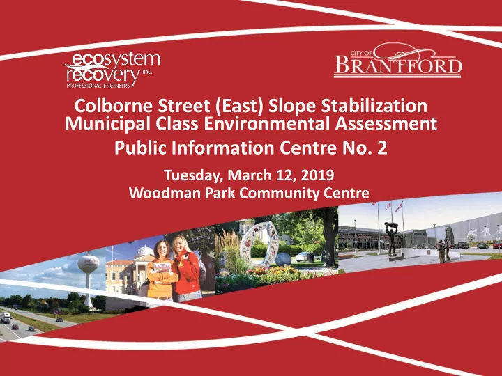
Colborne Street (East) Slope Stabilization Municipal Class Environmental Assessment Public Information Centre No. 2 Tuesday, March 12, 2019 Woodman Park Community Centre The Purpose of this Information Centre Provide information on the
The Purpose of this Information Centre
❑ Provide information on the Environmental Assessment (EA) study purpose and background ❑ Provide an update of the EA activities now in progress ❑ Provide summaries of the existing conditions assessments ▪ Historical Slope Movements and Geotechnical Condition ▪ Water Resources and Geomorphic Conditions ▪ Natural Heritage ▪ Archaeological and Cultural Heritage ❑ Present alternative solutions and proposed evaluation criteria ❑ Present the recommended alternative solution ❑ Provide an opportunity for your input on the alternative solutions
Study Purpose
The EA study follows the Municipal Class Environmental Assessment under Schedule ‘C’ for the slope area situated between Colborne Street (East) and the north bank of the Grand River at a road section between Calvin Street to the west, and Johnson Road to the east in the City of Brantford. Problem Statement: Since the landslide event that occurred in 1986, several studies have been completed to determine cause and effects. Monitoring shows that slope movement continues to occur. Slope stability concerns revolve around soil type and moisture issues as well as toe erosion. The EA is being completed to develop feasible alternatives to address stability concerns and to create a management strategy for the area.
Background Information and Timeline
1986 Major slope failure on South side of Colborne Street. 1987 First Environmental Study Report (ESR) completed for the GRCA. 1988 Canadian Pacific Railway removed. 1995 First Environmental Assessment completed to evaluate slope stability alternatives. 1996 Former railbed converted to Hamilton-Brantford Rail Trail. 1999 Grand River bank failure along toe of slope.
929 Colborne Street (East) after 1986 landslide Beach Road after 1986 landslide 951 Colborne Street (East) after 1986 landslide Railway along Beach Road after 1986 landslide
Background Information and Timeline
Sept 2018 First PIC for Colborne Street (East) EA. Summer/Fall 2019 Third PIC (Summer) and final draft of Environmental Study Report (Fall). 2012 Update made to the 1995 Environmental Assessment. 2015/2016 Additional studies to review slope monitoring data and collect additional field observations.
Slope monitoring in 2016, unstable slope evidence (left) and slumping near property line (right) Hamilton-Brantford Rail Trail within Study Area, April 2016 Slumping of the slope adjacent to the Rail Trail, October 2018
March 2019 (today) Second PIC for Colborne Street (East) EA.
Evidence of toe erosion, including bare banks and fallen trees, April 2016
Municipal Class EA Process Overview
STUDY DURATION (12-14 Month Process)
PIC #1 September 13, 2018 PIC #2 March 12, 2019 PIC #3 Summer 2019
Drone Survey
❑ Light Detection and Ranging (LiDAR) survey completed using a drone in November 2018 ❑ Drone collected 40-80 elevation points per square metre, which was used to build a bare earth digital terrain model (DTM) and elevation contours of the site
Characterization of Existing Conditions
Site Geometry Description: General description of the slope area Quick Facts:
- Study area spans approximately 1.1km along the Grand River.
- Slope height is an average of 31m.
Geotechnical
Description: Slope condition and hydrogeologic factors Quick Facts:
- Slope is defined with a table land, upper slope and lower
slope.
- Overburden is approximately 40m thick with two silty clay
layers intersected by a sand layer.
- Groundwater measured within 1m of lower slope and rises
to 3m below table land surface.
- Main influencing factors affecting slope stability are high
groundwater levels, weak native soils and toe erosion.
Geomorphological
Description: Grand River impacts on slope Quick Facts:
- Toe erosion from Grand River is a factor in slope instability.
- Slope toe movement tends to be greater in lower zones.
- Grand River width was reduced to half as a result of the 1986
slope failure. Since 2012 it has returned to its pre-failure width. Surface Runoff Description: Impact of overland flow on slope Quick Facts:
- Surface runoff from Colborne Street increases soil moisture
at top of slope.
- Outfalls and seepage pathways identified in slope area from
field investigations and LiDAR survey.
- Local drainage issues increase risk of slope failure, and
should be a consideration in the alternative solution.
Natural Heritage
Description: Potential impacts on natural environment Quick Facts:
- No species at risk have been identified; however significant
plant, fish and mussel species are known to be in the area.
- Potentially suitable bat habitat exists.
Characterization of Existing Conditions
Social
Description: Impacts on communities Quick Facts:
- Relocation of eight (8) properties within the study area
- ccurred between 1995 and 2012, currently six (6) private
properties are located adjacent to the slope.
- Hamilton-Brantford Rail Trail, which begins along Beach
Road within the study area, is a well-used recreational asset.
Economic
Description: Costs and life cycle impacts Quick Facts:
- Colborne Street (East) is a major arterial road.
- The study area contains a mix of land uses, including eight (8)
commercial properties.
Archaeological
Description: Archaeological significance of Study Area Quick Facts:
- The study area is within 1 km of 43 registered
archaeological sites, including an ossuary.
- Area is within the historic community of Cainsville.
- A Stage 1 Archaeological Assessment has been completed,
and recommends further Stage 2 assessment for the slope area. Built and Cultural Heritage Description: Built heritage and cultural heritage landscapes Quick Facts:
- The study area is within a Canadian Heritage River watershed,
and is adjacent to the Grand River.
- The study area contains structures over 40 years old.
- Built and Cultural Heritage Assessment identified several
important assets in the study area, including the rail trail, and several properties along Colborne Street (East), Clara Crescent and near Johnson Road.
- A Heritage Impact Assessment report is recommended to be
undertaken once a preferred alternative is selected.
Existing Conditions – Slope Movement Rates
Alternative Solutions
Alternative No. Alternatives Details 1 Do Nothing
- Continue physical topographic survey and monitoring
2 Monitoring, Assessment and Phased Stabilization
- Bi-annual LiDAR survey and monitoring
- Acquire private properties if required or if available to reduce risk to public
- Implement real-time monitoring and mitigation plan
- Implement phased slope stabilization and toe protection, based on
monitoring and assessment 3 Alter the top of slope constraint (change the level of service of Colborne Street East)
- Alter level of service of Colborne Street (East)
- Reduce the slope through a cut at the top of the slope that would extend into
Colborne Street (East)
- Acquire private properties or provide mechanical stabilization where required
- Continue slope monitoring to ensure success
4 Mechanical Slope Stabilization (maintain both the top and toe
- f slope)
- Stabilize slope using mechanical/structural approach
- Stabilize toe of slope at the bank of the Grand River
- Could be implemented in stages, or phased
- Continue slope monitoring to ensure success
5 Alter the toe of slope constraint (realign the Grand River)
- Realign the Grand River away from the slope (70m minimum)
- Reduce the slope through filling from the toe
- Acquire private properties or provide mechanical stabilization where required
- Continue slope monitoring to ensure success
Alternative Solutions
Evaluation of Alternative Solutions
Category Criteria Public Health and Safety
- Protection of residents and property/ buildings from eventual slope failure
- Protection of travelling public along Colborne Street from eventual slope failure
- Protection of residents from potential flood impacts
- Reduction of risk impact to major future slope failures
Technical
- Protection from erosion
- Impacts to river stability and flood risk
- Protection of traffic use along Colborne Street (East)
- Impacts on water quality in the Grand River
Environmental
- Impact on fish habitat and vegetation
- Impact on terrestrial habitat
Archaeological and Heritage Resources
- Disturbance of potential archaeological resources
- Disturbance of heritage resources
Socio-economic
- Impact on existing usage of the Hamilton-Brantford rail trail
- Disruption of businesses
- Impacts to private property
Construction Cost
- Property acquisition costs
- Construction costs
- Operation and Maintenance costs
Constructability
- Design implementation and access
- Project constructability
- Maintenance requirements
- Impact to existing utilities
Evaluation of Alternative Solutions
Recommended alternative solution at this stage
Next Steps Before PIC #3
❑ Selection of the alternative solution ❑ Develop alternative designs to the selected alternative solution ❑ Develop evaluation criteria ❑ Conduct evaluation of alternative designs ❑ Public Information Centre #3 (Summer 2019) ▪ Present the selected alternative solution ▪ Present alternative design concepts to the alternative solution ▪ Present evaluation criteria for the alternative design ▪ Announce 30-day period following notice of completion for study ❑ Final report and City Council presentation (Fall 2019)
Project Contacts
Please complete a Comment Sheet and leave it here today, or return it to Jeff Prince by March 26, 2019. Should you have any questions or concerns at any time during the project, please contact either of the following people: Jeff Prince, P. Eng Senior Project Manager Ecosystem Recovery Inc. 80 Courtland Ave East, Unit 2 Kitchener, Ontario N2G 2T8 Phone: 519-621-1500 Email: jeff.prince@ecosystemrecovery.ca Matt Welsh C. Tech., PMP Project Coordinator Design and Construction Public Works Commission City of Brantford 100 Wellington Square, P.O. Box 818 Phone: 519-759-4150 ext 5446 Email: mwelsh@brantford.ca