
SLIDE 1
Public Information Centre INCH FARM ARTERIAL ROAD AND INDUSTRIAL - - PowerPoint PPT Presentation
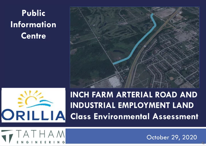
Public Information Centre INCH FARM ARTERIAL ROAD AND INDUSTRIAL EMPLOYMENT LAND Class Environmental Assessment October 29, 2020 Welcome 2 Public & Stakeholders should: This Public Information Centre will: review the
◼
◼
review the presentation material and background information
◼
ask questions of the City and/or Consultant through submission of a comment sheet
◼
confirm whether or not you want to be kept informed of the study process
◼
City of Orillia Project Website
(https://www.orillia.ca/en/city-hall/inchfarm-arterial-road.aspx)
2
◼
◼
establish channels of communication with public & stakeholders
◼
detail the study area, study objectives & purpose
◼
present the need & justification for the study and issues to be resolved
◼
identify potential environmental impacts & mitigation techniques
◼
Identify alternative solutions
◼
identify a recommended solution for public review
◼
seek input & comments for consideration in the selection of the final preferred solution
3
◼
◼
Project 19: Extension of Murphy Road parallel to Highway 11 to connect with existing Brodie Drive, providing a connection between Highway 12 and Burnside Line/West Street.
◼
Note this study only includes the section of the road extension within the City limits;
4
◼
5
◼
◼
Phases 1 and 2 completed. Completion of the MMTMP EA identified the need for this project.
◼
◼
Phases 3 to 5 will be completed by April 2021.
6 ◼
The OBJECTIVE of the study is to facilitate the implementation of the project considering:
1.
The goals identified in the Multi-modal Transportation Master Plan Update, 2019 and supporting studies;
2.
The impacts to adjacent property owners through evaluation of physical, natural, social, cultural & heritage, and economic environments;
3.
The needs of motorists, pedestrians, and cyclists;
4.
The needs of transit operations;
5.
The impacts to climate change;
◼
The PURPOSE of the study is to:
1.
identify the location, extent and sensitivity of affected environments;
2.
develop cost effective alternative solutions to transportation operations, servicing, and infrastructure implementation;
3.
assess the alternatives given potential environmental impacts;
4.
identify the preferred solution;
5.
establish measures to mitigate impacts;
6.
satisfy the Class EA requirements;
7
◼
◼
Includes provision for water and sanitary sewer servicing from Murphy Road, northerly along Uhthoff Line to the intersection with the proposed Arterial Road
8
◼
1.
TRANSPORTATION
2.
DRAINAGE
3.
SERVICING
9
◼
1.
PHYSICAL ENVIRONMENT
1.
Traffic operations;
2.
Cycling operations;
3.
Pedestrian operations;
4.
Transit operations;
5.
Driveway operations;
6.
Stormwater management;
7.
Utilities;
2.
NATURAL ENVIRONMENT
1.
Fisheries & Aquatic Impacts;
2.
Wildlife & Terrestrial Impacts;
3.
Vegetation Impacts;
3.
SOCIAL ENVIRONMENT
1.
Land Use;
2.
Property/Development Impacts;
3.
Aesthetics;
4.
Noise Impacts;
5.
Construction Impacts;
4.
CULTURAL/HERITAGE ENVIRONMENT
1.
Archaeological & Heritage Impacts;
5.
ECONOMIC ENVIRONMENT
1.
Construction Costs;
2.
Maintenance Costs;
3.
Land Acquisition Costs;
6.
CLIMATE CHANGE
10
◼
◼
Adhere to timing window for cutting and removing trees (October 15 – April 15);
◼
Implement Environmentally Protected (EP) area along limits
◼
Span entirety of north tributary valley area with an open bottom structure;
◼
Field investigation completed by Michalski Nielsen Associates in summer/fall 2020
◼
Existing conditions
◼
study area is vegetated with a mix of common plant species, widespread and secure in Ontario;
◼
Potential presence of bat habitat;
◼
No endangered or threatened species were
◼
Tributary creeks are both intermittent and non-fish bearing;
◼
North tributary creek has valley, open-space feature bearing some wildlife habitat;
11
◼
◼
assessment based on Stage 1 Archaeological/Heritage assessment
1.
Desktop exercise by Archaeologist to determine if there is potential for archaeological sites on the property;
2.
Site visits to inspect the current condition
3.
Contact the Ministry of Heritage, Sport, Tourism, and Culture Industries to confirm if there are any known archaeological sites near the property;
4.
Determine if a Stage 2 assessment is required;
◼
no archaeological potential found
◼ No further assessment required
◼
◼
no known impacts
12
◼
◼
Vacant, zoned M3 Business Park Industrial
◼
Adjacent land uses include:
◼ R2, Residential; ◼ Highway 11; ◼ OS-1, Open Space; ◼
all residences front adjacent streets (Murphy Road and Uhthoff Line)
◼
Highway 11 is primary noise source
◼
◼
Arterial Road;
◼
M3, Business Park Industrial; Note: Noise impact studies will be completed on a site specific basis as the business park lots are developed
◼
◼
potential property impacts
◼
potential noise impacts
13
◼
1.
Road alignment;
1.
East alignment along Highway 11;
2.
West alignment along west property limit;
3.
Middle alignment;
2.
Road cross-section;
1.
3-Lane;
2.
4-Lane;
3.
5-Lane;
3.
Pedestrian/Cycling
1.
Sidewalk(s);
2.
Bicycle Lane(s);
3.
Multi-Use Trail(s);
◼
2020 Forecast Traffic Volumes: 400 vehicles per hour (AM Peak Hour) 625 vehicles per hour (PM Peak Hour)
◼
2040 Forecast Traffic Volumes: 550 vehicles per hour (AM Peak Hour) 775 vehicles per hour (PM Peak Hour)
14
3991 3886 3981 4064 3991 3981 4064 3991 3886 3981 4064 3991 3886 3981 4064 4116 3886
15
3991 3886 3981 4064 3991 3981 4064 3991 3886 3981 4064 3991 3886 3981 4064 4116 3886
16
3991 3886 3981 4064 3991 3981 4064 3991 3886 3981 4064 3991 3886 3981 4064 4116 3886
17
Evaluation Criteria Option 1 - West Option 2 - Middle Option 3 - East
Physical Environment
✓Driveways will all be on one side of the corridor; ✓Provides most direct alignment for utilities (overhead and
underground)
× Requires S-bend; × Driveways will all be on both sides of the corridor; × Provides less direct alignment for utilities (overhead and
underground)
× Requires S-bend; ✓Driveways will all be on one side of the corridor; × Provides less direct alignment for utilities (overhead and
underground) Natural Environment ✓Impacts will generally be the same for each alternative; ✓Impacts will generally be the same for each alternative; ✓Impacts will generally be the same for each alternative ✓Existing crossing of south tributary may be salvaged; Social Environment ✓This option will result in an arterial road abutting future residential property along the west boundary rather than industrial use abutting future residential property; ✓Alignment provides maximum lot depth for future industrial development; ✓This alignment provides the shortest length of road, least construction impact; ✓This option will result in industrial use abutting future residential property along the west boundary; × This alternative leaves insufficiently sized lots for industrial development This alignment requires the longest length of road, most construction impact; Alignment provides slightly less lot depth for future industrial development due to the setback from Highway 11 (in alternative 1 the Highway 11 setback would overlap with the rear yard setback of the development lots) Cultural/Heritage Environment ✓No archaeological potential identified; ✓No archaeological potential identified; ✓No archaeological potential identified; Economic Environment ✓least construction and maintenance costs compared with
✓moderate construction and maintenance costs compared with
× the greatest construction and maintenance costs compared with other alternatives. ✓ Note this alternative does not require relocation of the south tributary water crossing; Climate Change ✓least construction impact, least construction materials, least runoff, least maintenance compared with other alternatives; ✓moderate construction impact, moderate construction materials, moderate runoff, moderate maintenance compared with other alternatives; longest length of road, most construction impact, most construction materials, most runoff, most maintenance;
NOTE: A copy of the comprehensive evaluation matrix is available for review on the project website.
18
3991 3886 3981 4064 3991 3981 4064 3991 3886 3981 4064 3991 3886 3981 4064 4116 3886
◼
left turns from queueing the traffic flow;
NOTE: There is adequate space to widen the R-O-W to 30m, providing additional width for utilities and SWM features;
19
3991 3886 3981 4064 3991 3981 4064 3991 3886 3981 4064 3991 3886 3981 4064 4116 3886
◼
directional;
NOTE: Lack of left turn lane results in queueing of traffic flow.
20
3991 3886 3981 4064 3991 3981 4064 3991 3886 3981 4064 3991 3886 3981 4064 4116 3886
◼
left turns from queueing the traffic flow;
directional
21
Evaluation Criteria Option 1 – 3-Lane (26m ROW) Option 2 - 4-Lane (30m ROW) Option 3 - 5-Lane (30m ROW)
Physical Environment
✓Cross section capacity meets the forecasted traffic volumes
to 2040;
✓Centre turn lane improves left turn operations; ✓Two-way left turn lane will assist with access to/from
driveways;
✓Least SWM requirements; ✓Provides 7.75m wide boulevard for utilities; ✓Cross section exceeds the forecasted traffic volumes to 2040; × lack of two-way left turn lane is inefficient and could result
in turn movements interfering with traffic and transit
× Left turns to/from driveways across two lanes of traffic; × Moderate SWM requirements; ✓ Provides 8.0m wide boulevard for utilities; ✓Cross section exceeds the forecasted traffic volumes to 2040 ✓Centre turn lane improves left turn operations; ✓Two-way left turn lane will assist with access to/from
driveways
× Greatest SWM requirements × Provides 5.7m wide boulevard for utilities
Natural Environment ✓Least impact due to narrowest road platform; ✓Moderate impact due to road platform; Greatest impact, widest cross section Social Environment ✓Less construction impact, shorter construction period ✓Moderate construction impact, slightly longer construction period Greatest construction impact, slightly longer construction period Cultural/Heritage Environment ✓No archaeological potential identified; ✓No archaeological potential identified; ✓No archaeological potential identified; Economic Environment ✓Lowest construction and maintenance cost, narrowest cross section ✓May require some land acquisition requirements, adjacent land is owned by City so no net cost impact ✓Moderate construction and maintenance cost, wider cross section × Requires some land acquisition requirements, adjacent land is owned by City so no net cost impact × Greatest construction and maintenance cost, widest cross section × Requires some land acquisition requirements, adjacent land is owned by City so no net cost impact Climate Change ✓least construction impact, least construction materials, least runoff, least maintenance compared with other alternatives; ✓moderate construction impact, moderate construction materials, moderate runoff, moderate maintenance compared with other alternatives; longest length of road, most construction impact, most construction materials, most runoff, most maintenance;
NOTE: A copy of the comprehensive evaluation matrix is available for review on the project website.
22
3991 3886 3981 4064 3991 3981 4064 3991 3886 3981 4064 3991 3886 3981 4064 4116 3886
For the purpose of this study, pedestrian and cycling infrastructure is being considered in context of the City’s standard arterial road corridor which includes 1.5m sidewalks on both sides of the road.
◼
more space);
multi-use trail option;
23
3991 3886 3981 4064 3991 3981 4064 3991 3886 3981 4064 3991 3886 3981 4064 4116 3886
For the purpose of this study, pedestrian and cycling infrastructure is being considered in context of the City’s standard arterial road corridor which includes 1.5m sidewalks on both sides of the road.
◼
lieu of sidewalk;
to bicycle lanes option;
24
Evaluation Criteria Option 1 – 1.8m Wide Bicycle Lane(s) Option 2 – 3.0m Wide Multi-Use Trail(s)
Physical Environment
× Provides shared vehicular / cycling facility, may increase interference with traffic
× Provides dedicated cycling route, not recommended on arterial roadway per MMTP × Creates conflict with transit operations ✓Provides separate vehicular / cycling/pedestrian facility, limited interference with traffic
✓Consistent with recommendations of 2012 ATP and 2019 MMTMP ✓Consistent with other City of Orillia Arterial road corridors (University Avenue, West Ridge
Boulevard, Memorial Drive); Natural Environment ✓Impacts are the same for each alternative ✓Impacts are the same for each alternative Social Environment ✓Impacts are the same for each alternative × Increased risks during winter use ✓Impacts are the same for each alternative ✓Less risks during winter use; Cultural/Heritage Environment ✓No archaeological potential identified; ✓No archaeological potential identified; Economic Environment ✓Less construction cost ✓Least on-going maintenance cost as feature is part of roadway ✓Winter maintenance costs are dependent on whether the feature is maintained for cycling in the winter (ie. May result in more frequent snowbank removal) × Greater construction cost ✓ Moderate on-going maintenance costs (asphalt patching, crack repair, etc..) ✓ Winter maintenance costs are dependent on whether the feature is maintained for cycling in the winter (ie. Does the full trail width get maintained) Climate Change ✓No net impact on climate change compared to other options, all options promote active transportation ✓No net impact on climate change compared to other options, all options promote active transportation
NOTE: The location and alignment of the multi-use trail will be determined through the detail design process. NOTE: A copy of the comprehensive evaluation matrix is available for review on the project website.
25
◼
1.
Creek Crossings;
1.
North Silver Creek Tributary;
2.
South Silver Creek Tributary;
2.
Stormwater Management;
26
3991 3886 3981 4064 3991 3981 4064 3991 3886 3981 4064 3991 3886 3981 4064 4116 3886
◼
acceptable;
access road;
be extended or relocated depending
◼
wildlife habitat;
is required to span the channel;
27
3991 3886 3981 4064 3991 3981 4064 3991 3886 3981 4064 3991 3886 3981 4064 4116 3886
◼
conveyance ;
passage;
culverts;
◼
passage;
culverts;
28
3991 3886 3981 4064 3991 3981 4064 3991 3886 3981 4064 3991 3886 3981 4064 4116 3886
◼
conveyance;
passage;
29
Evaluation Criteria Option 1 – Open Bottom Structure Option 2 – Conventional Culvert Option 3 - Bridge
Physical Environment
✓Driveway setbacks from crossing locations will be the same
for open bottom and culvert;
✓Crossing design can accommodate utilities; ✓Driveway setbacks from crossing locations will be the same for
✓Crossing design can accommodate utilities; × Bridge approaches may restrict driveway locations (due to
guiderail);
× Utilities would need to be attached to bridge superstructure,
span the crossing, or directional drill under crossing resulting in increased costs; Natural Environment ✓South Crossing (Intermittent flow, non fish bearing): conveyance only, higher costs, no other net benefit compared to other alternatives; ✓North Crossing (Intermittent flow, non fish bearing, EP): Provides opportunity to accommodate valley/tributary open space feature with footings outside the sensitive area; × Provides minor barrier for some wildlife movement; ✓South Crossing (Intermittent flow, non fish bearing): conveyance only, meets requirements; × North Crossing (Intermittent flow, non fish bearing, EP): Provides opportunity to accommodate valley/tributary open space feature with footings outside the sensitive area, does not meet requirements; × Provides minor barrier for some wildlife movement; ✓ South Crossing (Intermittent flow, non fish bearing): conveyance only, higher costs, no other net benefit compared to other alternatives; ✓ North Crossing (Intermittent flow, non fish bearing, EP): Provides opportunity to accommodate valley/tributary open space feature with footings outside the sensitive area; ✓ Provides connection for wildlife under roadway; Social Environment ✓Impacts are generally the same for each alternative ✓Discrete appearance ✓Moderate construction impacts; ✓Impacts are generally the same for each alternative ✓Discrete appearance ✓Moderate construction impacts; ✓Impacts are generally the same for each alternative × Noticeable appearance × Significant construction impacts; Cultural/Heritage Environment ✓No archaeological potential identified; ✓No archaeological potential identified; ✓No archaeological potential identified; Economic Environment × Moderate construction and maintenance costs; × Possible on-going inspection costs (OSIM); ✓ Lowest construction and maintenance costs; × Significant construction costs × Highest maintenance and on-going inspection costs (OSIM); Climate Change ✓Less impact ✓Least impact Greatest impact
NOTE: A copy of the comprehensive evaluation matrix is available for review on the project website. NOTE: Option 2 – Closed Bottom Culvert ranked highest but is not suitable for the North crossing;
30
3991 3886 3981 4064 3991 3981 4064 3991 3886 3981 4064 3991 3886 3981 4064 4116 3886
◼
storm runoff;
removal rate;
rate;
downstream receivers;
the right-of-way;
service this area due to topographic constraints;
NOTE: Use of existing regional SWM facility is not feasible due to topographic constraints.
31
3991 3886 3981 4064 3991 3981 4064 3991 3886 3981 4064 3991 3886 3981 4064 4116 3886
◼
runoff;
constraints;
32
3991 3886 3981 4064 3991 3981 4064 3991 3886 3981 4064 3991 3886 3981 4064 4116 3886
◼
receivers;
management in accordance with latest best practice design;
targets;
way;
33
Evaluation Criteria Option 1 – End of Pipe Facility Option 2 – Oversized Pipe & Oil-Grit Separator Option 3 – Bioswale & Storm Sewer
Physical Environment
× End-of-pipe SWMFs have potential to increase
discharging temperatures. Roadway must be graded such that overland flow is directed to the SWM Facilities. Roadway to convey runoff during major storm events.
× No impact to utilities anticipated. ✓Underground pipe system provides no benefit to discharging
temperatures.
× Roadway must be graded such that runoff ponds at catch
basin locations to allow for 100-year capture by inlets. There will be ponding on roadway to max. 0.30 m
× Provides less space for utilities in the right-of-way. ✓Underground filtration system has potential to decrease
discharging temperatures.
✓Curb cuts required to convey runoff from roadway to
bioswales for all storm events, less ponding water on roadway, less flow over roadway. Wider right-of-way required, no impact to utilities anticipated. Natural Environment ✓80% TSS removal rate, 63% TP removal rate, erosion and sediment control provided by SWMF. Potential to increase discharge temperatures; × some impacts to aquatic species can be anticipated without further mitigation. The tributary is not fish-bearing, no impacts to fish species are anticipated; ✓Mitigate loss of habitat by strategic planting and landscaping plan for SWMF; × 70% TSS removal rate, 60% TP removal rate, erosion and sediment control provided by Oversized pipes & OGS. Underground pipe system has potential to decrease discharge temperatures ; × Some impacts to aquatic species can be anticipated without further mitigation. The tributary is not fish-bearing, no impacts to fish species are anticipated; × No opportunity to offset loss of habitat; ✓ 80% TSS removal rate, 63% TP removal rate, erosion and sediment control provided by bioswale. Underground filtration system has potential to decrease discharge temperatures; ✓ No impacts to aquatic species anticipated. The tributary is not fish-bearing, no impacts to fish species are anticipated; ✓ Mitigate loss of habitat by strategic planting and landscaping plan for SWMF; Social Environment ✓Requires larger parcel of land that could otherwise be used for development; ✓All infrastructure underground, no visual impact on future
✓ Bioswales located on both sides of roadway within right-of- way, minor local visual impact on future properties. Can mitigate negative visual impact with strategic plantings and landscaping bioswale blocks; Cultural/Heritage Environment ✓No archaeological potential identified; ✓No archaeological potential identified; ✓No archaeological potential identified; Economic Environment ✓Lowest construction, maintenance and life cycle costs; × Highest construction, maintenance, and life cycle costs; × Moderate construction, maintenance, and life cycle costs; Climate Change ✓Provides improved treatment levels for downstream receiver; × Provides limited treatment levels for downstream receiver; ✓Provides improved treatment levels for downstream receiver;
NOTE: A copy of the comprehensive evaluation matrix is available for review on the project website.
34
SERVICING
1.
Gravity sanitary sewer;
2.
Sewage pump station;
3.
Sanitary force main;
4.
Water distribution (see note); For the purposes of the EA, alternatives for the water system layout were not considered as the water system layout will be in accordance with City of Orillia standards. Accordingly different layouts and alignments have no bearing on the outcome of the
35 ◼
SERVICING aspects of the study consider:
1.
Interim servicing conditions;
1.
Provide water, sanitary, and storm servicing to City of Orillia industrial lands;
flows up to the existing infrastructure on east side of Highway 11; (SEE NOTE 1);
2.
Accommodate contributing upstream sanitary sewage flows from Smart Centres;
3.
Accommodate contributing upstream sanitary sewage flows from existing residential development on Murphy Road and Uhthoff Line;
4.
Consider impacts to future development (SEE NOTE 2);
Note 1: the driving factor of the servicing layout is the location of the interim sanitary sewage pump station. Accordingly, the servicing aspects of the study focus on the location
Note 2: A permanent sewage pump station will ultimately be constructed within the Inch Farm Residential Subdivision (as determined by the Schedule B Municipal Class EA Sewage Pumping Station, completed September 2012).
36 ◼
SERVICING aspects of the study consider:
1.
Ultimate servicing conditions;
1.
Provide water, sanitary, and storm servicing to City of Orillia industrial lands;
2.
Accommodate contributing upstream sanitary sewage flows from Smart Centres;
3.
Accommodate future servicing and development of adjacent Inch Farm Residential Subdivision, to the west;
4.
Accommodate future servicing and development of adjacent Area 3 development in Severn Township, to the north;
5.
Accommodate future servicing and development of Mark Rich Homes development in Severn Township, to the south;
6.
Abandon/relocate interim sewage pump station to previously determined permanent location within Inch Farm Residential Subdivision.
37
3991 3886 3981 4064 3991 3981 4064 3991 3886 3981 4064 3991 3886 3981 4064 4116 3886
◼
Location 1
1.
Located in the triangular parcel of land west of the road alignment;
2.
Requires 6m deep wet-well;
3.
Requires no redundant or ‘throw-away’ infrastructure for the ultimate condition;
◼
Location 2
1.
Located within the arterial road right-of- way;
2.
Requires 5.2m deep wet-well;
3.
Requires some redundant, ‘throw-away’ infrastructure for the ultimate condition;
◼
Location 3
1.
Located within the arterial road right-of- way;
2.
Requires 4.5m deep wet-well;
3.
Requires greatest redundant, ‘throw-away’ infrastructure for the ultimate condition;
NOTE: The infrastructure shown within the future development area is outside the scope of this project and is
Future Easement
38
Evaluation Criteria Option 1 – SPS Location 1 Option 2 – SPS Location 2 Option 3 – SPS Location 3
Physical Environment ✓Provides the most space for utilities in the boulevard;
× Occupies space otherwise required for utilities; × Occupies space otherwise required for utilities;
Natural Environment ✓Require directional drilling construction methods to mitigate impacts to tributaries; ✓Require directional drilling construction methods to mitigate impacts to tributaries; ✓ Require directional drilling construction methods to mitigate impacts to tributaries; Social Environment ✓Makes use of triangular shaped lot which is otherwise unuseable space for industrial development. Easement required between future residential lots to provide connection to permanent pump station location; ✓Easement will be between two large lots and can be accommodated without restricting future lot development; × Adequate space required in the boulevard for the SPS wet well and control panel, and parking for wastewater
Easement required between future residential lots to provide connection to permanent pump station location; × Easement will be between two narrow lots and may restrict future lot development. × Adequate space required in the boulevard for the SPS wet well and control panel, and parking for wastewater
Easement required between future residential lots to provide connection to permanent pump station location; × Easement will be between two narrow lots and may restrict future lot development; Cultural/Heritage Environment ✓No archaeological potential identified; ✓No archaeological potential identified; ✓No archaeological potential identified; Economic Environment × Highest SPS construction costs; × Deepest wet well depth (6m below grade); ✓Shortest forcemain length to connect between the interim SPS and Highway 11; ✓No 'throw-away' costs: future forcemain from the permanent SPS will connect at this location so interim forcemain can be reused; × Slightly higher SPS construction costs than Location 3; × Deeper wet well depth (5.2m below grade); × Longer interim forcemain length required to connect between the interim SPS and Highway 11; × Some 'throw-away' costs: a portion of the forcemain from the interim SPS to the permanent SPS/forcemain configuration will be abandoned; ✓ Lowest SPS construction costs. ✓ Shallowest wet well depth (4.5m below grade); × Longest interim forcemain length to connect between the interim SPS and Highway 11; × Largest 'throw-away' costs: a significant portion of the forcemain from the interim SPS to the permanent pump station/forcemain configuration will be abandoned; Climate Change ✓Space available to accommodate future expansion if necessary to address climate change; × No space available for future expansion due to climate change; No space available for future expansion due to climate change;
NOTE: A copy of the comprehensive evaluation matrix is available for review on the project website.
39
Design Component Preferred Alternative Road Alignment Option 1 – West Alignment Road Cross Section 3-Lane Cross Section (30m R-O-W) Pedestrian / Cycling Features Sidewalk on one side, Multi-Use trail on one side Water Crossings Conventional Culvert for South Tributary, Open Bottom Structure for North Tributary Stormwater Management Roadside Bioswale & Storm Sewer Servicing Sewage Pump Station Location 1
40
3991 3886 3981 4064 3991 3981 4064 3991 3886 3981 4064 3991 3886 3981 4064 4116 3886
41 ◼
have your questions been addressed?
◼
have you completed a comment sheet?
◼
For additional information please visit the City of Orillia Project Website
(https://www.orillia.ca/en/city-hall/inchfarm-arterial-road.aspx)
◼
review/address stakeholder comments
◼
further develop the preferred solution with details for implementation & mitigation
◼
prepare final report for public review
◼
prepare Notice of Study Completion
◼
design & implementation
◼
Brad Laking, P.Eng Senior Engineer, Project Manager 10 Diana Drive, Building 8, Unit 7 Orillia, ON L3V 8K8 705-325-1753, ext 2046 blaking@tathameng.com
42