
SLIDE 1
Community Meeting #1 | May 15 2014
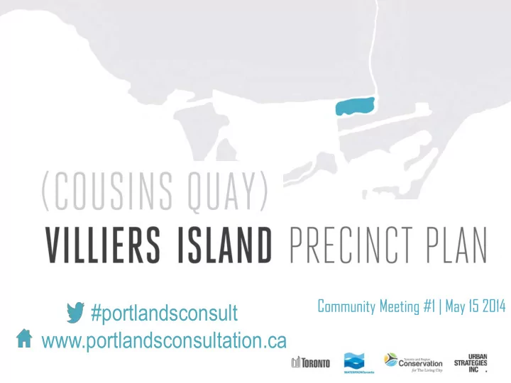
#portlandsconsult www.portlandsconsultation.ca Tonights agenda 6:30 - - PowerPoint PPT Presentation
Community Meeting #1 | May 15 2014 #portlandsconsult www.portlandsconsultation.ca Tonights agenda 6:30 pm Welcome and Introductory Remarks 6:40 pm Presentation Overview of Port Lands Initiatives and Planning Context Villiers
Community Meeting #1 | May 15 2014
2
3
Q4 2013
Framework Plan/TSMP EA CCM1 Introductory CCM on all Port Lands Initiatives
Q4 2014 Q3 2014 Q2 2014 Q1 2014 Q1 2015
Framework Plan/TSMP EA Workshop
Villiers Island Precinct Plan Options CCM/ Workshop
Framework Plan SAC DMNP EA/LDL EA Approval Villiers Island CCM2 (Precinct Plan) Framework Plan/TSMP EA Final CCM Finalize all Portlands Initiatives
4
Villiers Island PP SAC/ LUAC Villiers Island PP SAC/ LUAC (Built Form)
5
Approved DMNP EA Terms of Reference, 2006 Lower Don Lands Design Competition, 2007 Central Waterfront Secondary Plan 2003 Unlocking the Port Lands 1999 Port Lands Acceleration Initiative (PLAI), 2012 DMNP EA, LDL EA, LDL Framework Plan 2010 DMNP and LDL EA Amendments, 2013 Port Lands Planning Framework Ongoing
6
7
8
Don Mouth EA & Lower Don Lands Class EA [2013/2014]
Cousins Quay/Villiers Island Precinct Plan [2014] Port Lands Planning Framework [2014] Film Studio Precinct Plan [2014] South of Eastern Strategic Direction [2014] Port Lands/ South of Eastern Transportation Servicing MP [2014]
9
Port lands planning framework land use options
10
11
Don Mouth EA & Lower Don Lands Class EA [2013/2014]
Cousins Quay/Villiers Island Precinct Plan [2014] Port Lands Planning Framework [2014] Film Studio Precinct Plan [2014] South of Eastern Strategic Direction [2014] Port Lands/ South of Eastern Transportation Servicing MP [2014]
12
13
Original Cousins Quay Precinct Boundary Extended Cousins Quay Precinct Boundary Current Cousins Quay/Villiers Island Precinct Boundary
14
EAST BAYFRONT WEST DON LANDS UNILEVER
15
INDUSTRIAL USES MARTIN GOODMAN TRAIL LIFT BRIDGE EMPLOYMENT USES
16
TORONTO HYDRO SUBSTATION ESSROC SILOS FORMER BANK OF MONTREAL FORMER DOMINION BANK
17
Raise and Fill the Quays, realign and reconstruct Cherry Street Construct Polson Slip bridge and construct river valley system
18
Construct Greenway, FPL north of Lakeshore, Raise Don Roadway/valley wall feature and Sediment mgmt area
Flood Protection Development Phase 1: Phase 2: Phase 3: ~30 Years
employment-based development
community facilities
19
20
Surrounded by the new Don River Mouth, this industrial quay will be transformed into a remarkable new Villiers Island community. With a pivotal location as the gateway to the Port Lands, the Precinct will become significant as a regional destination and distinct as a sustainable community, surrounded by four unique water side edges.
21
MONTREAL HAMMARBY SJOSTAD, SWEDEN EAST RIVER, NYC OLYMPIC VILLAGE, VANCOUVER HAFENCITY, HAMBURG
destination
Lands
distinct skyline
excellence in community design
wide perspective
22
DOWNTOWN SEATTLE CHILDREN’S MUSEUM, BOSTON GRANT PARK, LONG ISLAND
23
24
and Munition Street (dimension/configuration)
25
Historic Cultural Corridor
water’s edge Option constants
constant)
including Villiers Street
Channel
parks, including Villiers Park
Option 1 Keating Gateway Option 2 Cultural Core Option 3 Central Spine
26
The long term plan
HAFENCITY, HAMBURG MADISON PARK, SEATTLE BROOKLYN BRIDGE PARK HAFENCITY, HAMBURG
HAFENCITY, HAMBURG MADISON PARK, SEATTLE BROOKLYN BRIDGE PARK HAFENCITY, HAMBURG
HAFENCITY, HAMBURG MADISON PARK, SEATTLE BROOKLYN BRIDGE PARK HAFENCITY, HAMBURG
HAFENCITY, HAMBURG MADISON PARK, SEATTLE BROOKLYN BRIDGE PARK HAFENCITY, HAMBURG
The interim plan
The long term plan
SILO PARK, NEW ZEALAND PORTLAND, OREGON BARRIE, ONTARIO DISTILLERY DISTRICT
SILO PARK, NEW ZEALAND PORTLAND, OREGON BARRIE, ONTARIO DISTILLERY DISTRICT
SILO PARK, NEW ZEALAND PORTLAND, OREGON BARRIE, ONTARIO DISTILLERY DISTRICT
SILO PARK, NEW ZEALAND PORTLAND, OREGON BARRIE, ONTARIO DISTILLERY DISTRICT
The interim plan
The long term plan
KING STREET, KITCHENER PIER 15, NYC HAFENCITY, HAMBURG BALTIMORE
KING STREET, KITCHENER PIER 15, NYC HAFENCITY, HAMBURG BALTIMORE
KING STREET, KITCHENER PIER 15, NYC HAFENCITY, HAMBURG BALTIMORE
KING STREET, KITCHENER PIER 15, NYC HAFENCITY, HAMBURG BALTIMORE
The interim plan
45
Precinct design maximizes potential for vital, animated place-making and distinct experiences within the Island and along the water’s edge Streets and blocks pattern is based on a fine-grained network to maximize pedestrian permeability Precinct design maximizes quantity and quality of view corridors and minimizes physical and visual barriers to the water’s edge Catalytic Use location showcases the Precinct’s key features & creates a cultural & tourist waterfront destination Location and design of primary retail creates an excellent walking and shopping experience Open space network includes a variety of scales and types of spaces at the local, city and regional scale Precinct design celebrates and responds to the Island’s heritage assets Framework is developable and will best leverage public and private investment Framework is implementable in terms of phasing and infrastructure
46
47