SLIDE 1
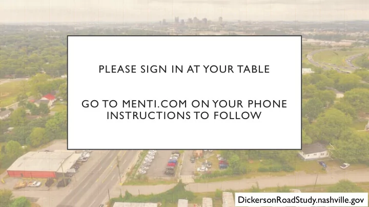
PLEASE SIGN IN AT YOUR TABLE GO TO MENTI.COM ON YOUR PHONE INSTRUCTIONS TO FOLLOW
DickersonRoadStudy.nashville.gov
SLIDE 2
DICKERSON CORRIDOR STUDY PHASE 1
Visioning Workshop
DickersonRoadStudy.nashville.gov
SLIDE 3 TONIGHT’S AGENDA
Introductions
- 2. The Project
- 3. Food for Thought
- 4. Visioning Exercises
SLIDE 4 STEERING COMMITTEE
(NEIGHBORHOOD REPRESENTATIVES, BUSINESSES, AND PROPERTY OWNERS)
T
Beau Daniel Ashonti Davis Myron Dowell Brent Elrod (Kelsey Oesmann) Ramona Gholston T erry Key Marty Lang Kathy Leslie Sam McCullough Scott Morton Taylor Perkins Jamie Pfeffer Matthew Strader Adam Vollrath (Nick Irwin or Chaz Flowers) Nathan Weinberg
SLIDE 5
PLANNING DEPARTMENT
Work with communities to create land use policies and transportation priorities in community plans Make recommendations to MPC on zoning and subdivision applications Provide design services and transportation planning to support sustainable development and complete streets
SLIDE 6
- 2. THE PROJECT
- Project Timeline
- Why are we here?
- Outcomes
SLIDE 7 CHARRETTE SCHEDULE JAN 28TH – 31ST
Visioning Workshop
Identify big ideas and goals Sonny West Conference Center Monday 1/28 5:30 PM
Open Design Studio
Create an updated framework
Trinity United Methodist Church (Trinity Community Commons)
Tuesday 1/29 1:30 to 3:30 PM Wednesday 1/30 10:00 AM to 12:00 PM
Work-In-Progress
Report back to the community
Trinity United Methodist Church (Trinity Community Commons)
Thursday 1/31 5:30 PM
SLIDE 8
*SNOW BACKUP DATES* FEB 19TH – 21ST DICKERSONROADSTUDY.NASHVILLE.GOV
Visioning Workshop
Identify big ideas and goals Sonny West Conference Center Monday 1/28 5:30 PM
Open Design Studio
Create an updated framework Location to be determined Tuesday 2/19 1:30 to 3:30 PM Wednesday 2/20 10:00 AM to 12:00 PM
Work-In-Progress
Report back to the community Location to be determined Thursday 2/21 5:30 PM
SLIDE 9 PHASE 1 PROJECT TIMELINE
Define study area Analyze study area Build public process Form Steering Committee Charrette Week Identify needs and vision Evaluate solutions Develop plan Consult Steering Committee Public Comment Period Vision Adoption Any Needed Council Action
Nov - Jan Jan - Feb Feb - Mar Mar - May
*
we are here
June
BUILD Grant
July
start Phase 2
*
SLIDE 10 WHY ARE WE HERE?
expectations
- 2. Build upon past plans
- 3. Articulate an updated
vision
- 4. Guide change and growth
Talk about the future of Dickerson Road
SLIDE 11 PHASE 1 STUDY AREA BOUNDARY
TRINITY LN. SPRING ST. JEFFERSON ST. CLEVELAND ST. DOUGLAS AVE.
SLIDE 12 POLICY VS ZONING
Policy change with a plan amendment does not change current zoning Guidance Vision for an area
Land Use Policy
Zoning is influenced by the policies in the Community Plans. It’s the Law Controls physical development of land e.g. use, density, height, setbacks, parking, access, landscaping, & signage
Zoning
SLIDE 13
COMPLETE STREETS EXECUTIVE ORDER
SLIDE 14 OUTCOMES OF THE CHARRETTE
- Vision statement
- Guiding principles
- Framework plan
- Implementation tools
SLIDE 15
THOUGHT How are land use and transportation tied together along Dickerson Road?
SLIDE 16
DICKERSON CORRIDOR EXISTING CONDITIONS
SLIDE 17 EXISTING LAND USE
- Commercial and Office
- Industrial
- Vacant
SLIDE 18 BUILDINGS
- Primarily 1 and 2 story
- Older building stock
- Surface parking
SLIDE 19 MOBILITY
- Access to goods, services, and jobs
- Connectivity
- Complete the trip
- Street context
- Signalized intersections
- Transit routes and stops
- Sidewalks and crossings
- Bikeways
SLIDE 20 EXISTING STREET
- South of Douglas Avenue
- 4 lanes, no turn lane
- Narrow sidewalks with utility
poles
- Sharrow for bicyclists
- North of Douglas Avenue
- 5 lanes
- No sidewalks
- Sharrow for bicyclists
ROW: 76’
South of Douglas Avenue North of Douglas Avenue
SLIDE 21
DICKERSON CORRIDOR CURRENT ENTITLEMENTS
SLIDE 22 PRIMARY ZONING DISTRICTS
- CS – Commercial Service
- Intended for a diverse range of commercial
uses.
- CL – Commercial Limited
- Intended for retail, consumer service, financial,
restaurant, and office uses.
- MUL – Mixed-Use Limited
- Intended for a moderate intensity mixture of
residential, retail, restaurant, and office uses
- RM20
- Intended for a moderately high intensity of
single-family, duplex, and multi-family dwellings.
SLIDE 23 REDEVELOPMENT DISTRICT
- Skyline Redevelopment District
- Identifies permitted and prohibit
uses within the mixed use districts
- Requires landscaping, buffering,
and sign compliance
- Requires projects to be reviewed
by a design committee
- Effective until 2037 (30 years)
SLIDE 24
DICKERSON CORRIDOR ADOPTED VISION
SLIDE 25 PAST LAND USE PLANS
- Concept 2010 (1992)
- Subarea 5 Plan (1994)
- Highland Heights Neighborhood Plan (1997)
- Dickerson Road Commercial Plan (2000)
- East Nashville Community Plan (2006 Update)
- Detailed Neighborhood Design Plans for
Cleveland Park, McFerrin Park, and Greenwood Neighborhoods (2006)
- Skyline Redevelopment Plan (2008)
- NashvilleNext (2015 & 2017 Update)
- Highland Heights Neighborhood Plan (2018)
SLIDE 26 PAST TRANSPORTATION PLANS
- Mobility 2010 (1992)
- Major & Collector Street Plan (1992)
- Strategic Plan for Sidewalks and Bikeways (2003 &
2008 Update)
- Mobility 2030 (2007)
- Strategic Transit Master Plan (2009)
- Northeast Corridor Mobility Study (2011)
- Major & Collector Street Plan (2011, 2015, &
2017 Updates)
- Access Nashville 2040 (2015)
- nMotion Transit Plan (2016)
- WalknBike Plan (2017)
SLIDE 27
GROWTH AND PRESERVATION CONCEPT MAP
SLIDE 28 NASHVILLENEXT
- Tier 2 Centers (update to Tier 1)
- I-65/I-24 Interchange at Trinity Lane
- Cowan Industrial or River North
- Neighborhood
Transitions around Centers and Corridor
- High Capacity Transit
- Dickerson Road – Immediate Need
- Trinity Lane – Long Term Need
SLIDE 29 COMMUNITY PLAN
- T4 Mixed Use
- Corridor
- Community Center
- Neighborhood
SLIDE 30 NMOTION MASS TRANSIT PLAN
- Short-term improvements:
- Improve stops
- Better information
- Simplify fare payment
- More frequent service
- Long term improvements:
- Full Bus Rapid Transit (BRT) along
Dickerson
- Transit Center near Skyline
SLIDE 31 WALKNBIKE NASHVILLE
COUNTY-WIDE BIKE/PEDESTRIAN PLAN
bike connectivity along most pikes
effective if you cannot walk or bike to a stop
Charlotte, Dickerson, Nolensville, Murfreesboro, and Gallatin
SLIDE 32 MAJOR AND COLLECTOR STREET PLAN
- Future street
- Countywide plan for streets
- Ties together nMotion and
WalknBike Plans
- Interim improvements with
private development
with major Metro capital projects
With Bus Rapid Transit
ROW: 86’
SLIDE 33 Increasing investments in transit service and infrastructure No service Local service Frequent local service High capacity transit High capacity transit in separate right of way
LAND USE & MOBILITY
SLIDE 34 DICKERSON ROAD FUTURE
- How will future redevelopment of
the street and buildings shape…
- Affordability?
- Essential goods and services?
- Housing types?
- Economic prosperity?
- Jobs?
- Mobility options?
- Parks and open space?
- Safety?
TRINITY LN. SPRING ST. JEFFERSON ST. CLEVELAND ST. DOUGLAS AVE.
SLIDE 35
VISIONING EXERCISES
DICKERSON CORRIDOR VISIONING WORKSHOP
SLIDE 36
WHAT IN THE WORLD IS A DESIGN CHARRETTE???
A hands on, intensive and collaborative public workshop. Bringing all stakeholders to the table to reach consensus over the future evolution of a place.
SLIDE 37
OVERVIEW OF EXERCISES
Wall exercises Online voting – 15 minutes Maintain/change – 15 minutes Future form & character – 20 minutes Design your corridor – 20 minutes Report back – 15 minutes
SLIDE 38
Engage with an open mind Everyone participates Listen, then respond Stay on topic/schedule All ideas have value Draw your ideas No speeches….have fun!
SLIDE 39
LIVE VOTING
SLIDE 40 BASE MAP
BEGIN PROJECT END PROJECT
SLIDE 41
EXERCISE 1 MAINTAIN/CHANGE Results tell us what YOU value along this stretch of Dickerson Pike and what YOU would like to see changed Group will identify: Areas that should be maintained and those that should change
SLIDE 42 EXAMPLE
Maintain Change
SLIDE 43 EXERCISE 2 FUTURE FORM & CHARACTER For each of the “change” areas outlined in Exercise 1, identify the land uses and building heights YOU want to see Results provide us with detail
- n the use and form of each
character area
SLIDE 44 BUILDING TYPES & HEIGHT
MIXED USE OFFICE RESIDENTIAL INDUSTRIAL COMMERCIAL
SLIDE 45
EXAMPLE
SLIDE 46
EXERCISE 3 DESIGN YOUR CORRIDOR Results tell us what factors are included in the ideal street section for Dickerson Pike For Dickerson Pike create a visual representation of your ideal street
SLIDE 47
EXAMPLE
SLIDE 48
MCSP CROSS SECTION
SLIDE 49
GROUP PRESENTATIONS
DickersonRoadStudy.nashville.gov
SLIDE 50 REPORT BACK
- 1. Highlights only
- 2. No more than 2 minutes per presentation
- 3. Avoid repeating factors presented by
previous groups
DickersonRoadStudy.nashville.gov
SLIDE 51 CHARRETTE SCHEDULE JAN 28TH – 31ST
Visioning Workshop
Identify big ideas and goals Sonny West Conference Center Monday 1/28 5:30 PM
Open Design Studio
Create an updated framework
Trinity United Methodist Church (Trinity Community Commons)
Tuesday 1/29 1:30 to 3:30 PM Wednesday 1/30 10:00 AM to 12:00 PM
Work-In-Progress
Report back to the community
Trinity United Methodist Church (Trinity Community Commons)
Thursday 1/31 5:30 PM
SLIDE 52
*SNOW BACKUP DATES* FEB 19TH – 21ST DICKERSONROADSTUDY.NASHVILLE.GOV
Visioning Workshop
Identify big ideas and goals Sonny West Conference Center Monday 1/28 5:30 PM
Open Design Studio
Create an updated framework Location to be determined Tuesday 2/19 1:30 to 3:30 PM Wednesday 2/20 10:00 AM to 12:00 PM
Work-In-Progress
Report back to the community Location to be determined Thursday 2/21 5:30 PM