paul stephens
play

Paul Stephens Director Sales & Marketing 3 rd February 2010 The - PowerPoint PPT Presentation

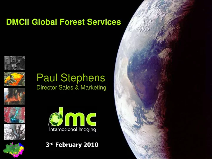
DMCii Global Forest Services Paul Stephens Director Sales & Marketing 3 rd February 2010 The DMC Concept A Unique International Partnership Combining National Objectives, Humanitarian Aid and Commerce The Coordinator The Constellation


  1. DMCii Global Forest Services Paul Stephens Director Sales & Marketing 3 rd February 2010

  2. The DMC Concept A Unique International Partnership Combining National Objectives, Humanitarian Aid and Commerce… The Coordinator The Constellation The Consortium Applications ; Commercial, Government and Humanitarian

  3. Full Spectrum Satellite Solutions Design Manufacture Assembly, Integration & Test Launch Services Ground Segment & Operations Processing & Supply

  4. Hands-on training & capacity building programmes 6 Space Agencies / Space programmes formed 6 Priming own space missions 2 Spin-out companies All but 1 remain active in space Nation Period Mission USA, NASA / MSU (2007-2008) Magnolia Nigeria, NASRDA (2007-2009) NigeriaSat-2 Nigeria, NASRDA (2001-2003) NigeriaSat-1 Turkey, Bilten (2001-2003) BILSAT-1 Algeria, CNTS (2000-2002) AlSAT-1 China, Tsinghua Uni. (1998-1999) Tsinghua-1 Malaysia, ATSB (1996-1998) TiungSat-1 Singapore, NTU (1995-1997) UoSAT-12 (payload) Thailand, MU (1995-1997) Thai-Phutt Chile, FACH (1994-1998) FASAT-A&B Japan, Fujitsu (1992-1994) (FjSAT) Portugal (1992-1994) PoSAT-1 S.Korea, KAIST (1989-1993) KITSAT S.Africa (1989-1992) UoSAT 3/4/5 Pakistan, Suparco (1984-1988) BADR-1

  5. Disaster Monitoring Constellation

  6. Constellations overcome cloud Multiple MODIS images May 2006 Single DMC image April 2007

  7. Rapid Regional Coverage LANDSAT 185 x 185 km Images) DMC Beijing-1 600 x 560 km Image

  8. Australia Example: 650km swath, 3000km along- track Image: Beijing-1 (32m resolution)

  9. Monitoring Europe; Working with GMES Delivered • Single year • 38 countries • 5.8 million km 2 • <5% cloud • 32 metre gsd

  10. Satellite Constellation Sustainability Principles 2002 2009 2010 2015+ 1 st Generation – 32m Data 2 st Generation – 22m Data More Launches 1 st Generation VHR – 2.5m Data Cost effective SSTL satellites, and self-sustaining funding principles of commercial organisations delivers data continuity Consistent design principles delivers imagery consistency

  11. Expansion in DMC Imaging Capacity DMC daily imaging capacity 30,000,000 Major capacity change 25,000,000 in 2010 Imaging capacity (sqkm/day) 20,000,000 ALSAT-1 UKDMC1 NIGERIASAT-1 BEIJING-1 15,000,000 DEIMOS-1 UK-DMC2 NIGERIASAT-X NIGERIASAT-2 10,000,000 5,000,000 - 2002 2003 2004 2005 2006 2007 2008 2009 2010 2011 2012 2013 2014 2015 Year

  12. DMCii Commercial Service DMCii coordinates DMC Constellation to deliver On-demand rapid imaging • Fast responsive imaging service – 2.8 and 4 metre panchromatic – 5.6 metre multispectral – 32 metre multispectral – 22 metre multispectral New sensors – 2.5 metre pan / 5 m multispectral (2010) Country / regional mapping • Multi-season coverage Precision Agriculture • Flexible, short imaging windows to cover large or small AoIs Forest monitoring • Large area change detection and classification Direct downlink near real-time imaging • 22 metre multispectral On-line Archive access Training

  13. Applications of DMC imagery Benefits of rapid revisit and wide area coverage Deforestation Precision monitoring Agriculture Flood Burnt Area mapping mapping

  14. Forestry – National Reporting Annual DMC campaigns: • 2005 Courtesy of INPE • 2006 • 2007 • 2008 • 2009 Brazilian Government annual Amazon deforestation PRODES program has used DMC imagery since 2005.

  15. Forest Area Classification Map Thematic Content: • Basic Landcover Scale: • 1:50 000 Projection/Ref: • UTM WGS84 Format: • GeoTiff • ERDAS.img • ENVI • PDF • KML/KMZ

  16. Forest Change Indicator Map Thematic Content: • Degradation • Re-growth • Burnt area • Flooded area Scale: • 1:50 000 Projection/Ref: • UTM WGS84 Format: • GeoTiff • ERDAS.img • ENVI • PDF Multi-temporal NDVI Composite ( 3 Dates)

  17. Rapid Continental Coverage 32 & 22 m • DMCii is supported by the EC-GMES to collect imagery in 12 months 2009/2010 • The EC-GMES state that the coverage is a ‘core dataset’ also for the 2011/2012 period

  18. UK-DMC2 image of Congo 11 Jan 2010

  19. 22m DMC satellite image 650km x 650km 250 km

  20. Lisala, D.R. Congo Congo River 22m detail from UK-DMC2 image

  21. Context in Central Africa • Remote sensing and forest inventory programmes in Central Africa have produced comprehensive historical high quality records and infrastructure (CARPE, OFAC, OSFAC) – Highly accurate surveys are necessary for biomass/carbon flux, these take time and effort • High frequency satellite surveys for operational monitoring are the future – After 1 year, degradation is difficult to detect – Enforcement needs information to target ground surveys • DMCii proposes to monitor key areas of COMIFAC countries two times a year on an ongoing operational basis – Countries without operational forest monitoring programmes will be refused entry to the REDD-Plus process

  22. Annual monitoring of Congo Basin Forests High frequency monitoring to identify annual forest change DMC Reliable regular information for 650km swath sustainable forest monitoring 3 satellites @ 22metres gsd 3 satellites @ 32metres gsd

  23. Proposed Congo Forest Monitoring Service • Covers dense tropical forest area – Annual basin wide survey (for policy makers and international projects) – more regular surveys - CARPE priority landscapes and other key areas • Focal points in each country through WRI • Central focus on capacity building with OSFAC – Training events on map interpretation and processing – Field training on map interpretation • Printed and digital map products – Products specified to meet REDD-Plus requirements • Harmonised with existing projects • Long term project plan for sustainability • Licensing of all the DMC data, for any user, globally

  24. Partners and Supporters • Existing initiatives have a strong need for operational annual data supply • Partners, co-funding bodies and stakeholders – UN-FAO, European Space Agency, CIFOR, World Resources Institute, EC-FORAF (OFAC), OSFAC, CARPE, IUCN, Jane Goodall Institute, GMES-REDD – DG of Environment (RC) – Association Congolese pour la Preservation des Forets – Institution Congolese pour la Conservations de la Nature – Ministry of Fauna and Forest (Cameroun) – Geographical Institute of Burundi – Further stakeholders in Gabon, Guinea Equatoriale – Other forest responsibles

  25. Project Responsibilities Task Primary Secondary Other Partner Partner Partners Training and Capacity Building WRI OSFAC DMCii Imagery Acquisition and Pre- DMCii Satellite Processing Partners Local Map Production OSFAC DMCii Interface with Local Groups WRI OSFAC JGI Improving Awareness DMCii CARPE Interface with National CARPE COMIFAC DMCii Governments Data Dissemination and OSFAC Processing Basin-Wide Survey CARPE OFAC WRI Logging Roads Monitoring WRI Crowd Sourcing?

  26. Thank you Merci www.dmcii.com info@dmcii.com

  27. DMC Disaster Response DMC’s role in International Charter; Space & Major Disasters. • Rapid response Imagery • Emergency On Call Officers • Executive Secretariat chair; Oct ’ 07- Apr ’ 08 • Charter Board chair; Oct ’ 07- Apr ’ 08 UK Charter Board Member DMC Disaster Response

Download Presentation
Download Policy: The content available on the website is offered to you 'AS IS' for your personal information and use only. It cannot be commercialized, licensed, or distributed on other websites without prior consent from the author. To download a presentation, simply click this link. If you encounter any difficulties during the download process, it's possible that the publisher has removed the file from their server.

Recommend


More recommend