P LANNED S ECTIONS OF US 19 Project Advisory Committee Meeting - - PowerPoint PPT Presentation

p lanned s ections of us 19
SMART_READER_LITE
LIVE PREVIEW

P LANNED S ECTIONS OF US 19 Project Advisory Committee Meeting - - PowerPoint PPT Presentation

B ICYCLE /P EDESTRIAN A CCESS TO T RANSIT S AFETY A SSESSMENT FOR E XISTING AND P LANNED S ECTIONS OF US 19 Project Advisory Committee Meeting December 2, 2015 A J OINT E FFORT OF THE P INELLAS M ETROPOLITAN P LANNING O RGANIZATION AND THE F LORIDA


slide-1
SLIDE 1

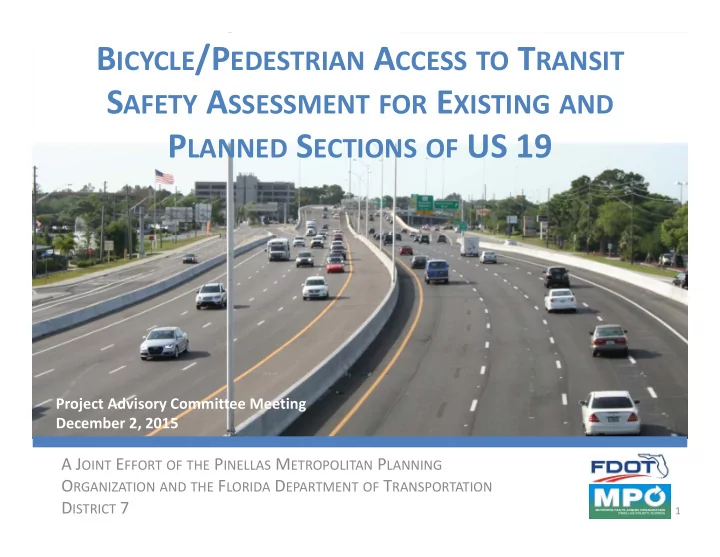
BICYCLE/PEDESTRIAN ACCESS TO TRANSIT SAFETY ASSESSMENT FOR EXISTING AND PLANNED SECTIONS OF US 19

A JOINT EFFORT OF THE PINELLAS METROPOLITAN PLANNING ORGANIZATION AND THE FLORIDA DEPARTMENT OF TRANSPORTATION DISTRICT 7

Project Advisory Committee Meeting December 2, 2015

1

slide-2
SLIDE 2

Purpose

This Study will look for ways to understand and improve transit access and crossings for existing and proposed conditions along US 19

2

slide-3
SLIDE 3

Overview

  • Progress Update
  • Update on Technical Memorandum #1
  • Prioritized Bus Stop Locations
  • Ped & Bike Crash Diagrams and Data
  • Ongoing and Upcoming Tasks

3

slide-4
SLIDE 4

Overview

  • Progress Update
  • Update on Technical Memorandum #1
  • Prioritized Bus Stop Locations
  • Ped & Bike Crash Diagrams and Data
  • Ongoing and Upcoming Tasks

4

slide-5
SLIDE 5
  • Task 1: Evaluate Crossing Issues

– Inventory of Existing Conditions and Summary of Data – Identify Bicycle/Pedestrian Safety Enhancements for Transit Access – Identify crossing needs and strategies

  • Task 2: Document Operating Assumptions

– Projected transit conditions along the corridor – Identify and summarize long term options for safety and access features

Progress Update

5

slide-6
SLIDE 6

Overview

  • Progress Update
  • Update on Technical Memorandum #1
  • Prioritized Bus Stop Locations
  • Ped & Bike Crash Diagrams and Data
  • Ongoing and Upcoming Tasks

6

slide-7
SLIDE 7
  • Received and incorporated comments – Thank

You!

– Updated Tech Memo to be posted on website

  • Pending additional pedestrian volume counts:

– Currently being conducted at:

  • US 19 at Mainlands Blvd
  • US 19 at Gateway Center Blvd
  • US 19 at 80th Ave N

Draft Technical Memo Comments

7

slide-8
SLIDE 8

Overview

  • Progress Update
  • Update on Technical Memorandum #1
  • Prioritized Bus Stop Locations
  • Ped & Bike Crash Diagrams and Data
  • Ongoing and Upcoming Tasks

8

slide-9
SLIDE 9

Short‐Term Prioritized Bus Stop Locations

Goal Identify bus stop locations along the corridor that may warrant additional analysis/evaluation in order to identify short‐term solutions to improve transit access and safety.

9

slide-10
SLIDE 10

Priority Locations: Methodology and Selection

Bus Stop clusters were identified, usually pairs but in some cases 3 or 4 stops in close proximity. Total bus stop ridership data was calculated and each location was ranked. Total bike/ped crashes within the vicinity of the locations was calculated and each location was ranked. Composite ranking was calculated using the sum of the ridership and crash ranking.

Bus Stop Groups Total Ridership Total Ped/Bike Crashes Composite Ranking

10

slide-11
SLIDE 11

Defining Locations

80th Ave N 82nd Ave N US 19

Bus Stops Stop Locations

11

slide-12
SLIDE 12

Priority Locations: Transit Ridership

Sunset Point Rd

Top Ridership Locations

Ulmerton Rd Curlew Rd Alderman Rd Belleair Rd 80th Ave N Whitney Rd SR 590/Coachman Rd East Bay Dr 110th Ave N

Rank Location

  • Avg. Weekday

Ridership Number of Stops 1 US 19 north of East Bay Dr 784 2 2 US 19 at Ulmerton Rd 415 4 3 US 19 at Sunset Point Rd 214 4 4 US 19 at 80th Ave N 173 2 5 US 19 at Coachman Rd 163 2 6 US 19 at 110th Ave N 124 2 7 US 19 at Belleair Rd 111 2 8 US 19 at Curlew Rd 97 4 8 US 19 at Alderman Rd 97 4 10 US 19 at Whitney Rd 92 4

12

Source: PSTA October 2014 Stop‐Level Ridership Data

slide-13
SLIDE 13

Priority Locations: Ped/Bike Crashes

Sunset Point Rd

Top Crash Locations

Ulmerton Rd Curlew Rd Citrus Dr/Innisbrook Dr Alderman Rd Tampa Rd 78th Ave N Gandy Blvd/Park Blvd Tarpon Ave Republic Dr Congress Ave

Rank Location Crashes 1 US 19 at Curlew Rd 13 2 US 19 at Ulmerton Rd 12 3 US 19 at 78th Ave N 10 4 US 19 at Tampa Rd 9 4 US 19 at Citrus Dr/Innisbrook Dr 9 4 US 19 at Park Blvd/Gandy Blvd 9 7 US 19 at Tarpon Ave 8 7 US 19 at Alderman Rd 8 9 US 19 at Sunset Point Rd 7 10 US 19 at Congress Ave 5 10 US 19 at Republic Dr/Hammock Pines Blvd 5

13

Source: 2010 – 2014 Pedestrian and Bicycle Crash Data

slide-14
SLIDE 14

Priority Locations: Rankings

Prioritized Bus Stop Locations:

14

slide-15
SLIDE 15

Priority Locations: Rankings

Ulmerton Rd Curlew Rd Sunset Point Rd Citrus Dr/Innisbrook Dr Alderman Rd Tampa Rd Belleair Rd 80th Ave N Whitney Rd Nebraska Ave/W Lake Rd SR 590/Coachman Rd

Top 10 Ranked Locations

118th Ave N

15

slide-16
SLIDE 16

Priority Locations: Next Steps

  • Meet with project team (FDOT, MPO, & PSTA) to

discuss locations and appropriate next steps

16

slide-17
SLIDE 17

Overview

  • Progress Update
  • Update on Technical Memorandum #1
  • Prioritized Bus Stop Locations
  • Ped & Bike Crash Diagrams and Data
  • Ongoing and Upcoming Tasks

17

slide-18
SLIDE 18

Ped & Bike Crash Diagrams

18

slide-19
SLIDE 19
  • 157 identified pedestrian and bicycle crashes directly

along US 19 between 2010 and 2014

– 89 crashes (57%) involved bicyclists – 68 crashes (43%) involved pedestrians

  • 133 injuries
  • 10 fatalities (8 pedestrian, 2 bike)

Crash Diagram Crash Data Summary

19

slide-20
SLIDE 20
  • Crashes by Time of Day:

20

Crash Diagram Crash Data Summary

slide-21
SLIDE 21
  • Crossing vs. Along Crashes:
  • 85 crashes ( 54%) involved people walking/biking along US 19 or crossing side streets
  • 72 crashes ( 46%) involved people crossing US 19

21

Crash Diagram Crash Data Summary

slide-22
SLIDE 22
  • 126 crashes (80%) occurred along existing at‐grade

segments

  • 16 crashes occurred along already reconstructed

segments

  • 15 crashes occurred along under‐construction

segments

22

Crash Diagram Crash Data Summary

slide-23
SLIDE 23
  • Many of the crashes along the already reconstructed

segments involved pedestrians crossing “mainline” traffic, not along the frontage roads

– Tended to be more severe

  • Crashes within areas that were under construction

tended to be “along” US 19 (not crossing).

– Exception = Enterprise Rd, mostly crossing crashes

  • Crashes occurred in 2011 and 2012, after opening of the overpass

in 2009.

23

Crash Diagram Crash Data Summary

slide-24
SLIDE 24

Crash Diagram Example

Right Turn Conflict No Crosswalk Driveway Conflict

24

slide-25
SLIDE 25

Crash Diagram Example

Right Turn Conflict Driveway Conflict

25

slide-26
SLIDE 26
  • Increasing safe crossing compliance for peds/bikes at

signalized location is critical

  • Turning movements at driveways and intersections

are a primary concern

– Increasing driver visibility of peds/bikes at intersections crosswalks and driveways is a priority

  • Frequent conflicts with bicyclists traveling along the

sidewalk (especially against the flow of traffic).

Crash Diagram Takeaways

26

slide-27
SLIDE 27

Overview

  • Progress Update
  • Update on Technical Memorandum #1
  • Prioritized Bus Stop Locations
  • Ped & Bike Crash Diagrams and Data
  • Ongoing and Upcoming Tasks

27

slide-28
SLIDE 28
  • Development of “purpose and needs”

statement

– Outline specific desires for safety, traffic

  • perations, transit operations, pedestrians, and

bicyclists.

  • Development of (transit access) alternatives
  • Active Stop Reviews

On‐Going and Upcoming Tasks

28

slide-29
SLIDE 29
  • Purpose – Conduct field reviews to determine

transit ridership generators

  • Reviewed 5 stops at 3 locations:

– Ulmerton Rd northbound and southbound – Bellair Rd northbound and southbound – Drew St northbound

Active Stop Reviews

29

slide-30
SLIDE 30

Ulmerton Rd

Safe Harbor Call Center

ULMERTON RD

Honeywell

30

slide-31
SLIDE 31

Belleair Rd

Residential Residential

BELLEAIR RD US 19

Plasma Center

31

slide-32
SLIDE 32

Drew St

SPC Residential Bright House Field

DREW ST US 19

32

slide-33
SLIDE 33

Recap

  • Progress Update
  • Update on Technical Memorandum #1
  • Prioritized Bus Stop Locations
  • Ped & Bike Crash Diagrams and Data
  • Ongoing and Upcoming Tasks

33

slide-34
SLIDE 34

Further Information

  • Project website:

www.tampabaytrafficsafety.com/D7BPAT/US19Corridor

  • FDOT Contact:

Elba Lopez Regional Transit/Intermodal Systems Planning FDOT District 7 – Intermodal Systems Development (ISD) Phone: 813.975.6403 Email: elba.lopez@dot.state.fl.us

  • Pinellas MPO Contact:

Sarah Perch Principal Planner Pinellas County Metropolitan Planning Organization (MPO) Phone: 727.464.5695 Email: sperch@pinellascounty.org

  • Consultant Contact:

James Fogarty or Chris Keller Phone: 813.224.8862 Email: jfogarty@tindaleoliver.com or ckeller@tindaleoliver.com

34