SLIDE 1 Oyster Integrated Mapping and Monitoring Program (OIMMP)
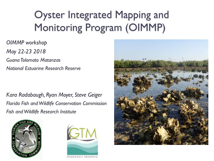
OIMMP workshop May 22-23 2018
GuanaTolomato Matanzas National Estuarine Research Reserve
Kara Radabaugh, Ryan Moyer, Steve Geiger
Florida Fish and Wildlife Conservation Commission Fish and Wildlife Research Institute
SLIDE 2
OIMMP introduction
OIMMP is funded by Florida’s State Wildlife
Grants (SWG) Program in order to support the study of high-priority coastal habitats and meet requirements of the State Wildlife Action Plan
SLIDE 3
OIMMP Team
Ryan P. Moyer, Ph.D. (PI) Kara Radabaugh, Ph.D. (Coordinator, Co-PI) Steve Geiger, Ph.D. (Co-PI) Christi Santi (GIS specialist) Kathleen OKeife (Geospatial support)
Many statewide collaborators!
SLIDE 4 IMMP Origins: SIMM
Seagrass Integrated Mapping and Monitoring
(SIMM) program by Laura Yarbro and Paul Carlson
SIMM report:
myfwc.com/research/habitat/seagrasses/projects/active/simm/
SLIDE 5 IMMP Origins: CHIMMP
Coastal Habitat Integrated Mapping and Monitoring
Program (CHIMMP)
CHIMMP report made with 48 statewide contributors:
http://myfwc.com/research/habitat/coastal- wetlands/projects/chimmp/
SLIDE 6 IMMP Origins: CHIMMP
Four year program, 2013-2017 funded by SWG Resources and presentations from three workshops
available at http://ocean.floridamarine.org/CHIMMP/
SLIDE 7 OIMMP goals
Inventory existing mapping and monitoring
programs
- Create publicly available mapping layer and collaborative
statewide report
Bring together representatives from mapping and
monitoring programs across the state
- Increase communication
- Compare current mapping and monitoring methods
- Identify data gaps, needs, and priorities for future efforts
Complete pilot studies of oyster mapping and
monitoring
SLIDE 8 OIMMP workshops
February 2017 at GTMNERR
- 2017 presentations available
- n OIMMP website
http://ocean.floridamarine.o rg/OIMMP/
SLIDE 9 Workshop Agenda
Day 1
- OIMMP updates and resources
- Attendee presentations
- Social event at Mill Top Tavern
Day 2
- Continuation of attendee presentations
- Breakout groups
SLIDE 10 Introduction to GTMNERR
MISSION To achieve the conservation of natural biodiversity and cultural resources by using the results of research to guide science-based stewardship and education strategies.
SLIDE 11
OIMMP Report updates
Regions for
statewide report determined at 2017 workshop
SLIDE 12 Chapter Contributor Affiliation All, report editors Kara Radabaugh FWC Steve Geiger FWC Ryan Moyer FWC All, GIS Christi Santi FWC Introduction Kara Radabaugh FWC Loren Coen FAU Steve Geiger FWC Ryan Moyer FWC Northwest Florida Katie Konchar FWC Katie Davis FDEP Patrice Couch
Watch Apalachicola Bay Ray Grizzle UNF Melanie Parker FWC Anne Birch TNC Megan Lamb ANERR Emma Dontis FWC Big Bend and Springs Coast Stephen Hesterberg USF Sean King SWFWMD Gregory Herbert USF Peter Frederick UF William Pine UF Chapter Contributor Affiliation Tampa/ Sarasota Bay Gary Raulerson TBEP Jay Leverone SBEP Allison Conner CHNEP Aaron Brown SWFWMD Kris Kaufman NOAA Andrew Lykens Tampa Bay Watch Kathryn Meaux Sarasota County Southwest Florida Anne Birch TNC Eric Milbrandt SCCF Mark Thompson SCCF Thomas Ries ESA Scheda Biscayne Bay and FL Keys Kara Radabaugh FWC Steve Geiger FWC Ryan Moyer FWC Central and Southeast Florida Melanie Parker FWC Vincent Encomio FOS Jeff Beal FWC Phyllis Klarmann SFWMD Emily Dark FDEP Joshua Breithaupt UCF Northeast Florida Nikki Dix GTMNERR Linda Walters UCF Erica Hernandez SJRWMD Annie Roddenberry FWC Stephanie Garvis UCF Matthew Anderson FDEP
39+ statewide contributors
SLIDE 13 OIMMP Report
Introduction to Florida oyster reefs
- Overview of methods used for mapping and monitoring
- Summary of benthic habitat classification schemes
- Summary of oyster reef mapping data
- Summary of oyster monitoring parameters and resources
SLIDE 14
OIMMP report chapter contents
Regional maps Introduction to regional history/ecology,
description of local oysters
Threats to oyster reefs Summary of regional mapping and
monitoring programs
Recommendations for management,
mapping, and monitoring
SLIDE 15
OIMMP Report example: Big Bend and Springs Coast
Mapping linked to published reports and websites Map shapefiles available for downloads at http://geodata.myfwc.com/d atasets/oyster-beds-in- florida
SLIDE 16
OIMMP Report example: Big Bend and Springs Coast
SLIDE 17 OIMMP Report example: Big Bend and Springs Coast
Figure 4.7. Oyster reef extent offshore of Withlacoochee and Crystal rivers in the mid-1800s and 2001. Map by Stephen Hesterberg. Data sources: Raabe et al. 2004, SRWMD 2001a.
SLIDE 18 OIMMP Report example: Big Bend and Springs Coast
FDACS Shellfish Harvesting Areas (SHAs) downloadable shapefiles:
Winter SHAs: https://www.arcgis.com/home/item.html?id=ac228ede47b04ac0ad69abcdc06e3a1f#overview Non-Winter SHAs: https://www.arcgis.com/home/item.html?id=6cf9f4ec8edb4dd8949cb23bb591745a#overview
SLIDE 19 1950 – 1983 data from printed copies of Summaries of
Florida Commercial Marine Fish Landings
- Will be available on OIMMP website and published as a report
appendix
1984 – present data from
https://public.myfwc.com/FWRI/PFDM/ReportCreator.aspx
1986 – Initiation of mandatory FWC reporting system
Oyster harvest data
SLIDE 20 1984 – present data from
https://public.myfwc.com/FWRI/PFDM/ReportCreator.aspx
Oyster harvest data
SLIDE 21 OIMMP Report Status
Approved for FWRI Technical Report
publication
Drafts written for 5 (of 9) chapters and well
underway for 3 more chapters
Writing & review process
- Write draft (Kara Radabaugh & coauthors)
- OIMMP editor revisions (Kara Radabaugh, Ryan
Moyer, Steve Geiger)
- Technical review & revisions (Bill Arnold, Amber
Whittle)
- Science & copy editor review & revisions (Bland
Crowder)
- Formatting (Bland Crowder)
SLIDE 22 Statewide Oyster Mapping and FWC GIS Resources
Christi Santi
Florida Fish and Wildlife Conservation Commission Fish and Wildlife Research Institute
SLIDE 23
Statewide Oyster Progress
Data were added from 15 sources in
additional areas or updates to existing areas.
Any overlaps between multiple data
sources were resolved.
Additional “Comments” are added to
retain details present in source data.
SLIDE 24
Statewide Oyster Progress
SLIDE 25
Statewide Oyster Progress
SLIDE 26
Updated Area: Apalachicola Bay
SLIDE 27
Updated Area: Lee County
SLIDE 28
Mapping Gaps
1992 maps Lack subtidal maps Vague maps Incomplete maps Incomplete maps Everywhere: Peripheral oysters
SLIDE 29 FWC GIS Data
http://geodata.myfwc.com/
SLIDE 30 FWC GIS Data
http://geodata.myfwc.com/
SLIDE 31 FWC GIS Data
http://geodata.myfwc.com/
SLIDE 32
Resource links
FWC GIS Downloads and Map Products:
http://geodata.myfwc.com/
FWC GIS Email:
GISLibrarian@MyFWC.com
SLIDE 33
Mapping Gaps
1992 maps Lack subtidal maps Vague maps Incomplete maps Incomplete maps Everywhere: Peripheral oysters
SLIDE 34 Monitoring Gaps
Monitoring efforts highly localized
- Limited comparison among bays
(but note Parker et al. 2013 Journal of Shellfish Research 32:695–708)
- Not all bays monitored
- Need standardized, long-term monitoring
Need data hub
- FDEP’s SEACAR program
- https://floridadep.gov/fco/fcmp/content/seacar-
goals
Need transition of data to management
- Need harvest management plan
SLIDE 35 Major Threats
Altered hydrology
- Salinity (predation, disease, mortality)
Loss of substrate
- Dredging, sedimentation, harvest
- Shoreline construction
Climate change & sea-level rise Metapopulations
SLIDE 36
Pilot monitoring study
Comparison of monitoring methods used
by FWC and Northern Coastal Basin group (Walters et al. 2016)
SLIDE 37 Effort to fill mapping gaps
Collaboration with UF to map subtidal
- ysters in Suwannee River sound
Lack subtidal maps
SLIDE 38
Online Resources
SIMM/CHIMMP/OIMMP websites FWC oyster compilation shapefile FDACS Shellfish harvesting areas
shapefiles
Oyster harvesting data Oyster restoration workgroup Oyster fisheries data Historical habitat data
SLIDE 39
Online Resources
Oyster restoration workgroup http://www.oyster-restoration.org
SLIDE 40
Online Resources
Historical habitat data University of Florida Aerial Photo Library
http://ufdc.ufl.edu/aerials
SLIDE 41
Online Resources
Historical habitat data University of Florida Aerial Photo Library
http://ufdc.ufl.edu/aerials
SLIDE 42
Online Resources
Historical habitat data University of Florida Aerial Photo Library
http://ufdc.ufl.edu/aerials
SLIDE 43 Online Resources
Historic habitat data NOAA topographic surveys (T
https://shoreline.noaa.gov/data/datasheets/t-
sheets.html
SLIDE 44 Online Resources
Historic habitat data NOAA topographic surveys (T
SLIDE 45 Online Resources
Historic habitat data NOAA topographic surveys (T
1939
SLIDE 46 Online Resources
Historic habitat data NOAA topographic surveys (T
- sheets)
- Not all georeferenced (especially older T
- sheets from 1800s)
SLIDE 47 Online Resources
Salinity model for bays along the Gulf of
Mexico
https://www.ncddc.noaa.gov/website/DataAtlas/atlas.ht
m?plate=Salinity%20-%20Zones
SLIDE 48 Monitoring resources
Name Association Focus Reference Design and monitoring of shellfish restoration projects The Nature Conservancy Instructional guide for bivalve restoration projects and monitoring Brumbaugh et al. 2006 Oyster habitat restoration monitoring and assessment handbook NOAA, TNC, University
Atlantic University Instructional guide for monitoring and characterization of oyster restoration sites Baggett et al. 2014 Science-based restoration monitoring of coastal habitats NOAA Volume 1: A framework for monitoring plans under the estuaries and clean waters act of 2000; Volume 2: Tools for monitoring coastal habitats Thayer et al. 2003, Thayer et al. 2005 Best management practices for shellfish restoration Interstate Shellfish Sanitation Conference, TNC, NOAA Methods for shellfish restoration including community outreach and harvesting concerns Leonard and Macfarlane 2011 Restoration goals, quantitative metrics and assessment protocols for evaluating success on restored
Chesapeake Bay Program Monitoring protocols and success metrics for restored oyster reefs Oyster Metrics Workgroup 2011 Effective monitoring to evaluate ecological restoration in the Gulf of Mexico National Research Council General and specific guidelines for monitoring numerous restored habitats, including oyster reefs NRC 2017 Oyster-generated marine habitats: their services, enhancement, restoration, and monitoring. Florida Atlantic University, University of Rhode Island TBD, in press Coen and Humphries, in press Oyster Condition Assessment Protocol UCF, SJRWMD, GTMNERR, NE Florida Aquatic Preserves Instructional guide for standardized oyster reef monitoring Walters et al. 2016
http://ocean.floridamarine.org/OIMMP/
SLIDE 49
Questions or comments?