Overview of the Southeast Deep Coral Initiative (SEDCI) Daniel - - PowerPoint PPT Presentation

overview of the southeast deep coral initiative sedci
SMART_READER_LITE
LIVE PREVIEW

Overview of the Southeast Deep Coral Initiative (SEDCI) Daniel - - PowerPoint PPT Presentation

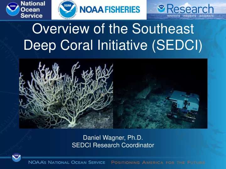
Overview of the Southeast Deep Coral Initiative (SEDCI) Daniel Wagner, Ph.D. SEDCI Research Coordinator Deep-Sea Coral Research & Technology Program - 2009 following reauthorization of Magnuson-Stevens Act - Science to address fishing


slide-1
SLIDE 1

Daniel Wagner, Ph.D. SEDCI Research Coordinator

Overview of the Southeast Deep Coral Initiative (SEDCI)

slide-2
SLIDE 2

Deep-Sea Coral Research & Technology Program

  • 2009 following

reauthorization of Magnuson-Stevens Act

  • Science to address fishing &
  • ther threats to deep corals

(>50 m, azooxanthellate)

  • Integrate expertise across

NOAA

  • Funding for studies and

fieldwork initiatives

slide-3
SLIDE 3

DSCRTP Fieldwork Initiatives

  • 3-4 year efforts
  • Research expeditions
  • Data/sample analysis
slide-4
SLIDE 4

Previous DSCRTP Initiatives

slide-5
SLIDE 5

2016-2019 Southeast Deep Coral Initiative

slide-6
SLIDE 6

Large Area

slide-7
SLIDE 7
slide-8
SLIDE 8
slide-9
SLIDE 9
slide-10
SLIDE 10

Our Approach

Councils Sanctuaries Data mining Federal agencies

REVIEW

Management priorities Past research

Academia

slide-11
SLIDE 11

Our Approach

Councils Sanctuaries Data mining Federal agencies

COLLECT REVIEW

Map Survey Sample Management priorities Past research

Academia

slide-12
SLIDE 12

Our Approach

Councils Sanctuaries Data mining Federal agencies

COMMUNICATE

COLLECT REVIEW

Internal External Map Survey Sample Management priorities Past research

Academia Meetings Publications Seminars & reports All data publicly available

slide-13
SLIDE 13

Publicly Available Data

slide-14
SLIDE 14

Our Approach

CONTRIBUTE

Management recommendations

Councils Sanctuaries Data mining Federal agencies

COMMUNICATE

COLLECT REVIEW

Internal External Map Survey Sample Management priorities Past research

Academia Meetings Publications Seminars & reports All data publicly available

slide-15
SLIDE 15
  • Management issues
  • Research questions
  • Expeditions & projects

SEDCI Science Plan

slide-16
SLIDE 16

Gulf of Mexico

Protected area Proposed FGBNMS expansion Proposed HAPC US EEZ

slide-17
SLIDE 17

U.S. South Atlantic

Protected area Proposed SMZ US EEZ

slide-18
SLIDE 18

U.S. Caribbean

Protected area US EEZ

slide-19
SLIDE 19

Priority Research Questions

U.S. Caribbean

  • What species?
  • Location of ecosystems?
  • Fishery impacts?
  • Anthropogenic impacts?

Gulf of Mexico

  • Location of ecosystems?
  • Fishery impacts?
  • Accuracy of habitat models?
  • Genetic connectivity?
  • Community structure drivers?
  • Human activity buffer distances?

South Atlantic

  • Location of ecosystems?
  • Fishery impacts?
  • Accuracy of habitat models?
  • Genetic connectivity?
  • Community structure drivers?
  • Differences inside/outside MPAs?
slide-20
SLIDE 20

South Atlantic

  • Location of ecosystems?
  • Fishery impacts?
  • Accuracy of habitat models?
  • Genetic connectivity?
  • Community structure drivers?
  • Differences inside/outside MPAs?

Gulf of Mexico

  • Location of ecosystems?
  • Fishery impacts?
  • Accuracy of habitat models?
  • Genetic connectivity?
  • Community structure drivers?
  • Human activity buffer distances?

U.S. Caribbean

  • What species?
  • Location of ecosystems?
  • Fishery impacts?
  • Anthropogenic impacts?

Priority Research Questions

slide-21
SLIDE 21

U.S. Caribbean

  • What species?
  • Location of ecosystems?
  • Fishery impacts?
  • Anthropogenic impacts?

Priority Research Questions

Gulf of Mexico

  • Location of ecosystems?
  • Fishery impacts?
  • Accuracy of habitat models?
  • Genetic connectivity?
  • Community structure drivers?
  • Human activity buffer distances?

South Atlantic

  • Location of ecosystems?
  • Fishery impacts?
  • Accuracy of habitat models?
  • Genetic connectivity?
  • Community structure drivers?
  • Differences inside/outside MPAs?
slide-22
SLIDE 22

U.S. Caribbean

  • What species?
  • Location of ecosystems?
  • Fishery impacts?
  • Anthropogenic impacts?

Priority Research Questions

South Atlantic

  • Location of ecosystems?
  • Fishery impacts?
  • Accuracy of habitat models?
  • Genetic connectivity?
  • Community structure drivers?
  • Differences inside/outside MPAs?

Gulf of Mexico

  • Location of ecosystems?
  • Fishery impacts?
  • Accuracy of habitat models?
  • Genetic connectivity?
  • Community structure drivers?
  • Human activity buffer distances?
slide-23
SLIDE 23

Our Strategy

Management Relevance

slide-24
SLIDE 24

Our Strategy

Management Relevance Research Priorities

slide-25
SLIDE 25

Our Strategy

Management Relevance Achievable Research Priorities

slide-26
SLIDE 26

Research Projects

Project Leads Region

Data Mining Tim Battista (NCCOS) John Reed (HBOI) Travis Sterne (FGBNMS) George Sedberry (GRNMS) Daniel Wagner (NCCOS) All Deep-Sea Species Guide Daniel Wagner (NCCOS) Peter Etnoyer (NCCOS) All Geodatabase Tim Battista (NCCOS) Daniel Wagner (NCCOS) All Modeling Matt Poti (NCCOS) All Environmental Monitoring Peter Etnoyer (NCCOS) All Fishery/Citizen Science Jen Schull (NMFS) Steve Smith (RSMAS) Caribbean

slide-27
SLIDE 27

Data Mining

Caribbean:

  • NCCOS (2004-present)
  • Okeanos Explorer (2015)
  • E/V Nautilus (2013)

Gulf of Mexico:

  • HBOI (1986-present)
  • FGBNMS (2001-present)

South Atlantic:

  • HBOI (1986-present)
  • NOAA Ship Pisces (2010)
slide-28
SLIDE 28

Deep-Sea Species Guide

slide-29
SLIDE 29

Geodatabase

Existing & proposed protected areas Previous submersible dives Museum and visual records Habitat suitability models

slide-30
SLIDE 30

Satellite bathymetry

Geodatabase

Place names Pipelines & platforms Multibeam bathymetry

slide-31
SLIDE 31

Modeling

Kinlan et al. 2013 Siceloff et al. in prep

Habitat suitability

  • Field test existing models to refine
  • New models for U.S. Caribbean

Fishing

  • Models on fishing activity
  • Areas surrounding proposed protections
slide-32
SLIDE 32

Fishery/Citizen Science

slide-33
SLIDE 33

Environmental Monitoring

slide-34
SLIDE 34

Vessel Lead Region Dates Operations

2016

Pisces Martha Nizinski North Carolina Canyons 8/24-9/7 AUV Sentry & mapping Manta Emma Hickerson Flower Garden Banks 9/4-9/9 ROV Mohawk

2017

Nancy Foster Peter Etnoyer Gulf of Mexico 8/12-8/24 ROV & mapping Nancy Foster Daniel Wagner South Atlantic Bight 8/27-8/31 Mapping Pisces Martha Nizinski North Carolina Canyons 8/27-9/7 AUV Sentry & mapping Manta Emma Hickerson Flower Garden Banks Sept.-Oct. (TBD) ROV Mohawk

2016-2017 Fieldwork

slide-35
SLIDE 35

2016 Fieldwork

R/V Manta & ROV Mohawk NOAA Ship Pisces & AUV Sentry

slide-36
SLIDE 36

2017 Fieldwork

R/V Manta NOAA Ship Pisces Nancy Foster Nancy Foster

slide-37
SLIDE 37

2018 Planned Fieldwork

NOAA Ship Okeanos Explorer NOAA Ship Nancy Foster

2 proposals: South Atlantic Gulf of Mexico 2 proposals: South Atlantic Caribbean

slide-38
SLIDE 38

Education/outreach

slide-39
SLIDE 39

Our Team

Name Affiliation

DSCRTP Tom Hourigan NMFS/DSCRTP Heather Coleman NMFS/DSCRTP Leadership & Coordination Peter Etnoyer NOS/NCCOS Daniel Wagner NOS/NCCOS Jennifer Schull NMFS/SEFSC Science Team Tim Battista NOS/NCCOS Andrew David & Stacey Harter NMFS/SEFSC Amanda Netburn OAR/OER Martha Nizinski NMFS/NSL G.P. Schmahl & Emma Hickerson NOS/FGBNMS

Name Affiliation

Project Leads Matt Poti NOS/NCCOS Travis Sterne & Marissa Nuttall NOS/FGBNMS John Reed HBOI George Sedberry NOS/GRNMS Steve Smith RSMAS Data Management Robert McGuinn NOS/NCCOS Matt Dornback NESDIS/NCEI Fishery Management Councils Morgan Kilgour GMFMC Graciela Garcia-Moliner CFMC Chip Collier SAFMC

slide-40
SLIDE 40

Thank you!

Daniel.Wagner@noaa.gov