Oklahoma Nonpoint Source Management Plan Update: 2013 Oklahoma - - PowerPoint PPT Presentation

oklahoma nonpoint source
SMART_READER_LITE
LIVE PREVIEW

Oklahoma Nonpoint Source Management Plan Update: 2013 Oklahoma - - PowerPoint PPT Presentation

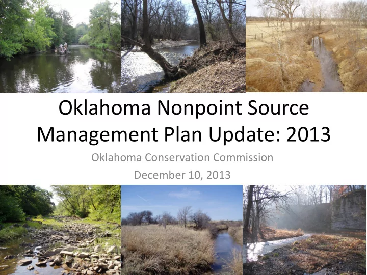
Oklahoma Nonpoint Source Management Plan Update: 2013 Oklahoma Conservation Commission December 10, 2013 Review of Sept. 2013 meeting Discussed long- and short-term goals Reviewed HUC 12 map Discussed ballot results and changes that


slide-1
SLIDE 1

Oklahoma Conservation Commission December 10, 2013

Oklahoma Nonpoint Source Management Plan Update: 2013

slide-2
SLIDE 2

Review of Sept. 2013 meeting

  • Discussed long- and short-term goals
  • Reviewed HUC 12 map
  • Discussed ballot results and changes that will

be made to NPS Watershed Prioritization Ranking Criteria

  • Next steps
slide-3
SLIDE 3

Topics for Today

  • Determine what long- and short-terms goal

should be

  • Discuss questions sent out with email
  • Show how changes to priority ranking have

changed

  • Next steps
slide-4
SLIDE 4

NPS Management Plan Goals

(from 2006 Update)

  • Long-term Goal of NPS Management Plan

– “By 2015, the State of Oklahoma’s NPS Program will establish a State-approved Watershed Based Plan, TMDL, or implementation plan (unless the original basis for listing a waterbody is no longer valid) to restore and maintain beneficial uses in all watersheds identified as impacted by NPS pollution in the 1998 303(d) List. The 1998 303(d) List identifies 8,156 miles

  • f stream and 291,293 acres of lake area as impaired
  • r fully supporting but threatened. By 2020, the State

will have implemented actions in each of those watersheds to move towards attainment and maintenance of beneficial uses in waterbodies listed

  • n the 1998 303(d) list as threatened or impaired by

NPS pollution.”

slide-5
SLIDE 5
  • By 2020, the State of Oklahoma’s NPS Program will

establish a State-approved Watershed Restoration Action Strategy, TMDL, or implementation plan (unless the original basis for listing a waterbody is no longer valid) to restore and maintain beneficial uses in all watersheds identified as impacted by NPS pollution in the 1998 303(d) List (Appendix A). The 1998 303(d) List identifies 8,156 miles of stream and 291,293 acres of lake area as impaired or fully supporting but

  • threatened. By 2040, the State will attain and maintain

beneficial uses in waterbodies listed on the 1998 303(d) list as threatened or impaired solely by NPS pollution.

NPS Management Plan Goals

(from 2012 Addendum)

slide-6
SLIDE 6

Short-Term Goal 1

  • Oklahoma will follow the priorities established by

the Unified Watershed Assessment, TMDL schedule, and the NPS Working Group per schedules in Table 1 to reduce NPS loading in priority watersheds with accepted plans by the percentages shown therein. This effort will address 487 stream miles (five percent of the 303(d) listed streams and one percent of the state’s total stream miles) and affect loadings to 79,312 acres of lakes (14% of the impaired lake acres and twelve percent of the state’s total lake acres).

slide-7
SLIDE 7
  • The OCC will identify pollutant sources within

watersheds monitored by the NPS Rotating Basin Monitoring Program. These potential sources of impairment will be included in the OCC’s submission of data for the State’s integrated Report.

Short-Term Goal 2

slide-8
SLIDE 8
  • Oklahoma will work to introduce the Blue Thumb Program

to all 87 Oklahoma Conservation Districts as a model program to meet their environmental education needs. Blue Thumb will then work with each Conservation District who requests assistance to develop and maintain a Blue Thumb program in their area. Blue Thumb will work to maintain a coverage of water quality enhanced education programs that include at least 100 consistently monitored stream sites maintained by volunteers and at least five active Blue Thumb groups in each of the five Conservation District Areas (i.e., 40 active Conservation District Blue Thumb Programs statewide). Blue Thumb will also work to maintain active programs in each of the State’s NPS Priority Watersheds listed in Table 1 as part of recommended Watershed Based Plan implementation efforts.

Short-Term Goal 3

slide-9
SLIDE 9
  • The State will draft and update Watershed

Restoration Action Strategies or Watershed Based Plans (WBP) in NPS impaired watersheds with sufficient data. These plans will be drafted as requests are made by local stakeholder groups and as funds become available for plan development.

Short-Term Goal 4

slide-10
SLIDE 10
  • The NPS program will work with other State

and Federal programs to identify alternative sources of funding to target and implement practices to achieve the long-term goal of beneficial use attainment by 2040 based on implementation plans developed by the State.

Short-Term Goal 5

slide-11
SLIDE 11

NEW NPS Watershed Prioritization Ranking Criteria

RANKING CRITERIA POINTS 15 10 5 3 % Waterbodies impaired on 303d list in HUC (includes Cat 4 & 5) (units of lake impairment reflected in actual stream miles ≥85% <85 to 65% <65 to 45% <45 to 25% ≥25% Pollutant severity score of HUC P, N, Turbidity, Pathogens & Low DO Toxics/Bioassay, Pesticides and Biocriteria Metals, Ammonia, O & G, CI/TDS/SO4, T & O, and pH no impairments Federal & State T & E species in HUC1 ≥3 2 1 Highest designated protected waterbody Scenic R/ORW HQW/SWS Nutrient Limited Watershed Yes No

  • Est. decrease in wetlands, 1982

to 2002 gain or <1% 1 to 5% >5 to 10% >10% to 20% >20% USF&WS priority wetland present YES NO

  • App. B, % of HUC

upper 50th percentile lower 50th percentile no appendix B areas NRCS Local emphasis areas and

  • ther protection programs

> 4 programs 2-3 programs 1 program only POINTS 7.5 5 2.5 1.5 # of PWS intakes in HUC ≥4 3 2 1 # of PWS customers served in HUC ≥100,000 999,999 - 10,000 9,999 - 1,000 999 - 1 1- includes habitat for Federally threatened or endangered aquatic and semi-aquatic organisms only.

slide-12
SLIDE 12

UWA - Watershed Frame

HUC 11 (830 total) HUC 12 (2116 total)

slide-13
SLIDE 13

IR 2012 - Category Difference

Cat 5 Cat 4 and 5

slide-14
SLIDE 14

Questions for Group

  • 1. Wetlands gains/losses metric – The UWA includes a

metric that scores watersheds based on wetlands loss

  • estimates. The current source of data (USDA NRI study)

renders probabilistic based estimates for HUC 8 watersheds, but over half of the watersheds show margins of error that far exceed the estimate itself. Are there other sources/ideas to represent wetland gains/losses in the scoring regime?

slide-15
SLIDE 15

Questions for Group

  • 2. Stream equivalence for lakes – The WG voted to

amend the manner by which stream equivalence was rendered for lakes from the simple areal multiplication method to the actual NHD hi-res stream network underlying the lake footprint. This appears to be rendering a much more realistic stream

  • equivalence. However, due to the more refined spatial

focus of HUC 12s, this means that watersheds with impaired lakes may still receive the maximum score since most of the watershed will be impaired. We still have more work to do to verify this, but please consider possible ways by which we can more equitably and reasonably represent watersheds with lakes.

slide-16
SLIDE 16

Questions for Group

  • 3. Conservation Programs metric – The WG voted to

amend the “NRCS LEA” metric to include other conservation related programs (e.g., CRP, WRP) in addition to source water and well head protection

  • areas. A quick application of this appears to show a

bolstering of scores for most watersheds with somewhat limited separation. We are proposing to potentially incorporate an element of actual areal percentage of these programs by watershed in place of

  • r in addition to the current presence/absence
  • scheme. Issues or comments?
slide-17
SLIDE 17

Revised Programs Core Only

slide-18
SLIDE 18

Original Cat. 1 Rankings

slide-19
SLIDE 19

Updated Cat. 1 Rankings

slide-20
SLIDE 20

Combine Orig. & New Cat. 1 Rankings

slide-21
SLIDE 21

Original Total Rank

slide-22
SLIDE 22

Revised Total Rank

slide-23
SLIDE 23

Revised Pollutant Severity Score

slide-24
SLIDE 24

Revised Pristine and New Waters Only Ranking

slide-25
SLIDE 25

Revised Pristine and New Waters & NLW Only Ranking

slide-26
SLIDE 26

Revised T & E Only Rankings

slide-27
SLIDE 27

Old and Revised Rankings

IDF WBID 303(d) Listed Streams HUC Outlet Stream Name HUC 11 Code Origina l total Origina l Total Rank Revised total REVISE D TOTAL RANK 383

OK121700030280_00 Illinois River

Illinois River 11110103050 37 52 65 1 181

OK121600050020_00 Spavinaw Lake

Spavinaw Creek (Hudson Lake) 11070209060 52 8 58 2 385

OK121700030010_00 Illinois River

Illinois River 11110103060 40 32 55 3 619

OK410210050020_00 Broken Bow Lake

Mountain Fork River (Broken Bow Lake) 11140108050 64 1 53 4 611

OK410210020020_00 Pine Creek Lake

Little River (Pine Creek Lake) 11140107020 53 6 50 5 615

OK410200010200_00 Little River

Little River 11140107050 59 3 50 5 407

OK220100040020_00 Fourche Maline Creek Fourche Maline

11110105040 42 23 48 7 439

OK311500030040_00 Little Elk Creek

Little Elk Creek 11120303050 34 67 48 7 513

OK310830060020_00 Fort Cobb Lake

Cobb Creek 11130302130 44 19 48 7 601

OK410300030010_20 Kiamichi River

Kiamichi River 11140105060 45 17 48 7 107

OK621200030010_00 Black Bear Creek

Black Bear Creek 11060006090 38 42 45 11 116

OK121510010020_00 Oologah Lake

Verdigris River (Oolagah Lake) 11070103050 58 4 45 11 164

OK121600030320_00 Whitewater Creek

Honey Creek (Grand Lake) 11070206040 51 9 45 11 392

OK121700020020_00 Tenkiller Ferry Lake

Illinois River 11110103110 48 14 45 11 614

OK410210080010_00 Glover River

Glover River 11140107040 50 10 45 11 48

OK620910040010_20 Cottonwood Creek

Cottonwood Creek 11050002130 35 58 43 16 61

OK620900020050_00 Council Creek

Cimarron River 11050003050 28 107 43 16 74

OK621010010160_00 Arkansas River, Salt Fork

Salt Fork Arkansas River 11060002040 30 87 43 16 187

OK121600010430_00 Chouteau Creek

Neosho River (Fort Gibson Lake) 11070209100 28 107 43 16 226

OK520810000020_00 Thunderbird Lake

Little River (Lake Thunderbird) 11090203010 43 22 43 16 310

OK520510000095_00 Turkey Creek, Trib A! North Canadian River

11100302030 34 67 43 16 316

OK520500020010_00 Wewoka Creek

Wewoka Creek 11100302050 34 67 43 16 389 Baron Fork 11110103080 15 249 43 16 412

OK220100020020_00 Wister Lake

Poteau River (Lake Wister) 11110105060 50 10 43 16 451

OK311600010040_00 Sandy Creek (Lebos)

Sandy Creek 11130101040 35 58 43 16

slide-28
SLIDE 28

NEXT STEPS

  • Continue data gathering to update UWA
  • Make adjustments based on this meeting
  • Next meeting
  • Questions/Comments?

– Jeri Fleming (jeri.fleming@conservation.ok.gov)