
SLIDE 1
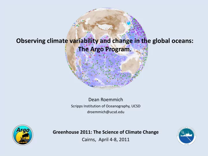
Observing climate variability and change in the global oceans: The Argo Program.
Dean Roemmich
Scripps Institution of Oceanography, UCSD droemmich@ucsd.edu
Observing climate variability and change in the global oceans: The - - PowerPoint PPT Presentation
Observing climate variability and change in the global oceans: The Argo Program. Dean Roemmich Scripps Institution of Oceanography, UCSD droemmich@ucsd.edu Greenhouse 2011: The Science of Climate Change Cairns, April 4 8, 2011 Outline The
Scripps Institution of Oceanography, UCSD droemmich@ucsd.edu
3200 free-drifting Argo floats collect high-quality Temperature/Salinity (TS) profiles, 0 – 2000 m, and velocity at 1000 m, every 10 days. The heat (T) and water (from S) balance are fundamental indicators of climate. In future, Argo will measure not only T and S, but also oxygen, nutrients, pH, and biological parameters.
Schematic of an Argo float cycle. No nation could do Argo by itself; cooperation is essential. The U.S. and Australia are the largest contributors of Argo floats. All of the data are freely and immediately available (www.argo.net).
Pre-Argo August Argo August
The global nature of Argo makes it possible to:
Over 750 research papers have used Argo data:
http://www.argo.ucsd.edu/Bibliography.html
Research topics include water-mass properties and formation, air-sea interaction, ocean circulation and transport, mesoscale eddies,
variability and change.
See: http://www.argo.ucsd.edu/Educational_Use.html
Operational centers around the world use Argo data in ocean state estimation, short-term forecasting and seasonal to decadal prediction.
http://www.argo.ucsd.edu/Use_by_Operational.html
Papers per year
From a few thousand profiles: WOCE produced neither a snapshot or a time mean, but rather a multi-year composite
sampling errors are difficult to estimate. From a few hundred thousand profiles: Argo provides both time means and snapshots, with realistic error estimates. (Inset plot: standard deviation of monthly temperatures)
WOCE Pacific Atlas, Talley (2007)
Potential temperature (oC) 500 m Argo 2004-2010 mean
Top: 1000 m geostrophic pressure from Katsumata and Yoshinari (2010) Bottom: 1000/2000 dbar steric height from Roemmich and Gilson (2009)
Absolute pressure: Argo Trajectories Relative pressure: Argo Steric Height
Absolute sea surface height, 1993-2002, from surface drifter and wind data (Maximenko et al, 2009, Method B) Absolute sea surface height, 2004- 2009, from Argo: based on 1000 m geostrophic pressure from Katsumata and Yoshinari, 2010, plus 0/1000 steric height from Roemmich and Gilson, 2009) The similarity of these independent estimates of SSH demonstrate the capability of the observing system.
Blue lines are observed values; red are residuals from the other 2 components. (Merrifield et al, 2010 update of Leuliette and Miller, 2009)
Steric + mass Measured
Depth (m) 10x Global SST anomaly 10x Global T160 anomaly Nino 3.4 SST anomaly T (oC)
The oceans dominate (~90%) heat gain in the climate system (e.g. Bindoff et al, 2007, IPCC; blue is 1961-2003, red is 1993-2003).
Upper right: Zonal average of temperature change (oC), Argo-minus-World Ocean Atlas 2001. From Roemmich and Gilson (2009). Lower right: Zonal and 0-2000 m depth integral of heat content change, Argo-minus-WOA01 (1016 J/m). Decadal change estimates have large uncertainty due to the sparse spatial coverage of historical data.
Most of the global heat gain is south of 30oS (e.g. Sutton and Roemmich 2011, in press)
50-yr heat gain by the oceans: ~0.3 x 10²² J/yr (0-700 m) Levitus et al. (2009)
Zonal averages, from Hosoda et al. 2009
E-P climatology Salinity climatology Salinity change (Argo minus climatology SSS)
Argo minus climatological salinity, 0-100 m avg, Roemmich and Gilson (2009)
Surface layer salinity has increased in the salty regions and decreased in the fresh regions, indicating an increase in global rates of evaporation and precipitation, by about 4% Hosoda et al. (2009). Also Helm et al (2010), Durack and Wijffels (2010).
Min/max protected thermometer from HMS Challenger (Fig from Tait, 1881)
Voyage of HMS Challenger 1872-1876
Challenger temperature section, New York-St Thomas (Worthington 1976)
Right: ∆T at 0 and 100 fathoms (red(+)/blue(-), tenths oC) Left: Global mean ∆T vs depth. Uncertainties remain regarding depths and T versus pressure corrections of Challenger measurements.
Temperature difference oC Depth (m) Mean ± Std err
100 fathoms 183 m
Mean 0.37 ± 0.12 oC
Argo – Challenger SST Mean 0.72 ± 0.07 oC
– Increase sampling at high latitudes (seasonal ice) and all marginal seas. – Develop deep floats for sampling to the ocean bottom. – Add new sensors (O2, pH, Chl, carbon, nitrate, …) to observe ecosystem and geochemical impacts of climate. – Implement 2-way high bandwidth communication. – Build boundary current arrays using floats and gliders in combination.
References
Bindoff, N.L. and co-authors, 2007: "Observations: Oceanic Climate Change and Sea Level." In: Climate Change 2007: The Physical Science Basis. Contribution of Working Group I to the Fourth Assessment Report of the Intergovernmental Panel on Climate Change, Cambridge, United Kingdom and New York, NY, USA: Cambridge University Press. Durack, P. J. and S. E. Wijffels, 2010: Fifty-Year Trends in Global Ocean Salinities and Their Relationship to Broad-Scale Warming. Journal
Helm, K. P., N. L. Bindoff, and J. A. Church, 2010: Changes in the global hydrological-cycle inferred from ocean salinity. Geophys. Res. Lett., 37, L18701. Hosoda, S., T. Suga, N. Shikama, and K. Mizuno, 2009: Global Surface Layer Salinity Change Detected by Argo and Its Implication for Hydrological Cycle Intensification. Journal of Oceanography, 65, 579-586. Katsumata, K. and H. Yoshinari, 2010: Uncertainties in global mapping of Argo drift data at the parking level. Journal of Oceanography, 66, 553-569. Leuliette, E. W., & L. Miller, 2009: Closing the sea level rise budget with altimetry, Argo, and GRACE, Geophys. Res. Lett., 36, L04608, doi:10.1029/ 2008GL036010. Levitus, S., J. I. Antonov, T. P. Boyer, R. A. Locarnini, H. E. Garcia, and A. V. Mishonov, 2009: Global ocean heat content 1955–2008 in light of recently revealed instrumentation problems, Geophys. Res. Lett., 36, L07608, doi:10.1029/2008GL037155. Maximenko, N., P. Niiler, M-H. Rio. O. Melnichenko, L. Centurioni, D. Chambers V. Zlotnicki, & B. Galperin, 2009: Mean dynamic topography of the ocean derived from satellite and drifting buoy data using three different techniques. J. Atmos. Oceanic. Technol, DOI: 10.1175/2009JTECHO672.1 D Merrifield, M. and co-authors, 2010: Sea level variations. In State of the Climate in 2009, D.S. Arndt, M.O. Baringer and M.R. Johnson, Eds, Bulletin of the American Meteorological Society, 91, s69 – s71. Roemmich D. and J. Gilson, 2009: The 2004–2008 mean and annual cycle of temperature, salinity, and steric height in the global ocean from the Argo Program. Progress in Oceanography, doi:10.1016/j.pocean.2009.03.004 Sutton, P. and D. Roemmich, 2011: Decadal steric and sea surface height changes in the Southern Hemisphere. Geophys. Res. Lett., doi:10.1029/2011GL046802, in press. Tait, P.G., 1881: The pressure errors of the Challenger thermometers. Challenger Narrative, v. II, Appendix A. (Reprinted by Cambridge University Press, 1898, as Scientific Papers by P.G. Tait) Talley, L.D., 2007: Hydrographic Atlas of the World Ocean Circulation Experiment (WOCE). Volume 2: Pacific Ocean (eds. M. Sparrow, P. Chapman and J. Gould), International WOCE Project Office, Southampton, U.K., ISBN 0-904175-54-5. Worthington, L.V., 1976: On the North Atlantic circulation, Oceanographic Studies, The John Hopkins University, Baltimore, MD, 6, 1-110.