
SLIDE 1
Nor
- rth Sh
Shor
- re L
Levee
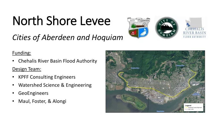
Cities of Aberdeen and Hoquiam
Funding:
- Chehalis River Basin Flood Authority
Design Team:
- KPFF Consulting Engineers
- Watershed Science & Engineering
- GeoEngineers
- Maul, Foster, & Alongi