
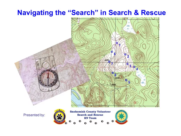
SLIDE 1
Navigating the “Search” in Search & Rescue
Presented by:
Navigating the Search in Search & Rescue Presented by: - - PowerPoint PPT Presentation
Navigating the Search in Search & Rescue Presented by: Navigating the Search in Search & Rescue The class objective is to provide an opportunity to practice , through repetition and field exercise, the skills necessary to
Navigating the “Search” in Search & Rescue
Presented by:
Navigating the “Search” in Search & Rescue
to practice, through repetition and field exercise, the skills necessary to maintain a continuous awareness of your team’s location during a search.
landscape and requiring cross country grid travel.
Reader, Ruler, Fine point pen (colors?), watch
Yes, these are also useful
www.scvsar.org
3
Wilderness Navigation
Redundant Navigation Systems Reduce Errors Map & Compass
Search team stays on intended route 1. Foundational Tools: Map and Compass 2. Augmented and Backed Up By:
GPS Brains & Senses
Team members constantly compare navigation info and decisions
Eyes & Brain Natural Clues; Landmarks Maps; Compass GPS; Altimeter
Navigating the “Search” in Search & Rescue (cont.)
GPS?
saying you are in San Francisco?
and continuously and fully engaged) *** Would you rather back-up your map & compass with your GPS,
using?
“Satellite reception lost …”
www.scvsar.org
Active Location Awareness
“The best way to know where you are, in the forest, . . .
A B C D
Search Tactics and Developing the Search Plan
quickly.
to be well practiced.
stops during the search.
navigational challenges.
(cliffs, wetlands, rivers, steep climbs)
for the resource: ground teams, voice checks, K9s?
Search Planning - Navigation Tactics
work hard boundaries that offer easier paths
(“hard boundary”: any unmistakable, unavoidable feature, i.e. roads, trails, cliff band, watercourses, clear-cut, etc. that is also a boundary of the search area)
assigned search area,
interior of area
boundaries
…….By making a new one!
Navigational Imperative
Active mental navigation: Maintain a constant estimate of where you are at any given time.
“We have travelled approximately 1/8 of a mile cross country
assigned area, and we are going to do a voice check”
ground and what you see on the map (e.g., logging roads that disappear, or appear on the ground, but not on the map) Avoiding wrong turns!
Navigation Challenges in the Field
“The best laid plans o’ mice and men gang aft agley” Active Navigation: Comparing your navigation plan to what you encounter in the real world. Maps don’t always keep up with the real world. “Distance” not the only important data – monitor both distance and direction
Personal Navigation Record
– Paces more accurate than time over shorter distances (under ¼ mile, and if you don’t lose count) – Time more accurate than paces over longer distances and off-trail
What are your personal data points? (assumes mission pack 32-38 pounds):
Your speed walking on a flat paved road: mph or:
Your speed walking on a moderate trail: mph or:
Your speed on moderate bushwhack in relatively flat terrain: mph or:
Your speed on moderate bushwhack in ‘steep’ terrain (125’-150’ gain per 1/4mi): mph or: ft./hr. Your speed on hard bushwhack relatively flat terrain: mph or: ft./hr. Your speed on hard bushwhack in ‘steep’ terrain (125’-150’ gain per 1/4mi): mph or: _____ ft./hr. Your speed on trail with 1000 feet elevation gain per mile: mph or:
Your pace length* on flat surface: feet Your pace length* going up hill (125’-150’ gain per 1/4mi) : feet Your pace length* going down hill (125’-150’ loss per 1/4mi) : feet
Personal Navigation Record – Metric Version
Estimated Travel Time per Distance // Paces per Distance (assumes mission pack 32-38 pounds)
ROAD // TRAIL X-COUNTRY BUSHWHACK (Enter Minutes)
(Enter Paces* for short segments, 100-200m; use minutes for 400+ m)
EASY TO MODERATE BRUSH HEAVY BRUSH DIFFICULT TRAVEL METERS MILES FEET FLAT STEEP DOWN FLAT STEEP FLAT STEEP
100 .06 328 ‘ ‘ ‘ ‘ 200 .12 656 ‘ ‘ ‘ ‘ 400 .24 1312 ‘ ‘ ‘ ‘ ‘ ‘ ‘ 500 .31 1640 ‘ ‘ ‘ ‘ ‘ ‘ ‘ 600 .37 1967 ‘ ‘ ‘ ‘ ‘ ‘ ‘ 800 .50 2625 ‘ ‘ ‘ ‘ ‘ ‘ ‘ 1000 .62 3280 ‘ ‘ ‘ ‘ ‘ ‘ ‘
Your speed on trail with 1000 feet elevation gain (quite steep) per mile: __miles per hr. // _____kilometers per hr. Your pace length* on flat surface: feet // ______meters Your pace length* going up hill (125’-150’ gain per 1/4mi) : feet // ______meters Your pace length* going down hill (125’-150’ loss per 1/4mi) : feet // ______meters
Personal Navigation Record – Metric Version
Estimated Travel Time per Distance // Paces per Distance (assumes mission pack 32-38 pounds)
ROAD // TRAIL X-COUNTRY BUSHWHACK (Enter Minutes)
(Enter Paces* for short segments, 100-200m; use minutes for 400+ m)
EASY TO MODERATE BRUSH HEAVY BRUSH DIFFICULT TRAVEL METERS MILES FEET FLAT STEEP DOWN FLAT STEEP FLAT STEEP
100 .06 328
60 paces 120 paces 110 paces
4 min 5+ min 8 min min 200 .12 656
120 paces 240 paces 220 paces
8 min 10+ min 16 min min 400 .24 1312
4 ¾ min 13 min 8 min
16 min 21 min 32 min min 500 .31 1640
6 min 17 min 10 min
20 min 26 min 40 min min 600 .37 1967
7 ¼ min 20 min 12 min
24 min 31+ min 48 min min 800 .50 2625
9 ¾ min 26 min 16 min
32 min 42 min 64 min min 1000 .62 3280
12 min 33 min 20 min
40 min 52+ min 80 min min
**Steep / down = 215’ / ¼ mi **Steep = 360’ / ¼ mi **Steep = ‘ / ¼ mi
My speed on trail with 1000 feet elevation gain (quite steep) per mile:
miles per hr. // ____ kilometers per hr.
My pace length* on flat surface: 5-1/2 feet // 1.7 meters My pace length* going up hill (215’ gain per 1/4mi) : 3 feet // .9 meters My pace length* going down hill (215’ loss per 1/4mi) : 2- 3/4 feet // .8 meters
Example of calculating a personal data point
Estimated Travel Time per Distance // Paces per Distance (assumes mission pack 32-38 pounds)
ROAD // TRAIL X-COUNTRY BUSHWHACK (Enter Minutes)
(Enter Paces* for short segments, 100-200m; use minutes for 400+ m)
EASY TO MODERATE BRUSH HEAVY BRUSH DIFFICULT TRAVEL METERS MILES FEET FLAT STEEP DOWN FLAT STEEP FLAT STEEP
100 .06 328 ‘ ‘ ‘ ‘ 200 .12 656 ‘ ‘ ‘ ‘ 400 .24 1312 ‘ ‘ ‘ ‘ ‘ ‘ ‘ 500 .31 1640 ‘ ‘ ‘ ‘ ‘ ‘ ‘ 600 .37 1967 ‘ ‘ ‘ ‘ ‘ ‘ ‘ 800 .50 2625 ‘ ‘ ‘ ‘ ‘ ‘ ‘ 1000 .62 3280 ‘ ‘ ‘ ‘ ‘ ‘ ‘
It took me 12 minutes to travel 325 meters through easy brush 325 divided by 12 = 27 (meters per minute) So . . . How long would it take me to travel 100 meters? 100 meters divided by 27 meters/min = 3.7 minutes (so, about 4 minutes) – for this type of terrain.
4 min
NAVIGATION RESOURCES
Useful ‘Equivalency’ Formulas:
– Formula: 1320 ft x 1320 ft.: 1,742,400 sq. ft. = 40 acres
– 500 ft x 500 ft. = 250,000 sq. ft. = 5.74 acres – 1000 ft x 1000 ft. = 1,000,000 sq. ft. = 23 acres
– 209 feet x 209 ft. = 43,681 sq. ft. = 1 +acre – 300 feet x 300 ft. = 90,000 sq. ft. = 2 acres
(or about about 1. 3 acres)
40 acres
On a 1:24,000 topo map, a 40 acre area is about the size of an average person’s thumb nail.
Plotting the Search
Start with your unmarked map Sketch the search area boundaries
A 1 2 3 E D C
Add guide points and planned travel segments
Technique: Using both the map and a separate sketch of your search plan
A 1 2 3 E D C
A 1 2 3 E D C B
B
The map is used to relate your search plan to the real world. The sketch diagrams your search tactics and records what you encountered during the search.
(and keeps your map uncluttered)
Sketching your search plan
A 1 2 3 E D C
A 1 2 3 E D C B
B
1. First, sketch the boundaries
(add in key points, such as junctions)
A 1 2 3 E D C
A A – 1, est.
B Est dist. Bearing:
?
Plotting the Search
A 1 2 3 E D C
determine and record bearings.
xxo xxo xxo xxo
lines in BOTH directions. (So you can determine back bearing)
possible)
?
Example of Completed Search Plan Sketch
xxo xxo xxo xxo
A 1 2 3 E D C B
A > 1: 1000 ft. / .19 mi. D > E: 1250 ft. / .24 mi. 3 > 2: 500 ft. / .09 mi. 2 > 1: 750 ft. / .14 mi.
A 1 2 3 E D C
Segmen ents s 1 t to C C to 2 2: wind from the NW
B
?
Example: Voice checks, (C)hange (O)f (B)ehavior, prevailing wind
Segmen ments s 2 t to D t to E: wind from the SE Covera rage ge in this area ea very poor due to w wind shifts
VC VC VC
COB: dog alert rts s and checks to the west
VC
Voice check C.O.B.
Remember, you will need to de-brief !!
Your (plan-sketch-notes) will support your de-brief
A Team consisting of Handler Jim Jones, Team Leader, K9 Gruff, and Max Factor, Field Support, departed the Northernmost point
boundary, counting 200 paces, or approx. 1000’. Then, travelling West at a bearing of 244 degrees, encountered a light wind from the NW and, upon intersecting with the Westside trail, performed a Voice Check(VC) with no detectable response. Then began another traverse on a 98 degree bearing to the East boundary trail, performed another (VC) at that location with no
noted that the wind had shifted coming out of the SE, meaning that, if the subject was between these last two grids, and unresponsive to (VC), they likely would not have been detected. Traveling East on the West side trail from there, the team noted that the trail to the S point of the area was not discernable in the dark and elected to travel on a bearing of approx. 160 degrees to that point and from there on a bearing of 29 degrees cross country, encountering the East boundary trail after about 10 minutes or approx. 1125 feet. Returning to the point of beginning
Behavior (COB) after about 250'. The K9 did not follow-up this indication after briefly inspecting an area of forest nearby. The subject was not located.
www.scvsar.org