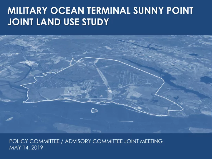
SLIDE 1 MILITARY OCEAN TERMINAL SUNNY POINT JOINT LAND USE STUDY
POLICY COMMITTEE / ADVISORY COMMITTEE JOINT MEETING MAY 14, 2019 NEED SOME SORT OF IMAGE
SLIDE 2
- Review Final Draft of the Joint Land
Use Study
- Finalize Recommendations +
Address Comments
- Schedule Final Public Meetings
MEETING AGENDA
SLIDE 3
Joint Land Use Study Organization
SLIDE 4
SECTION 1: INTRODUCTION
SLIDE 5
- Identify and mitigate barriers to the long term
sustainability of MOTSU’s mission.
- Promote compatibility between civilian land
use and military operational requirements.
- Strengthen coordination and communication
between local governments and MOTSU.
- Raise public awareness and understanding of
compatible growth issues.
JLUS PURPOSE AND GOALS
SLIDE 6 PROJECT SCHEDULE
Date Meeting
2018
February 23 Project Team Meeting April 11 Project Kickoff, Installation Tour & Committee Meetings May 21-24 Stakeholder Interviews June 26 Advisory Committee Meeting – Review Background Research July 30 Public Meeting – Overview & Research - (Southport and Carolina Beach) August 28 Advisory Committee Meeting – Review Compatibility Analysis October 16 Advisory Committee Meeting - Review Conflict Resolution Strategies November 19 Policy Committee Meeting December 4 Public Meetings – Interim Findings – (Boiling Spring Lakes and Carolina Beach) December 4 Advisory Committee Meeting – Draft Recommendations
2019
January 29 Policy Committee Meeting – Review Draft Recommendations February 25 Advisory Committee Meeting – Present Draft Study Documents March/April Advisory Committee Meetings – Finalize Study Documents May 14 Joint Policy and Advisory Committee Meeting – Finalize JLUS June 24/25 Public Meetings – Final Presentation – (Kure Beach and Southport)
SLIDE 7 0.75 miles 3 miles
JLUS STUDY AREA
Study Jurisdictions Brunswick County City of Boiling Spring Lakes Town of Leland City of Southport New Hanover County Town of Carolina Beach Town of Kure Beach Other Study Partners Cape Fear COG (Sponsor) MOTSU
SLIDE 8
SECTION 2: SUNNY POINT (MOTSU)
SLIDE 9 Leland Interchange Pleasure Island ESCZ Main Terminal Rail Corridor
MOTSU
Purpose-built ammunition transshipment terminal. Designed for SAFETY! Munitions are staged temporarily on MOTSU – no storage. Installation Components: Main Terminal – 8,600 acres ESCZ* – 2,200 acres Interchange Yard – 650 acres 16 mile rail corridor to Leland *Explosives Safety Clear Zone
SLIDE 10
SLIDE 11
SLIDE 12
SLIDE 13
SLIDE 14
Rail (80% of Inbound Cargo) Truck (20% of Inbound Cargo) Marine
SLIDE 15
Primary points of potential compatibility concern: – Maintaining use of the full extent of required explosives safety zones for temporary staging, as well as loading and unloading vessels, during munitions transshipment operations. – Maintaining safe and efficient transportation access. – Maintaining minimal levels of environmental constraint. – Maintaining strong relationships with host communities.
MISSION COMPATIBILITY
SLIDE 16
SECTION 3: STUDY AREA CHARACTERISTICS
SLIDE 17
POPULATION TRENDS
SLIDE 18
Population Density 2010 Census
SLIDE 19
HOUSING TRENDS
SLIDE 20
Housing Density 2010 Census
SLIDE 21
Developed Land Cover Change 2010-2017
SLIDE 22
Example of Development in Proximity to the MOTSU Rail Corridor
SLIDE 23
AADT Traffic Volume (2017)
SLIDE 24
AADT Traffic Volume (2017)
SLIDE 25
Cape Fear Crossing Study Routes
SLIDE 26
Cape Fear River Navigation
SLIDE 27
Cultural and Recreational Resources
SLIDE 28
SECTION 4: ENVIRONMENTAL RESOURCES
SLIDE 29
–Flood Hazards –Wetlands –Biological Resources –Sea Level Rise –Storm Surge Innundation –Fish Habitat –Water Resources –Protected Lands (Conserved Lands)
ENVIRONMENTAL RESOURCES
SLIDE 30
Wetlands
SLIDE 31
Storm Surge Inundation Hazards
SLIDE 32
Protected Lands
SLIDE 33
SECTION 5: COMPATIBILITY ANALYSIS
SLIDE 34
- ESQD = Explosive Safety Quantity Distance
- K Factor = Assumed degree of risk used in
calculating ESQD.
– Public Traffic Route (PTRD) = K30 – Inhabited Building (IBD) = K50 – K88 Glass Breakage Hazard (Roughly 2x IBD) – Absolute Safe Distance = K328
– D = Distance (ft) – W = Licensed Net Explosive Weight (lbs)
EXPLOSIVES SAFETY ZONES
SLIDE 35
Net Explosive Weight (lbs) Required Distance (feet) Explosives Safety Quantity Distance Requirements Inhabited Building Distance (IBD) Example
SLIDE 36
- ESQD Zones are not applicable to munitions
during their transportation: – Truck traffic on local highways – Rail traffic, including in the Leland Yard and
– Ship traffic in the Cape Fear River
- Once on the Terminal, ammunition is
temporarily staged per the license and applicable ESQD arcs for each holding area.
- ESQDs are static, but the degree of risk
increases and decreases with the presence and absence of munitions.
EXPLOSIVES SAFETY ZONES
SLIDE 37 Public Traffic Route Distance (K30) Inhabited Building Distance (K50) K88
(Glass Breakage Hazard)
SLIDE 38
- DESR 6055.09 / DA Pamphlet 385-64 establish
siting criteria for certain uses within the Inhabited Building Distance (as well as other safety zones).
- Primarily focused on uses typically found on a
military installation / ammunition facility.
- Best guidance available, and can be
translated to apply to civilian uses.
IBD COMPATIBILITY
SLIDE 39
DA PAM 385-64 USE TABLES
SLIDE 40
DA PAM 385-64 USE TABLE EXAMPLES
RECREATION USES WATER STORAGE TANKS
SLIDE 41
Compatible Use Easements Inhabited Building Distance (K50) Identified Non- MOTSU Uses Within the IBD
SLIDE 42
K88 Glass Breakage Hazard Tall Structures (5+ Stories)
SLIDE 43
- DESR 6055.09 / DA Pamphlet 385-64 establish
identical “Emergency Withdrawal Distances for Nonessential Personnel”
- Distances are intended for initial response to
an incident involving ammunition/explosives.
- Substitute guidance in the absence of ESQD
arcs for the rail line.
- Applies to both transportation and facilities
EMERGENCY EVACUATION CRITERIA
SLIDE 44 EVACUATION DISTANCES
evacuation distance when over 500 lbs: 5,000 ft.
evacuation distance when over 55,285 lbs: D=105W1/3
SLIDE 45
Example Point Rail Incident Withdrawal Area 5,000 Foot Rail Incident Withdrawal Area Example Facility Withdrawal Areas
SLIDE 46
- The main Cape Fear River shipping channel
and ICWW fall within the Public Transportation Route explosives safety zone.
- The current Cape Fear River restricted area at
MOTSU may not meet all safety / security requirements.
- The Fort Fisher Ferry route is considered a “high
volume” maritime route which triggers the use
- f the Inhabited Building distance to assess
compatibility.
TRANSPORTATION RELATED COMPATIBILITY ISSUES
SLIDE 47
ICWW Public Traffic Route Distance ICWW / Cape Fear Channel Restricted Area
SLIDE 48
Inhabited Building Distance Public Traffic Route Distance Fort Fisher Ferry Route
SLIDE 49
- Expansion to a third ferry on the Fort Fisher ferry
route will increase passenger volume within the IBD.
- Dow Road is within the IBD, and is
approaching the AADT volume at which compatibility concerns will apply.
- Easements rather than fee simple ownership of
the MOTSU – Leland rail corridor present challenges with access restrictions and law enforcement.
TRANSPORTATION RELATED COMPATIBILITY ISSUES
SLIDE 50
Dow Road Within IBD – Approaching Traffic Volume Threshold
SLIDE 51
- Lack of redundant regional rail access can
impede the mission – requiring 100% use of trucks for inbound cargo if the rail is compromised.
- At-grade rail crossings along the MOTSU rail
corridor present safety and security challenges.
- Several potential Cape Fear Crossing routes
will require additional grade separated crossings of the MOTSU rail corridor – but also an opportunity for better truck access to MOTSU.
TRANSPORTATION RELATED COMPATIBILITY ISSUES
SLIDE 52
Railroad Grade Crossings
SLIDE 53
Generalized Cape Fear Crossing Study Routes
SLIDE 54
SECTION 6: COMPATIBLE GROWTH FRAMEWORK
SLIDE 55
–Federal Military Land Use Compatibility Programs –NC Military Land Use Statutes and Programs –Local Government Plans and Ordinances
COMPATIBLE GROWTH FRAMEWORK
SLIDE 56 Military Coordination & Notice
– N.C.G.S. § 153A-323 [counties] – N.C.G.S. § 160A-364 [cities]
- Within five (5) miles of boundary of military base,
jurisdictions must notify commander of proposed changes:
– To the zoning map; – Affecting permitted uses of land; – Related to telecom towers or windmills; or – To proposed new major subdivision preliminary plats; – Or >50% increases in approved subdivision size.
SLIDE 57
Statutory Land Use Coordination Area
SLIDE 58
SLIDE 59
SECTION 7: RECOMMENDATIONS
SLIDE 60
The JLUS process has produced 52 primary recommendations in 5 categories:
– Coordination (C) – Land Use (LU) – Public Safety (PS) – Transportation (T) – Pleasure Island ESCZ (PIE)
JLUS RECOMMENDATIONS
SLIDE 61
SLIDE 62
SLIDE 63
C-10: Once established, MOTSU should communicate the new procedure for requesting licenses on installation property to the Standing Committee. Justification: The lack of clarity in how communities submitted license requests to MOTSU was an underlying issue of the JLUS. License request procedures are now in flux due to Army policy changes. Providing the new procedure to the communities, once established, will help improve transparency and enhance communication between MOTSU and its host communities.
ADDITIONAL RECOMMENDATION
SLIDE 64
- Meeting locations have been secured for
June 24 and 25
– June 24: Kure Beach Town Hall (Evening) – June 25: Southport Community Center (Afternoon)
- Need consensus from the Policy
Committee to publish the JLUS and begin advertising for the meetings.
- Possible follow-up Policy Committee
meeting following final public meetings
FINAL PUBLIC MEETINGS
SLIDE 65 MILITARY OCEAN TERMINAL SUNNY POINT JOINT LAND USE STUDY
POLICY COMMITTEE / ADVISORY COMMITTEE JOINT MEETING MAY 14, 2019 NEED SOME SORT OF IMAGE