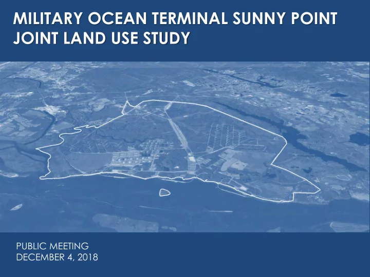
SLIDE 1 MILITARY OCEAN TERMINAL SUNNY POINT JOINT LAND USE STUDY
PUBLIC MEETING DECEMBER 4, 2018 NEED SOME SORT OF IMAGE
SLIDE 2
JLUS OVERVIEW
SLIDE 3 A study funded by the DoD’s Office of Economic Adjustment to help communities and military installations work together in achieving compatible growth and long-term sustainment
- f the military training mission.
WHAT IS A JOINT LAND USE STUDY?
SLIDE 4
- Identify and mitigate barriers to the long term
sustainability of the installation’s mission.
- Promote compatibility between civilian land use
and military operational requirements.
- Strengthen coordination and communication
between local governments and the installation.
- Raise public awareness and understanding of
compatible growth issues.
JLUS PURPOSE / GOALS
SLIDE 5 Completed Joint Land Use Studies
143 Completed as of December 2017
(1985 – 2017)
SLIDE 6 SUNNY POINT JLUS PARTNERS
- Military Ocean Terminal Sunny Point
- Cape Fear Council of Governments
- Brunswick County
- New Hanover County
- City of Boiling Spring Lakes
- Town of Carolina Beach
- City of Southport
- Town of Kure Beach
- Town of Leland
SLIDE 7
JLUS STUDY AREA
SLIDE 8 PROJECT SCHEDULE
Date Meeting
2018
February 23 Project Team Meeting April 11 Project Kickoff, Installation Tour & Committee Meetings May 21-24 Stakeholder Interviews June 26 Advisory Committee Meeting – Review Background Research July 30 Public Meeting – Overview & Research - 1 Day (2 locations) August 28 Advisory Committee Meeting – Review Compatibility Analysis October 16 Advisory Committee Meeting - Review Conflict Resolution Strategies November 19 Policy Committee Meeting December 4 Public Meetings – Interim Findings - 1 Day (2 locations) December 4 Advisory Committee Meeting – Draft Recommendations
2019
January Policy Committee Meeting February Advisory Committee Meeting – Present Draft Study Documents March Advisory & Policy Committee Meetings – Finalize Study Documents April/May Public Meetings – Final Presentation - 1 Day (2 locations)
SLIDE 9 JULY 30 PUBLIC MEETINGS
Southport and Carolina Beach
accordance with the Public Participation Plan
both meetings.
introducing MOTSU and the JLUS to the community
SLIDE 10
STAKEHOLDER INTERVIEW SUMMARY
SLIDE 11
STAKEHOLDER INTERVIEWS
– MOTSU (x3) – Brunswick County – New Hanover County – Carolina Beach – Southport – Kure Beach – Leland – Boiling Spring Lakes – H2GO – NCDNCR – Cape Fear Regional Jetport – Wilmington MPO – NCDOT Division 3 – Orton Plantation – NC State Port – NCDEQ – Corps of Engineers – SDDC – Atlantic Commercial Properties
SLIDE 12
- Local governments and state agencies are
eager to be good partners with MOTSU.
- Desire to establish more formal relationships,
particularly between elected officials / executive staff and key military / civilian leadership on the post.
- Numerous examples of partnerships already
exist; primarily focused on public safety and
- infrastructure. These tend to be staff-driven.
INTERVIEW THEMES
SLIDE 13
- MOTSU has a reciprocal desire to be a good
neighbor and partner with host communities.
- Need for ongoing / regular engagement
- pportunities with elected officials to build
relationships and understand MOTSU’s mission.
- Peer to peer staff relationships are generally
good, and longstanding, but subject to personnel changes.
INTERVIEW THEMES
SLIDE 14
- Perception of a lack of a single point of
contact on MOTSU to distribute communications to appropriate department.
- Inconsistent application of statutory
requirement for land use notice + lack of acknowledgment of receipt – few comments.
- Confusion on process / authority for granting
licenses + clear rules for use of MOTSU land – stemming from recent enforcement actions.
INTERVIEW THEMES
SLIDE 15
MOTSU MISSION FOOTPRINT
SLIDE 16
SLIDE 17
SLIDE 18
- Purpose-built ammunition transshipment
terminal – DESIGNED FOR SAFETY
- Ammunition is staged temporarily at the
terminal, while waiting to be shipped.
- Composed of three geographically separate
areas:
– Main Terminal: 8,600 acres – Pleasure Island Buffer Zone: 2,200 acres – Leland Interchange Yard: 650 acres
- Main Terminal linked to Leland Interchange by
a 16 mile rail line (on easements vs. government property).
INSTALLATION CHARACTERISTICS
SLIDE 19
JLUS STUDY AREA
MAP GOES HERE MAIN TERMINAL RAIL CORRIDOR LELAND YARD BUFFER ZONE MOTSU Components
SLIDE 20
- Primary points of potential compatibility
concern: – Maintaining use of the full extent of ESQD for temporary staging, as well as loading and unloading vessels, during munitions transshipment operations. – Maintaining safe and efficient transportation access:
– Maintaining minimal levels of environmental constraint.
MISSION COMPATIBILITY
SLIDE 21
- Inbound shipments to the Terminal are
typically: – 80% rail – 20% truck
- Inbound trains entering the Leland Yard are
typically switched to Army locomotives and brought to the Terminal immediately.
- In the case of a rail outage, all shipments will
come in by truck. Local highway infrastructure will have to support the traffic volume.
TRANSPORTATION
SLIDE 22
SLIDE 23
JLUS STUDY AREA
MAP GOES HERE Primary Transportation Routes
SLIDE 24
- ESQD = Explosive Safety Quantity Distance
- K Factor = Assumed degree of risk used in
calculating ESQD.
– Public Traffic Route (PTRD) (K24/30) – Inhabited Building (IBD) (K40/50) – K88: Glass Fragmentation Hazard (Roughly 2x IBD) – Absolute Safe Distance = K328
– D = Distance (ft) – W = Net Explosive Weight (lbs)
EXPLOSIVES SAFETY ZONES
SLIDE 25 JLUS STUDY AREA
MAP GOES HERE Explosive Safety Zones
K88 Distance Inhabited Building Distance Blast Easements
SLIDE 26
- Example ESQD Calculations for IBD Arc:
Net Explosive Weight: 1,000,000 lbs. – Inhabited Building Distance K Factor: 50
- Distance = 50*1,000,0001/3
- Inhabited Building Distance Arc = 5,000 ft.
Net Explosive Weight: 5,000,000 lbs. – Inhabited Building Distance K Factor: 50
- Distance = 50*5,000,0001/3
- Inhabited Building Distance Arc = 8,550 ft.
EXPLOSIVES SAFETY ZONES
SLIDE 27
IBD WEIGHT/DISTANCE CHART
SLIDE 28 JLUS STUDY AREA
MAP GOES HERE Inhabited Building Distance
Blast Easements IBD
SLIDE 29
- ESQD Zones are not applicable to munitions
during their transportation: – Truck traffic on local highways – Rail traffic, including in the Leland Yard and
– Ship traffic in the Cape Fear River
- Once on the Terminal, ammunition is
temporarily staged per the license and applicable ESQD arcs for each holding area.
- ESQD zones expand and contract as munitions
are temporarily staged and then shipped out.
EXPLOSIVES SAFETY ZONES
SLIDE 30
LAND USE AND GROWTH TRENDS
SLIDE 31 POPULATION GROWTH
Jurisdiction % Change 1990-2000 % Change 2000-10 % Change 2010-17 % Change 1990-2017 Brunswick County 43.5% 46.9% 21.8% 156.7% Boiling Spring Lakes 80.1% 80.8% 12.2% 265.3% Leland 7.6% 598.0% 47.7% 1,009.2% Southport (0.8%) 20.5% 31.5% 57.2% New Hanover County 33.3% 26.4% 12.1% 88.9% Carolina Beach 29.5% 21.4% 9.9% 72.7% Kure Beach 143.5% 33.5% 4.6% 240.1%
SLIDE 32 JLUS STUDY AREA
MAP GOES HERE Population Density
> 1 person / 10 acres > 1 person / acre Census Block Density
SLIDE 33 JLUS STUDY AREA
MAP GOES HERE Parcel Density
< 1 acre > 100 acres Parcel Size
SLIDE 34 JLUS STUDY AREA
MAP GOES HERE Developed Land Cover Change 2010 - 2017
2017 Increase 2010 Developed
SLIDE 35
ENVIRONMENTAL CONSIDERATIONS
SLIDE 36
SLIDE 37
Overall opinion that MOTSU is a good neighbor and land steward:
Water resources Protected species Controlled burns/ land management Wildlife management NEPA documentation for proposed actions Environmental compliance
ENVIRONMENTAL CONSIDERATIONS
SLIDE 38
Relationship with Corps of Engineers
Positive and close relationship with MOTSU Provides environmental, planning, AE design, real estate and construction support Provides and maintains navigable depths at berths Compliant with federal permits and regulations
ENVIRONMENTAL CONSIDERATIONS
SLIDE 39
Relationship with NCDEQ - Division of Coastal Management (CAMA)
In full compliance with existing permits and regulations Work actively with MOTSU on permits and CZM consistency reviews Primary nursery areas and coastal reserve within buffer zone Land management and stormwater management activities in compliance
ENVIRONMENTAL CONSIDERATIONS
SLIDE 40 JLUS STUDY AREA
MAP GOES HERE Development Constraints
Wetland Floodplain
SLIDE 41 JLUS STUDY AREA
MAP GOES HERE
Conserved Property
Conservation Lands
SLIDE 42
COMPATIBILITY ANALYSIS
SLIDE 43 JLUS STUDY AREA
MAP GOES HERE Inhabited Building Distance
Inhabited Building Distance Blast Easements
SLIDE 44
- DoD Manual 6055.09 / DA Pamphlet 385-64
establish siting criteria for certain uses within the Inhabited Building Distance (as well as
- ther safety zones).
- Primarily focused on uses typically found on a
military installation / ammunition facility.
- Best guidance available, and can be
translated to apply to civilian uses.
IBD COMPATIBILITY
SLIDE 45
DA PAM 385-64 USE TABLES
SLIDE 46
DA PAM 385-64 USE TABLE EXAMPLES
RECREATION USES WATER STORAGE TANKS
SLIDE 47 JLUS STUDY AREA
MAP GOES HERE IBD Non-MOTSU Uses (Updated)
Non-MOTSU Uses Blast Easements IBD
SLIDE 48
- Identified 19 sites / uses / structures within the
Inhabited Building Distance ESQD arc. – 17 public / 2 private – 9 on MOTSU land (excludes USAF Rec. Area) – USAF recreation area is on US Government (not MOTSU land) and is subject to a separate compatible use agreement – 9 within compatible use easements – Uses on MOTSU land subject to licenses granted by the Department of the Army
IBD USE CHARACTERISTICS
SLIDE 49
- Public works facilities (water / wastewater)
- Public park in Kure Beach
- USAF Recreation Area – not part of MOTSU
- FAA Joint Surveillance System Radar Facility
- Fort Fisher Ferry – landing, admin building,
parking area, etc.
- NCWRC Boat Ramp
- Brunswick Town / Fort Anderson – historic sites
and structures, visitors center, support bldgs.
IBD USE CHARACTERISTICS
SLIDE 50
GLASS FRAGMENTATION HAZARDS
DoD Manual 6055.09 Extract
SLIDE 51 JLUS STUDY AREA
MAP GOES HERE Tall Structure Glass Fragmentation Hazard
Inhabited Building Distance Tall Structures (5+ stories) K88 Distance
SLIDE 52
- DoD Manual 6055.09 / DA Pamphlet 385-64
establish identical “Emergency Withdrawal Distances for Nonessential Personnel”
- Distances are intended for initial response to
an incident involving ammunition/explosives.
- Substitute guidance in the absence of ESQD
arcs for the rail line.
- Applies to both transportation and facilities
EMERGENCY EVACUATION CRITERIA
SLIDE 53 EVACUATION DISTANCES
evacuation distance when over 500 lbs: 5,000 ft.
evacuation distance when over 55,285 lbs: D=105W1/3
SLIDE 54
JLUS STUDY AREA
MAP GOES HERE 5,000 Foot Emergency Withdrawal Distance Rail Incident Withdrawal Distance
SLIDE 55
- Distance applies to any given point on the line
where an incident occurs, not the entire line.
- Withdrawal distance may be increased based on
the specific situation.
– 2010 Population: +/- 11,200 – 2010 Dwelling Units: +/- 5,200
– South Brunswick School Campus – Northwest District Park – US 17 Commercial Area – US 74/76 Industrial Area
RAIL INCIDENT WITHDRAWAL AREA
SLIDE 56 JLUS STUDY AREA
MAP GOES HERE Rail Incident Withdrawal Distance: Developed Areas
Developed Land Cover
SLIDE 57 JLUS STUDY AREA
MAP GOES HERE Rail Incident Withdrawal Distance: Population Density (2010)
High Low Population Density
SLIDE 58
JLUS STUDY AREA
MAP GOES HERE Facility Emergency Withdrawal Distance (D=105W1/3) Facility Incident Withdrawal Distance
SLIDE 59
- Distance applies to any given facility – docks
were used as an example.
- Withdrawal distance may be increased based
- n the specific situation.
- Area Characteristics:
– 2010 Population: +/- 14,300 (excludes seasonal) – 2010 Dwelling Units: +/- 10,850
– Brunswick Nuclear Station – Pleasure Island Evacuation Route – South Brunswick High School Campus
FACILITY INCIDENT WITHDRAWAL AREA
SLIDE 60 JLUS STUDY AREA
MAP GOES HERE Facility Incident Withdrawal Distance: Developed Areas
Developed Land Cover
SLIDE 61 JLUS STUDY AREA
MAP GOES HERE Facility Incident Withdrawal Distance: Population Density (2010)
High Low Population Density
SLIDE 62
- Cape Fear main shipping channel and ICWW
channel from Snows Cut (pass-by traffic) within safety zones.
- Regional traffic congestion concerns
- Flooding – maintaining road and rail access
- Grade crossings on the rail line to Leland
- Brunswick Nuclear Station
EXAMPLES OF OTHER AREAS OF POTENTIAL COMPATIBILITY CONCERN
SLIDE 63
PLANNING AND DEVELOPMENT REGULATION REVIEW
SLIDE 64 PLANNING AND DEVELOPMENT REGULATION REVIEW
– Summary of relevant NC land use and military-related statutes – Overview of existing plans and ordinances for local governments within the JLUS Study Area
- Two (2) counties
- Five (5) municipalities
SLIDE 65
Development
– Counties: N.C.G.S. §§ 153A-320 thru
– Cities: N.C.G.S. §§ 160A-360 thru - 459.1 – CAMA: N.C.G.S. §§ 113A-106 thru - 112
- Military Affairs Commission
– N.C.G.S. §§ 143B-1310 thru -1314 – Strategic Plan updated every 4 years (next is 2020) – Annual Report made to General Assembly
SLIDE 66 Military Coordination & Notice
– N.C.G.S. § 153A-323 [counties] – N.C.G.S. § 160A-364 [cities]
- Within five (5) miles of boundary of military base,
jurisdictions must notify commander of proposed changes:
– To the zoning map; – Affecting permitted uses of land; – Related to telecom towers or windmills; or – To proposed new major subdivision preliminary plats; – Or >50% increases in approved subdivision size.
SLIDE 67 Leland Interchange 5 Mile Notice Area Main Terminal 5 Mile Notice Area Rail Corridor 5 Mile Notice Area
SLIDE 68
NORTH CAROLINA STATUTES
Military Lands Protection Act of 2013
– N.C.G.S. §§ 143-151.70 to -151.77 – Prohibits construction of a “tall building or structure” (200’ or greater) within 5 miles without approval of State Construction Office – Exempts wind energy facilities (due to extensive siting requirements per N.C.G.S. § 215.115 et seq.)
SLIDE 69 NORTH CAROLINA STATUTES
Military Presence Stabilization Fund
– N.C.G.S. §§ 143B-1217 – NC Military Affairs Commission approves use of Fund for actions designed to make the State less vulnerable to BRAC and related initiatives – The Fund can be used for:
- Grants to local communities or military
installations
- Public-public/public-private initiatives
- Identification and implementation of
innovative measures to increase the military value of installations
SLIDE 70 FAA RULES FOR UAS
- FAA, under 14 CFR § 99.7 — Special Security
Instructions (SSI), prohibit all UAS flight operations within the lateral boundaries of sensitive facilities – Specific locations depicted on an interactive
– Extend from ground up to 400 feet AGL; – Apply to all types & purposes of UAS flight; and – Remain in effect 24/7
SLIDE 71
FAA ONLINE MAPS FOR UAS
SLIDE 72 STUDY AREA JURISDICTIONS
- 3 municipalities exercise ETJ
- No military overlay zoning districts, land use
limitations, or subdivision regulations – Brunswick County has a “Military Installation” special base zoning district
- Most jurisdictions require plat notices re:
certain property characteristics
SLIDE 73 STUDY AREA JURISDICTIONS
comprehensive land use plan
background information on MOTSU
- 1 jurisdiction (Kure Beach)
provides specific land use limitation policies to address compatibility with military operations
SLIDE 74 STUDY AREA JURISDICTIONS
- Kure Beach Land Use Plan 2006
– Explicitly expresses desire of the Town for the MOTSU buffer zone to remain in a natural state with the Town Public Works activities (including water, sewer, or stormwater) being the only allowable use.
SLIDE 75 STUDY AREA JURISDICTIONS
- Military Notice Requirements per N.C.G.S.
– Some jurisdictions are informally coordinating – 2 have incorporated the statutory requirement into their Codes, to one degree or another (Brunswick County and Carolina Beach)
- Tall Structure Notice Requirements per
N.C.G.S. – No jurisdictions have adopted
- Wind Energy Facility Requirements per
N.C.G.S. – No jurisdictions have adopted
SLIDE 76
CONFLICT RESOLUTION STRATEGIES
SLIDE 77
CONFLICT RESOLUTION STRATEGIES
MANDATORY VOLUNTARY Zoning Ordinances Legal Agreements Land Acquisition State / Fed. Statutes Comprehensive / Land Use Plans Interagency Coordination Easement Purchases Joint Planning Development Guidelines MOUs Advocacy Groups Promotional Activities BLENDED
SLIDE 78
- Issue: Local governments do not currently
restrict use, density, or intensity of development based on proximity to the MOTSU rail corridor.
- Strategy: Zoning regulations could be
implemented that exclude certain uses (schools, daycares, multi-family, etc.) and limit development density for potentially compatible uses (e.g. large lot single family residential).
EXAMPLE 1
SLIDE 79
- Issue: The federally restricted portion of the
Cape Fear River related to MOTSU does not extend the entire width of the river, creating safety / security concerns.
- Strategy: Local governments could lend
support to MOTSU seeking modification to the Code of Federal Regulations that govern the extent of the restricted maritime area in the river.
EXAMPLE 2
SLIDE 80
- Issue: Plantation Road (NCDOT maintained)
provides public access to MOTSU’s back gate, Brunswick Town, and Orton Plantation property.
- Strategy: NCDOT, MOTSU and NCDNCR
could work together with Orton to identify access control / road ownership changes that would enhance security and access concerns for each entity.
EXAMPLE 3
SLIDE 81
- Issue: Windows in tall structures may be more
susceptible to glass breakage from blast
- verpressure.
- Strategy: While the NC Building Code does
not allow for local modification, additional standards could be developed and made available for implementation on a voluntary
- basis. Alternatively, such standards could be
made part of a Special Use Permit process.
EXAMPLE 4
SLIDE 82
RECOMMENDATIONS
SLIDE 83
- The study will conclude with a set of
recommendations for the study partners to consider implementing.
- JLUS recommendations are non-binding on
the study partners.
- Recommendations dealing with land use
and other local matters are subject to the discretion of local governing boards.
- If desired, the study partners may seek
funding from OEA and/or the state to move forward with certain recommendations.
RECOMMENDATIONS
SLIDE 84
- Draft recommendations are in the
development stages.
- Currently divided into 5 categories:
– Coordination – Land Use / Zoning – Public Safety – Transportation – MOTSU Buffer Zone
RECOMMENDATIONS
SLIDE 85
QUESTIONS
SLIDE 86 MILITARY OCEAN TERMINAL SUNNY POINT JOINT LAND USE STUDY
POLICY COMMITTEE MEETING NOVEMBER 19, 2018 NEED SOME SORT OF IMAGE