
SLIDE 1
Measurements of air quality during hydraulic fracturing in the Surat Basin
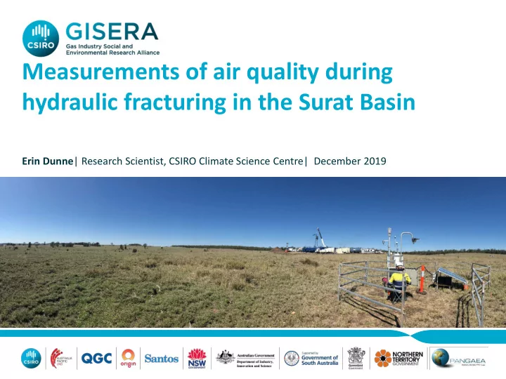
Erin Dunne| Research Scientist, CSIRO Climate Science Centre| December 2019
Measurements of air quality during hydraulic fracturing in the Surat - - PowerPoint PPT Presentation
Measurements of air quality during hydraulic fracturing in the Surat Basin Erin Dunne | Research Scientist, CSIRO Climate Science Centre| December 2019 Potential sources of air pollutants Vehicles & equipment exhaust emissions & dust
Erin Dunne| Research Scientist, CSIRO Climate Science Centre| December 2019
HF Impacts Presentation 1 | Erin Dunne | 2
HF Impacts Presentation 1 | Erin Dunne | 3
Source: Queensland Globe (2016). "Queensland Government CSG Globe” Available: https://www.business.qld.gov.au/business/support-tools-grants/services/mapping-data-imagery/queensland-globe
HF Impacts Presentation 1 | Erin Dunne | 4
HF Impacts Presentation 1 | Erin Dunne | 5
HF Impacts Presentation 1 | Erin Dunne | 6
National Environmental Protection Measure (NEPM) Ambient Air Pollutants Nitrogen dioxide (NO2) Carbon monoxide (CO) Sulfur dioxide (SO2) Ozone (O3) Particles – diameter less than 10 µm (PM10) Particles – diameter less than 2.5 µm (PM2.5) National Environmental Protection Measure (NEPM) Air Toxics Formaldehyde Benzene Toluene Xylenes Benzo(a)pyrene as a marker for PAHs Additional Pollutants in Qld Environmental Protection Policy for Air Components in PM10 – Arsenic, Manganese, Nickel, Sulfate Gases - Mercury, Hydrogen Sulfide, Styrene, 1,2,-Dichloroethane, Tetrachloroethylene Australian Radiation Protection & Nuclear Safety Agency (ARPANSA) Recommendations for Limiting Exposure to Ionizing Radiation Radon-222
HF Impacts Presentation 1 | Erin Dunne | 7
HF Impacts Presentation 1 | Erin Dunne | 8
Jul Aug Sept Oct Nov Dec Well Development Drilling Hydraulic Fracturing + Well Completion (HF + WC) Continuous sampling North & South AQMS NO2, CO, O3, SO2, and PM2.5 , PM10 (mass) Formaldehyde & BTX Radon & mercury Intensive Sampling North & South AQMS Daily PM10 (composition) Formaldehyde, BTX, PAHs Solar AQMS- Weekly PM2.5, PM10 Daily formaldehyde & BTX
HF Impacts Presentation 1 | Erin Dunne | 9
HF Impacts Presentation 1 | Erin Dunne | 10
Proportion of total observations in each AQ index category
AQ Index categories Very Good Good Fair NEPM Ambient Air Quality Objective Poor Very Poor Location Pollutant AQ objective North AQMS NO2 NEPM 1h 100% 0% 0% 0% 0% CO NEPM 8h 100% 0% 0% 0% 0% O3 NEPM 1h 68% 32% 0% 0% 0% NEPM 4h 45% 55% 1% 0% 0% SO2 NEPM 1h 100% 0% 0% 0% 0% NEPM 24h 100% 0% 0% 0% 0% PM2.5 NEPM 24h 85% 13% 2% 0% 0% PM10 NEPM 24h 88% 12% 1% 0% 0% TSP EPP 24h 81% 17% 1% 1% 0% South AQMS NO2 NEPM 1h 100% 0% 0% 0% 0% CO NEPM 8h 100% 0% 0% 0% 0% O3 NEPM 1h 62% 38% 0% 0% 0% NEPM 4h 34% 65% 1% 0% 0% PM2.5 NEPM 24h 86% 13% 1% 0% 0% PM10 NEPM 24h 83% 13% 3% 1% 0% TSP EPP 24h 70% 23% 4% 2% 2%
HF Impacts Presentation 1 | Erin Dunne | 11
Proportion of total observations in each AQ index category AQ Index categories Very Good Good Fair Poor Very Poor NO2 1-hour average North-AQMS 100% 0% 0% 0% 0% South-AQMS 100% 0% 0% 0% 0% Hopeland 100% 0% 0% 0% 0% Miles Airport 100% 0% 0% 0% 0% Burncluith 100% 0% 0% 0% 0% Proportion of total observations in each AQ index category AQ Index categories Very Good Good Fair Poor Very Poor PM10 24-hour average North-AQMS 88% 12% 1% 0% 0% South-AQMS 83% 13% 3% 1% 0% Hopeland 93% 7% 0% 0% 0% Miles Airport 87% 11% 2% 0% 0%
HF Impacts Presentation 1 | Erin Dunne | 12
Benzene Toluene Formaldehyde Benzo(a) pyrene as a marker for polyaromatic hydrocarbons (PAHs)
HF Impacts Presentation 1 | Erin Dunne | 13
HF site (this study) HF Sites 2016/17a Regional sitesb (>10km from CSG) Gas-field sitesb Roma-Yuleba region Miles-Condamine region Tara region & Burncluith Wilgas, Hopeland Range (ppb) DF (%) Range (ppb) DF (%) Range (ppb) DF (%) Range (ppb) DF (%) Benzene 0.02 – 0.07 18% 0.01 – 0.09 21% 0.02 – 0.05 25% 0.01 – 0.09 29% Toluene 0.01 – 0.03 18% 0.01 – 0.18 29% 0.01 – 0.04 21% 0.01 – 0.04 43% m & p-xylenes 0.01 – 0.06 12% 0.01 – 0.08 9% 0.01 – 0.06 13% 0.01 – 0.03 19%
< 0.02 0 % 0.01 – 0.03 4% 0.01 – 0.03 4% 0.01 – 0.04 5% Formaldehyde 0.04 – 1.30 94% 0.33 – 2.12 100% 0.04 – 1.30 83% 0.39 – 1.30 100% DF% = detection frequency (%)- the number of observations above the detection limit of the method
a Dunne et al (2018) available :https://gisera.csiro.au/project/air-water-and-soil-impacts-of-hydraulic-fracturing/ b Lawson et al (2018) available: https://gisera.csiro.au/project/ambient-air-quality-in-the-surat-basin/
HF Impacts Presentation 1 | Erin Dunne | 14
a (Kennedy et al 2010a) b (NEPC 2017)
HF Impacts Presentation 1 | Erin Dunne | 15
Location Average & standard deviation Air Quality Objective This study 0.57 ± 0.12 ng/m3 1100 ng m-3 Annual Qld EPP Near Darwin, NT 2015a 0.93 ± 0.12 ng/m3 Southern Ocean, Tasmania, 2013 0.85 ± 0.11 ng/m3 Inland site, Hunter Valley NSW 2019 0.8 - 1.0 ng/m3 Snowy Mountains, NSW 2017 0.59 ± 0.10 ng/m3
Average Max Air Quality Objective South-AQMS 4.44 Bq m-3 9.96 Bq m-3 200 Bq m-3 Long term ARPANSA objective for households Tara region (Surat Basin) 9.2 Bq m-3 34.2 Bq m-3
HF Impacts Presentation 1 | Erin Dunne | 16
HF Impacts Presentation 1 | Erin Dunne | 17
HF Impacts Presentation 1 | Erin Dunne | 18
Downwind of hydraulic fracturing & well completions (HF + WC) Wind Direction (WDR) ±20° Other Wind Directions (WDR) during the same period
N
Were pollutant levels higher downwind of HF + WC than they were when sampled:
HF Impacts Presentation 1 | Erin Dunne | 19
Bottom 95% of data Top 5% of data
HF Impacts Presentation 1 | Erin Dunne | 20
the North or South-AQMS.
HF Impacts Presentation 1 | Erin Dunne | 21
Benzene Toluene
HF Impacts Presentation 1 | Erin Dunne | 22
HF Impacts Presentation 1 | Erin Dunne | 23
HF Impacts Presentation 1 | Erin Dunne | 24
Windborne dust, road dust from vehicles
Products of reactions between SO2 (e.g. fossil fuel burning) and ammonia (agriculture, industry, vehicles, non-road diesel equipment, soils)
Sea salt reacted with industrial, commercial, road & non-road transport emission from local & regional sources, esp. NO2
Long range transport of smoke
Fresh sea salt aerosol from wave-breaking
Smoke from local/regional fires
Fungi, lichen and soil biota
Natural fungal spores found in soil
HF Impacts Presentation 1 | Erin Dunne | 25
High rainfall period with shift in winds from S-SW to NE suppressed contribution from dust and smoke
24h concentration (µg m-3)
HF Impacts Presentation 1 | Erin Dunne | 26
24h concentrations (ppb) 24h concentrations (ppb)
HF Impacts Presentation 1 | Erin Dunne | 27
HF Impacts Presentation 1 | Erin Dunne | 28
Soil dust was identified as the source of the exceedance of PM10 and TSP Dust events were associated with the movement of vehicles and equipment
Emissions from diesel powered vehicles and equipment on well pad the most
Analysis of available data on composition of HF fluids, flowback fluids and
HF Impacts Presentation 1 | Erin Dunne | 29
HF Impacts Presentation 1 | Erin Dunne | 30
Erin Dunne Research Scientist t +61 3 9239 4434 e erin.dunne@csiro.au w gisera.csiro.au
CSIRO Climate Science Centre Erin Dunne, Melita Keywood, Jason Ward, James Harnwell, Jennifer Powell, Paul Selleck, Maximilien Desservettaz, Suzie Molloy, Min Cheng, Scott Henson ANSTO Alistair Williams, Sylvester Werczynski, Ot Sisoutham Armand Atanacio Macquarie University Grant Edwards, Anthony Morrison Queensland Alliance for Environmental Health Sciences (QAEHS) Fisher Wang Ecotech and SGS Leeder Origin Energy