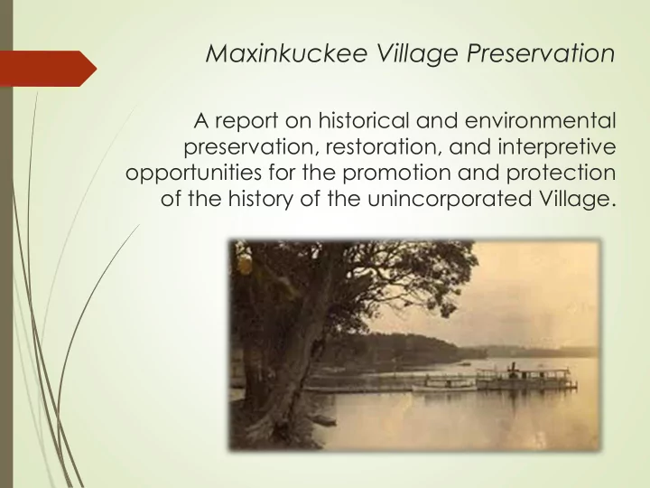
SLIDE 1 Maxinkuckee Village Preservation
A report on historical and environmental preservation, restoration, and interpretive
- pportunities for the promotion and protection
- f the history of the unincorporated Village.
SLIDE 2 BACKGROUND TO THE PROJECT
- Committee
- Documentation
- Research
COMPOSITION OF THE REPORT
- Historical Record
- Resource Identification
- Interpretive Plan/Improvements
- Building “Community”
SLIDE 3
Daniel McDonald’s account of the village in his 1881 History of Marshall County, states “Maxinkuckee…has not been regularly laid out as a town, but, as the merits of the lake as a summer resort become better known, it is destined to grow into considerable importance.” McDonald includes that the streets dividing the town east/west and north/south were called Lake and Washington, respectively. Since the lake is what gives the village its name, it should be noted that in Native American terms, “Maxinkuckee” is interpreted as “clear water” or “diamond lake.” However, one account by Niago, a Native American said that Maxinkuckee meant “stone or stony, for the numerous stones and pebbles on the shores and in the bed of the lake.” Regardless of the meaning, it is a far better name than what it was first referred to as: “Fizzletown”.
History of the Village
SLIDE 4
Lake Street (18B) Washington Street (old alignment/Queen)
SLIDE 5 Village founded on Reservation
The earliest history of the region that is recorded is tied to the Nis-waug-ee and Quash-qua Indian reserves established by treaty in 1832. They were but a few sections of land, each, on the east side of the lake with 18B Road, also a section line, being the dividing line between the two. Nis-waug-ee on the north side and Quach-qua on the south; the two chiefs were brothers. Together they shared a village, and encampments dotted the east shore of the lake. According to McDonald, Nis-waug-ee’s residence and main village site was located on the Bigley property, across the north side of the road from the Allegheny House. William Thompson, an early settler of Union Township “kept house” for the chief when he traveled to receive payment on the treaty, and references are made to the Chief’s residence being a cabin. It has been stated that homes were constructed in the village for Native Americans by Moses Scott on behalf of the Federal Government in
- 1828. The removal of these Native American bands
- ccurred about 1838 and the lands were sold by the
federal government. George Winter’s painting
SLIDE 6
SLIDE 7
VILLAGE OF MAXINKUCKEE POPULATION IN 1880 As identified in the 1880 census, the Village of Maxinkuckee had 13 households, shown in the following order over two pages; the village is not recorded separately under any other census: Bigley, Thomas family. Farmer. Mother, Amelia Smith living with family. Wise, Jonathan family. Retail merchant (in partnership with Parker) Parker, Eli family. Farmer & Merchant Benedict, Aaron family. Farmer & Miller (saw/grist) Stevens, Oliver P. family. Physician. Son, Adin, was a teacher South, William family. Farm laborer Hissong, Samuel family. House carpenter Hay, Susan family. Housekeeper, included two boarders Foss, William family. Shoemaker Edwards, Edward family. Hotel keeper, included five hired hands for hotel Spangler, Peter family. Farmer, included Abraham Bogardus and William Easterday (farm laborer) Miles, John C. family. Farmer Miles, Daniel family. Farmer
SLIDE 8 VILLAGE OF MAXINKUCKEE RESOURCES The resources identified in the Village of Maxinkuckee are varied. The term “resource” here includes buildings, structures such as stone walls, foundations and fences, and landscape features such as glacial hills, fauna, and
- streams. Though varied in their construction dates and
details, all work in unison to create the “feel” of the
- village. This is the fabric, if strengthened, can provide
the sense of community in built form and ultimately lead to its preservation. Natural landscape Man-built resources
SLIDE 9
Wildflowers are abundant at the west end of 18B Road, near the wetlands at the golf course. Glacial “kames” characterize the east edge of the village and rise 50’ from surrounding farmland. Ravines, woods, and streams are counted among the natural resources of the Village.
Natural Landscape
SLIDE 10
Man-Built Resources
Walls, Fences, and Buildings
SLIDE 12
1908 Plat Map of the Village
Notable Buildings of the Village
Of approximately 36 total
SLIDE 13
Overmyer Store & I.O.O.F Lodge, c. 1913. The building was located southeast of 18B and Queen Road. Only foundations remain.
SLIDE 14 Maxinkuckee Disciples of Christ Church, c. 1888. A church building is identified
- n the 1898, 1908, and 1922
plat maps of the village.
SLIDE 15 Maxinkuckee School-Wooley House, c. 1875 This house was the old Maxinkuckee School, located here as early as 1880. An earlier schoolhouse was located on Queen Road, some 1000’ north of the intersection with 18B Road, by about 1852. That was likely the first school in the village, this was likely the second and may have served for religious services for both the Disciples of Christ and Methodists until the church was built. This building was sold to the highest bidder in 1908 after the new brick school was
- constructed. G. D. and Ida Wooley purchased the property that included a one-
story frame building and converted it to their house.
SLIDE 16 Maxinkuckee School, 1908. The township school was constructed in 1908. The contract was let to Fred Thompson, local builder, though he in turn let it to John Gill for $2569.00.
directed the creation of a playground and beautification of the school site in 1916. The schoolhouse, after consolidation and ordered closed by the state in 1936, was used by the Bigleys as a cold storage facility for apples.
SLIDE 17 Allegheny House, c. 1855 The early hotel was constructed just as people were beginning to visit Lake Maxinkuckee for recreational opportunities. Notable people, like Lew Wallace, stayed in the home and it is purported that he wrote a portion
- f Ben Hur at the house while
- vacationing. The house has
sleeping rooms and a “ballroom” area on the second floor, and a second story front porch for
- guests. The house was likely
constructed as a tavern/inn by Abraham (Abram) Wicks (and Frances) Bogardus, then owned by Peter & Harriet Spangler. Harriet was the daughter of Abraham and Frances Bogardus. Spangler had settled in Union Township in 1865. By 1881 and as early as 1870, the Spanglers were assisting with operations of the old inn, now called the Spangler Hotel, until Harriet died in 1909.
SLIDE 18 Parker Farm & Store (1881 engraving) The farm was probably first developed by Eli Parker, who came to Union Township in
- 1856. He had a small stock of general merchandise and opened a store just west of the
- house. He married Catherine Spangler, the daughter of Samuel Spangler of Fulton County,
in 1860. Through his business, he amassed enough capital to increase his land holdings to 400 acres. His son, Francis M. Parker, continued on the farm and became the township trustee during the early 1900s. Parker had several partnerships, beginning with James Dale, then Harvey Atkinson, and finally John Wise by the 1880s. Parker & Wise opened a second store location at Maxinkuckee Landing. The village post office was maintained in
- ne corner of the store above. This building later served as the Oddfellows Hall and
burned in 1903 after it was purchased of Parker in 1899.
SLIDE 19 Parker-Mahler House A fire in 1932 destroyed the 2-story Italianate residence of Eli Parker, however, it appears that Francis Parker reconstructed this house using much of the
The c. 1870 barn remains, as does the stone wall and portions
- f the original iron fence.
SLIDE 20 Bigley Farm, 1875. This was part of the 80 acre farm
- wned by A. (Amelia) Smith,
shown on both the 1881 and 1908 plats. Edward Bigley and Amelia (Fisher) married in 1850, in Marshall County. The Bigley and Fisher families were early pioneers of the area. In 1837, Amelia’s oldest brother John came to Lake Maxinkuckee and built a cabin. In 1844, John purchased the tract of land on which the Bigley farm was
- established. After Edward and
Amelia were married, they lived
- n the Fisher farm. Thomas
Jefferson Bigley was born a year later, in 1851, but Edward died by the late 1850s. Thomas J. Bigley married Sarah Jane Benedict (daughter of Aaron and Rose Benedict) in 1875 and constructed this house and barn at that time. The timbers came from the Benedict saw mill at Maxinkuckee.
SLIDE 21 John Bigley, the grandson
built the bungalow in 1929 and established the
later built the apple storage barn and store.
SLIDE 22
- Dr. Abram Stevens House, c. 1890
The house was owned by Abram E. Stevens in 1908, then shown as P. E. Stevens in 1922. This Stevens was also a physician. He is shown at this location in 1900. Abram was the son of Oliver Stevens, also a physician in the village. Abram lived and practiced in Monterey prior to coming to Maxinkuckee, then moved on to Argos by 1930.
SLIDE 23
INTERPRETIVE OPPORTUNITIES While there are many stories to tell from the village’s history, many can be combined into a few specific viewing areas if interpretive signage is contemplated. There are generally five locations that would act as both interpretive “nodes” as well as gateways into the village. Consistency in graphics and the structure itself is important, and should reflect the stone construct of many of the village’s walls. The gateways should incorporate the name “Village of Maxinkuckee” and a founding date, if one can be determined. It will be vitally important to work with the Marshall County Highway Department for placement of the structures in county right of way, so that they are protected from damage by equipment and not interfere with utilities. While placement on private property would resolve some of those issues, further issues of ownership transfers may be more problematic.
SLIDE 24
Proposed interpretive sign/welcome locations (5 total)
SLIDE 25
- 1. Maxinkuckee Landing/West Gateway
Stories of the lake, natural environment including stream, elevation points Stories of the landing, commercial activities, including photos Story of the Country Club and photos *construction of roadside protection for stream, features the stories above in interpretive panels, includes wetlands plantings, possible Lake Max Environmental and country club participation. Restoration of the water wheel at this corner, possibly along the stream in the right-of-way. Encourage private preservation of features on northeast corner “Gateway” sign construction
SLIDE 26
- 2. Allegheny House/Nis-Waug-ee Village/Bigley Orchard
Story of the Allegheny House, and photos Stories of the Native Americans, possibly George Winters sketches Story of Bigley Orchard, and photos *restoration of roadside edging at Allegheny and interpretive panels for stories above; encourage private restoration of Allegheny House and Bigley sign. Future reconstruction of cabin or village buildings
- n north side as a “park” feature, potential assistance from
Potawatomie tribe.
SLIDE 27
- 3. Intersection of Washington and Lake Streets/Maxinkuckee
School/Parker & Overmyer Stores Story of commerce in the village, and photos Story of the road continuing to the south Story of school #3 and photos Story of sawmill *develop large interpretive kiosk or rest pavilion with benches and/or tables at this location, possibly on the pad of the former Overmyer
- Store. This would tell the story of the village and its people, as well as
those stories above
SLIDE 28
- 4. Glacial Hills/Maxinkuckee School #2/Church/East Gateway
Story of early education Story of the church/congregation and photo Stories of the geography, elevation points, drumlins and sketches of glacial movement/formation *interpretive panels with the stories above, probably located
- n south side of road if available. “Gateway” sign
construction
SLIDE 29
- 5. Bigley & Parker Farms/North Gateway
Stories of orchards and farming Story of early education, school #1 *interpretive panels with the stories above, probably located
- n west side of road if available.
“Gateway” sign construction
SLIDE 30
Interpretive kiosks Gateway signs Dual function rest pavilion
Public Structure Development
SLIDE 31
Schematic designs of Rest Pavilion (above) and Welcome/Interpretive Signs (left)
SLIDE 32 General improvements:
- 1. Encourage the preservation of existing features, particularly landscape
features like stone fences, steps, etc. Reestablish landscaping or provide recommendations of new features that would enhance the streetscape. This is not meant to be homogenous, so a palette of ideas should be provided that include types of plant and tree species, as well as example stone wall or fence
- design. Potentially reestablish orchard trees where appropriate.
- 2. Provide photographs to property owners along with histories of the
properties in order to engender a desire to preserve or restore the properties.
- 3. Provide samples of what “infill” buildings may look like to ensure the
appropriateness of new construction. There are potentially a dozen or more sites that could be constructed on.
- 4. Work with the county and utilities to be sensitive to tree cutting, road
improvements, ditching, etc. along the road and in the watershed. Work with the county to potentially stripe the road to allow for a bike/pedestrian lane on the south side of 18B and west side of Queen Road to reduce speed and allow for safe walking/biking for interpretive improvements.
SLIDE 33 Building a sense of “Community” in the Village
Sharing the history of the Village, with photographs and what is included in the report, will go a long way to re-establish a sense of community. However, other communal activities, like social events, live music
- n the lawn, art shows, and history tours would further strengthen
the fabric of the community. An annual “homecoming” event is recommended. The establishment of a walking tour brochure should also be undertaken.
SLIDE 34
Village of Maxinkuckee Restoration Committee
James Peterson & Patricia Cole, Co-Chairs Melva Githens, Recording Secretary Linda Whitton Agnes Bramfield Lois Curtis Gretchen Miller Jeff Kenney Frederick Karst
Culver Antiquarian & Historical Society
THANK YOU