
SLIDE 1
Marina Basin Beach Algoma, Wisconsin Looking east over Marina Basin - - PowerPoint PPT Presentation
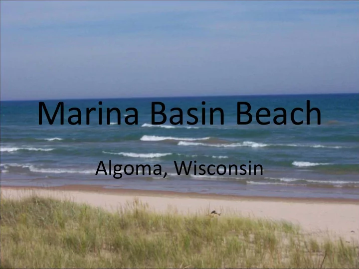
Marina Basin Beach Algoma, Wisconsin Looking east over Marina Basin Beach in the City of Algoma. Rip-rap lined trench conveys stormwater from the parking lot area. Looking west toward the shore area at Marina Basin Beach in the City of Algoma.
Looking east over Marina Basin Beach in the City of
the parking lot area.
Looking west toward the shore area at Marina Basin Beach in the City of Algoma.
Looking west toward the parking lot from the south break-wall at Marina Basin Beach in Algoma.
Stormwater conveyance off road and parking lot into water at Marina Basin Beach in Algoma.
Road and parking lot drainage directed to “beach” area directly north of Marina Basin Beach in Algoma.
Looking over the northeast corner of Crescent Beach toward the break-wall. Accumulation of Cladophora can be seen at the base of the break-wall. North stormwater discharge is visible at the bottom of the photo.
The north corner of Crescent Beach in Algoma, showing Cladophora accumulation at the break-wall.
North outfall at Crescent Beach in Algoma.
North stormwater discharge at Crescent Beach in Algoma.
Looking south along the boardwalk and over groomed sand at Crescent Beach in Algoma.
Looking north over groomed sand at a loafing seagull flock at Crescent Beach in Algoma.
Coyote decoy to discourage shorebirds at Crescent Beach, Algoma.
Looking south over the south end of Crescent Beach in Algoma.
Storm water discharge (≈ 12”) in the wet bank above the boardwalk at Crescent Beach, Algoma
Stormwater discharge in the west bank, above the boardwalk at the south end of Crescent Beach, Algoma.
Erosion caused by stormwater discharge near the visitor center at Crescent Beach, Algoma.
Stormwater discharge at Crescent Beach.
Looking east over the south stormwater outfall at Crescent Beach in the City of Algoma.
Looking northwest at the south storm-water
showing dry weather flow.
Drainage from the parking lot over the lawn area and toward the beach at Father Marquette Memorial Park in Kewaunee.
Looking north over a large Cladophora accumulation at Father Marquette Memorial Park beach in Kewaunee. The beach is very low and flat with severe Phragmites infestation.
Looking northeast over the beach area from existing revetment at Father Marquette Memorial Park in Kewaunee. The beach is very low and flat with severe Phragmites infestation and large accumulation of Cladophora. Breakwalls on both sides of the beach prevent circulation of water at this location.
Looking northeast over the beach area and “treated” Phragmites at Father Marquette Memorial Park beach in Kewaunee.
Looking west at the parking lot stormwater conveyance at Selner Park Beach in Kewaunee.
Looking south from Selner Park Beach in Kewaunee.
Looking west at the stormwater discharge area toward the north end of the Selner Park Beach in Kewaunee.
Stormwater flow path off the lawn area onto the Selner Park Beach in Kewaunee.
Looking north over the east edge of the parking lot at the Selner Park Beach in Kewaunee.
Looking east over the south end of the Selner Park beach in Kewaunee. Looking from the park on top of the bluff, west of the parking lot.
Street drainage to the parking lot and adjacent lawn area at the Selner Park beach in Kewaunee.
Standing at submerged stormwater discharge point at the end of an entrance street to the parking lot at Selner Park beach in Kewaunee.
Looking south over the Pioneer Park beach in
accumulations of Cladophora.
Parking lot area above the north end of the Pioneer Park beach in Kewaunee. Storm water from this lot and the street above discharges to the beach.
Stormwater discharge route from the street and parking lot area, above the north end of the Pioneer Park beach in Kewaunee.
Looking south over the volleyball area, just above the Pioneer Park beach in Kewaunee. Sand on the volleyball courts appears to be recently placed fill.
The end of the curb line at the back parking lot above Pioneer Park beach in Kewaunee. It allows storm flow to exit the lot and flow toward the beach.
Looking south over the Pioneer Park beach in Kewaunee. This low, flat beach has accumulations of matted Cladophora.
A view of the Pioneer Park beach in Kewaunee. This low, flat beach has accumulations of matted Cladophora.
BEFORE: Low, flat beach with large swash zone. Rock jetties reduce water movement.
BEFORE: Low, flat beach with large swash zone. Minimal vegetation to hold sand in place. Waterfowl loafing helps create environment for bacterial growth.
BEFORE: Low, flat beach with large swash zone. Large populations of waterfowl consistently utilizing beach area.
DURING CONSTRUCTION: Beach is nourished to minimize swash zone and improve infiltration. Native plantings are used to hold sand in place and discourage waterfowl. Stormwater runoff is treated through infiltration and bio- infiltration prior to entering the sandy beach area.
DURING CONSTRUCTION: Native plantings improve aesthetics, treat stormwater, and hold sand in place. Walkways and picnic areas are established throughout the planting area.
AFTER: Beach is higher and drier as a result of beach nourishment.
AFTER: Native vegetation assists in holding sand in place, treating stormwater runoff from parking lot and nearby roadways, and preventing waterfowl loafing.
AFTER: Boardwalks and pathways direct beachgoers to sandy beach area with minimal disturbance to vegetation.
AFTER: Picnic areas are designated throughout park/beach area.