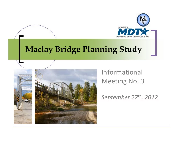
Maclay Bridge Planning Study Informational Meeting No. 3 September 27 - - PowerPoint PPT Presentation

maclay bridge planning study
SMART_READER_LITE
LIVE PREVIEW

Maclay Bridge Planning Study Informational Meeting No. 3 September 27 - - PowerPoint PPT Presentation

Maclay Bridge Planning Study Informational Meeting No. 3 September 27 th , 2012 1 Outline of this Evenings Meeting Title VI considerations Meeting ground rules Existing and projected conditions additional work since last public


slide-1
SLIDE 1

Maclay Bridge Planning Study

Informational Meeting No. 3

September 27th, 2012

1

slide-2
SLIDE 2

Outline of this Evening’s Meeting

 Title VI considerations  Meeting ground rules  Existing and projected conditions –

additional work since last public meeting

 Needs and objectives  Options under consideration  Next steps & conclusion

I N F O R M AT I O N A L M E E T I N G N O . 3 S E P T E M B E R 2 7 T H, 2 0 1 2

2

slide-3
SLIDE 3

TITLE VI Considerations

TITLE VI

This meeting is held pursuant to Title VI of the 1964 Civil Rights Act which ensures that no person shall, as provided by Federal and State Civil Rights laws, be excluded from participation in, denied the benefits of, or be otherwise subjected to discrimination on the basis of a protected status during any MDT project. Further information is available in Title VI pamphlets available at the sign‐in table

I N F O R M AT I O N A L M E E T I N G N O . 3 S E P T E M B E R 2 7 T H, 2 0 1 2

3

slide-4
SLIDE 4

Meeting Ground Rules ‐ Format

 Presentation

 Please, no interruptions……

 Hold questions and/or comments for after

presentation

 Will be available as long as necessary

tonight!

4

I N F O R M AT I O N A L M E E T I N G N O . 3 S E P T E M B E R 2 7 T H, 2 0 1 2

slide-5
SLIDE 5

Meeting Ground Rules ‐ Guidance

 Please help maintain an atmosphere where

everyone feels comfortable and welcome

Please don’t interrupt anyone while they are speaking

Please remain quiet so others can hear

Please leave the room for side discussions

Please refrain from addressing the audience or asking for audience participation

Please turn off cell phones and pagers or set them to vibrate

5

I N F O R M AT I O N A L M E E T I N G N O . 3 S E P T E M B E R 2 7 T H, 2 0 1 2

slide-6
SLIDE 6

Existing & Projected Conditions – Additional Work Since Last Public Meeting

6

I N F O R M AT I O N A L M E E T I N G N O . 3 S E P T E M B E R 2 7 T H, 2 0 1 2

slide-7
SLIDE 7

Revisions include:

Fracture‐critical nature of bridge truss

Potential for scour at bridge abutments and piers, and unknown conditions underneath

Health and function of river and how bridges in general may impact riverine environments

Emergency response times and how the Maclay Bridge may impact responders

Additional work on the regional travel demand model by Missoula MPO and MDT

7

Revisions to Existing & Projected Conditions Report

I N F O R M AT I O N A L M E E T I N G N O . 3 S E P T E M B E R 2 7 T H, 2 0 1 2

slide-8
SLIDE 8

Needs and Objectives

8

I N F O R M AT I O N A L M E E T I N G N O . 3 S E P T E M B E R 2 7 T H, 2 0 1 2

slide-9
SLIDE 9

Needs and Objectives Overview

Based on a high‐level review of:

Existing data

Input from resource agencies, stakeholders and the public

Reflect the existing social, environmental, and engineering conditions described in the draft Existing and Projected Conditions Report

9

I N F O R M AT I O N A L M E E T I N G N O . 3 S E P T E M B E R 2 7 T H, 2 0 1 2

slide-10
SLIDE 10

Need Number 1

Improve the safety and operation of the river crossing and connecting roadway network Objectives (To the Extent Practicable)

Improve sub‐standard elements of facilities to meet current applicable design standards

Reduce delay and vehicle restriction for emergency responders under existing and future traffic demands

Manage travel speeds and provide adequate clear zones to improve operations

10

I N F O R M AT I O N A L M E E T I N G N O . 3 S E P T E M B E R 2 7 T H, 2 0 1 2

slide-11
SLIDE 11

Need Number 2

Provide a long‐term river crossing and connecting roadway network that accommodates planned growth in the Maclay Bridge area Objectives (To the Extent Practicable)

Accommodate existing and future capacity demands

Address non‐motorized facilities consistent with local planning efforts

Provide connectivity to neighborhood residents, and regional users accessing recreational lands to the west of the Bitterroot River

11

I N F O R M AT I O N A L M E E T I N G N O . 3 S E P T E M B E R 2 7 T H, 2 0 1 2

slide-12
SLIDE 12

Need Number 3

Minimize adverse impacts from options to the environmental, cultural, scenic and recreational characteristics of the study area Objectives (To the Extent Practicable)

Minimize adverse impacts to the Bitterroot River from potential options

Minimize adverse impacts to the wildlife and aquatic organisms from potential options

Provide reasonable access to recreational sites in the study area (Kelly Island Fishing Access Site, Lolo National Forest, and Missoula County Parks)

Avoid or otherwise minimize adverse impacts to historic, cultural, and archaeological resources that may result from implementation of options

12

I N F O R M AT I O N A L M E E T I N G N O . 3 S E P T E M B E R 2 7 T H, 2 0 1 2

slide-13
SLIDE 13

Need Number 4

Minimize adverse impacts from options to the neighborhood characteristics of the study area Objectives (To the Extent Practicable)

Implement improvements with special sensitivity to area schools

Minimize impacts to existing residents and businesses in the area

Recognize the historic value of the Maclay Bridge to the community and the role it plays in local regional events

13

I N F O R M AT I O N A L M E E T I N G N O . 3 S E P T E M B E R 2 7 T H, 2 0 1 2

slide-14
SLIDE 14

Other Considerations

Other Considerations (To the Extent Practicable)

Options should be sensitive to the availability of funding for recurring maintenance obligations or for the construction of new improvements

14

The subject of parking, vandalism, illegal activity, and enforcement, along with perpetuating recreation access to the Bitterroot River, are areas of concern generally outside the scope of this Maclay Bridge Planning Study. However, they are areas of concern that have been documented and commented on by members of the public.

I N F O R M AT I O N A L M E E T I N G N O . 3 S E P T E M B E R 2 7 T H, 2 0 1 2

slide-15
SLIDE 15

Options Under Consideration

15

I N F O R M AT I O N A L M E E T I N G N O . 3 S E P T E M B E R 2 7 T H, 2 0 1 2

slide-16
SLIDE 16

Four (4) Categories of Options Being Considered

Category number 1 includes options that will improve safety and operations on the existing bridge

Category number 2 includes options to rehabilitate the existing bridge

Category number 3 includes options to build a new bridge at various locations

Category number 4 includes the “do nothing” option

16

I N F O R M AT I O N A L M E E T I N G N O . 3 S E P T E M B E R 2 7 T H, 2 0 1 2

slide-17
SLIDE 17

Option 1A: Enhance Traffic Operations and Safety on and near the Existing Structure

Minor improvements intended to enhance traffic

  • perations and safety on and near the Maclay Bridge

New signals along each approach to regulate traffic flows by direction and address sight distance limitations

Street lighting at the westerly approach with signage on both ends

Missoula County perform periodic maintenance activities

No changes to the configuration or alignment of the approaches

17

I N F O R M AT I O N A L M E E T I N G N O . 3 S E P T E M B E R 2 7 T H, 2 0 1 2

slide-18
SLIDE 18

Option 1B: Maintain Current Usage and Add Bicycle/Pedestrian Facilities

Incorporates separated pedestrian/bicyclist facilities in the vicinity of Maclay Bridge

Limited improvements for non‐motorized users on the approaches to the bridge

Shoulder widening on River Pines Road, signing and striping

  • n both sides of the bridge, and pavement markings

A new, separated non‐motorized bridge would be necessary adjacent to the existing Maclay Bridge

No changes to the alignment of the approaches

18

I N F O R M AT I O N A L M E E T I N G N O . 3 S E P T E M B E R 2 7 T H, 2 0 1 2

slide-19
SLIDE 19

Option 1C: Implement Additional Restrictions on Use

Additional use restrictions on Maclay Bridge, such as:

Restricting vehicle use of the structure to one travel direction (i.e. a one‐way route)

Further reducing travel speeds

Prohibition of use by all large trucks, school buses, and emergency vehicles; or

Increased enforcement of parking ordinance (no tolerance policy)

No changes to the alignment

19

I N F O R M AT I O N A L M E E T I N G N O . 3 S E P T E M B E R 2 7 T H, 2 0 1 2

slide-20
SLIDE 20

Option 1D: Close Bridge to Vehicles and Retain Use for Non-Motorized Travel Modes

Close Maclay Bridge to vehicular traffic, but allow non‐ motorized transportation modes

Further investment in active transportation facilities in the Maclay Bridge area would be necessary

Vehicle access across the Bitterroot River would be via the Kona Ranch Bridge or Buckhouse Bridge (via US Highway 93)

Eliminates through traffic on North Avenue and River Pines Road

Inconveniences local residents and visitors

20

I N F O R M AT I O N A L M E E T I N G N O . 3 S E P T E M B E R 2 7 T H, 2 0 1 2

slide-21
SLIDE 21

Option 1E: Retain Bridge and Provide a New Bridge Elsewhere

Keeps existing bridge in service for vehicular traffic

Provides another structure somewhere else in the area to help meet existing and projected travel demands.

21

I N F O R M AT I O N A L M E E T I N G N O . 3 S E P T E M B E R 2 7 T H, 2 0 1 2

slide-22
SLIDE 22

Option 1F: New One-Lane Bridge at a New Location & Retain Existing Bridge for Non-Motorized Uses

New one‐lane bridge at a South Avenue extension ‐ similar to that of the existing bridge

I.e. carries two‐way vehicular traffic across a new one‐lane bridge at South Avenue

Existing Maclay Bridge could remain as a non‐ motorized facility that does not meet design standards (Missoula County, MDT, or AASHTO)

22

I N F O R M AT I O N A L M E E T I N G N O . 3 S E P T E M B E R 2 7 T H, 2 0 1 2

slide-23
SLIDE 23

Option 1G: New One-Lane Bridge at a New Location & Retain Existing Bridge for One-Way Travel

Existing Maclay Bridge would be rehabilitated for one‐ way travel only

I.e. westbound or eastbound travel only

New single lane bridge at the extension of South Avenue would also be used for one‐way travel

In the opposite direction from that of the existing Maclay Bridge

Modifies travel patterns in a dramatic fashion over existing traffic flow

23

I N F O R M AT I O N A L M E E T I N G N O . 3 S E P T E M B E R 2 7 T H, 2 0 1 2

slide-24
SLIDE 24

Option 1H: Close Bridge and Remove Structure

Closes and removes existing Maclay Bridge

No replacement bridge would be provided in the area

Vehicles would use the Kona Ranch Bridge or Buckhouse Bridge

Would require roadway closures with barricades and adequate turnaround area(s) for vehicles near the ends of the existing bridge

Utilities installed on the bridge would need to be relocated

24

I N F O R M AT I O N A L M E E T I N G N O . 3 S E P T E M B E R 2 7 T H, 2 0 1 2

slide-25
SLIDE 25

Option 2A: Minor Rehabilitation

Rehabilitation tasks:

Tighten and/or replace loose bolts

Spot painting of structural steel

Cleaning of bearings to remove moss and/or soil

Crack sealing of asphalt surfacing to prolong surface

Minor repairs and upgrades to the truss and floor system to increase load capacity

Shorter lifespan than a major rehabilitation effort

Would not eliminate inherent safety concerns

Ongoing inspections and related maintenance activities would still be needed

25

I N F O R M AT I O N A L M E E T I N G N O . 3 S E P T E M B E R 2 7 T H, 2 0 1 2

slide-26
SLIDE 26

Option 2B: Major Rehabilitation

Goal of a major rehabilitation would be to extend the life of the bridge 50 to 100 years

Does not address substandard geometry of the existing bridge or roadway approaches, or the fracture critical nature of the truss structure

Could allow the bridge to handle full legal loads so that there would be no need for a load posting

Ongoing inspections and related maintenance activities is a long‐term commitment due to the increase in life span

26

I N F O R M AT I O N A L M E E T I N G N O . 3 S E P T E M B E R 2 7 T H, 2 0 1 2

slide-27
SLIDE 27

Option 2B: Major Rehabilitation

Major rehabilitation would likely consist of the following specific work features:

Sand blast rusted steel members and re‐paint as needed

Replace steel stringers and floor beams as determined necessary

Upgrade truss members as determined necessary

Evaluate abutments and piers for repair versus replacement

Replace bearing devices

Replace the short span pony truss with a new one lane truss

Rehabilitating the main truss will likely require removing the main truss from the river, rebuilding or repairing offsite and installation

Possible abutment and pier upgrades or replacement

27

I N F O R M AT I O N A L M E E T I N G N O . 3 S E P T E M B E R 2 7 T H, 2 0 1 2

slide-28
SLIDE 28

Option 3 “New Locations” Graphic

28

I N F O R M AT I O N A L M E E T I N G N O . 3 S E P T E M B E R 2 7 T H, 2 0 1 2

slide-29
SLIDE 29

Option 3A: Build New Bridge Connecting to North Avenue

On existing alignment

Off existing alignment but near North Avenue

North 1

North 2

29

I N F O R M AT I O N A L M E E T I N G N O . 3 S E P T E M B E R 2 7 T H, 2 0 1 2

slide-30
SLIDE 30

Option 3B: Build New Bridge Northern Alignment

  • S. 3rd Street West

30

I N F O R M AT I O N A L M E E T I N G N O . 3 S E P T E M B E R 2 7 T H, 2 0 1 2

Spurgin Road

slide-31
SLIDE 31

Option 3B: Build New Bridge Mount Avenue Alignment

Mount 1

Mount 2

31

I N F O R M AT I O N A L M E E T I N G N O . 3 S E P T E M B E R 2 7 T H, 2 0 1 2

slide-32
SLIDE 32

Option 3B: Build New Bridge Edward Avenue Alignment

Edwards 1

Edwards 2

32

I N F O R M AT I O N A L M E E T I N G N O . 3 S E P T E M B E R 2 7 T H, 2 0 1 2

slide-33
SLIDE 33

Option 3B: Build New Bridge South Avenue Alignment

South 1

South 2

33

I N F O R M AT I O N A L M E E T I N G N O . 3 S E P T E M B E R 2 7 T H, 2 0 1 2

slide-34
SLIDE 34

Option 3B: Build New Bridge Sundown Road Alignment

Sundown 1

Sundown 2

34

I N F O R M AT I O N A L M E E T I N G N O . 3 S E P T E M B E R 2 7 T H, 2 0 1 2

slide-35
SLIDE 35

Option 3B: Build New Bridge Southern Alignment

Humble Road / Blue Mountain Road

35

I N F O R M AT I O N A L M E E T I N G N O . 3 S E P T E M B E R 2 7 T H, 2 0 1 2

slide-36
SLIDE 36

Option 3B: Build New Bridge New Location Not Identified in 1994 EA

New locations

None identified……

36

I N F O R M AT I O N A L M E E T I N G N O . 3 S E P T E M B E R 2 7 T H, 2 0 1 2

slide-37
SLIDE 37

Option 4A: Do Nothing

Represents current situation for Maclay Bridge

Bridge would remain in its present configuration

Periodic maintenance to keep the structure in service under its current load limitation

No changes to the configuration or alignment of the approaches

Traffic operations at and near the Maclay Bridge would be unchanged

Pedestrian and bicyclist travel would continue on the existing roadway or other facilities in the area

37

I N F O R M AT I O N A L M E E T I N G N O . 3 S E P T E M B E R 2 7 T H, 2 0 1 2

slide-38
SLIDE 38

Next Steps and Conclusion

38

I N F O R M AT I O N A L M E E T I N G N O . 3 S E P T E M B E R 2 7 T H, 2 0 1 2

slide-39
SLIDE 39

Next Steps

Continue study coordination and outreach

Finalize existing and projected conditions report

Finalize transportation system needs & objectives

Identify potential improvement options

Screen potential improvement options based on screening process (under development)

Draft corridor study report

39

I N F O R M AT I O N A L M E E T I N G N O . 3 S E P T E M B E R 2 7 T H, 2 0 1 2

slide-40
SLIDE 40

Study Schedule

40

I N F O R M AT I O N A L M E E T I N G N O . 3 S E P T E M B E R 2 7 T H, 2 0 1 2

slide-41
SLIDE 41

Prepare Planning Study Report

 Draft Study Report (December 2012)

 Available to the public

 Posted on website  In conjunction with Informational Meeting 4

 Typically 3‐week review

 Finalize the Study Report

41

I N F O R M AT I O N A L M E E T I N G N O . 3 S E P T E M B E R 2 7 T H, 2 0 1 2

slide-42
SLIDE 42

Conclusion

Questions, answers and/or comments?

Study website:

http://www.mdt.gov/pubinvolve/maclay/

Study contacts:

Sheila Ludlow Montana Department of Transportation Statewide and Urban Planning PO Box 201001 Helena, Montana 59620‐1001 Email: sludlow@mt.gov Tel:(406) 444‐9193 Lewis YellowRobe Missoula County Office of Planning and Grants 435 Ryman Street Missoula, MT 59802 Email: lyellowrobe@co.missoula.mt.us Tel:(406) 258‐4651 Erik Dickson Missoula County

  • Dept. of Public Works

6089 Training Drive Missoula, MT 59808 Email: edickson@co.missoula.mt.us Tel:(406) 258‐3772

42

I N F O R M AT I O N A L M E E T I N G N O . 3 S E P T E M B E R 2 7 T H, 2 0 1 2