Ma#hew Minnick Ph D. Graduate Student Colorado School of - - PowerPoint PPT Presentation

ma hew minnick ph d graduate student colorado school of
SMART_READER_LITE
LIVE PREVIEW

Ma#hew Minnick Ph D. Graduate Student Colorado School of - - PowerPoint PPT Presentation

Ma#hew Minnick Ph D. Graduate Student Colorado School of Mines Co-Author Dr. Wendy (Wei) Zhou Brief IntroducCon to the Project Funding


slide-1
SLIDE 1

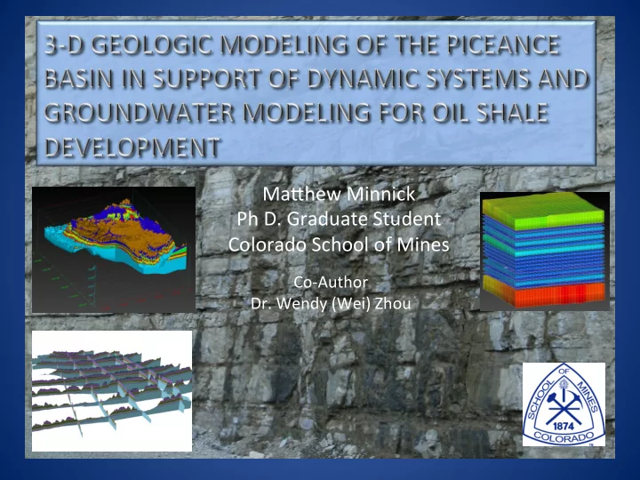
Ma#hew ¡Minnick ¡ Ph ¡D. ¡Graduate ¡Student ¡ Colorado ¡School ¡of ¡Mines ¡

Co-­‑Author ¡ ¡

  • Dr. ¡Wendy ¡(Wei) ¡Zhou ¡
slide-2
SLIDE 2

Brief ¡IntroducCon ¡to ¡the ¡Project ¡

  • Funding ¡Agency: ¡NETL/DOE, ¡DE-­‑NT0006554 ¡ ¡
  • DuraCon: ¡October ¡2008 ¡~ ¡September ¡2011 ¡
  • Goal: ¡To ¡develop ¡a ¡water ¡resource ¡geospaCal ¡

infrastructure ¡that ¡serves ¡as ¡“baseline ¡data” ¡for ¡ creaCng ¡soluCons ¡on ¡water ¡resource ¡management ¡ and ¡for ¡making ¡decisions ¡on ¡oil ¡shale ¡resource ¡ development ¡in ¡the ¡Western ¡U. ¡S. ¡

– Project ¡Team: ¡ – Colorado ¡School ¡of ¡Mines: ¡Wei ¡(Wendy) ¡Zhou, ¡Ma# ¡Minnick, ¡ Mengistu ¡Geza, ¡Jerry ¡Boak, ¡Elif ¡Acikalin ¡ – University ¡of ¡Texas ¡at ¡San ¡Antonio: ¡Kyle ¡Murray, ¡Tuan ¡B ¡Le ¡ – Idaho ¡Na:onal ¡Laboratory: ¡Earl ¡Ma#son, ¡Carl ¡Palmer ¡

slide-3
SLIDE 3

ObjecCve ¡

  • Construct ¡a ¡3-­‑D ¡geologic ¡framework ¡of ¡the ¡

Piceance ¡Basin ¡to ¡support ¡interpolaCon ¡of ¡ Fisher ¡Assay ¡data, ¡geohydrologic ¡parameters, ¡ fracture ¡distribuCon ¡

  • Extract ¡spaCally ¡Ced ¡input ¡parameters ¡for ¡a ¡

Systems ¡Dynamic ¡Retort ¡Model, ¡and ¡provide ¡ grid ¡geometry ¡input ¡for ¡MODFLOW ¡and ¡ PARFLOW ¡models. ¡ ¡

slide-4
SLIDE 4

DOE, ¡2008 ¡

slide-5
SLIDE 5

USGS, ¡2009 ¡

slide-6
SLIDE 6

USGS, ¡2009 ¡

Green ¡River ¡FormaCon ¡Cross ¡SecCon ¡

slide-7
SLIDE 7

Full ¡Basin ¡Cross ¡SecCon ¡ USGS, ¡2003 ¡

E-­‑W ¡Piceance ¡Basin ¡Cross ¡SecCon ¡

slide-8
SLIDE 8

GeospaCal ¡ Infrastructure ¡

slide-9
SLIDE 9

Geologic ¡Mapping ¡

slide-10
SLIDE 10

Geologic ¡FormaCon ¡Tops ¡Data ¡

slide-11
SLIDE 11

Fisher ¡Assay ¡Samples ¡(Oil ¡Content ¡ GPT) ¡

slide-12
SLIDE 12

Fisher ¡Assay ¡Samples ¡(Water ¡Content ¡GPT) ¡

slide-13
SLIDE 13

Structure ¡Map ¡

slide-14
SLIDE 14
slide-15
SLIDE 15

Output ¡to ¡3-­‑D ¡ArcGIS ¡Files ¡

slide-16
SLIDE 16

Retort ¡Grid ¡

Extract ¡Retort ¡

slide-17
SLIDE 17
slide-18
SLIDE 18
slide-19
SLIDE 19
slide-20
SLIDE 20

Smith, ¡1980 ¡

slide-21
SLIDE 21

Fracture ¡Pictures ¡

Conceptual ¡Fracture ¡Model ¡

Taylor, ¡1987 ¡

slide-22
SLIDE 22
slide-23
SLIDE 23

Taylor, ¡87 ¡ Shells ¡Freeze ¡Wall ¡ ArCsts ¡RendiCon ¡ ¡

slide-24
SLIDE 24

Extracted ¡Retort ¡Nodal ¡Data ¡

slide-25
SLIDE 25

Ficke, ¡J. ¡F., ¡Weeks, ¡J.B., ¡Welder, ¡F. ¡A., ¡ (1974), ¡Hydrologic ¡Data ¡from ¡the ¡Piceance ¡ Basin, ¡Colorado ¡Colorado ¡Water ¡Resources ¡ Basic ¡Data ¡Release ¡No.31USGS ¡ DOE ¡Hydrologic ¡CharacterizaCon ¡of ¡ NOSR ¡1, ¡1982, ¡DOE/RA/32012-­‑T23 ¡ Dougan ¡P.M., ¡Markley ¡D.E., ¡Munson ¡S.D., ¡ (1980) ¡Geohydrology ¡and ¡Surface ¡Water ¡ Hydrology ¡Programs ¡of ¡the ¡Equity/DOE ¡ BX ¡In-­‑Situ ¡Oil ¡Shale ¡Project ¡Rio ¡Blanco ¡ County, ¡Colorado. ¡ ¡ ¡ ¡13th ¡Annual ¡Oil ¡Shale ¡ Symposium ¡Colorado ¡School ¡of ¡Mines ¡ Coffin ¡D. ¡L., ¡Welder ¡F. ¡A., ¡Glanzman ¡R. ¡K., ¡ Du#on ¡X. ¡W., ¡(1968) ¡Geohydrologic ¡Data ¡ from ¡the ¡Piceance ¡Creek ¡Basin ¡Between ¡ the ¡White ¡and ¡Colorado ¡Rivers, ¡ Northwestern ¡Colorado, ¡USGS ¡and ¡ Colorado ¡Water ¡ ¡ ¡Weeks ¡J. ¡B., ¡Dale ¡R. ¡H., ¡(1978) ¡ Hydrologic ¡analysis ¡of ¡the ¡U.S. ¡Bureau ¡of ¡ Mines ¡Underground ¡Oil-­‑Shale ¡Research-­‑ Facility ¡Site, ¡Piceance ¡Creek ¡Basin, ¡ ¡USGS ¡ Water ¡Resources ¡InvesCgaCon ¡78-­‑28 ¡

Data ¡Sources ¡

slide-26
SLIDE 26

V-­‑Code ¡and ¡Parameter ¡Input ¡Tables ¡

slide-27
SLIDE 27

Input from GIS Database Modeling Output to Decision Support

Dynamic ¡Systems ¡Modeling ¡

Process Models Control Technologies Local/Regional Response Models

slide-28
SLIDE 28

Retort ¡Model ¡

  • E. ¡Ma#son, ¡2009 ¡
slide-29
SLIDE 29
  • E. ¡Ma#son, ¡2009 ¡

Water ¡Usage ¡with ¡Time ¡

slide-30
SLIDE 30

Groundwater ¡Data ¡Model ¡

slide-31
SLIDE 31

CGS, ¡2004 ¡

slide-32
SLIDE 32

Geologic ¡Framework ¡Flexibility ¡

Taylors ¡Layers ¡ ¡ ¡/ ¡ ¡ ¡Shells ¡Layers ¡

CorrelaCon ¡Chart ¡for ¡Hydrogeologic ¡Units ¡(Taylor, ¡1982) ¡

FORMATION MEMBER OIL SHALE ZONES & MARKER UNITS HYDROGEOLOGIC UNITS GENERAL HYDROGEOLOGIC FUNCTION MODFLOW LAYER AVERAGE THICKNESS (FEET) Surficial Alluvium Surficial Aquifer Layer1 50 Uinta Hydro5 Upper Aquifers Layer2 360 Green River Parachute Creek Hydro4 Layer3 350 A groove Mahogany Hydro3 Aquitard Layer4 141 B groove Hydro2 Lower Aquifers Layer5 174 R-6 L-5 Hydro1 Layer6 435 R-5 L-4 R-4 L-3 R-3 L-2 R-2 Garden Gulch L-1 Hydro0 Aquitard Layer7 NA R-1 L-0 R-0

Wasatch

slide-33
SLIDE 33

PARFLOW ¡Model ¡

  • Developed ¡at ¡Lawrence ¡Livermore ¡NaConal ¡

Laboratories ¡

  • Fully ¡coupled ¡surface/GW ¡model ¡with ¡a ¡common ¡

land ¡model ¡

  • Simulate ¡climate ¡change ¡effects ¡
  • Designed ¡to ¡run ¡on ¡parallel ¡processors ¡
  • Non-­‑linear ¡
  • Richards ¡equaCon ¡
  • MulC-­‑grid ¡conjugate ¡gradient ¡solver ¡
slide-34
SLIDE 34

PARFLOW ¡Model ¡Solidfile ¡Geometry ¡

slide-35
SLIDE 35

Forward ¡

  • Geologic ¡Model ¡

– Refine ¡surface ¡contacts ¡ – Add ¡Mesaverde ¡ – Fisher ¡Assay ¡Data ¡Refinement ¡and ¡InterpolaCon ¡

¡

  • Water ¡Balance ¡Model ¡

– Based ¡on ¡Systems ¡Dynamic ¡Model ¡Grid ¡Layer ¡

  • ArcGIS ¡Server ¡3D ¡Data ¡Layer ¡DistribuCon ¡

– Coarser ¡resoluCon ¡Layers ¡

slide-36
SLIDE 36

Summary ¡

  • 3-­‑D ¡Geologic ¡Model ¡

– Construct ¡geologic ¡framework ¡of ¡basin ¡ – Interpolate ¡Fisher ¡Assay ¡data ¡ – Interpolate ¡fracture ¡data ¡ – Generate ¡geohydrologic ¡parameters ¡ – Extract ¡input ¡files ¡for ¡Systems ¡Dynamic ¡Retort ¡ Model ¡ – Provide ¡flexible ¡framework ¡for ¡flow ¡modeling ¡

slide-37
SLIDE 37

QuesCons? ¡