
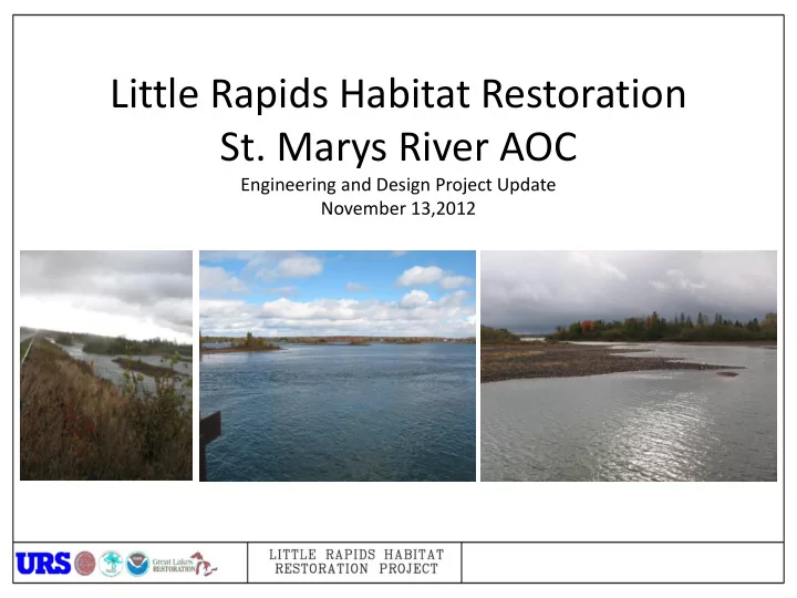
SLIDE 1
Little Rapids Habitat Restoration
- St. Marys River AOC
Engineering and Design Project Update November 13,2012
Little Rapids Habitat Restoration St. Marys River AOC Engineering - - PowerPoint PPT Presentation
Little Rapids Habitat Restoration St. Marys River AOC Engineering and Design Project Update November 13,2012 Why Restore the Rapids? Rapids are productive Lake Whitefish Lake Herring habitat for a number of important species. Walleye
Engineering and Design Project Update November 13,2012
habitat for a number of important species.
in the St. Marys River have been destroyed.
populations in the St. Marys River.
have economic benefits.
Walleye Lake Herring Lake Sturgeon Main Rapids Rapids btwn Sugar Island and Neebish Island West of Neebish Island Little Rapids 1 3 4 2
1 2 3 4
Lake Whitefish
Q1: What will be the impact on river flows? Will flow and/ or water level change in the main shipping channel, through the little rapids area and north of the island? Answer: The flow diverted through the lower rapids is approximately 4% of total flow above the rapids. 95% of this flow is from the shipping channel. The diverted flow volume is small compared to total flow. Thus, changes to water depths and velocity in the shipping channel and Lake George Channel are small (<0.1 ft and <0.1 ft/s at low flows) Q2: How will flow changes impact shipping, water quality, ice formation (in the shipping channel and within the little rapids area), the ferry, and the causeway. Answer: Since flow, depth and velocity changes in the Shipping Channel and Lake George channel are very small conditions related to water quality and ice formation will not change. In the Little Rapids area velocities increase (this is the goal of the project). This will reduce ice formation in the rapids area. Velocities near the ferry dock are the same with and without modifications to the causeway and thus no change related to ice in this area is predicted. Q3: How will this project affect the North End WWTP issues? Answer: The water diverted through the rapids lessens flow in the Lake George channel, but does not “pull” water from near the WWTP back to the rapids. Thus, conditions in the Little Rapids area will not change from as they currently exist. Q4: How much will O&M be on the bridge and who will pay for it? Answer: TBD. Once the preferred alternative is selected O&M will be estimated.
Q5: How large of a bridge is expected? Answer: We are considering spans from 400 feet to 1,000 feet Q6: Traffic maintenance during construction is critical to Island Residents. How will this be done? Answer: One lane of traffic will be maintained during construction. Queuing and timing of traffic will be coordinated with ferry operations. Construction is expected to take 6 - 8 months. Q7: The lower little rapids is very nice swimming during the summer and because of solid ice supports ice skating and snowshoeing during the summer. Will the project impact these activities? Answer: The project will mostly increase velocities in the main channel of the lower little rapids. Near shore areas will change less. Thus, impacts to swimming near shore will be minimally impacted and swimmers in the main channel will have to contend with increased velocities and flow. Increased velocities and flow will also reduce ice formation in this area. Q8: Many residents get their drinking water from Little Rapids Bay. Will the project impact their water supply? Answer: No. Changes to flow and velocity will not affect drinking water supply. Q9: Water levels are low now, but were historically higher. Will the project assess impacts at other lake levels? Answer: The project assessed impacts at 4 lake level and flow conditions. These included historically low (42,000 cfs) and high (127,000 cfs) levels, biologically important (82,000 cfs) flows and an average of recent conditions (62,000 cfs).
Little Rapids
(Area assessed for Direct impacts)
Soo Locks Lake George Channel Lake George Study Area for Environmental Assessment Sault Ste. Marie, Ontario – WWTP
Habitat Restoration Target
Proposed Bridge Alternatives
Impacts Related to Construction:
Velocities, water depths and flow are identical for all alternatives considered for most of the study area. Only near the Little Rapids area are differences predicted (See Table Inset for differences).
Velocities comparison for existing conditions and no causeway conditions
Location Discharge (CFS) Velocity (feet/sec) Water Surface Elevation (feet IGLD) Shipping Channel
0.0 North Channel
0.0 0.0 Lower Little Rapids 3,918 3.0
Cloverland Power Canal
Velocities above and below the causeway under existing conditions are less than 0.1 m/s (0.33 ft/s) Velocities above and below the causeway with a 600’ bridge under high flow conditions are a maximum of 1.15 m/s (3.8 ft/s) Velocities comparison for 600’ bridge under high flow conditions of 3,596 m3/s (127,000 f3/s)
Impacts Related to Velocity:
Little Rapids Velocities (fps) at 42,000 cfs Inflow Alternative Ship Channel North Channel Upper Rapids West Upper Rapids East Lower Rapids West Lower Rapids East Lake George Habitat (Acreage >0.8 fps) Causeway (Ex) 3.2 0.8 0.2 0.1 0.0 0.0 0.2 0.17 No Causeway 3.1 0.8 0.7 0.6 1.6 2.1 0.3 9.32 A (600 ft) 3.2 0.8 0.5 0.0 1.3 0.1 0.2 7.02 B (400 ft) 3.2 0.8 0.9 0.0 2.0 0.0 0.2 2.94 C (800 ft) 3.2 0.8 0.9 0.9 1.2 0.7 0.2 2.84 D (1,000 ft) 3.1 0.8 0.9 0.8 1.3 0.6 0.2 8.12 E (600 ft) 3.2 0.8 0.9 1.0 1.3 0.8 0.2 3.02 F (800 ft) 3.1 0.8 0.8 0.7 1.4 0.5 0.2 8.58 Little Rapids Velocities (fps) at 127,000 cfs Inflow Alternative Ship Channel North Channel Upper Rapids West Upper Rapids East Lower Rapids West Lower Rapids East Lake George Habitat (Acreage >0.8 fps) Causeway (Ex) 6.0 1.3 0.2 0.1 0.0 0.0 0.5 4.95 No Causeway 5.3 1.4 1.3 2.1 2.6 3.1 0.4 116.79 A (600 ft) 5.6 1.5 1.5 0.1 3.8 0.1 0.4 57.45 B (400 ft) 5.8 1.5 1.6 0.1 3.1 0.1 0.4 43.13 C (800 ft) 5.6 1.4 1.3 2.3 2.7 2.2 0.4 69.92 D (1,000 ft) 5.5 1.4 1.3 2.1 3.2 1.8 0.4 84.67 E (600 ft) 5.6 1.4 1.4 2.5 2.6 2.4 0.4 75.36 F (800 ft) 5.5 1.4 1.3 2.3 3.6 1.2 0.4 79.01
Water surface elevations above and below the causeway under existing conditions Water surface elevations above and below the causeway with a 600’ bridge. Water elevations throughout study area unchanged. Water surface elevation comparison for 600’ bridge with flow conditions of 2,322 m3/s (82,000 f3/s)
Impacts Related to Water Level:
Alternative Costs
Alternative Effective Length Bridge w/Full Length Fishing Bridge No Fishing Bridge Fishing at Ends Full Length Fishing Box Culverts Three Sided Culverts CMP Culverts A 600 $5,125,560 $4,267,560 $4,767,560 $5,894,394 $9,458,988 $6,733,122 B 400 $3,417,040 $2,845,040 $3,345,040 $3,929,596 $6,305,992 $4,488,748 C 800 $6,834,080 $5,690,080 $6,190,080 $7,859,192 $12,611,984 $8,977,496 D 1000 $8,542,600 $7,112,600 $7,612,600 $9,823,990 $15,764,980 $11,221,870 E 600 $5,125,560 $4,267,560 $4,767,560 $5,894,394 $9,458,988 $6,733,122 F 800 $6,834,080 $5,690,080 $6,190,080 $7,859,192 $12,611,984 $8,977,496
Caveats/disclaimers: 1. Limited soil information (This is a BIG
temporary roads, etc) 2. Doesn’t account for number of spans 3. Study level cost analysis (i.e. not very detailed) 4. Study level structural analysis A. sheeting at approach fishing areas not designed B. abutments not designed C. Piers not yet designed D. scour depths not yet known
Length of Spans August 2009 Scenario 4-year Scenario High Scenario % Restored Model Run (feet) Acreage >0.8 fps Acreage >0.8 fps Acreage >0.8 fps (Aug 09 - 4-yr – High) Existing Conditions N/A 0.17 0.62 4.95 NA No Causeway 2,500 9.32 25.97 116.79 100%
600 7.02 20.38 57.45 75% - 78% - 49%
400 2.94 9.05 43.13 32% - 35% - 37%
400 & 400 2.84 11.00 69.92 30% - 42% - 60%
600 & 400 8.12 25.40 84.67 87% - 98% - 72%
400 & 200 3.02 12.68 75.36 32% - 49% - 65%
600 & 200 8.58 24.92 79.01 92% - 96% - 68%
– Determine impacts and mitigation actions for impacts to natural and built environment
– Determine impacts of alternatives to flows, velocities and depth under a variety of conditions
– Develop several conceptual alternatives and a detailed design for the selected alternative