
SLIDE 1
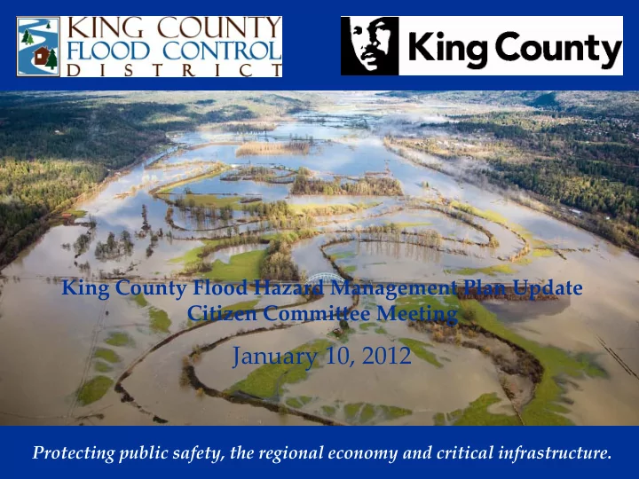
King County Flood Hazard Management Plan Update Citizen Committee Meeting
January 10, 2012
Protecting public safety, the regional economy and critical infrastructure.
January 10, 2012 Protecting public safety, the regional economy and - - PowerPoint PPT Presentation
King County Flood Hazard Management Plan Update Citizen Committee Meeting January 10, 2012 Protecting public safety, the regional economy and critical infrastructure. GOALS, OBJECTIVES AND GUIDING PRINCIPLES Goals of the King County Flood
King County Flood Hazard Management Plan Update Citizen Committee Meeting
Protecting public safety, the regional economy and critical infrastructure.
2.
3.
Key themes of the 14 plan objectives include:
risks
using cost-effective approach that sustains economic productivity
jurisdictions and organizations
Key themes of the 11 guiding principles include:
property
processes reduces cost
natural processes, including flooding
NOTE: We will revisit these again at the end
Hazard is the physical feature that is the source of risk
flooding, flow paths, river ecology, habitats, sediment and wood movement, and built impediments, i.e. bridges
habitat restoration projects, and to protect important features, i.e. flood conveyance and storage, rearing areas
Risk is the possibility of suffering harm or loss from the
exposure to a hazard
Floodplains and Floodways
Physical
Channel and overbank areas shaped by flowing water Allows for water to be conveyed and stored
Regulatory
Apply mathematical computations to estimate hydrology
(how much water) and hydraulics (extent of inundation) and to illustrate areas of flooding on a map
Zone A, AE, AO, AH
Also physical and
channel movement due to bank destabilization, rapid stream incision, bank erosion and shifts in the location of channel
Per King County Code, two hazard areas (Severe and Moderate)
Severe -- The total width of the severe channel migration hazard
area equals one hundred years times the average annual channel migration rate, plus the present channel width. The average annual channel migration rate as determined in the technical report, is the basis for each Channel Migration Zone map.
Moderate – area that lies between the severe channel migration
hazard area and the outer boundaries of the channel migration zone.
Channel Migration Zone – refer to handout
Since 1993, new flood hazard studies on major rivers and
recently along Vashon Maury Island and Incorporated marine shoreline
estimates of flood elevations) or where available mapping was notably erroneous, or areas of consequence.
Since 1991, channel migration studies and mapping on Tolt,
Raging, Green Rivers and the Three Forks of Snoqualmie
channel movement and erosion problems, or areas of consequence.
Alluvial fans: river-scale (i.e. lower Tolt and White),
Landslides: mass wasting along Cedar River Lahars: Mt. Rainier, along White and potentially
Seismic: Leveed reaches
Upper White and Greenwater are not yet updated (Zone A ) Continue checking for map accuracy to represent current day flood
hazards, i.e. channel capacity or infrastructure changes.
Large streams (Soos, Boise and Newaukum Creeks) having
approximate hazard mapping (Zone A)
Cedar, SF Skykomish and White Rivers – studies started Increased technical approaches to preparing CM mapping; allows for
improved application to the variety of physical settings, i.e. braided, alluvial fan, avulsions
How should remaining flood mapping needs be prioritized? Continue
to update unmapped river areas; start updating large streams? Should large stream updates within incorporated areas be addressed by cities?
Should recent studies be prioritized to be revised per the newly
proposed FEMA Levee Analysis and Mapping Procedures?
How should channel migration mapping proceed? Continue with
current county methodology or review all studies and reprioritize all river reaches?
Should assumed boundaries to migration, (i.e. levees, arterial roads,
railroads or sole access roads), continue to be considered “boundaries”? Should the “overnight line” be considered?
Should mapping of alluvial fans and lahars be prepared?
Focus is on reducing risk to
insurable buildings
Building standards (lowest floor at
elevation, foundation openings, anchoring buildings, flood resistant materials, etc.)
Encroachments in the floodplain
that will cause a rise in the FEMA floodway
State law addresses allowed uses
and substantial improvements in the FEMA floodway
Requirements to address the
Recognition of the natural and
Comprehensive flood plans developed by the county with
Once County adopts the plan it is “binding on each
Jurisdictions within the planning area must adopt the plan
Little enforcement of this state requirement
Policy G-11: Cities must meet
the minimum NFIP and state standards
Policy G-12: Encourages cities
to adopt higher standards
Policy G-13: Encourages “No
Adverse Impact Floodplain Management”
Current use taxation (282,151
acres)
Transfer of Development
Rights (TDR) (141,500)
Farmland Preservation Program
(13,200 acres)
Open space charter amendment
(154,393 acres)
Capital improvement projects
(170 levee repairs between 1990 and present, acquired 119 parcels and 284 acres of floodplain property since 2007, elevated 47 homes since 2000,
1.
2.
3.
1.
2.
Natural accumulations of sediment or large
Modifying the river channel is one tool that
Alter the distribution of sediment within a
Alter the corridor within which the channel
Kondolf and Matthews (1993)
Quantify in-channel sediment trends Quantify trends in floodwaters, flood hazards Consider effect of sediment on floodwater levels
Have flood hazards increased?
… beyond an identified acceptable threshold?
Are such increases attributable to sedimentation? If so: Consider Sediment Management Actions
Levee setback, flood-
Buy out and remove
Elevate structures at risk
Temporary flood protection
Proposed Countyline Levee Setback & Flood-plain Reconnection Project; Lower White River, Left Bank
Levee
Evaluate alternatives relative to:
Effectiveness in flood risk reduction Avoid or minimize environmental impacts Minimize long-term costs Consistency with Flood Plan Policies
Select a sediment management project Any potential sediment mgmt project would be
Flood Plan Figure 4-6,
Flood Plan Policy
South Fork Snoqualmie River Gravel Removal
http://www.kingcounty.gov/environment/waterandland/flooding/doc uments/south-fork-snoqualmie-gravel-removal-study.aspx
Channel Conveyance Capacity, Channel Change,
http://pubs.usgs.gov/sir/2010/5240/
City of Renton analyses for the 1998 Cedar River dredging. In Progress: Lower White, Lower Raging &Tolt, Mainstem
King County responds to requests to remove or
That response includes an onsite assessment of
In some cases, it is appropriate for King County to
1. Levees only reduce the risk to individuals and structures behind them. They do not eliminate the risk. 2. To the extent that development and investments occur behind levees, risk may actually increase for higher magnitude, less frequent floods. 3. Levees can help to reduce risk – and the community needs to make informed decisions about their tolerance for residual risk in the long-term, and clearly communicate the residual risks to those that live and work in the floodplain.
Johnstown, PA Cedar Rapids Iowa, 2008 Lowell, MA New Jersey, September 2011 Pittsburgh, PA Pittsburgh, PA
Residential Agricultural Industrial Natural
Floodplain reoccupied, increased flood storage and conveyance Increased complexity, dynamic salmon habitat
Chinook Bend (Snoqualmie R.) Pautzke (Green R.) Lower Tolt River
floodplain (30+ acres)
floodplain
setback levees
Reduce flood hazards Re-establish river processes to
restore habitat
2008
– Protected adjacent homes and roads – Provided storage and conveyance
– Trapped sediment
habitat formation
Challenges with both engineering approaches and recreational safety
– Design review and approval by P.E. – Evaluate and plan for range of geomorphic
– Construction oversight, record drawings – Design redundancy, higher factors of safety, stable protection at site margins – Better outreach: discussions with community about project goals and expected outcomes – Recreational Safety Outreach? (part of future issue paper on large wood management)
Evaluating and Managing Risk: Proposed Rainbow Bend Levee Removal on the Cedar River
Room to ‘lay back’ the levee in some areas…. …..but less room in others
– Public safety – Listed species – Economic development
comes to dams and levees
land uses = $$!
$$!
you own the land’
convened to review Green River Strategy
– Plan for larger flood events, and a wider (500-foot) corridor – Use a risk-based approach – Long-term strategy should be guided by reducing flood risk and achieving environmental benefit, cost effectiveness, and sustainability. – Lack of regulatory consistency across jurisdictions has resulted in significant increase in risk exposure – Convene forum of GRV cities to develop long-term strategy:
locations
inundation on undeveloped lands
not repeat historical steps that led to current problem
is ‘far too risky’
an integrated system
well during Katrina
failure of I-walls
that provide resilience would significantly reduce the probability of breaching when
resilience, adaptation, and redundancy
Howard Hanson Dam (HHD)
it is somewhat or very important to prepare for flood season
it because of direct mail
emergency
emergency
Saffa Bardaro | Communications Specialist River and Floodplain Management Section King County Department of Natural Resources & Parks saffa.bardaro@kingcounty.gov 206-296-1959