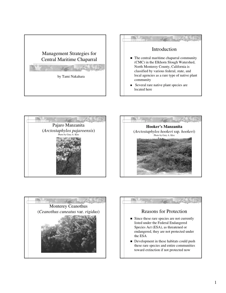
Introduction Management Strategies for The central maritime - - PDF document

introduction management strategies for
SMART_READER_LITE
LIVE PREVIEW

Introduction Management Strategies for The central maritime - - PDF document

Introduction Management Strategies for The central maritime chaparral community Central Maritime Chaparral (CMC) in the Elkhorn Slough Watershed, North Monterey County, California is classified by various federal, state, and local agencies


slide-1
SLIDE 1

1

Management Strategies for Central Maritime Chaparral

by Tami Nakahara

Introduction

The central maritime chaparral community

(CMC) in the Elkhorn Slough Watershed, North Monterey County, California is classified by various federal, state, and local agencies as a rare type of native plant community

  • Several rare native plant species are

located here

Pajaro Manzanita (Arctostaphylos pajaroensis)

Photo by Gary A. Klee

Hooker’s Manzanita (Arctostaphylos hookeri ssp. hookeri)

Photo by Gary A. Klee

Monterey Ceanothus (Ceanothus cuneatus var. rigidus)

Reasons for Protection

Since these rare species are not currently

listed under the Federal Endangered Species Act (ESA), as threatened or endangered, they are not protected under the ESA

Development in these habitats could push

these rare species and entire communities toward extinction if not protected now

slide-2
SLIDE 2

2

Purpose

To gather comprehensive scientific and

regulatory information on CMC and make recommendations on the types of strategies that could be used to manage the CMC community in North Monterey County

To examine the current use of CMC conservation

easements for residential developments to determine if and what guidelines could be implemented to protect CMC from further decline

Objective 1

To conduct an extensive literature review

and interview various federal, state, and local agencies and organizations to collect comprehensive information on

Ecology of CMC Strategies and recommendations for the

management of this rare plant community

Objective 2

To examine established conservation

easements to determine if there is a correlation between the dimensions of easements and the percent cover of non- native species

Management Issues in North Monterey County

Habitat loss and fragmentation Fire suppression Succession to oak woodland High fuel load Invasion by non-native species Hybridization Sudden Oak Death Syndrome

Habitat Loss and Fragmentation

Fire Suppression Succession to Oak Woodland

slide-3
SLIDE 3

3 Fire Suppression High Fuel Load Fire Suppression High Fuel Load

Jubata grass, pampas grass (Cortaderia jubata)

Photo by Gary A. Klee

Pampas Grass Along Trail

Hottentot fig, iceplant (Carpobrotus edulis)

Iceplant Choking Out Coyote Brush

slide-4
SLIDE 4

4

Blue gum eucalyptus (Eucalyptus globulus)

Low Species Diversity in Eucalyptus Understory

Non-native Grasses Non-native Grasses in Disturbed Areas Management Strategies

Botanical surveys/baseline studies Mitigations

In situ approches Mitigation agreements

Monitoring plans/agreements

Management Strategies

Easements

Local Coastal Program (LCP) Size, shape, spatial arrangement, connectivity Buffer zones Easement contracts Purchase easements/donations

slide-5
SLIDE 5

5

Management Strategies

Prescribed burns

Maintain shifting mosaic of age classes Crush and burn Multicutting /strategic recycling/chipped

biomass

Cutting/mowing

3,000 seedlings per acre after burning compared to

29 seedlings per acre after cutting (Harding ESE,

  • Inc. 2002a)

Management Strategies

Weed control Bradley method Sudden Oak Death Syndrome

Methods

Study area

Coastal zone and adjacent non-coastal area in

Elkhorn Slough Watershed, North Monterey County

No large wildfires have occurred in this

region in approximately 80 years due to fire suppression

Map of Study Area

Data Collection

Vegetation Surveys

Conducted from June to September 2001 Identified 40 residential parcels with CMC

botanical surveys conducted from 1987 to January 1999

Contacted owners of the 33 parcels with

conservation easements designated on them

Final pool of ten parcels contained a

combined total of 13 easements

Easement 1a

Photo by Eric Van Dyke

slide-6
SLIDE 6

6 Easement 1a Easement 1a

Easements 12a and b

Photo by Eric Van Dyke

Easement 12a Easement 12b

Easement 17

Photo by Eric Van Dyke

slide-7
SLIDE 7

7 Easement 17

Easements 21a, b, c, d, and e

Photo by Eric Van Dyke

Easement 21a Easement 21d Easement 21e

Easement 23

Photo by Eric Van Dyke

slide-8
SLIDE 8

8

Easements 26a and b

Photo by Eric Van Dyke

Easement 26a

Easement 28

Photo by Eric Van Dyke

Data Collection

Percent cover of each species Transects

Average of 50-meters long Randomly placed

Quadrats

1 m2 quadrats were placed at 5-meter intervals

along each transect

Tree, shrub, and herb layer measured

Data Analysis

For the vegetation surveys, a Product Moment

Correlation statistical test was done to determine whether there was a significant correlation between

  • The average percent cover of non-native or native

species in an easement and the easement size, shape, and distance to the nearest source of non-natives and CMC

Data Collection

Agency interviews

Conducted from February to September 2002 Interviewed 9 federal, state, and local

agencies and organizations

Interviewed 1 to 2 people from each agency Each interviewee was asked a standard list of

questions regarding their agency’s policies, strategies, and recommendations for managing CMC

slide-9
SLIDE 9

9

Data Analysis

Information from the literature review and

the agency interviews was compared to determine

What is known about the biological and

ecological requirements of CMC

Which strategies and policies are currently

being used and which are recommended for the conservation of CMC

Results of Vegetation Surveys

For non-native and natives

No significant correlation between

% cover and area % cover and the distance to the nearest sources of

non-natives

% cover and the distance to the nearest sources of

CMC

Significant correlation between

% cover and edge-to-area ratio r ≥ 0.553, α = 0.05

Area vs. Perimeter

0.000 100.000 200.000 300.000 400.000 500.000 600.000 700.000 800.000 900.000 0.000 2000.000 4000.000 6000.000 8000.000 10000.000 12000.000 14000.000 16000.000 Area (m2) Perimeter (m)

Easement 17

Photo by Eric Van Dyke

Relationship Between Non-natives and Edge-to-Area Ratio

0.05 0.1 0.15 0.2 0.25 0.3 0.35 10 20 30 40 50 60 70 80 Percent cover of non-natives Edge to area ratio

Relationship Between Natives and Edge- to-Area Ratio

Figure . Correlation between percent cover of natives in quadrats and edge to area ratio of easement. 0.05 0.1 0.15 0.2 0.25 0.3 0.35 20 40 60 80 100 120 140 160 180 200 Percent cover of natives Edge to area ratio

slide-10
SLIDE 10

10

Results of Agency Interviews

Loss of habitat or habitat fragmentation

listed as the management concern that has the highest priority for CMC (55%)

Two other management concerns for CMC

listed as having the highest priority: fire suppression and invasive non-native plant species (33% each)

Summary of Interviews with Agencies and Organizations

Do your principal management plans involve any of the following tools?: Conservation Easements? Impact restrictions? Mitigations? Prescribed burning? Mowing? California Coastal Commission Yes. Yes. Yes. No. No. US Bureau of Land Management Fort Ord No. Yes. Yes. Yes. No. US Fish and Wildlife Service Yes. Yes. Yes. Yes. No. USDA Natural Resources Conservation Service No. Yes. Yes. Yes. No. California Department of Fish and Game Yes. Yes. Yes. No. No. County of Monterey Planning and Building Inspection Yes. Yes. Yes. No. No. Monterey County Parks No. Yes. No. No. No. California Native Plant Society, Monterey Bay Chapter Yes. Yes. Yes. Yes. No. Elkhorn Slough Foundation No. Yes. No. No. No. Percentage with “yes” responses. 56% 100% 78% 44% 0%

Summary of Interviews with Agencies and Organizations

Do your principal management plans involve any of the following tools?: Control of invasives? Restoration? Monitoring? Enforcement? Specific policies for CMC? California Coastal Commission No. Yes. Yes. Yes. Yes. US Bureau of Land Management Fort Ord Yes. Yes. Yes. Yes. Yes. US Fish and Wildlife Service Yes. Yes. Yes. Yes. No. USDA Natural Resources Conservation Service Yes. Yes. Yes. Yes. No. California Department of Fish and Game Yes. Yes. Yes. Yes. No. County of Monterey Planning and Building Inspection Yes. No. No. Yes. Yes. Monterey County Parks Yes. No. No. No. No. California Native Plant Society, Monterey Bay Chapter Yes. Yes. Yes. Yes. No. Elkhorn Slough Foundation Yes. Yes. Yes. No. Yes. Percentage with “yes” responses. 89% 78% 78% 78% 44%

Results of Agency Interviews

According to the agencies, the non-natives

that are the biggest threats to CMC, in

  • rder of importance, are:

Pampas grass Eucalyptus Iceplant French broom (Genista monspessulana) Non-native grasses

Other Agency Recommendations

1.

Conserve more habitat

  • Conservation easements
  • Mitigation banks
  • Buffer zones

Conservation Easements

Monterey County’s use of conservation

easements in proposed developments is inconsistent

Lack of maintenance, monitoring, and

enforcement

County does not enforce Right of Entry

provision

Easement boundaries were not marked on

the ground

slide-11
SLIDE 11

11 Other Agency Recommendations

2.

Prescribed burns

  • Burn frequency
  • Fort Ord Habitat Management Plan suggests

interval of about 12-15 years

  • 3 agencies stated that the 15-year interval was

too short and should be closer to 30 or 35 years

Other Agency Recommendations

3.

Update General Plan

  • Periodic updates
  • Necessary for long-term management and

protection

Study Recommendations

1.

Large tracts of interconnected natural habitat should be protected before development occurs

2.

Mitigation banks or conservation banks should be established to preserve large tracts of land that will not be developed

3.

Easements should be consistently designated across all sensitive habitats such that the edge to area ratio is minimized

Study Recommendations

4.

Monitoring programs should be established for scenic and conservation easements and deed restrictions

  • Combination of aerial/infrared photos with easement

and parcel boundaries overlaid and field visits

  • Monitoring intervals should be determined on a case-

by-case basis, but generally done annually

5.

Monitoring, maintenance, restoration personnel, and researchers should be granted the authority for on-site access to easements and parcels as a condition of the Conservation and Scenic Easement Deed and deed restrictions

Study Recommendations

6.

Easement boundaries must be clearly marked so that they can be easily identified in the field by landowners and monitoring personnel

  • Permanent markers
  • GPS coordinates
  • Aerial photos with easement and parcel boundaries
  • verlaid included with easement deeds

7.

Violations of development restrictions for scenic and conservation easements and deed restrictions should be strictly enforced

Study Recommendations

8.

Incentive programs should be established for landowners who establish conservation easements on their properties

9.

Buffer zones should be included in subdivision design plans for use between large areas of CMC habitat or preserves and developments

  • Smaller buffer zones of native vegetation between

easements and development envelopes

slide-12
SLIDE 12

12

Study Recommendations

  • 10. Before a development permit is issued, a

biological survey of the property should be conducted by a qualified biologist/botanist familiar with CMC habitats and species

  • Done during time of year when species identifiable
  • Identify all plant species
  • Vegetation maps
  • Identify impacts and mitigations
  • 11. Development envelopes should be clustered to

preserve as much continuous open space as possible and reduce edge effects

  • Development clusters should be located as far from

CMC as possible

Study Recommendations

  • 12. A program to monitor construction

activities and mitigate impacts should be implemented for all proposed developments

  • Mitigation agreements should be required as

part of development permit

  • Should contain assurances of implementation,

monitoring, and maintenance

Study Recommendations

  • 13. Prescribed burning should be implemented
  • n preserves at established intervals to

create a mosaic of various vegetation age classes

  • 14. Mowing/cutting without burning is not

recommended as a way to promote CMC regeneration

Study Recommendations

  • 15. A program to control and monitor invasive

non-native plant species should be implemented on undeveloped and developed parcels

  • Non-chemical methods should be used

whenever feasible

  • New invasive non-native species should be

monitored and controlled for

Study Recommendations

  • 16. Landowners should be restricted from planting

invasive non-native plants in their landscaping

  • Native, fire-resistant plants should be used whenever

possible

  • 17. The removal of CMC species and the

construction of paths or trails through CMC should be restricted

  • Public access should be restricted or limited
  • If access allowed, areas should be monitored and

controlled for weeds, erosion, and other impacts

Study Recommendations

  • 18. Mitigation for the removal of sensitive plant

species should require impacted species to be replaced on site at a minimum of a 2:1 ratio

  • Ratio should be higher for species that are more rare
  • 19. When creating a restoration program,

environmental professionals with specific experience in the restoration of CMC communities should be consulted

  • Restoration activities should include soil

preparation, weed control, and erosion control

  • All plant materials should be gathered from the same

watershed where restoration is occurring

slide-13
SLIDE 13

13

Study Recommendations

  • 20. After prescribed burns, any surface erosion

control on steep slopes involving reseeding should use deep-rooted native perennial grasses

  • Deep-rooted, dense, woody chaparral vegetation

should be restored for permanent slope stability

  • 21. Sudden Oak Death Syndrome should be

carefully monitored and controlled for in CMC

Study Recommendations

  • 22. All native wildlife populations should be

protected

  • Predators/prey that become pests should be relocated
  • Poisons should be prohibited
  • Fencing should allow wildlife to cross
  • Curbs should be at low angle of 50 degrees
  • All surface water should be protected and enhanced
  • 23. Public education programs should be

implemented to increase awareness of the importance of CMC conservation and encourage community involvement and cooperation in management efforts

Conclusions

Biggest threat to CMC in North Monterey

County is habitat loss

Fire suppression is second Invasive non-native plant species are third

Conclusions

Top management strategy recommended in

the literature and by agencies and

  • rganizations is more habitat protection

Conservation easement policies need to be

improved in North Monterey County

Central maritime chaparral is a fire-adapted

plant community and prescribed burning is necessary for its continued existence

Conclusions

Management strategies need to take an

ecosystem approach to conservation

Public education and community

involvement in CMC management are important since the majority of the chaparral is located on private land in this part of the county

Further research on the needs of this

ecosystem and adaptive management will help to improve future management efforts