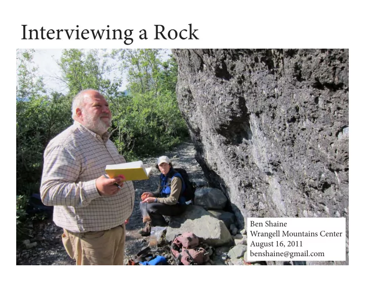
SLIDE 1 Interviewing a Rock
Ben Shaine Wrangell Mountains Center August 16, 2011 benshaine@gmail.com
SLIDE 2
To start: Just the facts. (What do we observe?) Field work.
SLIDE 3 BIG DUDE is a really big chunk of rock, way bigger than most around the glacier edge, located next to the Glacier Trail, with a moraine ridge below and the Bo- nanza Mountain slope above. Seems like it’s sitting mostly on top of the ground, set in a bit into some smaller rocks and soil.
- 1. What is the form and location of this thing?
SLIDE 4
Tie location overlooks the lower end of the Root Glacier.
SLIDE 5
- 2. What is the material Big Dude is made of? What stufg is in it? What pat-
terns or forms are in it?
SLIDE 6
Lots of smaller rocks (clasts), up to 6” diameter, mostly rounded, are set into fjne-grained, gray material. Most of the rocks are limestone.
SLIDE 7
But some aren’t, including some granite and other igneous rocks.
SLIDE 8
Many of the limestones are eroded more than the surrounding rock (the matrix), disolved by water.
SLIDE 9
Many, but not all, of the limestones have an outer rind that looks difgerent from the inner material.
SLIDE 10
A branching stripe (vein) of fjne-grained grayish material runs through one side of the rock
SLIDE 11
Tie side facing the trail has several lighter stripes Tie area of the stripes looks clean, compared with the weathered surface of the rest of the rock.
SLIDE 12
What’s a good story that fjts the facts?.
SLIDE 13
We know we’re dealing with a conglomerate. Tie geologic map shows only two kinds of conglomerate up- valley from our big boulder: Frederika conglomerate and Root Glacier Conglomerate.
SLIDE 14 Frederika conglomerate Locally abundant andesitic sills and a few andesitic dikes cut the for- mation… Tie conglomerates are mainly pebble or cobble conglomerate but include subordinant boulder conglomerate. Tiey range from wellin- durated rocks to poorly indurated crumbly masses. Tie conglomer- ates are variegated with multicolored clasts in light-gray, lightbrown,
- r yellowish-brown matrices. Generally their cobbles and
pebbles are well rounded and their boulders subrounded or subangu- lar. Matrices of most of the conglomerates consist of poorly sorted coarse-grained calcite-cemented sandstone that is rich in quartz and plagioclase. Tie conglomerates are polymict, and their clasts generally consist of Wrangell Lava, some Nikolai Greenstone, and rare chert, quartz, granitic rocks, quartzite, shale, and limestone.
hmmmm.... Ed MacKevett describes the Frederika conglomer- ate like this:
Ed MacKevett
SLIDE 15 And Root Glacier conglomerate like this:
Tie formation is cut by andesitic dikes that locally are suffjciently numerous to constitute dike swarms and by a few sandstone dikes. … Tie conglomerates contain well-rounded pebbles, cobbles as much as 6 inches in diameter, and a few blocky intraformational fragments
- f mudstone and siltstone, all in a sandy matrix. About two-thirds of
the cobbles and pebbles are limestone, probably derived from the Chitistone and Nizina Limestones. Tie other cobbles and pebbles include medium-grained granite that is rich in pink K-feldspar, chert, altered basalt derived from the Nikolai Greenstone, and quartz.
Tiat fjts!
SLIDE 16 So, starting at the beginning, Tie smaller pieces included within the big rock (the clasts) are the
- ldest part of a conglomerate rock.
(Is this true for all rocks? When not?) Most of those clasts are Chitistone & Nizina Limestones.
SLIDE 17 * * * *
Sediment S e d i m e n t Continental crust Ocean Sediment Lithosphere Asthenosphere Magma Spreading ridge Volcanic arc Mantle Continental crust Trench Oceanic crust Magma Subduction Earthquake foci Mantle—The zone of the Earth below the crust and above the core Lithosphere—The solid part of the Earth (as opposed to atmosphere and hydrosphere). It includes the crust and part of the upper mantle and rides on the underlying asthenosphere Asthenosphere—The part of the upper mantle that is weak and behaves more like a fluid than a solid Subduction zone—Zone where one crustal plate overrides another along a convergent margin Trench—Depression of the sea floor, formed at convergent plate boundaries where an oceanic plate is subducted beneath a continental plate Spreading ridge—Suboceanic zone where magma rises between two crustal plates and spreads them apart Magma—Molten rock generated within the asthenosphere; the parent of all volcanic and plutonic rocks Volcanic arc—A curved belt of volcanoes above a subduction zone where crustal plates converge
EXPLANATION
A
Ah Ha -- Tiat takes us to the WRANGELLIA STORY and plate tectonics
SLIDE 18
Figuring out the Wrangellia story helped geologists understand plate tectonics, one of the major scientifjc insights of our time. Some of the fjnest fjeld geologists have worked on it here over the decades. Building on the efgorts of pioneers, Jefg Trop is one of those who are taking a lead recently in putting together the pieces of the Wrangellia story and learning more details. He comes to the McCarthy area with his Bucknell students. Jefg Trop
SLIDE 19 Wrangellia Chugach
SLIDE 20 Formation of the limestones in the tropical Pacifjc
It looked like the Persian Gulf, where limestones are forming today.
Jurassic coral
SLIDE 21
Collision of the terrane including the Chugach with Wrangellia, Uplifu of a previous generation of Wrangellia mountains, and their erosion into the Pacifjc Ocean.
SLIDE 22 Jefg Trop et. al’s account
conglomerate formed
(But is it true? Barry’s not so sure.)
SLIDE 23 DENALI FAULT SYSTEM CHUGACH–ST. ELIAS FAULT SYSTEM Wrangell volcanic field Asthenosphere Weak subduction Yakutat terrane TRANSITION FAULT SYSTEM NORTH AMERICAN PLATE PACIFIC PLATE Lithosphere Yakutat terrrane Wrangellia composite terrane Volcanic arc Rising magma Strong subduction Southern margin composite terrane North South
B C
Figure 10. Diagrammatic cross sections through the Earth’s crust and upper mantle, showing plate-tectonic features developed in ocean basins and at continental margins. A, General features and nomenclature. B, The Wrangell–Saint Elias region and the northern Pacifi c Ocean, about 26 m.y. ago, showing collision of oceanic and continental plates, the Pacifi c and North American plates, with strong subduction causing formation of an active volcanic arc. C, The Wrangell– Saint Elias region and the northern Pacifi c Ocean at the pres- ent time, showing that collision of continental plates, the Yakutat terrane and the North American plate, has jammed the subduction zone and quieted the volcanism. (Modifi ed from Richter, Rosenkrans, and Steigerwald, 1995.)
Collision of the Yakutat Terrane, erupton of the Wrangells volcanoes and uplifu of the Wrangell Mountains
From Winker (one of the pioneers), A Geologic Guide to Wrangell-St. Elias National Park and Preserve, Alaska
SLIDE 24 So, intrusion of hot material can explain the veins, cracks and rinds.
(But why do only some of the limestones have rinds?)
SLIDE 25 Now, we’ve got a pretty good story behind the answers Big Dude Rock gave us to second set of questions we asked it: What is the material it’s made of? What stufg is in it? What patterns or forms are in it? Let’s go back to our fjrst question What is the form and location of this thing? and see what story we can come up with to explain the answers for that
SLIDE 26 Big Dude is a chunk of rock near the edge of a glacier. It’s angular, so it probably hasn’t been in fmowing water, at least for very long. It’s too big for liquid water to move easily! Glaciers move big angular rocks. Ergo: B.D. arrived on or in a glacier. (Maybe since has rolled downhill?)
Large rock being carried on the Root Glacier today
SLIDE 27 Where exactly did B.D. come from? It has to be from upvalley. (Glaciers fmow downhill.) And it has to be from a place that has Root Glacier conglomerate, since that’s what B.D.’s made of. Ed MacKevett’s geologic map doesn’t show any Root Glacier conglomerate up the Root Glacier. Tiere’s three exposures up the Kennicott, though: X
Where B.D. is today
SLIDE 28
But B.D. is above the edge of the Root Glacier today, not the Kennicott. Could Ed MacKevett have missed see- ing a Root Glacier conglomerate clifg when he was helicoptering the Root Glacier Valley? ...not likely ...but possible? Or maybe such a clifg there was com- pletely eroded away by the time Ed got there in the 1960’s? Or is there a way B.D. could have come down the Kennicott Glacier, even though it’s next to the Root Glacier to- day?
SLIDE 29
Remember another clue we haven’t fjgured into the story yet: Many of the limestones are eroded more than the surrounding rock (the matrix), disolved by water.
SLIDE 30 Looks like the surface of B.D. has been exposed to rainwater long enough to disolve a half-inch or a centimeter of limestone. How long does that take? ...dunno. But longer than the 150 years since the Little Ice Age!
Little Ice Age maximum about
- 1860. B.D. is now about 100’
below this elevation. Little Ice Age bathtub ring around the valley
SLIDE 31
Probably thousands of years? Combine this with the (likely) fact that B.D. came from the upper Kennicott. Tiat’d imply that the Kennicott Glacier extended to above where the lower Root Glacier is today! How can that be?
SLIDE 32 During major ice advances, glaciers around here are much thicker.
Two of the lateral moraine lines on Porphyry Mountain
SLIDE 33
Imagine how the Chitina Valley looks during the height of major ice advances. Similar to the Bagley Icefjeld today?
SLIDE 34 LaChapelle Glacier 4-8Kfu accumulation area Gates Glacier 4-8Kfu accumulation area Root Glacier 4-8Kfu accumulation area Kennicott Glacier 4-8Kfu accumulation area McCarthy Creek Glacier 4-8Kfu accumulation area
x
RGc Erratic
x
RGc source
RGc erratic travel route
How do each of the Kennicott Valley glaciers respond to colder weather?
SLIDE 36
Big Dude Glacier edge, about 1900 (Could be?) Big Dude rolls down
SLIDE 37
What next?