
SLIDE 1
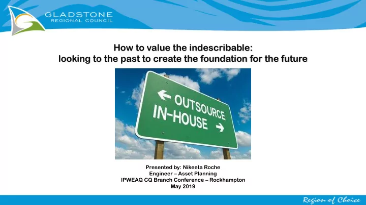
How to value the indescribable: looking to the past to create the foundation for the future
Presented by: Nikeeta Roche Engineer – Asset Planning IPWEAQ CQ Branch Conference – Rockhampton May 2019
How to value the indescribable: looking to the past to create the - - PowerPoint PPT Presentation
How to value the indescribable: looking to the past to create the foundation for the future Presented by: Nikeeta Roche Engineer Asset Planning IPWEAQ CQ Branch Conference Rockhampton May 2019 What is a Population Model? Census Data
Presented by: Nikeeta Roche Engineer – Asset Planning IPWEAQ CQ Branch Conference – Rockhampton May 2019
Census Data
(total dwellings, people and
Council GIS Data
(base parcels, zoning, aerial mapping, water meter connections)
Statistical Areas
(SA3, SA2’s, SA1’s, mesh blocks available from ABS)
Projected Population Growth
(Australian Bureau
Priority Growth Order
(based on existing zoning, future projects and strategic plans, local knowledge)
Development Applications
(both historical and current DA’s, Building Permits, OPW)
Document assumptions made Stakeholder engagement Up-skilling Understand end user needs Maintain and monitor Working together with both parties can achieve amazing results but we must not forget the value of in-house skills and knowledge!
Stormwater Transport Sewer LGIP Population Model
Stormwater
Parks Water
Input data: For our baseline (current population)
level was used For Forecasting
used Output Data: Population and Dwelling/s per lot at 5 year increments (Current – 2041)
State / Territory - QLD
Input Data
Input data: For our baseline (current population)
level was used For Forecasting
used Output Data: Population and Dwelling/s per lot at 5 year increments (Current – 2041)
State / Territory - QLD SA4 – Central QLD
Input Data
Input data: For our baseline (current population)
level was used For Forecasting
used Output Data: Population and Dwelling/s per lot at 5 year increments (Current – 2041)
State / Territory - QLD SA4 – Central QLD SA3 – Gladstone Region
Input Data
Input data: For our baseline (current population)
level was used For Forecasting
used Output Data: Population and Dwelling/s per lot at 5 year increments (Current – 2041)
State / Territory - QLD SA4 – Central QLD SA3 – Gladstone Region SA2 – Agnes Water Miriam Vale
Input Data
Input data: For our baseline (current population)
level was used For Forecasting
used Output Data: Population and Dwelling/s per lot at 5 year increments (Current – 2041)
State / Territory - QLD SA4 – Central QLD SA3 – Gladstone Region SA2 – Agnes Water Miriam Vale SA1 – Pop. 200 - 800
Input Data
Input data: For our baseline (current population)
level was used For Forecasting
used Output Data: Population and Dwelling/s per lot at 5 year increments (Current – 2041)
State / Territory - QLD SA4 – Central QLD SA3 – Gladstone Region SA1 – Pop. 200 - 800 Mesh Blocks – 30 dwellings
Input Data
SA2 – Agnes Water Miriam Vale
Mesh Blocks containing relevant Census Data
Population Dwellings Occupancy rate
Input Data
2011 EP values Equivalent Person per dwelling Expected typically 2.7– 3.0 Persons per dwelling Findings show some areas are significantly less in the 2011 Census Data
Finding the trends within the data Input Data
Finding the trends within the data
2016 EP values Trends identified by Council Officers:
Input Data
55,000 60,000 65,000 70,000 75,000 80,000 85,000 90,000 95,000 100,000 105,000 110,000 115,000 120,000 2011 2016 2021 2026 2031 2036 2041 2046
Total Population Year
Population Growth for the whole Gladstone Region
SA2 2015 Projections
2015 Projected Population Growth: Average rate of 2.22% growth per year Input Data
Growth Methodology and Assumptions Growth was developed according to:
Input Data
55,000 60,000 65,000 70,000 75,000 80,000 85,000 90,000 95,000 100,000 105,000 110,000 115,000 120,000 2011 2016 2021 2026 2031 2036 2041 2046
Total Population Year
Population Growth for the whole Gladstone Region
Original Model SA2 2015 Projections
Population Model on deliverable: Average rate of 3.24% growth per year 2015 Projected Population Growth: Average rate of 2.22% growth per year Output Data: Per Lot Assessment
55,000 60,000 65,000 70,000 75,000 80,000 85,000 90,000 95,000 100,000 105,000 110,000 115,000 120,000 2011 2016 2021 2026 2031 2036 2041 2046
Total Population Year
Population Growth for the whole Gladstone Region
SA2 2018 Projections Original Model SA2 2015 Projections
Population Model on deliverable: Average rate of 3.24% growth per year 2015 Projected Population Growth: Average rate of 2.22% growth per year 2018 Projected Population Growth: Average rate of 0.71% growth per year Output Data: Per Lot Assessment
55,000 60,000 65,000 70,000 75,000 80,000 85,000 90,000 95,000 100,000 105,000 110,000 115,000 120,000 2011 2016 2021 2026 2031 2036 2041 2046
Total Population Year
Population Growth for the whole Gladstone Region
SA2 2018 Projections Original Model SA2 2015 Projections
2036 growth projections dropped by 33,000 Output Data: Per Lot Assessment
Output Data: Per Lot Assessment
Census Data
(total dwellings, people and
Council GIS Data
(base parcels, zoning, aerial mapping, water meter connections)
Statistical Areas
(SA3, SA2’s, SA1’s, mesh blocks available from ABS)
Projected Population Growth
(Australian Bureau
Priority Growth Order
(based on existing zoning, future projects and strategic plans, local knowledge)
Development Applications
(both historical and current DA’s, Building Permits, OPW)
Baseline completed by external consultant – minor changes only needed Realignment work requires Priority Growth Area
Applied previous Methodology to align with 2018 forecasting data General findings:
using analyst tools and local knowledge Input Data
Input Data Census Data: Alignment:
Output Data: Per Lot Assessment
Output Data: Per Lot Assessment