
SLIDE 1
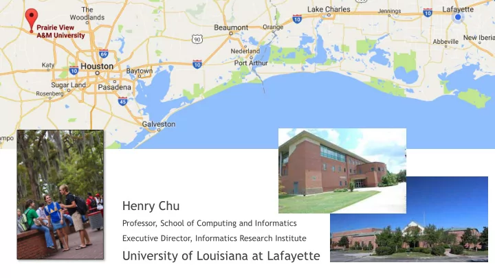
Henry Chu
Professor, School of Computing and Informatics Executive Director, Informatics Research Institute
Henry Chu Professor, School of Computing and Informatics Executive - - PowerPoint PPT Presentation
Henry Chu Professor, School of Computing and Informatics Executive Director, Informatics Research Institute University of Louisiana at Lafayette Informatics Research Institute We conduct research in data science to unleash the potential of Big
Professor, School of Computing and Informatics Executive Director, Informatics Research Institute
Smart and Connected Community Health Informatics Data Science and Big Data Analytics Crisis Research
Cyber Physical Systems Big Data Platform Open Data Predictive Analytics Public Safety Information Exchange We conduct research in data science to unleash the potential of Big Data for the benefit of society in such areas as health, crisis response, community security & resiliency, and smart & connected community
Collect, Connect, Aggregrate, and Analyze
u Foundation for increased safety and resilience u Improved efficiencies and civic services u Broader economic opportunities and job growth u Deep embedding of sensing, computing, and
u Real time crowd analysis u Threat detection; dispatch public safety officers u Anticipate vulnerable settings and events u New communication and coordination response
u Real time water levels in flood prone areas u Timely levee management and evacuations as needed u Anticipate flood inundation with low-cost digital terrain
u Inform vulnerable populations
Points of Distribution and Supply Chain Optimization Human Geography Mapping Louisiana Hazard Information Portal Fuel Demand & Supply Prediction for Regional Evacuation Consequence Analysis of Natural Gas Pipeline Disruptions Geo-Referenced Wireless Emergency Alerting Business Emergency Operations Center
u
Probabilistic modeling of complex events to develop predictive analytics and enhance the capabilities for appropriate and adaptive response, and to refine response planning.
u
Multilevel, multiscale modeling methods for understanding factors that contribute to or undermine community resilience
u
Capture and visualize data elements reflecting different aspects of a community, from physical geography to built infrastructure to activities, entities, events, and processes on the infrastructure
u
Research into protocols and methods for ensuring both reliability and privacy
crises.
Presented by
u
Fire
u
Mass killings
u
Floods
u
Hurricanes
u
Tornadoes
u
Toxic gas releases
u
Hostage situations
u
Chemical spills
u
Explosions
u
Civil disturbances
u
Utility failures
u
EMS calls
u
Automatic fire/security alarms Source: Eagle View Technologies
Active threat policy/protocol for Dispatch
Source: Eagle View Technologies
High-fidelity, intractable 3D content, such as intelligent virtual humans and interactive virtual environments, drives the creation of compelling graphics innovations such as augmented reality (AR) and virtual reality (VR) applications. Creating such interactive, smart virtual content goes beyond the traditional graphics goal of attaining visual realism, giving rise to a new wave of exciting opportunities in computer graphics research. This new research frontier aims to close the loop between 3D scanning and content creation, 3D scene and object understanding, virtual human modeling, physical simulations, 3D graphics researchers, as well as experts in AR/VR, computer vision, robotics and artificial intelligence
u feature detection, u feature matching (typically poor accuracies), u matched pair pruning, u solutions of transformation parameters, and u stratified reconstruction
u Handcrafted solutions typically based on
Feature points detection and matching, usually very error-prone Use 3D parameters to eliminate mis-matched pairs Stratified reconstruction to create sparse and dense data points
u labeled image regions with surface normals and depth information
Deep Learning Analysis
3D Synthesis
VGG Network RGB still frame Color coded surface normal Color coded depth map VGG Network Color coded segmentation output
VGG Network RGB still frame Color coded surface normal Color coded depth map VGG Network Color coded segmentation output
u Large horizontal surface sometimes
[-0.17450304, -0.73930991, 0.57329011], [ 0.70876521, -0.65309978, -0.18121877], [-0.66661775, -0.7170617 , -0.09909129], [ 0.31662983, -0.91938305, -0.03420801], [-0.1909277 , -0.93683589, -0.1962584 ], [-0.00796445, -0.32743418, 0.93818361]
Horizontal plane
[-0.17450304, -0.73930991, 0.57329011], [ 0.70876521, -0.65309978, -0.18121877], [-0.66661775, -0.7170617 , -0.09909129], [ 0.31662983, -0.91938305, -0.03420801], [-0.1909277 , -0.93683589, -0.1962584 ], [-0.00796445, -0.32743418, 0.93818361]
Vertical planes
u We go back to the surface normal map and label each
u Use the cluster id label (“horizontal”, “vertical”, etc) to
u Orientation u Position u Scale
u Orientation u Position u Scale
u Orientation u Position u Scale
Camera
Recovered depth data Surfaces identified by surface normals
u Orientation u Position u Scale
Camera
How do we find x, y, z? Grid the space and find the set that agrees with the recovered depth data
Hypothesized plane that is not consistent with depth data
u Orientation u Position u Scale
Camera
Recovered depth data Surfaces identified by surface normals
u Fine tune the reconstruction process for one frame u Rectify reconstruction from different viewpoints obtained
u Connect asset data to insert into the scene (replacing the
u Use an initial classification step to identify scene category
Deep Learning Analysis
3D Synthesis
u Goal is to estimate the underlying probability density of
u Image synthesis from an image collection
Original data density
Generator Discriminator
Generator Discriminator
Deep Learning Analysis
3D Synthesis
u
The main challenge is for the computer to recognize low-level and high-level activities in the context of a scene
u
Factors that create the challenge are accurate depth estimation, video segmentation into scenes, then into objects both rigid and non-rigid which are further segmented and classified into data structures that can be then used to generate the desired result
u
Advances in computer vision and machine learning techniques and algorithms have improved over years, including more accurate eye, face and head tracking and motion capture
u
Video recording of human activities can be of use for potential marketing research (for example, how do consumers move in a store and where they stay the most), business surveillance, robotic assembly or as datasets for biologists, sociologists and psychologists to observe human motion and overall action
u
An ensemble of neural nets will be used for the production solution of inferencing the immersive experience from the legacy video
u
We also use a few commercial software and open-source software applications: Unreal Engine 4, Poser Pro 11, and Blender+Luxrender, & Nvidia’s Deep Learning SDK, Auto Desk Maya, Micro Soft Kinect SDK, VR Works, Game Works, all running on Nvidia TITAN X Pascal GPUs.
u
We have created a framework for the workflow pipeline: the UI of the system is built from Unreal Engine 4 with the deep learning embedded into the engine pipeline
u
The pipeline takes the video and other input in and using well known published algorithms and models for various tasks creates new data structures to be used in the generation of the immersive content
u
The workflow consist of a well defined ensemble of neural nets that each produce one set of the data that is needed for the following steps in the process
u
After each neural net outputs its data it is sent into a semi-supervised neural net that allows a human to perform a guided quality assurance process to correct any errors with a series of mouse clicks, spoken words, or mouse or pen drawn lines
u Our ensemble would allow for the creations of VR
u We use the Unreal Engine customized with plugins to
u We chose UE4 because of its open source and the blue
u We chose Poser Pro 11 for its Unreal Portal Development
u FBX is an Autodesk file format that provides interoperability between
digital content creation applications such as Autodesk Motion Builder, Autodesk Maya, and Autodesk 3ds Max
u Autodesk Motion Builder software supports FBX natively, while Autodesk Maya and
Autodesk 3ds Max software include FBX plug-ins. u Unreal Engine features an FBX import pipeline which allows simple
transfer of content from any number of digital content creation applications that support the format.
u The advantages of the Unreal FBX Importer over other importing
methods are:
u Static Mesh, Skeletal Mesh, animation, and morph targets in a single file
format.
u Multiple assets/content can be contained in a single file. u Import of multiple LODs and Morphs/Blendshapes in one import operation. u Materials and textures imported with and applied to meshes. u Poser's Unreal Portal Development Environment
The algorithm DeepMask1 segmentation framework coupled with the newwSharpMask2 segment refinement module. Together, they have enabled FAIR’s machine vision systems to detect and precisely delineate every object in an image. The final stage of their recognition pipeline uses a specialized convolutional net, which they call MultiPathNet3, to label each object mask with the object type it contains (e.g. person, dog, sheep).
We were able to replicate this research from FAIR including UR torch and also UnrealCV which both interface with Unreal Engine 4 and serve as an interface to deep learning and
screen shots of our findings
Movie Scene Example Movie Scene Object Segmentation Captured in Unreal Engine with Embedded Deep Learning
Reconstructed VR Scene using Unreal Engine with the Torch Plugin with embedded Deep Learning
UnrealCV is a project to help computer vision researchers build virtual worlds using Unreal Engine 4 (UE4).