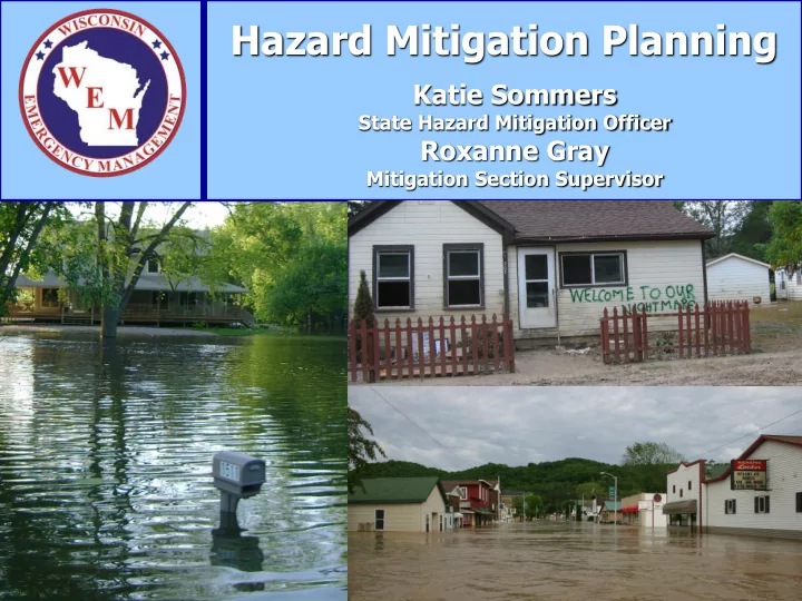
SLIDE 1 Katie Sommers
State Hazard Mitigation Officer
Roxanne Gray
Mitigation Section Supervisor
Hazard Mitigation Planning
SLIDE 2 What is Mitigation?
“Mitigation is any sustained action taken to eliminate or reduce the long-term risk to human life and property from natural and technological hazards”
According to the Federal Emergency Management Agency (FEMA):
Photo from Soldiers Grove, WI Photo from Kenosha County
SLIDE 3 Break the Cycle
Disaster
SLIDE 4
too much
insufficient
damages
response and recovery process
the local level
Why Do We Mitigate?
SLIDE 5
(GAO) responding to disasters
flood damages
- Costs continue to rise
- People continue to
build and live in high- risk areas
Why Do We Mitigate?
Nationwide Trends
SLIDE 6 Why Do We Mitigate?
- $3 billion in disaster-related
damages last 3 decades
Declarations in the 90’s compared to 6 in the 80’s
2004, 2007, 2008, two in 2010, 2011, 2012, 2013
and 2008)
In Wisconsin
SLIDE 7 For every $1 spent on mitigation, $4 is saved in future damages.
(Per the National Institute of Building Sciences -2005)
Value of Mitigation
Gays Mills, WI
SLIDE 8
Examples of Mitigation
SLIDE 9 Acquisition/Demolition
Communities acquire land, demolish structures, and keep the land in
Images from Darlington, WI
SLIDE 10 Elevation
Elevation raises a structure out of the floodplain. Wisconsin has specific regulations to follow with elevation projects. See DNR for more information. Images from Soldiers Grove, WI
SLIDE 11 Floodwall
Floodwalls can prevent water from inundating structures that cannot be elevated, relocated, or demolished. Image from Darlington, WI
SLIDE 12 Community Safe Room
Community safe rooms built to FEMA-361 standards can withstand winds up to 250 MPH.
Image from Town of Dunn, WI
SLIDE 13 Stormwater Detention
Detention ponds can store stormwater runoff, decreasing flash flooding in urban areas.
Image from MMSD Stormwater Detention Project (Wauwatosa, WI)
SLIDE 14 Stormwater
Stream restoration allows watersheds to better manage flooding.
Image from Theinsville, WI
SLIDE 15 River Warning Systems
River warning systems installed on conservation dams to warn county
- fficials about expected dam breaching.
Images from Vernon County
SLIDE 16
and utilities
valves
resistance
public awareness
and sewer backup)
Other Projects
Mobile Home Tie-Downs NOAA Weather Radios Proper Landscaping
SLIDE 17
and tourism
- Parks
- Trails
- Increase community
pride & improve quality of life
Benefits of Mitigation
Darlington, WI Chaseburg, WI
SLIDE 18
Mitigation Planning
SLIDE 19
- Use skills, experience, and
expertise of wide range of groups
hazards
citizens
- Identify the best mitigation
projects
- Gain public and political
support
Benefits of Pre-Disaster Planning
Soldiers Grove, WI
SLIDE 20
- Mitigation can support other goals of the community
- Capitalize on mitigation opportunities after a disaster
- Identify sources of technical and financial assistance
- Fewer constraints on time and resources vs. post-
disaster
Darlington, WI
Benefits of Pre-Disaster Planning
SLIDE 21
signed into law 10/30/00
disaster hazard mitigation program
Pre-Disaster Mitigation Program
Planning Requirement
Disaster Mitigation Act of 2000
SLIDE 22
- To reduce disaster losses thru pre-disaster
mitigation planning by pre-identifying, cost- effective mitigation
- Mitigation planning would then streamline and
speed up the recovery process
Vision of DMA 2000
SLIDE 23
mitigate hazards, risks, and vulnerabilities
implement those actions
to ensure comprehensive, integrated approach to hazard reduction
Mitigation Planning
SLIDE 24
- Local Planning – 44 CFR Part 201.6
- Tribal Planning – 44 CFR Part 201.7
- Components
- Planning Process
- Risk Assessment
- Mitigation Strategy
- Plan Maintenance Process
- Plan Adoption
- Plan Review
Local/Tribal Mitigation Plan Criteria
SLIDE 25
Opportunities
- Housing
- Transportation
- Utilities and
Community Facilities
and Cultural Resources
Development
Cooperation
Comprehensive Planning
SLIDE 26
- Must have an approved All-Hazards
Mitigation Plan to receive PDM, HMGP, FMA
- Local plans have to be reviewed, updated,
and re-approved every 5 years
Planning Deadlines
SLIDE 27
- Should allow one year to 18 months for update
- Plan expires 5 years from approval date
Plan Updates
Vernon County, WI
SLIDE 28
Planning Process
SLIDE 29 Planning Process
- 1. Determine the planning area and
resources
- 2. Form and organize the team
- 3. First steps
- 4. Engage the public
- 5. Document the process
SLIDE 30
- 3. First Steps
- Establish responsibilities
- Confirm the purpose of the plan
- Review the current mitigation plan
- Refine the plan scope and schedule
- Develop an outreach strategy
SLIDE 31
- 3. First Steps
- Review Existing Plans, Studies, and Laws
– Stormwater studies – Engineering reports – Floodplain ordinances – State Hazard Mitigation Plan – Comprehensive plans – Local hazard analysis – Land use plans – Building codes
SLIDE 32
- Tell your story. Educate the public about the
progress and the results of the planning process.
- Publish progress in a newspaper.
- Publish newsletters or brochures.
- Host public-input workshops and/or focus
groups.
- Open planning meetings to the public.
- 4. Engage the Public
SLIDE 33
- Consider outreach activities at local festivals,
fairs, or other public events.
- Post progress and results on the internet.
Allow electronic feedback submissions.
- Have the draft plan available for review at
county and municipal buildings, libraries, etc. Display the final plan once it’s approved.
- Be creative!!
- 4. Engage the Public
SLIDE 34
- Documentation of the planning process is a
requirement!
- Plan adoption is a requirement!
- Document time and expenses for local match
for FEMA grants.
SLIDE 35
Include copies of…
- Meeting agendas, sign-in sheets, minutes
- Public notices
- Media articles
- Public comments or input
- Surveys
- Correspondence
SLIDE 36
Risk Assessment
SLIDE 37 Risk Assessment: What is it?
- A process that produces a specific section of
your plan that answers these questions:
What hazards could affect your jurisdiction? What assets could be affected? What areas of your jurisdiction are vulnerable to hazards? To what degree will these assets be affected?
SLIDE 38 Risk Assessment: Why?
- Better-understand which hazards affect your
community
– Previous occurrences – Probability of future events
- Estimate potential impacts and losses
- Consider how future development impacts
hazards, risk, and potential losses
SLIDE 39
- Provide sufficient information to develop and
prioritize mitigation actions to reduce the risk from identified hazards
- Information from local risk assessments is
integrated into the State Plan to help establish statewide goals and policies
Risk Assessment: Outcomes
SLIDE 40 Process
- Identify hazards that occur
– Which ones are most prevalent? – Natural hazards required, technological hazards
- ptional
- Describe the hazards
– Type, extent, previous occurrences, severity, duration
- Estimate losses and impacts to your community
SLIDE 41 Describe the Hazards
Item Examples Hazard Extent
(strength, magnitude)
- High, medium, low (define)
- Enhanced Fujita Scale
- Water depth
- Wind speed
Previous Occurrences
- Past damages
- Severity
- Duration
- Dates
Probability of Future Events
- Unlikely, likely, highly likely (define)
- Historical frequencies
- Statistical probability (1% in any given year)
- Hazard probability maps
SLIDE 42 Identify Community Needs
People
- Visiting (students, second homeowners, migrant farm
workers, special events)
- Access/functional needs (children, elderly, people with
physical/mental disabilities, non-English speaking) Economy
- Direct and indirect losses
- Loss of function
- Key economic sectors (agriculture, major employers,
industries, etc.)
SLIDE 43
- Structures
- Infrastructure
- Utilities
- Cultural
resources
facilities
Assess the Built Environment
Source: Google Earth; generated by Robyn Wiseman, (15 May 2014)
SLIDE 44
the community such as tourism/ recreation
- Clean air/water
- Wetlands and
floodplains
Assess the Natural Environment
Sources (Above) Google Earth; generated by Robyn Wiseman (15 May 2014) (Below) FEMA Map Service Center; ” generated by Robyn Wiseman, http://msc.fema.gov (15 May 2014)
SLIDE 45
- Evaluate vulnerable assets
- Describe the potential impacts
- Estimate potential losses
- List key issues or problem statements that
describe the community’s greatest vulnerabilities
Analyze the Risk
SLIDE 46
- When and how often is the hazard likely to
- ccur?
- How bad will it get?
- Where is it most likely to strike?
- How large an area will be affected?
- How long will it last?
- When is it more likely to occur?
- Is there adequate warning time?
- Can more than one hazard occur
simultaneously?
Questions to Ask
SLIDE 47
– Quantify the number, type and value of structures, critical facilities and infrastructure exposed to a specific hazard
– Use data from previous events to predict losses from future events
Analysis Methods
Example: 10 residential structures are exposed to the 1% annual flood. Example: Based on historic data, Examplesville can expect to experience an average of $5,000 in reported residential hail damage every year.
SLIDE 48 Analysis Methods (Cont.)
– “What if” based on a particular scenario – HAZUS-MH
SLIDE 49 Repetitive Loss and Severe Repetitive Loss Properties
- Repetitive Loss (RL) Properties
– NFIP insured structure with at least 2 paid flood claims
- f at least $1,000 each
- Severe Repetitive Loss (SRL) Properties
– 4 or more separate claims exceeding $5,000 and cumulative amount exceeding $20,000, or – 2 separate payments with cumulative total exceeding market value of the structure
- Privacy Act
- Contact WEM for information
SLIDE 50
development so mitigation can be considered in future land use decisions
– Declining or increasing populations – Anticipated annexations – Infrastructure expansion – Economic shifts
Land Use and Development Trends
Source: City of Elkohorn, WI GIS Department; accessed by Robyn Wiseman, http://www.cityofelkhorn.org/community/maps.asp (15 May 2014)
SLIDE 51 Include a risk assessment for each participating jurisdiction to reflect unique
- r varied risks as needed
- Floodplains
- Dams
- Coastal areas
- Wildland Urban Interface (WIU) for wildfire
risk
Multi-Jurisdictional Plans
SLIDE 52
- Flood maps
- Road maps
- Parcel maps
- USGS topographic
maps
- USGS digital
- rthophoto maps
- Aerial topographic
and/or planimetric maps
- Land use maps
- Tornado track maps
Map Hazards
(Where and When Appropriate)
http://www.geotechmap.org/Pages /WisTorProj.aspx
SLIDE 53
- Avoid using state or national scale maps
- Use multiple layers to clarify each hazard
- Clearly show jurisdictional boundaries
- Make them legible
- Include a legible legend
- Document map data limitations
Map Considerations
SLIDE 54
agencies and
- rganizations
- State of Wisconsin
Hazard Mitigation Plan
analyses
historical records
Service/NOAA
Information Sources
SLIDE 55 Information Sources (Cont.)
- Existing plans and reports
- GIS data and experts
- HAZUS-MH
- Experts in the community
- Surveys or questionnaires
- Internet (USGS, NOAA/NWS, etc.)
- After-action reports
- Oral histories
- Other government documents
SLIDE 56
- Document the METHODOLOGY used
- Document SOURCES
- Address all hazards; if little or no impact,
state this
- Use best available data
- Identify data limitations and deficiencies
- Build on risk assessment in future updates
Documentation
SLIDE 57
Mitigation Strategy
SLIDE 58 Mitigation Strategy
What is it?
- Blueprint for reducing potential losses
identified in the risk assessment
- Based on existing authorities, policies,
programs, and resources
SLIDE 59 Strategy must include…
- 1. Long-term goals
- 2. Mitigation actions for each
jurisdiction that will reduce risk for each identified hazard
- 3. Action plan for implementing the
identified actions Mitigation Strategy
SLIDE 60
Action Plan = Mitigation Actions + Implementation
- Partners
- Resources
- Estimated cost
- Potential funding
sources
- What is the action?
- Who is responsible?
- When will it be
completed?
prioritized?
SLIDE 61 Capability Assessment (each jurisdiction)
– Planning department, floodplain ordinances
- Administrative and technical
– Public works department, WEM, FEMA
– Special taxing authority, FEMA grants
– Hazard awareness campaigns, brochures
SLIDE 62
Plan Maintenance
SLIDE 63 Plan Maintenance Components:
- Monitoring
- Evaluating
- Updating
- Integration with other planning mechanisms
- Continued public participation
SLIDE 64
Monitoring, Evaluating, Updating
Monitoring = tracking the implementation of the plan over time Evaluating = assessing the effectiveness of the plan at achieving the purpose and goals Updating = reviewing and revising the plan to reflect changes in development, progress in mitigation efforts, and changes in priorities
SLIDE 65 How will the local government(s) integrate the hazard mitigation plan into other planning mechanisms? (required)
- Comprehensive plans (9 elements)
- Capital improvement plans
- Stormwater management plans
- Sustainability plans
- Economic development plans
- Master plans
- Codes and ordinances
Plan Integration
SLIDE 66 Plan Integration
Plan sections to consider integrating:
- Risk assessment data (maps) – informs policies
and decision-making
- Goals – contribute to overall community
- bjectives
- Actions – take advantage of existing
mechanisms for implementation
Plan updates must explain how the previous plan was incorporated into other planning mechanisms.
SLIDE 67 Continued Public Participation
The plan must include a strategy for maintaining public participation between plan
- updates. Here are some ideas:
- Hold periodic public meetings
- Post monitoring and evaluation activities to a
website
- Hold workshops
- Distribute newsletters
- Make information available
in public places
SLIDE 68
Plan Review
SLIDE 69 Plan Review
Steps
- 1. Plan development
- 2. WEM plan review
- 3. FEMA plan review
- 4. Plan adoption
- 5. FEMA approval
SLIDE 70
- http://emergencymanagement.wi.gov/mitigation
- http://www.fema.gov/hazard-mitigation-assistance
- https://www.fema.gov/multi-hazard-mitigation-
planning
- Resource Guide to All Hazards Mitigation Planning –
April 2003
- State of Wisconsin Hazard Mitigation Plan
- HAZUS
- FEMA How-to-Guides (386-1 through 386-9) –
http://www.fema.gov/media-library/collections/6
Planning Tools and Resources
SLIDE 71
Questions?
Please contact us anytime with questions or concerns.
Katie Sommers katie.sommers@wisconsin.gov (608) 242-3222 Roxanne Gray roxanne.gray@wisconsin.gov (608) 242-3211