
SLIDE 1
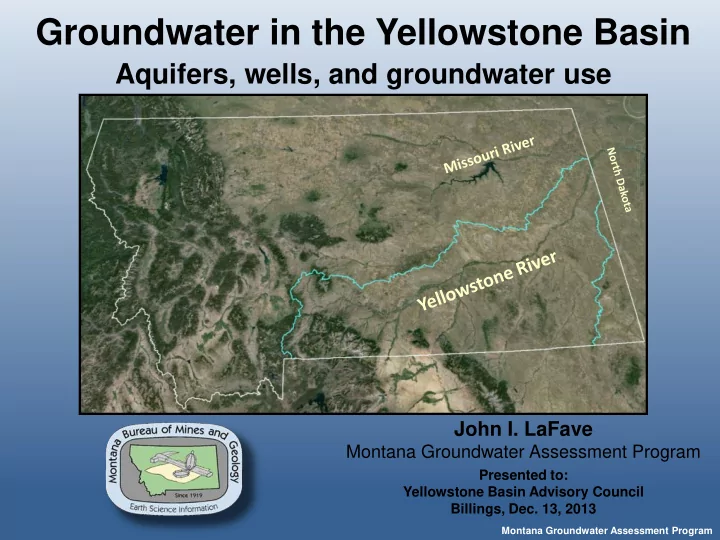
Groundwater in the Yellowstone Basin
Montana Groundwater Assessment Program
John I. LaFave
Montana Groundwater Assessment Program
Presented to: Yellowstone Basin Advisory Council Billings, Dec. 13, 2013
Groundwater in the Yellowstone Basin Aquifers, wells, and - - PowerPoint PPT Presentation
Groundwater in the Yellowstone Basin Aquifers, wells, and groundwater use John I. LaFave Montana Groundwater Assessment Program Presented to: Yellowstone Basin Advisory Council Billings, Dec. 13, 2013 Montana Groundwater Assessment Program
Montana Groundwater Assessment Program
John I. LaFave
Montana Groundwater Assessment Program
Presented to: Yellowstone Basin Advisory Council Billings, Dec. 13, 2013
Montana Groundwater Assessment Program
85-2-902(2) MCA
Montana Groundwater Assessment Program
Field work Complete Field work Complete Field work Complete Field work Complete Field work Complete Field work Complete Field work Complete Ongoing Field work Complete
Montana Groundwater Assessment Program
Montana Groundwater Assessment Program
in the Yellowstone Basin :
992 wells in the State-Wide Network ~200 in the Yellowstone Basin
Montana Groundwater Assessment Program
Well Logs Water Quality Hydrographs Maps & Repts Project data
Montana Groundwater Assessment Program
In 2009, the Montana State Legislature established GWIP within the MBMG to conduct detailed groundwater investigations in areas with of concern
Montana Groundwater Assessment Program
Clear Lake Buried Channels Sidney CBM Fox Hills monitoring
Fort Union Formation – eastern Montana
Montana Groundwater Assessment Program
Alluvial terrace– Red Lodge
Montana Groundwater Assessment Program
Pryor uplift Beartooth uplift Crazy Mtns Porcupine Dome Powder River Basin Black Hills Williston Basin
Montana Groundwater Assessment Program
Alluvium
Hell Creek Fox Hills Pierre Judith River Clagget Eagle
Pryor uplift Beartooth uplift Crazy Mtns Porcupine Dome Powder River Basin Black Hills Williston Basin
Montana Groundwater Assessment Program
Alluvium
Hell Creek Fox Hills Pierre Judith River Clagget Eagle
major valleys – high level benches.
some irrigation.
Montana Groundwater Assessment Program
Alluvium
Hell Creek Fox Hills Pierre Judith River Clagget Eagle
and coal.
Montana Groundwater Assessment Program
Alluvium
Hell Creek Fox Hills Pierre Judith River Clagget Eagle
permeable sandstone.
Up to 2,000 ft below LS
Montana Groundwater Assessment Program
Alluvium
Hell Creek Fox Hills Pierre Judith River Clagget Eagle
shale.
Montana Groundwater Assessment Program
Alluvium
Hell Creek Fox Hills Pierre Judith River Clagget Eagle
shale.
Montana Groundwater Assessment Program
Total wells Wells per yr
Montana Groundwater Assessment Program
Montana Groundwater Assessment Program
(26,000 ac-ft/yr)
Montana Groundwater Assessment Program
(3.4M ac-ft/yr)
Irrigated lands ~525,000 acres
Montana Groundwater Assessment Program
Irrigated lands ~525,000 acres Irrigation canals ~2000 miles
Montana Groundwater Assessment Program
Montana Groundwater Assessment Program
Yellowstone: Huntley Clarks Fork- Yellowstone Yellowstone: Sidney Rock Ck: Red Lodge Yellowstone: Paradise Val.
Sate-wide obs wells
Montana Groundwater Assessment Program
Clarks Fork- Yellowstone
Sate-wide obs wells
discharge (cfs) USGS 06208500 Clarks Fork Yellowstone River at Edgar MT
Oct
Montana Groundwater Assessment Program
Harold E. Thomas, 1951
Montana Groundwater Assessment Program
Producing Oil and Gas wells
the state – 20 in Yellowstone Basin
Montana Groundwater Assessment Program
FHHC water wells FHHC obs wells
Montana Groundwater Assessment Program
South Pine oil field Terry
Montana Groundwater Assessment Program
Montana Groundwater Assessment Program
Montana Groundwater Assessment Program
Montana Groundwater Assessment Program