
SLIDE 1
www.sonomacountywater.org
.
Groundwater in the Santa Rosa Plain Santa Rosa Plain Groundwater - - PowerPoint PPT Presentation
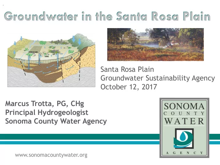
. Groundwater in the Santa Rosa Plain Santa Rosa Plain Groundwater Sustainability Agency October 12, 2017 Marcus Trotta, PG, CHg Principal Hydrogeologist Sonoma County Water Agency www.sonomacountywater.org Presentation Overview 1.
www.sonomacountywater.org
.
US Geological Survey Circular 1139
Courtesy The Nature Conservancy
“Gaining Stream”
High Groundwater Levels Groundwater Maintains Stream Flow
Pumping Lowers Groundwater Levels Stream Loses Flow to Groundwater
“Los
im ng ” Stream”
Pumping Lowers Groundwater Levels Stream Loses Flow to Groundwater
Courtesy The Nature Conservancy
Part 1 - Completed July 2013
Groundwater Quality
Part 2 - Completed April 2014
Groundwater Model
Conditions and Alternative Water Management Strategies
Serves as scientific foundation for management planning
Santa Rosa Plain Groundwater Basin
32% 50% 18%
Agriculture Rural Domestic Municipal Supply
1976-2010 (US Santa Rosa Plain Watershed Estimated Groundwater Demands by Use Type: Average for GS, 2014)
10,000 20,000 30,000 40,000 50,000 60,000 1975 1980 1985 1990 1995 2000 2005 2010 2015 Wet Years Agricultural Rural Domestic Public Supply Total
End of current SRPHM simulation period (2010)
Estimated Pumpage in Acre-Feet Per Year
Note: Estimated pumpage for rural domestic and agricultural uses based on 1976 – 2010 simulations from calibrated Santa Rosa Plain Hydrologic Model (USGS, 2014)
Santa Rosa Plain Geology and Primary Hydrogeologic Units
Santa Rosa Plain Groundwater Subbasin
Bulletin 118 Basin Boundary
Groundwater occurs in all four primary formations Precipitation and streambed infiltration primary source of recharge Primary discharge: Pumping ET Baseflow Dominantly flows east to west Strong connection between surface water and groundwater
1951
Groundwater flowing mainly east to west and discharging to Laguna de Santa Rosa 90 Increases in groundwater pumping through 1980s and 1990s Pumping depressions developed in southern and western areas 07 – 2015 Reduction in groundwater pumping within southern area due to increased Russian River water use, conservation and recycled water use
depression has predominantly recovered
Santa Rosa Plain Groundwater Subbasin
Precipitation Temperature Stream segments & conduct Imperviousness Soil moisture Geology Hydraulic conductivity Groundwater wells
EXAMPLE MODEL USES
strategies
Well Pumping 35,600 Streambed Discharge 25,800 Groundwater Evapotranspiration 8,500 Springs and Seeps 6,100
Values in Acre Feet Per Year
Surface Percolation 41,000 Streambed Percolation 32,400 Subsurface
Aquifer Inflows 7,200
Subsurface
Aquifer Outflows 7,900
Imbalance in the amount
the basin - could be exacerbated by future climate change Key USGS Findings Potential for lowering of groundwater levels, reduction of streamflows and affect on ecosystems Proactively and voluntarily develop non-regulatory Groundwater Management Plan Collaborative Stakeholder-driven Process Local Response
Monitoring and Modeling
Stakeholder Involvement Groundwater Protection Water Reuse Groundwater Recharge Conservation and Efficiency Integrated Planning
Groundwater Monitoring Wells
Green 200-500 feet deep Blue - >500 feet deep Yellow – depth unknown
monitoring program to comply with SGMA
Santa Rosa Plain Groundwater Subbasin
Santa Rosa Plain Groundwater Subbasin
Santa Rosa Plain Groundwater Subbasin
Example of Information available from Additional GSP Requirements Required GSP existing GMP or studies Component*
Description of Annual and cumulative change in groundwater storage based groundwater elevation
trends over time, groundwater contamination sites and plumes, rates and map Groundwater groundwater elevation
Conditions hydrographs and interconnected surface waters and groundwater dependent contour maps, ecosystems and estimates on timing and quantity of stream groundwater quality depletions. data.
*Represents one of many required GSP components