greatland gold plc
play

GREATLAND GOLD PLC (AIM:GGP) ERNEST GILES PROJECT - EASTERN YILGARN - PowerPoint PPT Presentation

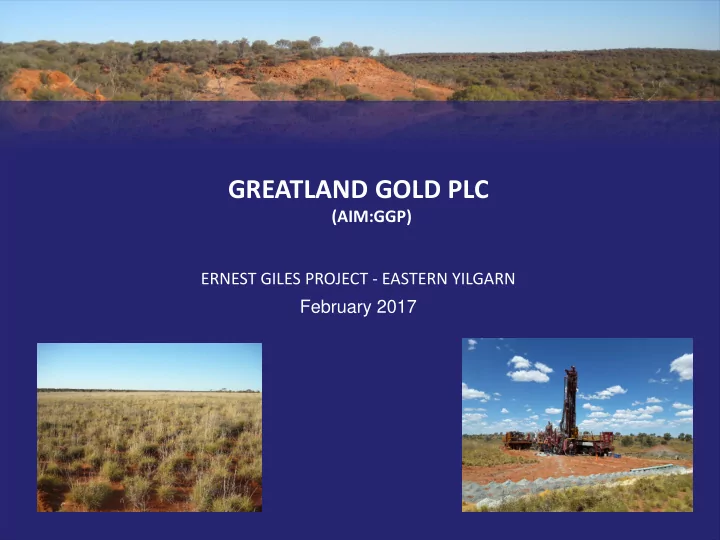
GREATLAND GOLD PLC (AIM:GGP) ERNEST GILES PROJECT - EASTERN YILGARN February 2017 ERNEST GILES PROJECT Located in the eastern Yilgarn of Ownership Western Australia Greatland Pty Ltd 100% Area 1,040 square kilometres Licences E38/2204


  1. GREATLAND GOLD PLC (AIM:GGP) ERNEST GILES PROJECT - EASTERN YILGARN February 2017

  2. ERNEST GILES PROJECT Located in the eastern Yilgarn of Ownership Western Australia Greatland Pty Ltd 100% Area 1,040 square kilometres Licences E38/2204 Calanchini – Granted E38/2882 Carnegie – Granted E38/3183 Empress – Application E38/3184 Ida Range – Application E38/3185 Peterswald - Application Region NE Margin of Yilgarn Craton of Western Australia Target Commodity Gold www.greatlandgold.com 2

  3. ERNEST GILES PROJECT Crustal Setting Very north eastern portion of Archean Yilgarn Craton in Western Australia Location Adjacent to Yilgarn crustal margin Endowment Crustal Margin of Archean Yilgarn Craton and adjacent Proterozoic Fraser Orogen only relatively recently recognised as highly prospective for large deposits Deposits Include Fraser – Tropicana 7.9M oz gold Yilgarn – Yamarna +7.0M oz gold www.greatlandgold.com 3

  4. ERNEST GILES PROJECT Many Gold Deposits in the Yilgarn The many greenstone belts of the Yilgarn Craton in Western Australia are significantly endowed with gold and other commodities All the greenstone belts hold some amount of gold with several areas hosting very large deposits such as Kalgoorlie and Laverton Eastern Goldfields Underexplored The greenstone sequences east of Laverton were, until recently, very poorly explored due to their remote location and cover sequences (lack of outcrop) Recent large discoveries such as Yamarna in the Yilgarn and Tropicana in the Fraser Orogen highlight the potential of these eastern greenstones and adjacent sequences to host large deposits www.greatlandgold.com 4

  5. ERNEST GILES PROJECT Ernest Giles covers an entire unexplored greenstone belt located 250 km north east of Laverton The project area covers an entire arcuate shaped greenstone sequence for over 100km of strike The greenstone sequence at Ernest Giles does not outcrop so historic prospecting failed to locate the prospective rocks Western Mining Corporation (WMC) first postulated the presence of a large greenstone sequence here in the mid 1990s. This was based on broad spaced regional aeromagnetic data outlining the relatively magnetic greenstone rocks Geology shown in the adjacent map is from an aeromagnetic interpretation published by Geoscience Australia in 2002 www.greatlandgold.com 5

  6. ERNEST GILES PROJECT Early regional Aeromagnetic data highlighted the potential WMC were working in various areas through the eastern Yilgarn during the mid 1990s Interpretation work on early broad spaced open file surveys first noted the potential of the Ernest Giles area WMC completed an airborne geophysical survey over the south western portion of the belt along with surface geochemistry and ground gravity Results were considered encouraging and WMC embarked on a drilling programme www.greatlandgold.com 6

  7. ERNEST GILES PROJECT Several broad gold anomalies generated from WMC geochemistry Despite the cover sequences of unknown depth conventional soil sampling was completed by WMC over the south western parts of the belt Also, lag and enzyme leach samples were collected Enzyme leach showed the most coherent results and several ‘Yilgarn Camp’ scale targets were outlined Ground gravity broadly defined the limits of the greenstone sequence www.greatlandgold.com 7

  8. ERNEST GILES PROJECT WMC drilling results showed greenstone basement at Ernest Giles WMC embarked on an RC drilling programme in late 1998 Poor equipment led to slow drilling rates and poor penetration so the programme was cut short to 8 holes Only two holes reached basement with rocks identified as Archean greenstone – basalt and BIF. Depth of cover was 172m Gold was noted in EGRC007 peaking at 67ppb. Results were considered encouraging but WMC disbanded exploration globally and no further work was carried out www.greatlandgold.com 8

  9. ERNEST GILES PROJECT Yilgarn Camp Scale Gold Targets – Mt Magnet vs Ernest Giles Prior to embarking on exploration Greatland looked at possible analogies to guide its exploration efforts Deposits at Mt Magnet in Western Australia displayed similar structural features and magnetic signatures Potential gold endowment of sufficient size (+5M oz) to justify exploration under cover Size of Ernest Giles project highlighted potential for multiple Mt Magnet gold camps Early Greatland licences are shown on the adjacent map www.greatlandgold.com 9

  10. ERNEST GILES PROJECT Greatland management recognised the area in 2003 and the project was secured Empress Wishbone in 2008 7070000 Dromedary Greatland has completed; Carnegie 7060000 - acquisition and interpretation of detailed airborne magnetics 7050000 - mobile metal ion (MMI) geochemistry over Greatland Pty Ltd several areas peaking at 338ppb gold Maple Ernest Giles Project MMI Au(ppb) 7040000 Welstead - diamond drilling and RC drilling with 0.1 to 0.2 multiple gold intersections up to 2g/t gold 0.2 to 0.3 0.3 to 0.6 0.6 to 2.1 7030000 2.1 to 338.1 Results have been successful in outlining several large scale gold targets and also showing mineralisation over large areas. Meadows 7020000 Many targets remain untested 590000 600000 610000 620000 www.greatlandgold.com 10

  11. ERNEST GILES PROJECT Access Great Central Road – 3hrs from Laverton Then via Carnegie Road 50km to southern project area or 75km to north eastern project area Alternative access from west via Lake Wells Great Central Road regularly maintained Food, fuel, accommodation and airstrip at Tjukayirla Roadhouse 10km east of Great Central/Carnegie Road intersection www.greatlandgold.com 11

  12. ERNEST GILES PROJECT Meadows Target Initial wildcat drill holes were sighted based on airborne geophysics. These holes intersected massive sulphide mineralisation and large alteration systems with anomalous gold to 1.0g/t Trial MMI geochemistry was then completed generating a positive response peaking at 68ppb gold. Incomplete MMI coverage over prospect Broad spaced RC drilling was carried out in late 2016 on a nominal 1,600 x 800m spacing returning numerous anomalous gold results peaking at 2.0g/t gold Cover less thick than expected with shallowest basement intercept of 119m Results to date define a Western Zone 6km x 1.5km and an Eastern Zone 2km x 1.5km. Both open to the north www.greatlandgold.com 12

  13. ERNEST GILES PROJECT Empress Target Located 50km north east of Meadows Set on a major structural feature terminating the eastern portion of the greenstone sequence with cross-cutting structures Trial MMI geochemistry was successful in outlining an 8km long gold anomaly which remains open to south Many MMI results over 5ppb gold peaking at 338ppb suggesting basement is relatively near surface Anomaly remains unexplained – high priority www.greatlandgold.com 13

  14. ERNEST GILES PROJECT Some Other Targets – Maple and Wishbone MAPLE - 30km NNW of Meadows Favourable structural location – break in BIF sequence Broad MMI response peaking at 6.6ppb gold 2km long and open to the north. Incomplete MMI coverage over prospect WISHBONE – 50km north of Meadows Large scale folded BIF sequence with several demagnetized zones. Incomplete MMI coverage Represents a cluster of high priority structural targets www.greatlandgold.com 14

  15. ERNEST GILES PROJECT Multiple Target Areas Identified – Most Untested Many targets identified with several displaying potential to be very large Meadows - broad spaced RC drilling has identified gold mineralisation over 6km of strike and open to north Empress – gold anomaly 8km long and remains unexplained. Open to south Other very good targets - untested MMI geochemistry coverage is incomplete Seismic and gravity would assist targeting www.greatlandgold.com 15

  16. ERNEST GILES PROJECT Conclusion Ernest Giles project is an entire ‘unexplored’ greenstone sequence of over 100km of strike Potential for multiple large targets Cover sequence relatively shallow and easily penetrated with modern drilling equipment Deep sensing geochemistry and aeromagnetics appear to be successful targeting tools Incomplete MMI coverage. Seismic and gravity not yet employed Western Australia – safe jurisdiction with secure title and demonstrated mineral potential www.greatlandgold.com 16

Download Presentation
Download Policy: The content available on the website is offered to you 'AS IS' for your personal information and use only. It cannot be commercialized, licensed, or distributed on other websites without prior consent from the author. To download a presentation, simply click this link. If you encounter any difficulties during the download process, it's possible that the publisher has removed the file from their server.

Recommend


More recommend