
SLIDE 1
Ga Garfield ield Par Park Housing Analysis and Opportunities - - PowerPoint PPT Presentation
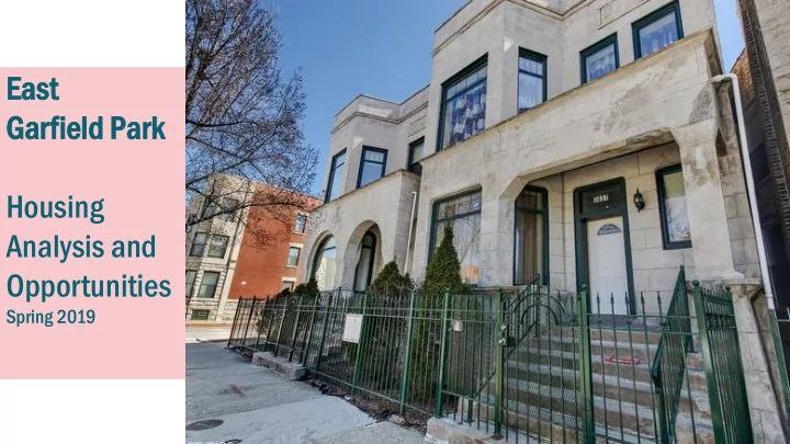
Ea East t Ga Garfield ield Par Park Housing Analysis and Opportunities Spring 2019 Project Purpose Undertake research on the area housing market to assist in establishing goals for affordability, density and design. Develop
3
5
In 2018, DPD initiated the Kinzie Industrial Corridor Modernization plan AND a housing affordability analysis of East Garfield and the Near West Side community areas. Kinzie Industrial Corridor
Periphery (CMAP Region) Source: U.S. Census Bureau. 2018. LEHD Origin-Destination Employment Statistics (2002-2015). Washington, DC: U.S. Census Bureau, Longitudinal-Employer Household Dynamics Program [distributor], accessed on 2-14-2018 at https://onthemap.ces.census.gov. LODES 7.3.
Percent change of total employment in the Chicago Region: City Center vs. Periphery 2002-2015
City Center (CBD and area within 3-mile radius of CBD center) Periphery (CMAP Planning Region that is greater than 3-miles from the CBD center)
CBD
Fullerton 31st Western
Job growth in Chicago follows a national trend:
,821 +7,004 +42,42 ,423 +6,471 +7,512 +2,479
,847
Populat ation ion Change By Sector r 2010-2015 2015
Source: Crain’s December 13, 2016
Region have lost population
population gains
Central Area
the Far South Side and Far West Side
Western 31st Fullerton
North Side Central Area Far West Side Southwest Side South Lakefront Far Southwest Side Far South Side
Western 31st Fullerton
Lake Western
City-owned Vacant Parcel (Approx. 33 Acres) Large surface parking lot Community Investments or Proposed Projects Cook County Land Bank Parcel (Approx. 6 Acres) Cook County Scavenger Sale Parcel (Approx. 9 Acres) Parks Study Area Kinzie Industrial Corridor
12
25.6% 8.6% 3.4% 6.6% 30.1% 39.0% 16.0% 16.0% 24.6% 29.6% 0% 10% 20% 30% 40% 50% 60% 70% 80% 90% 100%
Chicago Study Area
CHICAGO VS. STUDY AREA HOUSING UNIT TYPE, 2016 (US CENSUS)
Detached Townhouse 2-4 Unit 5-19 Unit 20+ Units Other Single Family Multifamily Mixed Uses
70.7% Multifamily 84.6% Multifamily
SF Detached: 306,270 789 SF Attached: 41,112 611 Multifamily: 844,298 7,777 Other: 2,418 18 TOTAL: 1,194,098 9,177
Residential Land Use
Source: Chicago Housing Authority; City of Chicago; HUD (LIHTC Only); IHDA; Cook County Assessor (TY 2016); US Census; SB Friedman Please note that the Census Data noted above is aggregated at the tract level. The Census tract boundaries extend outside of the study area.
Western
13
There is both higher vacancy and larger households West of Rockwell compared to the Study Area as a whole
STUDY AREA WEST OF ROCKWELL EAST OF ROCKWELL
OCCUPIED HOUSEHOLDS: 7,769 3,064 4,705 MEDIAN HOME VALUE: $193,382 $155,098 $219,850 MEDIAN GROSS RENT: $757 $888 $676 AVERAGE RESIDENTS PER HOUSEHOLD: 2.59 2.91 2.37 ESTIMATED AVERAGE BUILDING AGE 55 YEARS 74 YEARS 41 YEARS
Source: US Census, SB Friedman Please note that the Census Data is aggregated at the tract level. The Census tract boundaries extend outside of the study area.
14
Source: US Census, SB Friedman Please note that the Census Data is aggregated at the tract
study area.
OW OWNE NER-OCCUP CUPIED IED RENTE TER-OCCUPI OCCUPIED ED
UNITS (69.0%)
UNITS (15.5%)
VAC ACANT NT
UNITS (15.5%)
14.4% 4% 73.3% 3% 12. 12.3% 3% 17.0% 0% 63.0% 0% 20.0% 0%
TOTAL AL
UNITS
OW OWNER-OC OCCUPI PIED ED
UNITS
OW OWNER-OC OCCUPI PIED ED
UNITS
RENTER-OC OCCUPI PIED ED
UNITS
VACANT NT
UNITS
RENTER-OC OCCUPI PIED ED
UNITS
VACANT NT
UNITS
15
AFFORDABLE HIGHER RENT
TOTAL STUDY AREA RENTAL UNITS
Source: City of Chicago, US Census, SB Friedman Please note that the Census Data is aggregated at the tract level. The Census tract boundaries extend outside of the study area.
NO RENT STUDY AREA WEST OF ROCKWELL EAST OF ROCKWELL
TOTAL RENTAL UNITS
TOTAL RENTAL UNITS
LEGALLY RESTRICTED AFFORDABLE NATURALLY- OCCURING AFFORDABLE
Key takeaway from recent stakeholder interviews: an increas rease e in housing using un units s would ld spark rk comm mmerci cial al
tuni niti ties es that can help p shape pe the e neighbo ighborhoo hood d for long-term rm suc uccess cess.
strong rental market in the area.
Gardens and Henry Horner Chicago Housing Authority developments.
homes on Warren, west of Campbell Avenue.
18
Building Neighborhood and Affordable Homes Program – Pilot program in five targeted neighborhood areas (Englewood Sq., Humboldt Park/Garfield Park, North Lawndale, South Lawndale and Woodlawn). Chicago Community Land Trust – Long-term affordable home ownership for households at or below the median income. City Land for Working Families – Incentivize homebuilders to purchase vacant, city-owned property to construct affordable housing. Community Connections Home Buyer Assistance Program (formally “Public Safety Officer”) – A pilot targeted area program within six police districts (6th, 7th, 9th, 10th, 11th and 15th ). Home Buyer Assistance Program – Citywide program administered by Chicago Infrastructure Trust. Neighborhood Lending Program – Citywide program administered by NHS of Chicago. TaxSmart – Mortgage Credit Certificate – Citywide program available trough participating lenders.
19
Emergency Heating Repairs – Service between November 1st and April 1st. Historic Bungalow Initiative - Energy efficiency grants to low-income homeowners. Neighborhood Lending Program - Home Improvement Loans and Micro Market Recovery (MMRP) targeted grants. Roof and Porch Repairs – Intake date 9/12/2019. Small Accessible Repairs for Seniors – Small repairs and ramps. TIF-Neighborhood Improvement Program -- Single-family (27th Ward: Central West 80.49% / Midwest 10.69% / Division-Homan 10.69%) Troubled Building Initiative - Tool to help reclaim troubled and abandoned buildings that create dangerous and hazardous conditions for residents, neighbors, and first responders.
conditions in East Garfield Park?
to see change?
City-owned Vacant Parcel (Approx. 33 Acres) Large surface parking lot Community Investments or Proposed Projects Cook County Land Bank Parcel (Approx. 6 Acres) Cook County Scavenger Sale Parcel (Approx. 9 Acres) Parks Study Area Kinzie Industrial Corridor