
SLIDE 1
PREPARED FOR AI INTERNATIONAL BY GARY E. SCHWEIKERT
THIS VERSION SANCTIONED FOR RELEASE JUNE 7 2013 BY AI TO ARAMBYS FOR PURPOSES OF ASCERTAINING INTEREST IN DEVELOPING THE PARCEL OF LAND DESCRIBED HEREIN. FORWARDING NOT PERMITTED.
Friars Bay, St. Kitts Development Study PREPARED FOR AI - - PowerPoint PPT Presentation
Friars Bay, St. Kitts Development Study PREPARED FOR AI INTERNATIONAL BY GARY E. SCHWEIKERT THIS VERSION SANCTIONED FOR RELEASE JUNE 7 2013 BY AI TO ARAMBYS FOR PURPOSES OF ASCERTAINING INTEREST IN DEVELOPING THE PARCEL OF LAND DESCRIBED
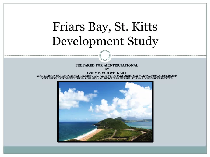
PREPARED FOR AI INTERNATIONAL BY GARY E. SCHWEIKERT
THIS VERSION SANCTIONED FOR RELEASE JUNE 7 2013 BY AI TO ARAMBYS FOR PURPOSES OF ASCERTAINING INTEREST IN DEVELOPING THE PARCEL OF LAND DESCRIBED HEREIN. FORWARDING NOT PERMITTED.
I. Development Overview
Friars Bay consists of 262 acres of pristine land, fronting both the Atlantic Ocean and the Caribbean Sea on the island of St Kitts. Ownership has requested a feasibility review to determine the highest and best use of the land, should development be considered. The site is currently vacant and can be developed with multiple uses to include: § A 100-room luxury hotel § 150 single family home sites § Two condominium sites of 60 units each § Restaurant opportunity overlooking the Atlantic Ocean § Retail shopping village § Twenty-five acre ecological sanctuary § One acre turtle conservation area The development would add to the already burgeoning residential market on the island and satisfy the need for greater commercial opportunities (hotel and retail).
Location: The property extends from the ridge at the top of Sir Timothy’s Hill and extends southward to the ridge at the top of St Michael’s Hill and covers the total width of the island. A portion of the beachfront is shared with the adjacent landowner on the Caribbean side. Surrounding Uses: The southernmost border of the property shares the ridge with the Sundance Ridge development of 15 luxury homes. On the Caribbean beachfront, an adjacent landowner has established a high end beach club and restaurant and is potentially planning a small marina. To the north, residential development is apparent on the far side of Sir Timothy Hill with views of the Atlantic. A pre-existing scenic overlook off the main road facing the Atlantic is popular with tourists. Topography and Visibility: The terrain is both accommodating and foreboding. Most of the hilltop areas include steep slopes, yet coexist with serene beaches on both bodies of water. Also included is a bird sanctuary surrounded by native mangrove and marsh as well as a beachfront turtle conservation area on the Atlantic side. Nearly all parcels of land on the property enjoy a view. Accessibility: The main road “Kennedy Simonds Highway” intersects the entire length of the property and additional roads will be developed to access each parcel considered for development.
INSERT AERIAL VIEW IMAGE
The property had previously undergone a development review which suggested residential development but did not maximize the potential yield. The significant difference in this study: Ø Provide ultimate flexibility in development options and land usage Ø Maximize yield of saleable land
development
Ø Mitigate financial risk by phasing various parcels over time and according to market conditions Ø Involve other development partners only where appropriate and not contingent on the entire property’s development
Why is the benefit for development greater now than before? We evaluated the slope of the land from a different point of view. Extensive work with the local engineering firm proved that the prior standard practice related to construction on sloped land was outdated. Plots may now be sold with a combination of buildable and unusable land. Parcels previously considered unbuildable are now under construction routinely.
Although no formal regulations exist regarding riparian or avian sanctuaries, protection of the salt pond marsh and the turtle spawning areas is good for business. The pond is an avian sanctuary for migratory birds travelling from North toward South America. The mangrove is highly regarded by the local population. The turtle spawning area has the attention of the Caribbean communities and potentially US-based ecological organizations. Destructive actions in these areas may bring negative sentiment toward any development on the property and unnecessarily delay your plans.
We have earmarked the reserve areas requested by owner in two locations: No development will take place in the pond area A turtle protection zone will be established on the Atlantic Ocean beach The focus on “ecological tourism” has existed on other islands but this would be the first effort on St Kitts. The pond area requires some remediation and non- invasive construction of boardwalks for nature viewing. The turtle area may require support for legislative changes and restricted beach access. Both of these activities would be of interest to locals and tourists alike. Expert advocacy groups interested in lending assistance are at our disposal but we suggest contacting them after master planning documents for the development are completed and filed for approvals.
Narrative
Land Parcel
(sf) (acres) A
439,754.8
10.1
Residential lots
B
162,659.3
3.7
commercial/restaurant/ lookout point
C
2,638,403.8
60.6
residential lots
D
415,744.0
9.5
residential lots
E
291,860.3
6.7
very steep and difficult to access
F
348,928.4
8.0
commercial
G
307,075.0
7.0
Existing roadways and verges
H
190,586.9
4.4
potential apartment condos
K
910,417.4
20.9
Nature reserve
L
606,871.2
13.9
residential similar to sandy bank development
M
2,073,288.1
47.6
residential lots
N
1,502,202.1
34.5
boutique hotel or condo
O
953,809.7
21.9
residential lots
Q
279,062.5
6.4
Multi unit apartment / commercial
R
280,195.1
6.4
Beaches along the Atlantic shore line
S
43,588.3
1.0
TURTLE CONSERVATION AREA
TOTALS
11,444,446.9
262.7 NOTE: ALL AREAS IN THIS SCHEDULE ARE APPROXIMATE AND MUST BE CONFIRMED BY A LAND SURVEYOR
Area Proposed land usage
Land Parcel
(sf) (acres) (sf) (acres) (sf) (acres) (sf) (acres) (sf) (acres) (sf) (acres) A 388,255.7 8.9 186,011.2 4.3 202,244.5 4.6 388,255.7 8.9 38,825.6 0.9 349,430.1 8.0 residential (3 lots) B 158,955.2 3.6 68,955.2 1.6 90,000.0 2.1 158,955.2 3.6 15,895.5 0.4 143,059.7 3.3 commercial/restaurant/ lookout point C 1,757,694.3 40.4 1,237,845.2 28.4 519,849.1 11.9 1,757,694.3 40.4 175,769.4 4.0 1,581,924.9 36.3 residential (18 lots) D 408,058.7 9.4 225,713.1 5.2 182,345.6 4.2 408,058.7 9.4 40,805.9 0.9 367,252.8 8.4 residential (4 lots) E 202,828.2 4.7
4.7
F 261,062.4 6.0 138,143.1 3.2 122,919.3 2.8 138,143.1 3.2 13,814.3 0.3 124,328.8 2.9 commercial G 307,075.0 7.0
7.0
H 146,277.2 3.4 130,444.6 3.0 15,832.6 0.4 146,277.2 3.4 14,627.7 0.3 131,649.5 3.0 potential apartment condos I 698,920.3 16.0
16.0
J 386,310.0 8.9
8.9
K 154,865.4 3.6 154,865.4 3.6
3.6 15,486.5 0.4 139,378.9 3.2 back of house ancillary service and parking. L 466,805.2 10.7 369,714.0 8.5 97,091.2 2.2 466,805.2 10.7 46,680.5 1.1 420,124.7 9.6 residential (12 lots) similar to sandy bank development M 1,998,496.5 45.9 1,438,047.1 33.0 560,449.4 12.9 1,998,496.5 45.9 199,849.7 4.6 1,798,646.9 41.3 residential (27 lots) N 778,343.4 17.9 546,206.5 12.5 232,136.9 5.3 778,343.4 17.9 77,834.3 1.8 700,509.1 16.1 boutique hotel or condo O 812,994.0 18.7 438,371.6 10.1 374,622.4 8.6 812,994.0 18.7 81,299.4 1.9 731,694.6 16.8 residential (9 lots) P 1,914,266.0 43.9
43.9
to develop Q 279,062.5 6.4 279,062.5 6.4
6.4 27,906.3 0.6 251,156.3 5.8 Multi unit apartment / commercial R 280,195.1 6.4
6.4
S 43,588.3 1.0
1.0
TOTALS 11,444,053.4 262.7 5,213,379.5 119.7 6,230,673.9 143.0 7,487,951.2 171.9 748,795.1 17.2 6,739,156.1 154.7 NOTE: ALL AREAS IN THIS SCHEDULE ARE APPROXIMATE AND MUST BE CONFIRMED BY A LAND SURVEYOR
Net Saleable Land Area Buildable Land
Very Steep and Difficult to access Land
Proposed land usage Gross Saleable Land
10% to be deducted for infrastructure
v The single family residential development would take place on a minimum of ½ acre lots; exact density would be determined in the master plan based on access. v Pricing is based on a competitive review of other luxury developments with a discount factor of 15%-20%. This seems reasonable given the extensive amenities planned or present in the Christophe Harbour development. v Home sizes are roughly 3500-4500 square feet. v Construction cost is calculated at a finish level similar to other peninsula developments. v Soft costs include government transfer fees, commissions, and professional fees v Infrastructure relates to utilities, roadways, water and sewage.
Two locations on the property would be ideal for condominium apartments:
We recommend considering the development of these units to take advantage of the citizenship program on St Kitts. There continues to be strong interest in the program and these units would provide a strong financial foundation for future development. We envision duplex apartments with one and two bedroom configurations. In the area of Parcel Q, a “retail village” could be the first floor tenants for these buildings (potentially 10).
v Two parcels are quite suitable for commercial development: B and F v Parcel B presents an outstanding opportunity for a unique scenic restaurant, overlooking the Atlantic Ocean v No such experience exists on St Kitts v Contemporary 3-level design would incorporate: v Parking on upper levels for scenic overlook tourists and restaurant guests v Full glass façade one level below with restaurant on second level v Support facilities on third level v Full financials can be modeled after locating a suitable partner for this
locations. v Section F can be developed as a shopping arcade as ease of access from the main road already exists.
Ø The luxury hotel would be situated on the Caribbean beachfront, nestled back into the mountain and matching the contour of the hillside. Ø The design would be contemporary, featuring a roof top pool and event deck with 100 rooms, restaurant, and spa below. Ø The ancillary services and support functions would be located on parcel K, just behind the adjacent owner’s property. Ø Some land reclamation work would need to be done to regenerate the beachfront lost in recent storms.
Demand for St Kitts is growing vs last year! +2.3% in Hotel Occupancy, +4.4% in Average Rate, Competitive set +6%, Revenues +10%
Project Name City & State Country Opening Date # Rooms Ritz-Carlton Grand Cayman Grand Cayman, GCY Cayman Islands Dec 2005 365 Cap Juluca Hotel Maundays Bay, Anguilla Jun 1992 98 Rosewood Little Dix Bay Virgin Gorda, VGG British Virgin Islands Jan 1964 100 One & Only Ocean Club Paradise, PAR Bahamas Jun 1962 105 Sandy Lane Hotel St James, Barbados Mar 2001 113 Rosewood Caneel Bay Resort Cruz Bay, STJ US Virgin Islands Jan 1956 166 Viceroy Anguilla Barnes Bay, Anguilla Jul 2009 166 CuisinArt Resort & Spa Rendezvous Bay, Anguilla Dec 1999 103