fl flight t 93 93 nati tional m mem emori rial refores
play

Fl Flight t 93 93 Nati tional M Mem emori rial Refores - PowerPoint PPT Presentation

Fl Flight t 93 93 Nati tional M Mem emori rial Refores estation on P Projec ect (Ph Phases I-IV) V) M.C. Tyree 1 , J. Larkin 1 , S. Eggerud 2 , P. Angel 2 , M. French 3 , C. Barton 4 1 Indiana University of Pennsylvania, Department of


  1. Fl Flight t 93 93 Nati tional M Mem emori rial Refores estation on P Projec ect (Ph Phases I-IV) V) M.C. Tyree 1 , J. Larkin 1 , S. Eggerud 2 , P. Angel 2 , M. French 3 , C. Barton 4 1 Indiana University of Pennsylvania, Department of Biology 2 Office of Surface Mining Reclamation and Enforcement 3 The American Chestnut Foundation 4 Department of Forestry, UK Photo credit: National Park Service

  2. Fi Field c collection Photo: Ian Forte (left) and Cassandra Krul (right) collecting field data at Flight 93 National Memorial. Posted 09.08.15 at http://www.iup.edu/news- item.aspx?id=201760

  3. Funded by: Green een Fores ests Wo Work The Nation onal Pa Park Foundation (Pe Permit #: FLNI NI-2015 2015-SCI CI-0003 0003) Indiana Unive vers rsity of of Pennsylvania, Departmen ent of of Biolog ogy Additional tha hanks ks Leroy Renninger and MaryEllen Snyder from the NPS. Thanks to Emily Newton, Virginia Tech, The PINEMAP Undergraduate Fellowship Program for her assistance with data collection throughout the summer. Wesley Palmer and Wilson Hood for their GIS assistance throughout this project. Finally, to the hundreds of individuals that volunteered their time to help plant the site.

  4. Fl Flight 9 t 93 N Nati tional Memorial Near Shanksville, PA (40.058, -78.905)

  5. Fl Flight 9 t 93 N Nati tional Memorial Septem ember er 1 10, 2011 2011 The site was officially dedicated and opened to the public Photo credit: National Park Foundation. Accessed on 04.06.17 at http://www.honorflight93.org/remember/?fa=dedication

  6. Fl Flight 9 t 93 N Nati tional Memorial 1950’s u 1950 until m mid-1990’ 1990’s Surface mined and then most of the 890 ha of was re-contoured and seeded. https://www.arcc.osmre.gov/images

  7. Fl Flight 9 t 93 N Nati tional Memorial 2012 2012 - tod oday National Park Service & Office of Surface Mining Reclamation and Enforcement teamed with others to begin reforesting sections using native woody trees and shrubs Photo credit: National Park Service

  8. Refor orestation on P Proj oject ( (2012-15; P Phases I I-IV) V) Phase Year Area ha (ac) No. of trees I 2012 7.7 (19) 14,369 II 2013 9.1 (23) 17,300 III 2014 11.3 (28) 20,550 IV 2015 11.2 (28) 22,000 Total 39.3 (98) 74,219 > 30 spp. of native trees and shrubs Photo credit: National Park Service

  9. Planting List Phase I Phase II Phase III Phase IV Total (2012) (2013) (2014) (2015) (All) Plant name # plants #/ha # plants #/ha # plants #/ha # plants #/ha # plants white pine 4,600 599 6,700 734 8,200 728 9,050 810 28,550 red pine 700 91 200 22 200 18 200 18 1,300 pitch pine 500 65 500 55 600 53 0 0 1,600 Table . Absolute (total Virginia pine 0 0 0 0 0 0 350 31 350 eastern hemlock 0 0 1,200 131 800 71 700 63 2,700 number) and relative red spruce 0 0 0 0 800 71 700 63 1,500 Conifer tree species subtotal 5,800 755 8,600 942 10,600 941 11,000 984 36,000 (plants per hectare) red oak 1,200 156 2,000 219 2,000 178 2,400 215 7,600 abundance of woody white oak 600 78 600 66 800 71 1,100 98 3,100 black oak 600 78 0 0 0 0 0 0 600 trees and shrubs sugar maple 800 104 970 106 600 53 700 63 3,070 planted across the red maple 600 78 300 33 200 18 200 18 1,300 black cherry 600 78 800 88 1,000 89 500 45 2,900 Phases I-IV of The Flight black locust 600 78 800 88 900 80 900 81 3,200 quaking aspen 500 65 600 66 800 71 900 81 2,800 93 National Monument black walnut 100 13 200 22 400 36 400 36 1,100 Reforestation Project. blackgum 400 52 0 0 0 0 0 0 400 yellow-poplar 0 0 200 22 200 18 200 18 600 Planting for each phase hickory species 0 0 0 0 500 44 1,100 98 1,600 American elm 0 0 150 16 150 13 0 0 300 took place in the second American chestnut backcrosses *569 74 480 53 1,000 89 1,500 134 3,549 half of April of each Deciduous tree species subtotal 6,569 855 7,100 778 8,550 759 9,900 886 32,119 American hazelnut 0 0 0 0 100 9 0 0 100 year. flowering dogwood 400 52 200 22 0 0 200 18 800 gray dogwood 300 39 200 22 0 0 0 0 500 silky dogwood 300 39 200 22 300 27 0 0 800 red osier dogwood 0 0 200 22 500 44 500 45 1,200 sweet American crabapple 300 39 200 22 0 0 200 18 700 Washington hawthorn 300 39 200 22 0 0 0 0 500 elderberry 200 26 200 22 0 0 0 0 400 staghorn sumac 100 13 0 0 0 0 0 0 100 mountain ash 100 13 0 0 0 0 200 18 300 ninebark 0 0 200 22 0 0 0 0 200 scrub oak 0 0 0 0 500 44 0 0 500 Wildlife trees & shrubs subtotal 2,000 260 1,600 175 1,400 124 1,100 98 6,100 GRAND TOTAL 14,369 1,869 17,300 1,895 20,550 1,824 22,000 1,968 74,219
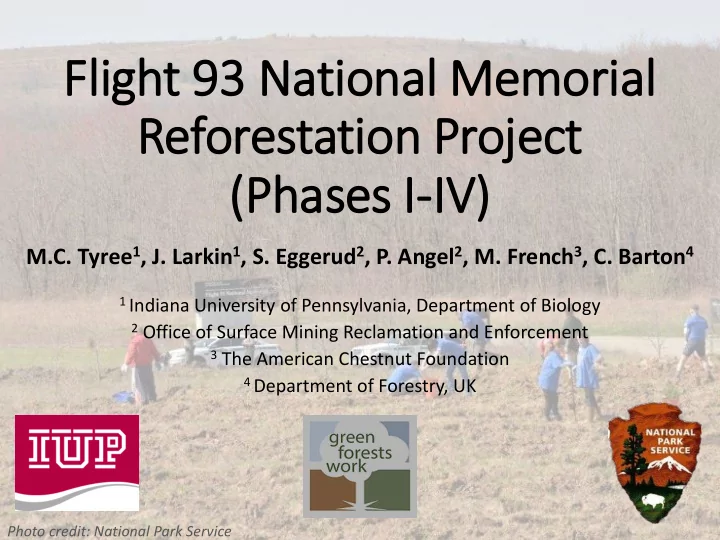
  10. Refor orestation on P Proj oject ( (2012-15; P Phases I I-IV) V) Objectives 1. Survival 2. Deer Browse 3. Competing Vegetation 4. Planting Position Summer 2015 each Phase was evaluated independently and represented 3, 2, 1, and 0.25 years following planting of Phase I, II, III, and IV, respectively.

  11. Size = 7.7 ha (19 ac) Refores estation Projec ect (2012; P Phase I e I) No. of plots = 28 Percent sampling = 15%

  12. Size = 9.1 ha (23 ac) Refores estation Projec ect (2013; P Phase I e II) No. of plots = 30 Percent sampling = 13%

  13. Size = 11.3 ha (28 ac) Refores estation Projec ect (2014; P Phase I e III) No. of plots = 30 Percent sampling = 11%

  14. Size = 11.2 ha (28 ac) Refores estation Projec ect (2015; P Phase I e IV) No. of plots = 30 Percent sampling = 11%

  15. Pl Plot Es Establishment Phase Yr. planted Adj. area (ha) No. of plots % sample I 2012 7.68 28 15% II 2013 9.13 30 13% III 2014 11.26 30 11% IV 2015 11.18 30 11% Total 39.25 118 12% Step 1: Plot boundary captured using Garmin 64s handheld GPS Step 2: Random plot centers generated using ArcGIS 10.2 Constraints > 30 meters between plot centers > 5 meters from boundary edge

  16. Pl Plot Establishment ent Step 1: Navigate to pre-established plot centers using Trimble Juno T41 GPS unit. Step 2: Drive 30 cm piece of rebar at plot center for relocating in future. Step 3: Plot photo taken Plot layout with 0.04 ha (0.10 ac) Step 4: Measure whole-plot data survey plot with four 1 m 2 nested sub- plots for percent cover determination.

  17. Whol ole-Plot M Measurem ement ents All “planted” woody plants within plot boundary were measured Measurements (Obj.) Height (Obj. 1) Basal diameter (Obj. 1) Species (Obj. 1) Vigor index (Obj. 1) Browse index (Obj. 2) Planting position (Obj. 4) Image: Posted 09.08.15 at http://www.iup.edu/news- item.aspx?id=201760

  18. Nested S Sub-Plot M Measurem ement ents Competing vegetation (Obj. 3) Categories (nearest 5%) Bare soil Rock Woody debris Grass/sedge Fern Forb Rubus spp. Woody vegetation Other Totaled 100%

  19. Data A Analysis Phases were treated as a separate experiments Plot-level variables that were calculated for each species (Table) Variable Description Symbol Units Species Abundance Number of individual plants for each species found within the n # or no. phase Relative abundance Number of plants relativized by plot size (0.04 ha) and expressed plants/ha #/ha (observed) on an area basis Mean height Mean height of all plants for each species within the plot Avg HT cm Minimum height Shortest individual for each species within the plot Min cm Maximum height Tallest individual for each species within the plot Max cm Mean diameter Mean basal diameter of al plants for each species within the plot Avg DIA mm Mean vigor Mean vigor value for each species within the plot. Vigor index Percent BO Percentage of plants that show no sign of deer browse % B0 % Percent B1 Percentage of plants with light deer browse % B1 % Percent B2 Percentage of plants with moderate deer browse % B2 % Percent B3 Percentage of plants with heavy deer browse % B3 % Phase-level data was averaged and standard error calculated. Treatments (position) were tested using ANOVA PDIFF Option for mean separation.

  20. Ove verall S Survi vival A total of 74,069 trees were planted across phases I-IV Overall survival was 55% Range was 93% - 37% within individual phases Phase I (2012) 93% (adj. 75%) Phase II (2013) 54% Phase III (2014) 41% Phase IV (2015) 37%

Download Presentation
Download Policy: The content available on the website is offered to you 'AS IS' for your personal information and use only. It cannot be commercialized, licensed, or distributed on other websites without prior consent from the author. To download a presentation, simply click this link. If you encounter any difficulties during the download process, it's possible that the publisher has removed the file from their server.

Recommend


More recommend