Erosion Implications for New Jersey Chronic flooding issues - - PowerPoint PPT Presentation
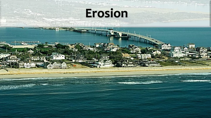
Erosion Implications for New Jersey Chronic flooding issues Increased development pressure More frequent, higher intensity storm events Sea level rise Erosion Vulnerable Coastal Communities How Does a Community Become Resilient to Coastal
Implications for New Jersey
Chronic flooding issues Increased development pressure More frequent, higher intensity storm events Sea level rise Erosion Vulnerable Coastal Communities
How Does a Community Become Resilient to Coastal Hazards?
- Create and Maintain Healthy
Ecosystems
- Healthy beaches and dunes
- Stable shorelines
- Healthy wetlands
http://www.nj.gov/dep/cmp/czm_hazards.html
Stable Shorelines
- Nature-Based Solutions
- Alternatives to gray or hard armoring our coastlines (e.g., sea walls or
bulkheads) (N.J.A.C. 7:7-6.24)
- Examples:
- Living Shorelines
- Thin Layer Placement
- Dredge Islands
- Advantages:
- Can break down wave energy during storms
- May grow or adapt over time, which may enable these systems to keep up with
rising sea levels (as opposed to walls and bulkheads, which weaken over time)
- Provide co-benefits, such as habitat for wildlife and improvements to water
quality
Healthy Wetlands
Protect against flooding and storm damage
- Wetland plants absorb the energy from storms
- Every three miles of wetlands absorbs approximately one foot of storm surge
Protect against erosion
- The roots of wetland plants hold soil and sand in place so that the water does not
take the soil or sand away with it
Protect against global warming and sea level rise
- Carbon dioxide traps heat close to the Earth
- Too much carbon dioxide causes the Earth’s temperature to rise, which melts the polar ice
caps and pushes more water into our oceans
- Salt marshes take a lot of carbon dioxide out of the air.
- Plants need carbon dioxide to grow
- The types of plants found in coastal wetlands take in carbon dioxide very quickly and hold it
for a long time
How Are We Ensuring NJ’s Coastal Communities Are More Resilient?
- Work with Municipalities
- Assess Community Vulnerability
- Review and Assess Gaps in Local Regulations, Zoning,
and Hazard Mitigation Planning
- Provide Technical Assistance and Grants
- Develop and Refine Data, Tools, and Guidance
- CVI mapping has been
prepared for the entire coastal area in New Jersey covering 239 municipalities over four sea level rise scenarios:
- 2014
- 2030
- 2050
- 2100
Coastal Vulnerability Index
http://www.nj.gov/dep/cmp/czm_cvi.html
Action Plan
NJFRAMES
NJFRAMES – What Are We Planning For?
Municipalities
NJFRAMES – Who is Involved?
- Hackensack Meridian Health
- Riverview Medical Center
- Monmouth County Regional
Health Commission
- Monmouth Arts
Society and Health
- Monmouth County Volunteer
Organizations Active in Disaster (VOAD))
- SBP, Inc.
Hazard Response
- Monmouth University
- Naval Weapons Station Earle
- NJAFM
Infrastructure
- American Littoral Society
- Clean Ocean Action
- Monmouth Conservation
Foundation
- NY/NJ Baykeeper
Ecology and Habitat
- EMACC - Eastern Monmouth
Chamber of Commerce
- Fair Haven Yacht Works /
Marine Trades Association NJ
Economic Development
NJFRAMES – Constituents
NJFRAMES – Involved Agencies
NJFRAMES – Municipal Meetings
NJFRAMES – Next Steps
http://www.tworiversonefuture.nj.gov
#TwoRiversOneFuture
NJFRAMES – Project Website
Regional Resilience Planning Grant Program
$15 million award to New Jersey
- $10 million Regional Resilience
Planning Grant Program
- $5 million Toolkit
5-year program (September 2022)
http://www.nj.gov/dep/oclup/resilientnj/index.html
The Program will fund the development and implementation of up to 5 regional resilience and adaptation action plans.
Planning
- Regional scale
- Risk/Vulnerability
- Scenario-based
planning
- Cost benefit
analysis
- Plan
development Implementation
- Outreach &
education
- Master plan
amendments
- Ordinances
- Project design
- Bid documents
- And more…
Regional Resilience Planning Grant Program
Who Qualifies?
- 9 HUD-identified MID
counties
- Groups of 3+
municipalities in those counties with a shared boundary
- Utility authorities
Regional Resilience Planning Grant Program
How will you benefit?
- Assess vulnerability to coastal and riverine
flooding
- Identify locally and regionally-significant assets
- Strategic and actionable mitigation
- Implementation
- Peer-to-peer sharing
- Head start on future funding opportunities
- Innovation
Outreach campaign
Spring 2018
Issue NOFA/RFP
May 21, 2018
Start planning phase
Early 2019
Start implementation phase
Late 2020
Complete projects
Summer 2022
Regional Resilience Planning Grant Program
Promoting Nature- Based Solutions
http://www.nj.gov/dep/oclup/docs/bescch-final.pdf
Living Shorelines AGO
http://www.nj.gov/dep/cmp/czm_mapindex.html
Living Shorelines Projects AGO
Living Shorelines AGO
Updating FEMA Flood Maps for Sea Level Rise
- There is an opportunity to include a Sea Level Rise Line directly
- n the FEMA FIRM map.
- LUM and the Division of Dam Safety and Flood Control are
supportive of this approach.
- We have representatives that participate on a steering committee for
the study on behalf of NJ.
- The Division of Dam Safety and Flood Control is in discussions with
FEMA on a cost estimate for incorporating SLR into the mapping analysis.
- It is expected that the state would need to cover a majority of the cost of the
modeling related to a separate Sea Level Rise Line.
Going Forward
- Tough Conversations
- Should we...
➢ Rethink how we build along our coastline? ➢ Change the type of development along our coast, working waterfronts (e.g., parks, marinas, restaurants, ecotourism, etc.)? ➢ Multi-residence housing on higher ground? ➢ Rolling easements?