SLIDE 1 Ecological and Socio-economic Vulnerability links closely with climate variation: A study exploring adaptation using this connect
Nidhi Nagabhatla
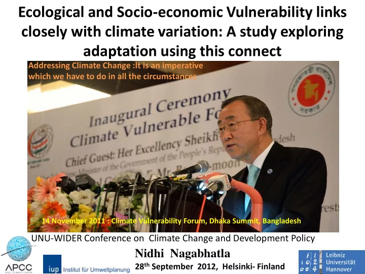
14 November 2011 : Climate Vulnerability Forum, Dhaka Summit, Bangladesh
28th September 2012, Helsinki- Finland Addressing Climate Change :It is an imperative which we have to do in all the circumstances
UNU-WIDER Conference on Climate Change and Development Policy
SLIDE 2
What is Vulnerability ?
Which Nations Are Most Vulnerable to Climate Change? Transforming Adaptive Capacity to Adaptation ?
British firm Maplecroft (top 10) : Bangladesh, India , Madagascar, Nepal, Mozambique, Philippines, Haiti, Afghanistan, Zimbabwe and Myanmar. ( 60% from Asia- S & SEA) Residual situation after adapting to a risk situation (IPCC) The way we respond and cope to change to the way it is required to Gradient of exposure and proneness to damage/disaster
SLIDE 3 IPCC- Socioeconomic Scenarios
- 1. Demographics and development: total population, current and
projected (2025) population density, urban population, coastal population.
- 2. Economics: per capita GDP, GDP distribution from agriculture,
industry, other sectors, trends in annual GDP growth rate.
- 3. Land cover/land use: total land area, arable and cropped, pastured,
forest and woodlands
- 4. Water: water resources per capita, annual allocations for different
sectors viz., domestic, industrial and agricultural use.
- 5. Agriculture: food production, irrigated/rain-fed areas, livestock’s,
agricultural labor markets & production value chains
- 6. Energy: energy consumption (commercial/domestic), renewables,
hydroelectric
- 7. Biodiversity: floral, faunal, avifaunal and marine diversity
SLIDE 4
Climate Change Monitoring First Segment
SLIDE 5 Scenarios for South Asia (adopted from Cruz et al 2007)
SLIDE 6 Pre Monsoonal Situation (MAM) 1870-2007
Drought Flood
SLIDE 7
Winter Rainfall (DJF)
SLIDE 8 Monsoonal Rainfall (JJA)
y = -0.03x + 61.285 R² = 0.0025
20 40 60
1870 1875 1880 1885 1890 1895 1900 1905 1910 1915 1920 1925 1930 1935 1940 1945 1950 1955 1960 1965 1970 1975 1980 1985 1990 1995 2000 2005
Anamoly ( Rainfall)
JJA
y = -0.0355x + 312.55 R² = 0.0035 150 200 250 300 350
1870 1875 1880 1885 1890 1895 1900 1905 1910 1915 1920 1925 1930 1935 1940 1945 1950 1955 1960 1965 1970 1975 1980 1985 1990 1995 2000 2005
Seasonal Mean Rainfall (Obs) in mm (JJA)
Drought Flood
SLIDE 9 Post Monsoon (SON)
y = 0.0326x + 32.443 R² = 0.0042
50 70 90 110 130 150 1870 1875 1880 1885 1890 1895 1900 1905 1910 1915 1920 1925 1930 1935 1940 1945 1950 1955 1960 1965 1970 1975 1980 1985 1990 1995 2000 2005 Seasonal Mean Rainfall (obs) in mm ( (SON) y = 0.0326x - 61.179 R² = 0.0042
20 40 60 80 1870 1875 1880 1885 1890 1895 1900 1905 1910 1915 1920 1925 1930 1935 1940 1945 1950 1955 1960 1965 1970 1975 1980 1985 1990 1995 2000 2005 Anamoly (Rainfall)
SLIDE 10 Temperature Trend : India ( T max)
R² = 0.1053
0.0 0.5 1.0 1.5 2.0 1901 1911 1921 1931 1941 1951 1961 1971 1981 1991 2001 Temprature (max) diifrence from the mean
MAM
East Coast
27 28 29 30 31 32 33 34 35 36 37 1901 1906 1911 1916 1921 1926 1931 1936 1941 1946 1951 1956 1961 1966 1971 1976 1981 1986 1991 1996 2001 T(max) 0C
DJF MAM JJA SON
1.5oC 1.27oC
SLIDE 11 R² = 0.1146
0.0 0.5 1.0 1.5 1901 1904 1907 1910 1913 1916 1919 1922 1925 1928 1931 1934 1937 1940 1943 1946 1949 1952 1955 1958 1961 1964 1967 1970 1973 1976 1979 1982 1985 1988 1991 1994 1997 2000 2003
Tempratyre (min) diifrence from the mean
DJF
18 20 22 24 26 28 1901 1904 1907 1910 1913 1916 1919 1922 1925 1928 1931 1934 1937 1940 1943 1946 1949 1952 1955 1958 1961 1964 1967 1970 1973 1976 1979 1982 1985 1988 1991 1994 1997 2000 2003 Tmin 0 C
DJF MAM JJA SON
0.170C
Temperature Trend : India ( T min)
0.97oC
SLIDE 12 1952 1960 1964 1986 1999 2005 1974
JJAS (MM) Normal Monsoon years
SLIDE 14
Socioeconomic consequences of climate variability and its effect on natural/ managed systems Second Segment
Climate Change Assessment
SLIDE 15
Case Study 1 : Climatic variability vis-a vis Fisheries in Bangladesh
Why Bangaldesh ?
SLIDE 16 Global Vulnerability Profiling (Wheeler and Haddad, 2005)
13.2 27
5 10 15 20 25 30 35 40
India Bangladesh China Indonesia Philippines Nigeria Vietnam Japan United States Egypt, Arab Rep. United Kingdom Korea, Rep. Myanmar Brazil Turkey Malaysia Germany Italy Mozambique Thailand
Vulnerable Population in Millions 2008 2050 Of Top 20 Countries more than 50 % in South , South East and East Asia Countries listed in the order of ranking with India stated as most vulnerable
SLIDE 17 Facts ….[
Export value of global fish trade is: US$63 billion in (2003), more than the combined value of net exports of rice, coffee, sugar and tea. ………………………………(FAO-UN)
]
- Half of global fish trade comes from developing countries
- Global consumption increased by 21% between 1992 and
2002 and increases further
- Nearly 25% of the world's marine fish stocks
are overexploited About 50% fully exploited
(overfishing and increasing degradation of coastal, marine and freshwater ecosystems and habitats)
More Facts
SLIDE 18 Leading to people migrating for work Total Inland Marine
SLIDE 19
- Three Different time periods :
MAM, SON and DJF
- Date Used : Sea Wifs
- Temporal Span : 1998-2009
- Standard Trend : declining
- Decline more pronounced in SON
- (nearly half of the value at the start end of the
temporal scale)
MAM SON DJF
SLIDE 20 Increasing trend during SON and DJF
SON DJF MAM
SLIDE 21 Increasing trend during DJF and MAM SON shows a declining trend attributed to fresh water turbidity and influx
SON DJF MAM
SLIDE 22
A negative correlation exists between Chl-a and SST during SON and MAM, except in coastal zone
SLIDE 23
Case Study 2 : Climate Change and Human Migration
Bangladesh
SLIDE 24
- Currently more 3% of world population migrate for work
- Stern (2007) estimates 150-200 million displaced by CC
[Christian Aid (2007) reports 1 billion ]
- Migration driven by ‘push and pull factors’
Highlights: Climate Shifts and Migration Flows
Pull
Country of destination Demand for workers /employment Access to resources Political Stability Low vulnerability to CC Regulated or low population growth
Push
Country of origin Political Instability Lack of economic growth and
Lack of access to resources Exposure to extreme climate events (high vulnerability to CC) Rate of population growth Socio-economic condition
SLIDE 25 5,000 110 1,400 30 2 2 4 6 8 10 12 1,000 2,000 3,000 4,000 5,000 6,000 Cyclone Bhola-Nov- 1970. Severe Cyclone-May
Bangladesh Cyclone- April-1991 Cyclone Sidr- November -2007 Cyclone Alia-May- 2009 Number of people dead('00) Total number of People Affected (millions)
Disaster drives Migration : IDP’s and Refugees
SLIDE 26 Observation and Projection
48 49 63 78 39 41 54 68
R² = 0.895
10 20 30 40 50 60
20 40 60 80
2009 2010 2015 2020 % People in millions
Recorded and Estimated Projections for next 10 years after 2010
Estimated People displacement (million) Total displacement by floods (millions) %of total population (estimated )
FLOOD FLOOD FLOOD FLOOD
50 % of the total population is projected to displace
SLIDE 27 10 20 30 40 50
Barisal Chittagong Dhaka Khulna Rajashahi Sylhet
% of Agriculture Labour Households to total households 2008 1996 1983
Spatial Distribution at the national level
Brahmaputra Ganges
Exposure to extreme events as a surrogate of ecological and biophysical vulnerability
SLIDE 28 1000 2000 3000 4000 5000 6000 7000 8000 9000 10000 Barisal Chittagong Dhaka Khulna Rajashahi Sylhet Number of households (000) Administrative Divisions Total Households Urban Households Rural Household Total Landless 10 20 30 40 50 60 70 80 90 100
Barisal Chittagong Dhaka Khulna Rajashahi Sylhet
% of the total landless households % Urban of the total Landless % Rural of the total Landless
Poverty as a surrogate of social vulnerability
( expressed as landless households)
SLIDE 29 Profiling Vulnerability
Bangladesh 1(Low)-5 (high) 1(Low)-5 (high) 1(Low)-5 (high) 1(Low)-5 (high) Provincial Divisions Exposure to Extreme Climate Events Sensitivity (Poverty) Adaptive Capacity Ranking Climate Vulnerability
Barisal 4 4 2 5 Chittagong 4 3 2 4 Dhaka 2 1 4 2 Khulna 2 3 4 3 Rajashahi 1 5 5 1 Sylhet 5 1 1 4
SLIDE 30 Case Study 3 : Agro-ecosystem
Kerela
rice
banana
Arecanut
SLIDE 31 Wayanad
31
Vellamunda Panamaram
Kerala Wayanad Administrative center : Kalpetta Three main blocks Area : 2000 sq km
Wayanad surrounds Western Ghats
Census 2011 Wayanad Population :816 558
SLIDE 32 32
Temporal trend in rice : what do records say ?
SLIDE 33 33
Paddy (rice ) growth trends
Ten years paddy (rice) distribution trend in Kerala Paddy (rice) distribution trend in Wayanad
SLIDE 34 DTR [Diurnal Temperature Range ) Anomaly
Winter
Summer
Crop growth simulations show that rice yields decrease 9% for each 1°C increase in seasonal average temperature (Kropff et al., 1993).
SLIDE 35 Concluding Remarks
- Clear understanding of climate interactions with social
and environmental varies with scale, season, systems and region is pertinent to assess vulnerability and address adaptation
- Integration of scientifically delineated
climate information in decision making is certainly one of the potential ways to attend to address uncertainty associated with climate change
- Transdisciplinarity is a point to ponder
SLIDE 36 Thank You for your attention
fearbeneath.com