Development of Response System for Volcanic Disasters 1 The study - - PowerPoint PPT Presentation

development of response system for volcanic disasters
SMART_READER_LITE
LIVE PREVIEW

Development of Response System for Volcanic Disasters 1 The study - - PowerPoint PPT Presentation

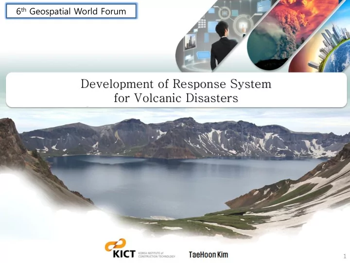
6 th Geospatial World Forum Development of Response System for Volcanic Disasters 1 The study area, Mt. Baekdu is the highest mountain(2,750m) in korea. In 969 , there was a large volcanic eruption(VEI 7.0) that had a wide spread


slide-1
SLIDE 1

Development of Response System for Volcanic Disasters

6th Geospatial World Forum

1

slide-2
SLIDE 2
slide-3
SLIDE 3
  • The study area, Mt. Baekdu is the highest mountain(2,750m) in

korea.

  • In 969, there was a large volcanic eruption(VEI 7.0) that had

a wide spread impact by 1,000km more than hokkaido in Japan.

  • Since 2002, volcanic earthquakes have been observed 10 to 15

times each month in Mt. Baekdu

  • Mt. Baekdu currently is a claasiffied as ‘a high-risk volcano’(Fig

1)’

  • Small-scale volcanic eruptions do not cause much damage.

However, with a large volcanic eruption in 969 happening again, then we can encounter lager political and economical impact than before.

  • Therefore, we need to develop an integrated volcano disater

response system in order to minimize any potential volcanic damage.

< Fig 1. Study area(right) and Location of magma/frequency of volcanic earthquake(left) >

slide-4
SLIDE 4

< Fig 2. Annual objectives >

  • Development of volcanic disasters resoponse system
  • Planning stategy
  • Designing system
  • Development of pilot system
slide-5
SLIDE 5

A response system for volcanic disasters consists of followings : 1) Damage prediction DB 2) Integrated damage prediction system 3) Decision support system 4) 3D GIS visualition system and Web GIS system 5) User interface

< Fig 3. Architecture of response system for volcanic disasters >

slide-6
SLIDE 6

The process of the response system :

  • First, a damage prediction scenario was processed by integrated damage prediction

system and the results store at damage prediction DB in advance.

  • Second, this results are shown by 2D/3D GIS visualization module similar to the actual

situation.

  • Third, when a volcanic eruption occurs, the decision support system searches most similar

prediction scenarios in the prediction DB, estimates damages, and supplies a targeted response plan very quickly.

< Fig 4. Architecture of response system for volcanic disasters >

slide-7
SLIDE 7

The system menu is designed based on the system architecture and work process analysis results.

< Fig 5. System menu of volcanic disasters response system >

slide-8
SLIDE 8

< Fig 6. Risk assessment models for integrated damage prediction system >

  • Volcanic disasters can be categorized as volcanic ash, volcanic flood, pyroclastic

flow/volcanic mudflow, and volcanic earthquake.

  • For volcanic ash, we need various programs as PANOPOLY1.0, SURFER10.0, NetCDF4.0.1,

PGI2.0, FALL3D6.2.

  • We can freely use most of the programs because they have open source codes except PGI,

ARC-GIS and SURFER.

  • For volcanic floods, Pyroclastic flow and volcanic mudflow, commercial ARC-GIS software

and Global-mapper are used for analyzing prediction models.

Application models for various volcanic disaster

slide-9
SLIDE 9

Classifica tion Area Data Spec. Dimension note Volcanic Acitivity Area Mt. Baek du Image Map 0.5m 2D New developmnt. DEM 10m 3D New developmnt. Land cover Map 1:5,000 2D New developmnt. surface deforma tion change Ma p 25m-50m 4D New developmnt. suface temperat ure change Map 30m-60m 4D New developmnt. digital topograp hic map 1/5,000 2D New developmnt. 3D hydrographic m ap 1/5,000 2D New developmnt. slope, gradient 10m 2D New developmnt. azimuthal map 10m 2D New developmnt. demographical map 1/5,000 2D New developmnt. Direct Impected Area North Korea Image Map 1m ~ 2.5m 2D NGI, KARI DEM 10m ~ 20m 3D NGI, KARI digital topograp hic map 1/25,000 ~ 1/5,000 2D,3D NGI, Land cover Map 1:25,000 2D

  • Mnstry. of Enviro

nmnt. hydrographic m ap 1/25,000 2D New developmnt. slope, gradient 20m 2D New developmnt. azimuthal map 20m 2D New developmnt. demographical map 1/25,000 2D New developmnt. Classification Area Data Spec. Dimension note Indirect Impected Area South K

  • rea

Image Map 0.1m ~ 0.5m 2D NGI, DEM 1m ~ 5m 3D NGI, Digital Map 1/1,000 ~ 1/5,000 2D,3D NGI, 3D Model Seoul and 6 metropoli tan city etc. 3D NGI, Land cover M ap 1:5,000 2D

  • Mnstry. of Environmn

t. hydrographic map 1/5,000 2D New developmnt. slope, gradien t 5m 2D New developmnt. azimuthal ma p 5m 2D New developmnt. demographica l map 1/5,000 2D New developmnt. Global Area Globe Image Map 15m 2D MLTM DEM 90m 3D MLTM Land cover M ap global scale 2D

  • Mnstry. of Environmn

t. hydrographic map 1/100,000 2D New developmnt. slope, gradien t 90m 2D New developmnt. azimuthal ma p 90m 2D New developmnt. demographica l map 1/100,000 2D New developmnt.

  • For location based damage analysis, we need various GIS database.
  • Therefore, we constructed GIS DB such as satellite image map, DEM, land cover map,

hydrographic map, geological map, etc.

slide-10
SLIDE 10

① Mt. Baekdu(25kmⅩ25km) : TerraSAR 2012 New 10M DEM ② North Korea : Digital topographic map 10M DEM(NGII) ③ CHINA : Global SRTM 90M DEM(MLTM)

  • Construction method of Mt. Baekdu(100kmⅩ100km) precise DEM(Digtal

Elevation Model) 10m DEM of study area = ①+②+③

Example of basic GIS DB

  • Sateliite Image
  • Land Cover Map
  • Geological Map

North Korea China Mt, Baekdu

slide-11
SLIDE 11
  • We developed a pilot 3D visualization program for volcanic ash diffusion and sedimentation
  • Sample modeling data was derived by volcano ash simulation model(Puff, Fall3D, FLEXPART)
  • and was transferred to grid data(x, y, z, t, value) for particle distribution of the analyzed area

in proportion to the concentration of volcanic ash.

  • Volcanic ash concentration and deposition data used in the pilot program is the calculated

data from Oct 29th to 31st of 2010 and it include the weather data of relevant date.

< Fig 7. 3D GIS visualization test result of volcanic ash modeling based on senario >

slide-12
SLIDE 12
  • A volcanic disaster response pilot system is developed by defining work processes, building

a GIS DB, proposed system design and application of various prediction models.

< Result of volcanic ash diffusion simulation > < Damage amount of volcanic ash simulation and response manual>

slide-13
SLIDE 13

< result of Pilot system test scenario>

slide-14
SLIDE 14

< result of Pilot system test scenario>

slide-15
SLIDE 15

This study proposes planning strategy, designing system and development of

pilot system for volcanic disaster response system.

Damage prediction should be based on spatial information and a decision support system to support the user’s decision efficiently. We have designed the response system and developed pilot system for volcanic disasters. We are going to develop a integrated system and to final test it in the near future. It is expected that the system in this study will effectively reduce the damages in the field of the industry, the transportation, and the environment during volcanic eruption.

slide-16
SLIDE 16