
SLIDE 1
Decommissioning Regulatory Process
Deanna Toy June 27, 2018
1
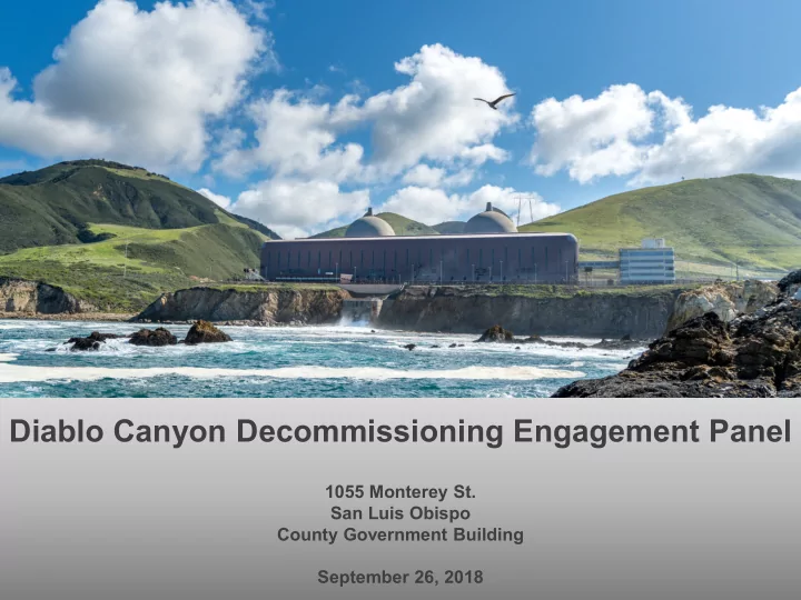
Diablo Canyon Decommissioning Engagement Panel
1055 Monterey St. San Luis Obispo County Government Building September 26, 2018
Decommissioning Regulatory Process Deanna Toy June 27, 2018 - - PowerPoint PPT Presentation
Decommissioning Regulatory Process Deanna Toy June 27, 2018 Diablo Canyon Decommissioning Engagement Panel 1055 Monterey St. San Luis Obispo County Government Building 1 September 26, 2018 Safety Moment AED CPR Meet and Guide Call 911
Deanna Toy June 27, 2018
1
Diablo Canyon Decommissioning Engagement Panel
1055 Monterey St. San Luis Obispo County Government Building September 26, 2018
2
Call 911 Meet and Guide
CPR Active Shooter ‘Get Out, Hide Out, Take Out, Call Out’ Earthquake ‘Duck, Cover, Hold’ AED Evacuation Plan
PG&E Vice President of Safety and Health
September 26, 2018
3
4
Diablo Canyon repurposing presentations Sanders / Jones Review of repurposing workshops Anders / Panel Review public comments and metrics Anders 10 minute break (7:30 p.m.) All Public comment (window closes at 7:30 p.m.) All Panel observations and discussion Panel Introduction to next meeting topics: NRC Decommissioning Rulemaking presented by Bruce Watson (NRC Chief, Reactor Decommissioning Branch) and Emergency Planning During Decommissioning Jones Meeting summary Anders Adjourn meeting Anders
Panel Kiosks
question
resources of Diablo Canyon lands and facilities
panel and panel activities
hiking trails
5
Sara Sanders, Planner III The Department of Planning & Building
Eureka Energy Company Fee Parcels
The Department’s Priorities
The Department operates using priorities which are directed by the Board of Supervisors The next time these will be discussed at the Board will be October 9th at the Strategic Planning Meeting
Zoning
Zoning is a tool that most cities and counties use to govern “uses” (e.g. residential, commercial, or industrial), the size of buildings, and how buildings relate to their surroundings, including other buildings, open spaces, and the street. The General plan is implemented primarily through zoning (in our Coastal (Title 23) and Inland Land Use (Title 22) Ordinances)
Land Use Categories
Are a part of zoning which identify areas for similar and compatible land uses Provide a basic order for development while allowing a range of uses PG&E parcels are zoned:
Agriculture (AG) Rural Lands (RL) Public Facilities (PF)
Agriculture (AG)
In these areas:
Soils are prime and agriculture practices are typically located Residential uses are allowed for property owners or employees actively engaged in agricultural production on the same property. Parcel sizes are sufficiently large to make agricultural
Examples of Allowable Uses:
Coastal Zone: Coastal Accessways, Passive Recreation, Electric Generating Plants Inland: Energy generating facilities, Crop Production and Grazing, Fisheries and Game Preserves
Even if a use is allowed, landowners are required to get a land use permit.
Public Facilities (PF)
In these areas:
Land and structures are typically committed to public facilities and public agency uses Intended to benefit and meet the needs of the public
Some Examples of Allowable Uses:
Coastal Zone: Coastal Accessways, Marinas, Passive Recreation, Harbors, Marine Terminals & Piers Inland: Crop Production and Grazing, Camping
Even if a use is allowed, landowners are required to get a land use permit.
Rural Lands (RL)
In these areas:
Low population densities with open and natural countryside preferred Open space, watershed, and wildlife habitat areas are maximized
Some Examples of Allowable Uses:
Coastal: Coastal Accessways, Passive Recreation, Rural Recreation & Camping Inland: Energy generating facilities, Crop Production and Grazing, Off-Road Vehicle Courses
Even if a use is allowed, landowners are required to get a land use permit.
Land use permit
Sets conditions for the use's establishment and operation. Only entitles the use itself; Separate permits may also be required for any construction or grading activities.
There are four types of land use permits:
Plot Plan Site Plan Minor Use Permit Conditional Use Permit (inland) or Development Plan (coastal)
Types of Land Use Permits
Plot Plan
Ministerial Permit, acted on by staff Example: Single Family House
Site Plan
Ministerial Permit, acted on by staff Required to review more project details, such as landscaping or signage, acted on by staff Example: Small grocery store less than 10,000 SQ
Minor Use Permit
Discretionary permit, acted on by a hearing officer on behalf of the Director of Planning & Building Required for projects that may have the potential to cause neighborhood concerns Example: Incidental camping in Rural Lands
Conditional Use Permit (Inland) / Development Plan (Coastal)
Discretionary permit, acted on by the Planning Commission Required for larger projects or other land uses that may have the potential to affect the neighborhood or community Example: proposed harbor in the Coastal Zone (Parcel Zoned Public Facilities)
“Master” Plan is a discretionary Land Use Permit in the Coastal Zone “Strategic Action Plan” is a document that provides an overall vision for a project including goals,
"Lead Agency" is the public agency that has the primary responsibility for approving a project that may have a significant impact upon the environment. The “lead agency” will depend on the applicant, PG&E, and the application type
7
Tom Jones PG&E Director, Strategic Initiatives September 26, 2018
CPUC Order: Public Engagement Process
California Public Utilities Commission (CPUC) Order from Joint Proposal Decision
respect to any of the lands and facilities, whether owned by the utility or a subsidiary, before completion of a future process including a public stakeholder process; there will be local input and further Commission review prior to the disposition of Diablo Canyon facilities and surrounding lands. (A.16-08-006, pp. 60-61)
8
9
Engagement Panel
Public Meetings
Constituent Groups
Workshops Website Public Comments Individual Discussions
PG&E
PG&E Employees Community Stakeholders
Panel Facilitator
Public Talks
Tour Program Media Digital Campaigns
Elected & Appointed Officials Regulators
CPUC Order: Breakwater/Repurposing
CPUC Order from 2015 Nuclear Decommissioning Cost Triennial Proceeding Decision
PG&E is directed to provide testimony summarizing further exploration of the application of Executive Order D-62-02 to the disposition of construction debris at DCPP. This testimony is to include a summary of consultations with the Department, Water Board, DTSC, and CCC. The testimony is also to include a status update concerning the environmental reviews required for retiring DCPP, the site specific plan required in A.16-08-006, and further exploration as to whether to remove or maintain the
10
Site Overview: Diablo Canyon Properties
Lands plus assets – i.e., sirens, breakwater, Energy Education Center….
11
Plant Site Wild Cherry Canyon
Site Overview: Diablo Canyon Site Boundary
12
Dry Cask Storage 500 KV Yard 230 KV Yard Breakwaters Turbine Bldg Desalination Facility Training Bldg Main Warehouse Building 113 Admin Bldg Admin Bldg: 151,408 SF Main Warehouse: 122,749 SF Security Bldg B: 11,789 SF Building 113: 32,712 SF Machine Shop: 33,343 SF Training Bldg: 21,193 SF Desal Facility: 440 gpm Maintenance Shop: 41,624 SF Turbine Bldg: 411,496 SF Marina: ~10 ac. Security Bldg A: 6,124 SF Available After 2068: Marina Maintenance Shop Security Bldg A Firing Range Machine Shop Security Bldg B
Phasing
14
15
population of 450
Humboldt Bay (HB) used fuel storage (53 feet from trail); number of trail visitors is not monitored
Humboldt Bay - California
HB Used Fuel
16
Public Trail
SONGS used fuel storage
state parks in California
San Onofre Nuclear Generating Station (SONGS) - California
SONGS Used Fuel
17 San Onofre Bluffs Campground
San Onofre State Beach State Beach and Public Trail
miles to nearest houses) with an approximate population of 24,400 (2010 Census)
Illinois Beach State Park wrapping around the Zion Station
Zion Station - Illinois
18
State Beach and Public Trail
Zion Used Fuel
to elevation difference
DCPP
19
DCPP Used Fuel Admin Bldg
Repurposing Decision Impact on Decommissioning Schedule
Lands plus assets – i.e. sirens, breakwater, Energy Education Center….
20
Project Level Description (Project Execution)
Project Level Description (Project Execution) Project Level Description
Submittal I: Shutdown, Decommissioning, and Initial Site Restoration Submittal II: Breakwater and Intake Cove Decommissioning, and Diablo Creek Restoration Submittal III: ISFSI Decommissioning and Restoration
2020 2021 2022 2023 2024 2025 2026 2027 2028 2029 2030 2031 2032 2033 2034 2035 2036 2037 2038 2039 2040 2041 2042 2043 2044 2045 2046 2047 2048 2049 2050 2051 2052 2053 2054 2055 2056 2057 2058 2059 2060 2061 2062 2063 2064 2065 2066 2067 2068 2069 2070 2071 2072 2073 20742020 2025 2030 2040 2035 2045 2050 2055 2060 2065 2070 2075 Approval Phase Approval Phase Program Level Description April 2020 CDP #1 Submittal January 2060 CDP #3 Submittal Approval Phase Program Level Description January 2030 CDP #2 Submittal Breakwater Removal Phase Initial Repurposing Opportunities
repurposing
public access compatibility
Panel’s recommendations, regulatory requirements, decommissioning goals, and other considerations
21
READ AND DELETE
For best results with this template, use PowerPoint 2003
Tom Jones Tom.Jones@pge.com
22
23
Repurposing Workshops Overview Workshops were conducted over two days (14 hours) Nine presentations from interested parties
24
Corporation
District
Company
Northern Chumash Tribe of SLO County and Region
Repurposing Workshops Proposals
25
Repurposing ideas included:
science / academic uses
storage, etc.
need specifics
assets
uses
are complementary
in concert with decommissioning timetable
and implementation schedule from PG&E
26
27
28
10 minutes
29
2018 TOTAL: 393 (up from 260 total last month)
REPURPOSING
ENVIRONMENTAL
LANDS
ECONOMIC IMPACTS
SAFETY
TRANSPORTATION
FUNDING OTHER OUTREACH PROCESS SECURITY
Tours:
tour participants
Presentations:
reached in eight public talks
Visitors:
hikers on the Pecho Coast and Point Buchon trails
30
31
Left Podium Right Podium
32
33
34
35
We’re available now to answer additional questions
36
Project and Permit Phasing
Lands plus assets – i.e. sirens, breakwater, Energy Education Center….
37
Dry Cask Storage 500 KV Yard 230 KV Yard Breakwater Power Block Submittal 1: 2020 Submittal 2: 2030 Submittal 3: 2060 Intake Old Steam Generator Storage Facility Firing Range
37
Return
Site Overview: Diablo Canyon Properties
Pecho Coast Trail
38
Point Buchon Trail Plant Site
Eureka Energy Company Fee Parcels; leased to PG&E containing Deed Restriction PG&E Fee Parcels containing Deed Restriction
PARCEL 24, 26, 27 0.41 ACRES 421.06 ACRES