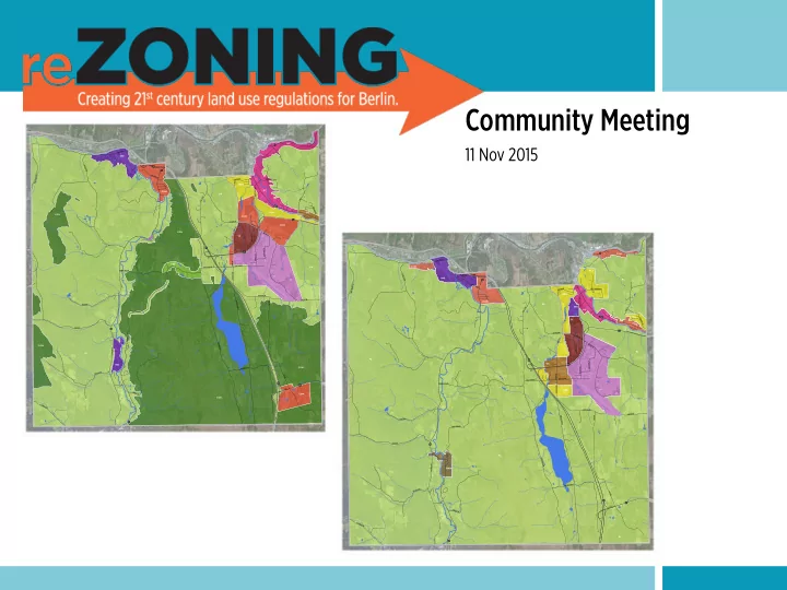
SLIDE 1 Community Meeting
11 Nov 2015
PAINE TPK C R O S S T O W N R D COMSTOCK RD SCOTT HILL RD E X I T 7 FISHER RD AIRPORT RD S T E W A R D R D BERLIN MALL RD INDUSTRIAL LN P A I N E T P K GRANGER RD B E R L I N S T A T E H W Y E X I T 8 EXIT 6 CHANDLER RD JUNCTION RD BARTLETT RD JONES BROOK RD C R O S S T O W N R D ROWELL HILL RD MUZZY RD C H A S E R D WEST HILL RD D A R L I N G R D COX BROOK RD BROOKFIELD RD BERLIN POND RD MIRROR LAKE RD EAST RD EAST RD S C O T T H I L L R D AIRPORT RD V I N E S T HIGHLAND AVE PARTRIDGE FARM RD A D D I S O N D R H I L L S T E X T D O G R I V E R R D
LI TC MDR HC M R CON COM RL RR IND COM COM HC R60 IND COM CON CON CON CON RR MDR
P A I N E T P K CROSSTOWN RD COMSTOCK RD S C O T T H I L L R D EXIT 7 F I S H E R R D AIRPORT RD STEWARD RD B E R L I N M A L L R D I N D U S T R I A L L N PAINE TPK G R A N G E R R D BERLIN STATE HWY EXIT 8 E X I T 6 CHANDLER RD JUNCTION RD BARTLETT RD JONES BROOK RD CROSSTOWN RD R O W E L L H I L L R D MUZZY RD CHASE RD W E S T H I L L R D DARLING RD COX BROOK RD B R O O K F I E L D R D B E R L I N P O N D R D M I R R O R L A K E R D EAST RD EAST RD SCOTT HILL RD AIRPORT RD V I N E S T HIGHLAND AVE PARTRIDGE FARM RD ADDISON DR HILL ST EXT D O G R I V E R R D
VC LI TC RES RES RES IND HC C O M IND COM HAM COM RL RL RL RL RL RL RES COM
SLIDE 2 AGENDA
What is the re-zoning project? Why is the re-zoning project necessary? What is the process for re-zoning? What is the current status of the project? What changes are being proposed? How do I find more information? How do I submit comments?
SLIDE 3 What is the re-zoning project?
- 1. Comprehensive revision of Berlin’s zoning & subdivision regulations
- 2. Unification of the zoning & subdivision regulations
- 3. Implementation of town planning goals
SLIDE 4 Why is re-zoning necessary?
- 1. Berlin’s town plan recommends changes to the regulations
- 2. Development Review Board and Zoning Administrator have
identified problems when reviewing development applications
- 3. Regulations are out-dated and out-of-step with federal, state and
case law
4.Changes in planning practices and technical standards
SLIDE 5
Berlin Town Plan Goals
Land use regulations implement the goals of the town plan.
๏ Revitalize the Route 302 corridor ๏ Develop a strong commercial/industrial center in the NE quadrant ๏ Recognize the historic district near the Four Corners ๏ Enhance and expand the town center area ๏ Maintain the commercial and industrial areas near the mouth of the Dog River ๏ Consider a hamlet district for Riverton ๏ Maintain the rural qualities of the remainder of town ๏ Continue to protect Berlin Pond
SLIDE 6
What is the process?
๏ Consultant completed a technical review of the town plan and regulations ๏ PC hosted a community workshop to kick-off the project in May ๏ PC began work on first draft in June ๏ PC has released a first draft of Parts 1, 2 and 4 of the revised regulations ๏ PC is hosting a public meeting to present revised zoning districts and map ๏ PC will complete work on Parts 3 & 5 by end of year ๏ PC will host another community meeting early next year ๏ PC will revise first draft based on public feedback ๏ Goal is to have a complete draft ready for adoption process next spring
SLIDE 7 What is the process?
- 1. PC drafts revised regulations, asking for public feedback during the process
- 2. PC holds a public hearing on the draft regulations
- 3. PC recommends draft regulations to the Selectboard
- 4. SB holds a public hearing on the draft regulations
- 5. SB places draft regulations on a town meeting ballot
- 6. Regulations must ultimately be adopted by the voters
SLIDE 8 PART 1. GENERAL
Chapter 100. General!
PART'1. GENERAL'
Chapter'100. Legal'Framework'
I
The purpose of this chapter is to establish a legal foundation for these regulations.!
Section 1001. Title1
1001.A These!are!the!Town!of!Berlin’s!Land%Use%and%Development%Regulations!and!constitute!the!
town’s!zoning!and!subdivision!regulations.! Section 1002. Authority2
1002.A The!Town!of!Berlin!has!adopted!these!regulations!in!accordance!with!and!as!authorized!by!
the!Vermont%Planning%and%Development%Act,!24!VSA!Chapter!117.! Section 1003. Purpose3
1003.A These!regulations!implement!the!goals!and!policies!of!the!Berlin%Town%Plan!and!the!Vermont%
Planning%and%Development%Act.!They!are!intended!to:!
(1)
Provide!for!orderly!community!growth;!
(2)
Protect!public!health,!safety!and!welfare;!
(3)
Allow!for!balanced!housing!and!economic!development!that!meets!the!needs!of!the! community!and!region;!
(4)
Protect!environmental!quality!and!conserve!natural,!agricultural,!scenic!and!historic! resources;!
(5)
Promote!approaches!to!land!use!and!development!that!are!consistent!with!smart! growth!principles.! Section 1004. Equal Treatment of Housing4
1004.A These!regulations!are!intended!to!allow!the!development!of!housing!in!accordance!with!
statutory!requirements.!They:!
(1)
Allow!mobile!homes,!modular!homes!and!prefabricated!homes!to!the!same!extent!as! conventional!homes.!!
(2)
Allow!mobile!home!parks!to!the!same!extent!as!other!residential!subdivisions!or! developments.!!
(3)
Permit!accessory!dwelling!units!in!all!zoning!districts!that!allow!single.family!homes! and!as!an!accessory!use!to!any!pre.existing!single.family!home!in!accordance!with!*.! !!!!!!!!!!!!!!!!!!!!!!!!!!!!!!!!!!!!!!!!!!!!!!!!!!!!!!!!!!!!!
Part 1
๏ Legal framework ๏ Exemptions ๏ Vested rights and nonconformities
SLIDE 9 PREPARE APPLICATION PRE-APPLICATION CONFERENCE FILE APPLICATION APPLICATION COMPLETE APPLICATION INCOMPLETE APPROVE APPLICATION DENY APPLICATION APPEAL DECISION PERMIT EFFECTIVE
30 days 15 days
DEVELOPMENT COMPLETE DEVELOPMENT INCOMPLETE
2 years
CERTIFICATE OF COMPLIANCE PERMIT EXTENSION
1 year
SITE CLEANED & STABILIZED
Part 4
๏ Zoning permit procedures ๏ Site plan and conditional use
review procedures
๏ Subdivision and planned unit
development review procedures
๏ Appeal procedures ๏ Enforcement procedures
SLIDE 10
Site Plan
๏ Development other than single- or two-family homes ๏ DRB hearing process for major projects: ๏ New conditional use ๏ New principal building or major renovation ๏ New curb cut ๏ 2,000 sf of new impervious surface ๏ Administrative approval for minor projects (everything else)
SLIDE 11
Part 2
Proposed Changes to the Zoning Districts and Map
๏ Creating several new zoning districts ๏ Consolidating some existing zoning districts ๏ Reshaping the boundaries of some existing districts ๏ Adding overlay districts around the airport and the town’s wells ๏ Modifying what would be allowed in flood hazard areas in some parts of town ๏ Considering adding river corridors to flood hazard overlay ๏ Adjusting dimensional standards within districts ๏ Changing what uses are allowed in districts ๏ Adding specific development standards in some districts
SLIDE 12 Table 1. Proposed Changes to Berlin’s Zoning District Standards (11 Nov 2015)
Village Center Town Center Commercial Highway Commercial Light Industrial Industrial Residential Hamlet Rural Min Lot Size 10,000 sf 20,000 sf 30,000 sf 30,000 sf 40,000 sf 80,000 sf 12,000 sf 16,000 sf 0.5 ac (residential) 5.0 ac (nonresidential)
25,000 sf 10,000 sf 25,000 sf 25,000 sf 40,000 sf 40,000 sf 20,000 sf C 40,000 sf 1.0, 2.0 or 5.0 ac
Min Lot Frontage 60 ft 90 ft 120 ft 120 ft 150 ft 180 ft 60 ft 90 ft 120 ft
120 ft 50 ft 120 ft 120 ft 150 ft 100 ft 100 ft 120 ft 120, 150 or 300 ft
Max Lot Coverage 60% 70% 50% 60% 50% 40% 40% 80% 20%
Max Building Coverage – 75% – – – – 20% 15% 5 or 15% ft
Min Front Setback 10 ft 10 ft 20 ft 20 ft 50 ft 50 ft 30 ft 10 ft 40 ft
50 ft 15 ft 50 ft 50 ft 50 ft 50 ft 50 ft 50 ft 50 ft
Max Front Setback 50 ft 80 ft 100 ft 100 ft – – – 50 ft – Min Side Setback 10 ft / 25 ftA 10 ft / 25 ftA 25 ft / 50 ftA 25 ft / 50 ftA 25 ft / 100 ftA 25 ft / 50 ftA 15 ft 10 ft 20 ft
25 ft / 50 ftA 10 ft 25 ft / 50 ftA 25 ft / 50 ftA 25 ft / 100 ftA 25 ft / 50 ftA 25 ft 25 ft 25 ft
Min Rear Setback 20 ft / 50 ftA 10 ft / 50 ftA 25 ft / 100 ftA 25 ft / 100 ftA 25 ft / 100 ftA 25 ft / 100 ftA 30 ft 20 ft 20 ft
25 ft / 100 ftA 10 ft 25 ft / 100 ftA 25 ft / 100 ftA 25 ft / 100 ftA 25 ft / 100 ftA 25 ft 25 ft 25 or 75 ft
Min Riparian Setback 20 ft 20 ft 30 ft 30 ft 40 ft 50 ft 30 ft 20 ft 50 ft Max Residential Density
1 du / 5,000 sf 1 du / 2,000 sf 1 du / 10,000 sf 1 du / 6,000 sf
– –
1 du / 6,000 sf 1 du / 8,000 sf
See Note B Max Floor Area Ratio 2.0 3.0 1.5 1.0 1.0 0.5 0.3 1.0 0.5 (lot < 1 ac) 0.2 (lot 1 - <5 ac) 0.1 (5+ ac) Max Building Footprint 12,000 sf – – – – – 6,000 sf 6,000 sf – Min Building Height 25 ft 25 ft – – – – – – – Max Building Height 45 ft 60 ft 35 ft 45 ft 40 ft 35 ft 35 ft 35 ft 35 ft
60 ft 45 ft 60 ft 45 ft 40 ft 50 ft 35 ft 35 ft 35 ft
Note A: If abutting the Residential or Rural district. Note B: 1 du / 1 ac of buildable land if accessed from Class 2 road or state highway. 1 du / 3 ac of buildable land if accessed from a Class 3 or equivalent private road. 1 du / 5 ac of buildable land if not accessed from a Class 3 road or better. Buildable land excludes slopes 25% or greater, wetlands and bufers, and floodplains. Note C: 36,000 sf for two-family and 12,000 sf per dwelling unit for multi-family. KEY: Figures in gray boxes are the dimensional standards in current zoning. DU = dwelling unit. AC = acre. SF = square feet. FT = feet.
SLIDE 13 VC TC COM HC LI IN RES HAM RL Single-family dwelling P C C – – – P P P Two-family dwelling P C C – – – P P P Multi-family dwelling P P C C – – P C C Accessory dwelling P P P P P P P P P Home occupation P P P P P P P P P Home business P P P P P P P P C Family childcare home P P P P P P P P P Congregate living C P C – – – C C – Assisted living C P C – – – C C – Skilled-nursing services C P C – – – C – – Bed and breakfast or inn P P P P – – P P P Rooming or boarding house P P P P – – P C C Hotel or motel C P P P C – – – – Shop or store P P P P C – – P – Open market P P P P – – – C – Lawn, garden, farm supply sales C P P P C C – P C Lumberyard, bldg materials – P P P C C – C C Sales lot C P P P C – – – – Fueling station C C P P – – – C – Repair and service C C P P C C – C – Rental and leasing C P P P C C – – – Ofce or service businesses P P P P P C – P – Restaurant P P P P C – – P – Tavern P P P P – – – P – Contractor's yard – – C C C P – – C Light industry – C C P P P – C – Heavy industry – – – – C P – – – Warehouse or storage – C P P P P – C C Laboratory, R&D – C P P P P – C – Media broadcast studio P P P P P P – P C Data center, info services P P P P P P – P – VC TC COM HC LI IN RES HAM RL Wholesale trade C C P P P P – C C Salvage yard, recycling center – – – – C P – – – Composting facility – – – – C P – – C Indoor recreation P P P P – – – P – Outdoor recreation P P P P – – C P P Religious facillity P P P C C – P P P Healthcare facility P P P P C – – P – Education facility P P P C – – C P C Government facility P P P C C C C P C Cultural facility P P P C – – C P C Cemetery – C P – – – P P P Funeral home or crematory P P P C C P C P – Supervision, rehab services C P C – – – – C – Daycare facility P P P P P C C P C Parking C C P P P P – – – Transit facility P P P P P P C – – Air transportation facility – – – – P – – – C Rail transportation facility – – P P P P – – – Truck transportation facility – – – P P P – – – Essential services P P P P P P P P P Communication antenna P P P P P P P P P Communication tower – C C P P P – – C Agriculture or forestry P P P P P P P P P Stable or equine facility – – P – – – – C P Kennel – – P P – – – – C Game, fishing, wildlife reserves – – – – – – – – P Extracting, quarrying – – C C C P – C C Rural enterprise – – C P P P C C C KEY: P = Permitted Use | C = Conditional Use | Gray = No change from current zoning | Green = Use becoming possible or easier | Red = Use becoming prohibited or harder | White = Use not listed in current zoning
Table 2. Proposed Changes to Uses Allowed in Berlin’s Zoning District Standards (11 Nov 2015)
SLIDE 14 P A I N E T P K CROSSTOWN RD C O M S T O C K R D S C O T T H I L L R D EXIT 7 F I S H E R R D AIRPORT RD STEWARD RD BERLIN MALL RD INDUSTRIAL LN PAINE TPK GRANGER RD BERLIN STATE HWY E X I T 8 EXIT 6 C H A N D L E R R D J U N C T I O N R D B A R T L E T T R D JONES BROOK RD CROSSTOWN RD ROWELL HILL RD M U Z Z Y R D CHASE RD W E S T H I L L R D DARLING RD COX BROOK RD BROOKFIELD RD B E R L I N P O N D R D MIRROR LAKE RD EAST RD EAST RD S C O T T H I L L R D AIRPORT RD VINE ST HIGHLAND AVE PARTRIDGE FARM RD ADDISON DR HILL ST EXT DOG RIVER RD
ADOPTED ZONING
1 1/2 MILE
TOWN CENTER (TC) COMMERCIAL (COM) HIGHWAY COMMERCIAL (HC) LIGHT INDUSTRIAL (LI) INDUSTRIAL (IND) MODIFIED RESIDENTIAL (MR) MEDIUM DENSITY RESIDENTIAL (MDR) RURAL RESIDENTIAL (RR) RURAL RESIDENTIAL 60 (R60) HIGHLAND CONSERVATION (CON)
LI TC MDR HC MR CON COM RL RR IND COM COM HC R60 IND COM CON CON CON CON RR MDR
Adopted Zoning Map
๏ Elevation based boundaries ๏ Spot zones ๏ Multiple rural districts
SLIDE 15 PAINE TPK C R O S S T O W N R D COMSTOCK RD SCOTT HILL RD EXIT 7 F I S H E R R D AIRPORT RD STEWARD RD B E R L I N M A L L R D INDUSTRIAL LN P A I N E T P K GRANGER RD BERLIN STATE HWY EXIT 8 EXIT 6 C H A N D L E R R D JUNCTION RD BARTLETT RD J O N E S B R O O K R D C R O S S T O W N R D ROWELL HILL RD MUZZY RD CHASE RD W E S T H I L L R D D A R L I N G R D COX BROOK RD B R O O K F I E L D R D B E R L I N P O N D R D MIRROR LAKE RD EAST RD EAST RD S C O T T H I L L R D AIRPORT RD VINE ST HIGHLAND AVE P A R T R I D G E F A R M R D ADDISON DR HILL ST EXT D O G R I V E R R D
DRAFT ZONING MAP
revised: 23 june 2015
1 1/2 MILE
VILLAGE CENTER (VC) TOWN CENTER (TC) COMMERCIAL (COM) HIGHWAY COMMERCIAL (HC) LIGHT INDUSTRIAL (LI) INDUSTRIAL (IND) RESIDENTIAL (RES) HAMLET (HAM) RURAL (RL)
VC LI TC RES RES RES IND HC COM IND COM HAM COM RL RL RL RL RL RL RES COM
Draft
Zoning Map
๏ Rationalize boundaries ๏ Simplify rural zoning ๏ Eliminate spot zoning ๏ Establish a village center ๏ Recognize Riverton as a
historic settlement
SLIDE 16
Village Center
๏ Transform Paine Turnpike into a pedestrian-
friendly “main street”
๏ Encourage smaller-scale, community-
serving businesses & higher density housing
๏ Reduce front setbacks and bring buildings
closer to road with less parking in front
๏ Establish landscaped greenspace along the
road and within sites for improved aesthetics and stormwater management
SLIDE 17
Village Center
๏ 10,000 sf lots ๏ Buildings 25 to 45 feet tall ๏ Buildings not more than 12,000 sf footprint ๏ Buildings set back 10 to 50 ft from street
SLIDE 18
Village Center
๏ Residential, lodging, retail, office, service
uses would be allowed
๏ Multi-family with >6 units, >6,000 sf new
commercial space, and drive-throughs would require conditional use approval
๏ Major projects would have to build
sidewalks and meet basic architectural standards
SLIDE 19
Hinesburg Village
SLIDE 20
Shelburne Village
SLIDE 21
Village Center
๏ Should district extend further south along
Scott Hill Road?
๏ How do residents feel about allowing
businesses in this entire area, given the proposed standards?
SLIDE 22
Town Center
๏ Encourage higher-density infill
development and redevelopment
๏ Reduce surface parking footprint ๏ Smaller footprint buildings, multi-story
buildings, multi-family housing
๏ Improve walkability
SLIDE 23
Town Center Infill
SLIDE 24
Town Center
๏ 20,000 sf lots ๏ Buildings 25 to 60 feet tall ๏ Buildings set back 10 to 80 ft from street
SLIDE 25
Town Center
๏ Residential, lodging, retail, office, service,
light industrial uses would be allowed
๏ Multi-family with >16 units, >16,000 sf new
commercial space, and drive-throughs would require conditional use approval
๏ Major projects would have to build
sidewalks and meet basic architectural standards
SLIDE 26
Town Center
๏ Should district extend further west to Paine
Turnpike?
SLIDE 27
Commercial
SLIDE 28
Commercial
๏ Encourage mixed-use and
integrated land use patterns and discourage strip development
๏ Quality site and building design ๏ Allow for higher-density housing
SLIDE 29
Commercial
๏ 30,000 sf lots ๏ Buildings up to 35 feet tall ๏ Buildings set back 20 to 100
ft from street
SLIDE 30
Commercial
๏ Residential, lodging, retail, office, service, light
industrial uses would be allowed
๏ >12,000 sf new commercial space, and drive-
throughs would require conditional use approval
๏ Major projects would have to make access
management improvements as needed and meet basic architectural standards
SLIDE 31
Highway Commercial
๏ Reinforce the Route 302 as a regional
commercial corridor
๏ Encourage mixed-use and integrated land
use patterns and discourage strip development
๏ Quality site and building design
SLIDE 32
Site and Building Design
SLIDE 33
Highway Commercial
๏ 30,000 sf lots ๏ Buildings up to 45 feet tall ๏ Buildings set back 20 to 100 ft from street
SLIDE 34 Highway Commercial
๏ Multi-family residential, lodging, retail,
- ffice, service, light industrial uses would be
allowed
๏ Major projects would have to make access
management improvements as needed
SLIDE 35
Light Industrial
๏ Provide a location for light industrial and
service businesses near the airport and major transportation corridors
SLIDE 36
Light Industrial
๏ 40,000 sf lots ๏ Buildings up to 40 feet tall ๏ Buildings set back at least 50 ft from street
SLIDE 37
Light Industrial
๏ Light industrial uses including
manufacturing, warehousing, distribution, laboratories, etc. allowed
๏ Lodging, retail and heavier industrial uses
allowed with conditional use approval
๏ Residential uses prohibited ๏ Major projects would have to make access
management improvements as needed
SLIDE 38
Industrial
๏ Provide suitable sites for heavier,
more intensive or more land consumptive uses
SLIDE 39
Industrial
๏ 80,000 sf lots ๏ Buildings up to 35 feet tall ๏ Buildings set back at least 50 ft from
street
SLIDE 40
Industrial
๏ All types of industrial uses allowed ๏ Retail and service uses allowed with
conditional use approval
๏ Residential uses prohibited ๏ Major projects would have to make
access management improvements as needed
SLIDE 41
Residential
SLIDE 42
Residential
๏ Promote compact and
efficient residential neighborhoods in proximity to major transportation corridors and services
SLIDE 43
Residential
๏ 12,000 sf lots ๏ Buildings up to 35 feet tall ๏ Buildings set back at least 30
ft from street
๏ 1 dwelling unit per 6,000
square feet of lot area
SLIDE 44
Residential
๏ All types of residential
uses allowed
๏ Limited opportunity for
nonresidential uses
SLIDE 45
Residential
๏ Should land west of Paine
Turnpike be zoned Residential?
๏ Should land east of Paine
Turnpike be zoned Residential or Town Center?
SLIDE 46
Hamlet
๏ Recognize the historic rural hamlet of
Riverton
๏ Match the traditional settlement pattern ๏ Allow for a mix of uses
SLIDE 47
Hamlet
๏ 16,000 sf lots ๏ Buildings up to 35 feet tall ๏ Buildings set back 10 to 50 ft from street
SLIDE 48
Hamlet
๏ Residential, retail, office, service, light
industrial uses would be allowed
๏ >3,000 sf new commercial space would
require conditional use approval
๏ Drive-throughs prohibited ๏ Major projects would have to meet basic
architectural standards
SLIDE 49
Rural
๏ Consolidate three existing
zoning districts
๏ Base density on the
suitability of land for development
๏ Allow for creation of small
house lots
๏ Allow for rural enterprises
and compatible small businesses
SLIDE 50
Rural Subdivision Example
๏ 40-acre rural parcel
SLIDE 51
Rural Subdivision Example
๏ 40-acre rural parcel ๏ 7 acres of unbuildable land
(steep slopes, wetlands, floodplains)
SLIDE 52
Rural Subdivision Example
๏ 40-acre rural parcel ๏ 7 acres of unbuildable land
(steep slopes, wetlands, floodplains)
๏ 33 acres of buildable land
SLIDE 53
Rural Subdivision Example
๏ 40-acre rural parcel ๏ 7 acres of unbuildable land
(steep slopes, wetlands, floodplains)
๏ 33 acres of buildable land ๏ Lots will be accessed from
Class 3 town road
SLIDE 54
Rural Subdivision Example
๏ 40-acre rural parcel ๏ 7 acres of unbuildable land
(steep slopes, wetlands, floodplains)
๏ 33 acres of buildable land ๏ Lots will be accessed from
Class 3 town road
๏ Divide buildable land by 3
SLIDE 55
Rural Subdivision Example
๏ 40-acre rural parcel ๏ 7 acres of unbuildable land
(steep slopes, wetlands, floodplains)
๏ 33 acres of buildable land ๏ Lots will be accessed from
Class 3 town road
๏ Divide buildable land by 3 ๏ 11 potential lots
SLIDE 56
Rural Subdivision Example
๏ 40-acre rural parcel ๏ Subdivide ten 2/3-acre lots
(lots can be as small as 1/2 acre)
SLIDE 57
Rural Subdivision Example
๏ 40-acre rural parcel ๏ Subdivide ten 2/3-acre lots
(lots can be as small as 1/2 acre)
๏ Set aside 6.5 acres of
common land for the 10 lots
SLIDE 58
Rural Subdivision Example
๏ 40-acre rural parcel ๏ Subdivide ten 2/3-acre lots
(lots can be as small as 1/2 acre)
๏ Set aside 6.5 acres of
common land for the 10 lots
๏ Leave a 27-acre parcel that
can be developed with 1 house and be used for farming or forestry
SLIDE 59
Questions and Comments
For more information about the re-zoning project go to:
www.placesense.com/berlin